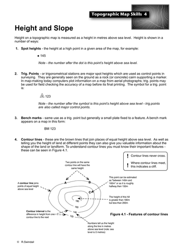
Photocopiable handout that introduces students to the ways in which height is given on a topographic map, including: spot heights, trigonometric stations, bench marks and contour lines. Also how arrangement of contours determine the type of slopes.
Also available at a vastly reduced price as part of my Topographic Maps Skills Bundle that includes all of the basic topographic map skills as well as a set of graded exercises to practice your students in all of the skills : https://www.tes.com/teaching-resource/topographic-map-skills-11564811
Get this resource as part of a bundle and save up to 17%
A bundle is a package of resources grouped together to teach a particular topic, or a series of lessons, in one place.
Something went wrong, please try again later.
Report this resourceto let us know if it violates our terms and conditions.
Our customer service team will review your report and will be in touch.
