Who doesn’t like the magic of city skylines? I do, and my class loves them and these worksheets on city skylines worked great.
The task here is to inspect the city skyline on each worksheet PLUS review the other clue. Then identify the name of the city.
The other clue may be figures about the city, the city’s logo or flag, a map of the city’s area, or a logo of the sporting club that is based in that city.
The task is challenging and fun, and normally requires the student to be creative in how they investigate the answer.
Do I use Google Maps?
Do I use Wikipedia?
Do I try to find the answer by identifying a building on the skyline?
The worksheets are a great library filler and you can always pull one out for that spare moment.
20 maps in all, with an Answer Key at the end. Note that the cities are all US cities.
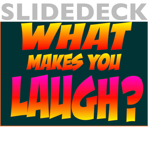
12 humor types are illustrated in this slide deck. The slides can be used to identify each of the humor types that are typically used.
Identify which humor type is being used in conversation, in literature, or by the scallywag in your class.
The slides identify the name of the humor type, includes a definition and an example along with an original illustration.
12 humor types are illustrated in this poster series. The posters are A3 size and can be used to identify each of the humor types that are typically used.
Refer to the posters to identify which humor type is being used in conversation, in literature, or by the scallywag in your class.
The posters identify the name of the humor type, includes a definition and an example along with an original illustration.
12 A3 posters - samples are shown here.
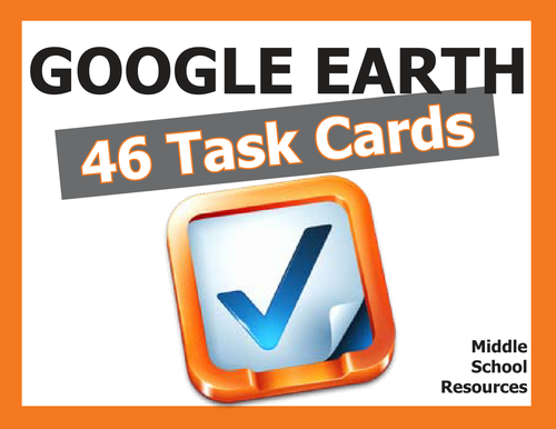
46 Task Cards with 46 activities for students to explore Google Earth.
Activities include:
- measuring distance with ruler function
- calculating area
- using longitude and latitude
- mastering Google Earth tools and applications
- understanding continents, countries
- exploring Google Sky, Moon and Mars
- zooming in to significant landmarks
- investigative work on the ground
- and much more.
Comprehensive Answer Key included.
Print out cards on to firm board - easy two-cut template to create four cards per page.
(Some samples shown)
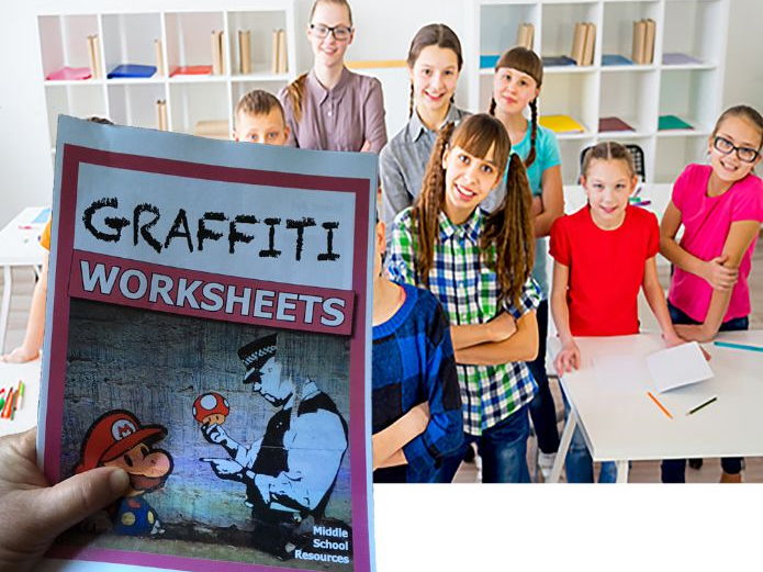
Some great investigative worksheets on the cross-curriculum topic of Graffiti. Here I have used student interest in the topic to explore various cross-curriculum areas such as math, social science, debate, visual arts, and history.
I find the cross curriculum nature of these units provide so many learning opportunities.
The packs covers the following topics:
- Street Artists such as Banksy
- School policy on dealing with graffiti
- Investigation on graffiti removal products - reading a chart
- Experimenting in Street Art
- Art v Vandalism arguments
- Creating a Tag
- History of Graffiti
- Graffiti Poetry Response
This is NOT a course in Graffiti, but rather a stimulus pack of activities that uses various skills to investigate the topic of Graffiti. Suitable to Middle Schools Students in both interest and ability level.
23 pages in total
Answer key included.
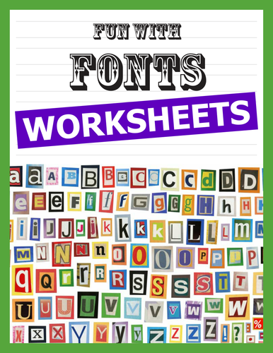
34 pages of different font styles. Children always enjoy writing stylish headings for their projects and posters. These worksheets open up a variety of letter styles that students can practice.
Children can trace over the letters to get a feel of shape and movement, and then rewrite the letter underneath.
Some letters could even be better reproduced with calligraphy pens if you feel like adding some extra interest to the art of writing.
A great activity filler and very calming fun for those times when your class need calming!
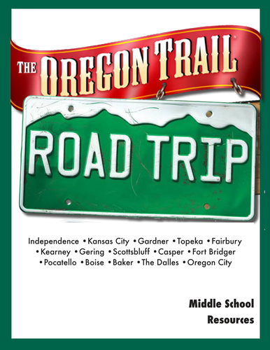
Cross country road trip that follows the original Oregon Trail across northern US, stopping in all the major towns, cities and landmarks.
Various activities to do at each site. The activities cover a range of cross-curriculum fun at each point and include maths, science, language, social studies, geography and more.
Just print and pass out.
Prerequisites: Access to Google Maps and Google Earth.
Pack also includes comprehensive Answer Key and a Checklist for parents, students or teachers to keep track of work completed
__________________________________________________
Activities include:
• Complete a distance chart • Design an archway • Judge a fair • Learn about linguistics • Write a poster ad • Apply for a job • Locate coordinates • Use longitude and latitude • Draw a fantasy map • Complete a biographic • Research an event • Brainstorm a solution • Solve a problem creatively • Calculate distances and fuel needed • and much more
__________________________________________________
The Table of Contents
• Preparation
• Route Map
• Start Your Engines
• Then and Now
• The Prairie Schooner
• Have You Forgotten Something
• City of Fountains
• You be the Judge
• Zoo Snooze
• Getting Wet
• Fairbury Bound
• Interstate 80 to Kearney
• I-80 Along the Platte River
• Straight Up and Down
• Chimney Rock Cemetery
• Speak Like a Native American
• Plains Speaking Alphabet
• Sioux Speak
• Geographic Signposts
• I Spy
• Casper
• Independence Rock
• Lander
• Pocatello
• Boise
• The Dalles
• The Columbia River
• Oregon City
________________________________________________________
This is probably the best bit of work I have ever done with my class. It took me around 4-6 weeks, because we kept exploring other things stimulated by each of the topics.
Hope others enjoy the activities and worksheets as much as we did.
Great value Activity Book of worksheets and activities using Google Maps, Google Earth and Google Street View.
Covers a wide range of topics, subject areas and skills. All self-guiding, challenging and very original.
This is a combination of all my various Google Maps packs and bundles, compiled into an updated and attractive single book of activities with an answer key.
Invest in this book, download and just share or print off whatever you need, whenever you need it.
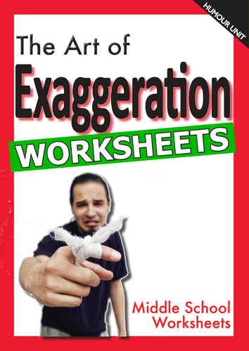
Using exaggeration or hyperbole can be one of easiest ways of getting a laugh from your audience.
These simple but challenging worksheets help the Middle School student identify humourous exaggeration techniques and develop some strategies to write their own comedy lines.
Great fun and yet another part of my humour series.
About 1 week's duration - answer key included - total of 24 pages in all.
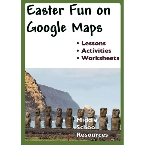
Great worksheets for Middle School students based around the story of Easter and everything connected with Easter (Easter Eggs - chocolate and non-chocolate!, Easter Island, the Easter sites of significance, and more.)
Use Google Maps to complete the worksheets
Learning objectives include:
• Ability to calculate distances in Google Maps
• Able to load a database to Google Maps
• Ability to insert Placemarker information in Google Maps
• Ability to use creativity and imagination in developing a fantasy island
• Ability to construct a map with all key features
• Ability to locate information in Google Maps using coordinates
• Ability to apply some simple knowledge of Excel.
All the activities were great fun in my classroom, and the students could progress through them at their own pace and without too much direction.
26 pages
Answer key included
Duration 1-2 weeks
Note: Sample pages only shown here, full pack of 26 pages of worksheets will be available for download after purchase
Representing data on a map is an important form of communicating information to the reader. Information graphics need to provide the right information in the clearest format possible. Google Maps provides an easy facility to display data for any reader, and anybody can use this facility to upload their information.
An excellent introduction to this topic would be for the teacher and students to explore the range of ways that data can be represented on a map. Different ways include heat maps, geographic stretching of continents, icons and symbols, colours and shades, bar graphs, and interactive maps.
The lessons and activities in this unit of work are for the lower and middle secondary years of schooling and focus on how to add Placemarks and how to bulk upload more than one data point to show a broader range of data.
Simple instructions and clear screenshots, along with relevant student activities make this unit of work self-instructing for every student.
14 pages
Duration 1 week.
Note that Sample pages only shown here. Full pack of 14 pages will be downloadable once purchase has been made.
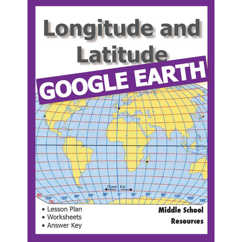
Lesson Plan with worksheets for the Middle School classroom that teaches the principles of Longitude and Latitude using the popular Google Earth.
The worksheets are simple and self-guiding. There is an answer sheet at the end of the booklet.
There are also links to short videos further explaining the activities. Just click on the links in the worksheets
The lesson takes about 3 weeks to complete and there are additional worksheets that the early finishers can work on to further extend their knowledge. Objectives included.
20 pages of things to do.
Note that sample pages only shown here. Full pack of 20 pages will be downloadable once purchase has been made.
Duration of activity is 1 week
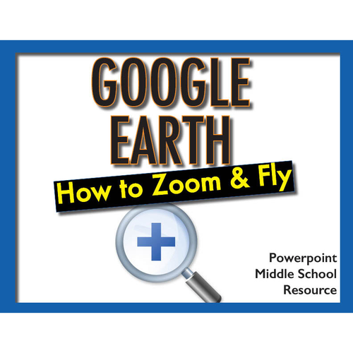
Google Earth is one of the great online educational tools and has so many features to learn. Download this Powerpoint slide set to show your students how to use and practice the zooming and flying functions. Easy to follow - students could review them at their own pace.
21 slides
Note that sample slides only shown here, but full presentation of 21 interactive slides will be downloadable once purchase has been made.
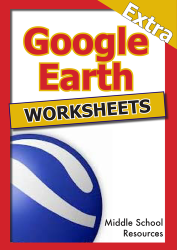
Use Google Earth to complete these self-directed worksheets. Easy to use and very educational.
A wide range of topics covered, including:
- Religions of the world
- Capital cities
- Deserts
- Trip planning
- Cryptic Clues to solve
- Volcanoes
- Rivers
- The Roman Empire
- Around the World in 80 Days
and more
Enjoy
30 pages
Note that only sample worksheets shown here, but full pack of 30 pages will be available for download once purchased.
Duration - 1 week
24 pages of worksheets for upper primary/lower secondary students using Google's fabulous Street View, newly updated with Answer Key and further instructions for Agent Pegman.
Activities include:
- looking for animals on safari
- looking for unusual landmarks
- perform some exemplary spy work
- visit some very obscure locations
- stand right in the middle of Stonehenge, Legoland, Warwick Castle gardens and travel the slopes of Whistler
32 pages
Answer key included
Duration 3 weeks
Note that only sample pages are shown here and the full 32 pages will be available for download once a purchase has been confirmed
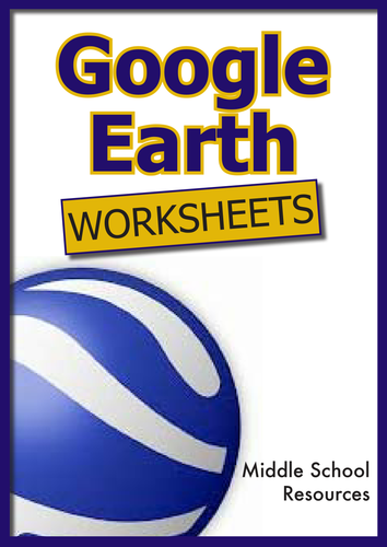
More than 50 pages of Blackline Masters for upper primary/lower secondary students.
All worksheet activities are completed with the fabulous Google Earth application which is free to download on to your PC or Mac from earth.google.com. Activities require minimum teacher direction and provide maximum learning for the student.
_______________________________________________________
Contents:
• Constellation conundrum
• Landmarks
• Cruise around the world
• Help!! Endangered species
• The Galapagos Islands
• Continents
• Google Moon
• The Earth's Grid System
• Make the World a Better Place
• Mission to Mars
• Majestic Mountains
• My Google Earth Autobiography
• Mysterious Locations
• National Parks
• Ocean Explorer
• Ocean Investigations
• The Olympics
• The ABCs of Google Earth
• Bonjour, Mon Ami
50 plus pages
3 weeks duration
Activity Sheets for the Middle School students. Great fun solving problems using Google Maps(and Google Earth). Simple instructions but challenging activities.
I have found that the students in my class need very little instruction to complete the tasks, so long as they understand the Google Maps tools.
Google account is not required - just access to the Google Maps online.
Table of Contents
1. Creating a Travelling Distance Chart
2. Solve the Riddle
3. A Different Type of Easter Egg
4. Fantasy Island
5. Landmarks Around the World
6. Cruising the Seas
7. All about Continents
8. The Earth’s Grid System
9. From Pegman’s Point of View
10. Time & Weather Clues
11. Sites with a View
12. Home Sweet Home
13. Street View Safari
14. Who Am I?
15. National Parks
16. Your Place
17. A Mission for Agent Pegman
18. Things to do on Google Earth
*********************************************
29 pages
1 month duration
Answer key included
The School Uniform is always a matter of conversation and debate in schools and this thematic unit explores various aspects of the School Uniform discussion.
As a thematic unit it covers a variety of topic starters including colour charts, infographics, budgetting, design, debate, SWOT analysis and more.
A thematic study is always great for the creative teacher who can use these study starters to explore different directions around a them.
The package is attractively presented and provides two pages of teachers notes to assist in further study explorations.
My kids thoroughly enjoyed working through the topic - as expected, there was much debate!
25 pages
(The pages shown here are samples only)
1 week duration
A slapstick was originally a harmless paddle composed of two pieces of wood that slapped together to produce a resounding whack when the paddle struck someone. It was soon used by jesters to playfully smack others in a play and soon came to be the descriptor of similar type of physical comedy.
Great printables around the theme of Clowns and the comedy method of slapstick. Research how slapstick is created, the principles of clowning and the history of both.
These printables are challenging and varied and all centred around the comedy of slapstick. Humour is a great way to engage students in the classroom and this Middle School Resource was great fun in my classes.
15 great worksheets that students can complete on their own, and teachers can use to build on with other activities and interests.
17 pages
Duration 1 week
Google Earth has over 50 layers of information and all are explained in this booklet, along with student activities designed to allow the student to explore each of the layers and track down the type of fascinating information that can be found on each layer.
Layers are also given a value rating so that teachers can go directly to the most valuable layer with the most educational information.
The booklet includes definitions and activities around the following Google Earth layers:
- Borders and Labels
- Photos
- 3D Buildings
- Ocean
- Weather
- Gallery
- Global Awareness
- and more
Key points of interest are highlighted and quirky little tips are included.
This is a true reference book for any student or teacher who works with Google Earth.
28 pages