<p>Theme 1 Eduqas A resource, journey across the World with multiple questions and routes. Best printed on A3. Multiple questions of varying difficulty, great for a retrieval and revision homework.</p>
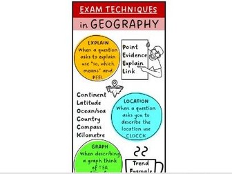
<p>This bookmark is full of great techniques which geography teachers have used for a while to help with geographical writing. I have put all the techniques together in one eye catching little tool. It includes all the acronyms; PEEL, CLOCCK, TEA, BUG, MADASS. I would recommend laminating a class set. The original ideas are obviously not mine, I have just put them together in one place.</p>
<p>This resource is for anyone who delivers the Duke of Edinburgh Award as part of the school curriculum or as an extra curricular activity. The booklet is easy to follow and includes lots of opportunities for practical sessions as well as in class activities such as; fill in the blanks, spider diagrams, poster making, colour coding, annotations.</p>
<p>The 55 page booklet includes</p>
<ul>
<li>Success Criteria</li>
<li>Scheme of Learning</li>
<li>First Aid- CPR, recovery position, strains and sprains, stings and bites etc</li>
<li>Map Skills- compass directions, route planning, OS symbols, contour lines etc</li>
<li>Cooking</li>
<li>Equipment</li>
<li>Biodiversity</li>
<li>Sustainability Project</li>
<li>Literacy- words its and popcorn reading</li>
<li>Space to take notes and recall</li>
</ul>
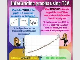
<p>This resource is a good visual aid to help pupils when answering questions which require pupils to describe a graph. An easy way to do this is by using TEA(M)<br />
Trend<br />
Evidence<br />
Anomaly<br />
Manipulate<br />
This resource could be blown up as a display or used within the classroom or for home learning.</p>
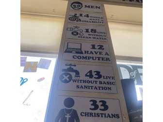
<p>This display shows the proportion of men/women/religions/access to water/sanitation/etc if the world was 100 people. It includes 18 different facts for example “12/100 people cannot read” and “18/100 live without basic sanitation” It is a simple black and white display which is great in any humanities classroom.</p>
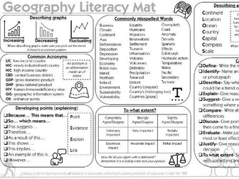
<p>This literacy mat is a great resource which can be used across every geography lesson. Personally I have this mat stuck in every book both KS3 and KS4. It is an eye catching tool and is in black and white so will save your printing budget!</p>
<p>It includes;</p>
<ul>
<li>Common SPaG errors</li>
<li>The meanings off command words</li>
<li>Translation of common geographical acronyms</li>
<li>How to extend points (PEEL)</li>
<li>How to describe graphs (increasing, decreasing, fluctuating, CLOCCCS)</li>
<li>“To what extent” table</li>
</ul>
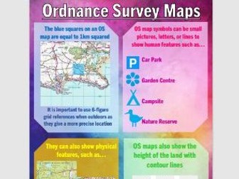
<p>This is an information sheet of everything OS! The eye catching display/information sheet includes; scales, contour lines, map symbols and physical features. It is a great little revision sheet for skills at KS3.</p>
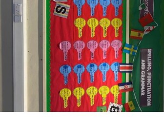
<p>This colourful display has key terms includes key terms printed on colouful keys, as well as a colourful title for you to use.</p>
<p><strong>Tectonics:</strong><br />
Destructive, Constructive, Conservative. Earthquake, Magma, Lahar, Lave, Core, Volcano<br />
<strong>Processes</strong>: Erosion, Abrasion, Attrition, Hydraulic action, Confluence, Meander, Deposition<br />
<strong>Weather and Climate</strong>: Altitude, Micro-Climate, Precipitation, Atmosphere, Prevailing wind, Latitude, Longitude, Weather, Climate</p>
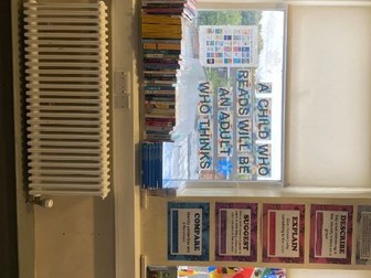
<p>These key command words are taken from Eduqas A and are a great colourful display to remind pupils. Each A3 sheet has; the word, its meaning, an example of how it is used.</p>
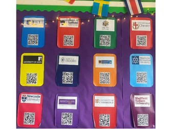
<p>This display has the QR codes for 12 different universities across England. Pupils can just point their phone camera at the QR code and it will take them straight to the geography course at that university. It’s a great interactive display.</p>