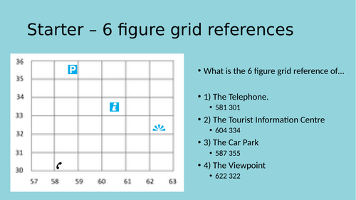


This resource, suitable for Key Stage Three Geography teaching, covers all important aspects of calculating height and relief on maps including contour lines, spot heights and triangulation pillars among a vast array of activities.
*For full completion, this lesson also requires the sheet titled ‘contours’ by Phoebe Murfin, available through TES for free.
Something went wrong, please try again later.
This resource hasn't been reviewed yet
To ensure quality for our reviews, only customers who have purchased this resource can review it
Report this resourceto let us know if it violates our terms and conditions.
Our customer service team will review your report and will be in touch.
£1.20
