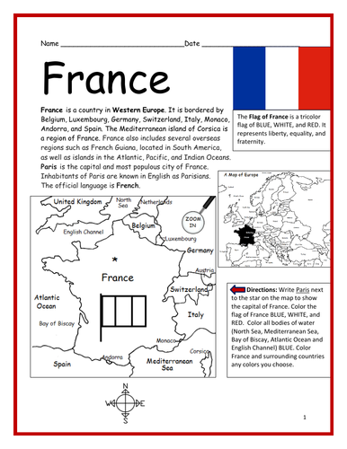
Introduce your students to France with this printable handout of two worksheets (plus answer key). Your students will read a brief introduction to France (location, capital, flag, language), write ‘Paris’ next to the star on the map to show the location of the capital, color the small map and flag, and use the map and compass to answer 7 questions on page 2. Colored pencils and a pen or pencil are needed for this activity. No other prep needed. Basic geography worksheet includes a simple map to introduce France and practice cardinal/ordinal directions.
For use with Interactive Notebooks: After completing the worksheets, students can cut out the map and flag and paste it into the notebook under the topic of Europe/Sub-Topic: France. Under the map and flag, students can write a summary in their own words of what they now know about France. Collect worksheets for other countries of Europe to add to the notebook! Please browse this store for a selection of worksheets for other countries of Europe (and beyond!).
Thank you so much for using my Geography worksheets in your classroom! Reviews are welcome and very much appreciated.
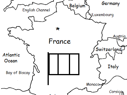
Included on map: Belgium, Luxembourg, Germany, Switzerland, Italy, Monaco, Andorra, Spain, Corsica, United Kingdom, Netherlands, Austria, North Sea, English Channel, Bay of Biscay, Mediterranean Sea, Atlantic Ocean.
Something went wrong, please try again later.
This resource hasn't been reviewed yet
To ensure quality for our reviews, only customers who have purchased this resource can review it
Report this resourceto let us know if it violates our terms and conditions.
Our customer service team will review your report and will be in touch.
$1.50