NGfL Cymru was a website funded by the Welsh Government. The resources on TES are a legacy of this project. The content or format of these resources may be out of date. You can find free, bilingual teaching resources linked to the Curriculum for Wales on hwb.gov.wales.
NGfL Cymru was a website funded by the Welsh Government. The resources on TES are a legacy of this project. The content or format of these resources may be out of date. You can find free, bilingual teaching resources linked to the Curriculum for Wales on hwb.gov.wales.
These PowerPoints offer fully illustrated and explained tours of sites of special interest to geologists. There are maps and photographs offering context and explanations of the sites.
These are fully illustrated PowerPoint slideshows with examples of minerals photographed in close detail. Minerals are classified, discussed and examples are shown. There are examples for students to identify.
Resources that can contribute to the understanding of the causes and effects of climate change.
There are opportunities to analyse the long and short term changes in climate and the effect of rising sea levels on Wales.
Different views and attitudes about the causes of climate change are presented and a view on how governments intend to tackle the problem in regards of transport and agriculture are considered.
A term's lesson plans that includes photograph resources worksheets and interactive white-board activities for Early Years and for Key Stage 1.
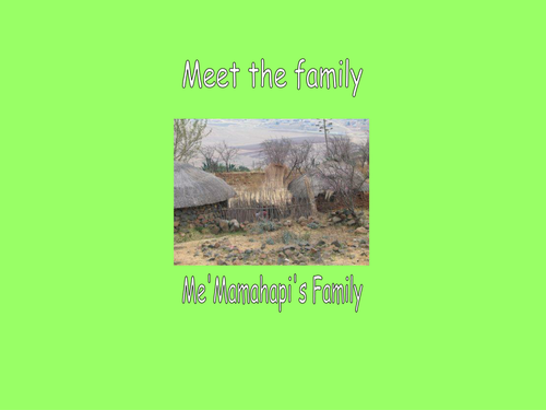
Activities that support children in comparing and contrasting places and features beyond their local area ,namely Wales and Lesotho.
Both units of work address several elements of the Global Dimension themes and Foundation Phase Learning Aims.
A Decision-Making-Exercise, using virtual fieldwork, on the best option to reduce river flooding in Cowbridge area, contains data on the history of flooding in the area, outlines of the different options considered by Environmental Agency Wales, the different economic costs and the environmental impact once built. Whiteboard and independent student activities use OS maps, constructor’s diagrams, old newspapers, spider diagrams, calculations. Photographs with sound commentary allow students to visualise and assess the success of the chosen scheme
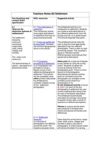
A series of whiteboard activities and extensive investigations and case studies relating to settlement.
There are extensive investigations focused on settlement patterns in the north east of Wales, Cheshire and Liverpool. This investigation adds to the understanding of the Key Questions in UNIT G2, Changing Human Environments, Investigating Settlement Change in MEDCs section of the WJEC AS GCE in Geography.
These activities do not attempt to cover the whole theme and can easily be incorporated into other resources and teaching and learning approaches.
This resource consists of detailed illustrated PowerPoints explaining mining techniques. It explores hazards linked to the strength or weakness of the rock being dug, the nature of the rock on which structures are built or material placed, the influence of water at the surface or underground, or a combination of these.
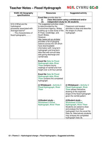
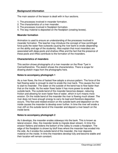
Excel data files of hourly rainfall and river height for three contrasting drainage basins in S Wales are used to construct and analyse flood hydrographs as both whiteboard and independent student activities. OS maps, sketch maps, photographs, videos and other Geographical Information Systems provide the background to an ‘Investigation into factors causing differing river flood levels’.
This resource will allow children to compare andcontrast twocountries (Ecuador and Wales).The countriesare compared using the following topics: rainforest / woodland, houses and lifestyles and recycling.
This resource covers many aspects across the seven ESDGC themes
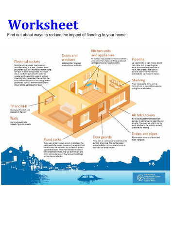
These resources link Environment Agency Wales’ resources to support teaching and learning for KS2 and KS3 Geography as well as PSE and ESDGC. They can provide a source of data for investigations, including real-time river levels and flood management schemes. These resources look at flooding in Wales and help to increase the awareness of flooding, why it happens, how you can be prepared and investigating different flood schemes. For more materials relating to this resource, please visit the NGfL site, linked below.
Each pack consists of teacher notes, activities for use in the classroom, information cards and posters to help teachers introduce and study the concept of renewable energy sources.