Hero image

Really Good Geography's Shop

Average Rating2.89
(based on 39 reviews)

Welcome to my shop. My aim is to provide high quality teaching, learning and assessment resources. In the case of GCSE and A Level resources I am adding examination questions to my resources as more become available. Please come in and browse. Feel free to contact me about any of the resources that you buy or if you are looking for something in particular.

207Uploads

100k+Views

13k+Downloads

Welcome to my shop. My aim is to provide high quality teaching, learning and assessment resources. In the case of GCSE and A Level resources I am adding examination questions to my resources as more become available. Please come in and browse. Feel free to contact me about any of the resources that you buy or if you are looking for something in particular.
A level; Long term changes in the water and carbon cycles
ReallyGoodGeographyReallyGoodGeography

A level; Long term changes in the water and carbon cycles

(0)
Firstly, the students are introduced to climate change over the last 1 million years, they then focus on the last 400,000 years and the 4 glacial periods contained within it. Next are details of the changes in the water and carbon cycle during glacial and inter-glacial periods. Students are asked to guess the fact, answers are included. Next there is a fact quiz to see what the students can remember. After that the students are introduced to a range of techniques used to monitor changes in the water and carbon cycles. they are given details of how they work and are asked to consider which groups and organisations would be able to use this information and what they could use it for. Resources are included at the end of the PowerPoint.
A Level; Impacts of long term climate change on the carbon and water cycles
ReallyGoodGeographyReallyGoodGeography

A Level; Impacts of long term climate change on the carbon and water cycles

(0)
Firstly, there is a gap fill activity to remind the students about the greenhouse effect. After that the students are given copies of the carbon and the water cycles and are asked if global warning will increase or decrease the processes within the cycles. Next the students are given diagrammatic information about the effects of climate change on the water cycle. the students are required to translate this information into an annotated water cycle diagram. The students repeat this for the carbon cycle, except this time the information is in a written format. Resources are included at the end of the PowerPoint.
Key Stage 3; OS maps - direction
ReallyGoodGeographyReallyGoodGeography

Key Stage 3; OS maps - direction

(0)
This lesson builds students knowledge from 4 to 16 point compass directions. It also teaches students to describe places in relation to one another. There are two quizzes which test pupil understanding one about skull island, which also test understanding of the use of map symbols and the other using direction to draw a symbol. A map skills booklet accompanies this lesson
Turkey Syria Earthquake February 2023
ReallyGoodGeographyReallyGoodGeography

Turkey Syria Earthquake February 2023

(0)
The lesson incorporates a range of activities. To start there is a short video clip from the day after the earthquake. Next are slides including maps and plate margin diagrams which can be explained to pupils prior to them completing a gap fill exercise, which explains how the earthquake occurred. After that are a selection of photos of the damage, which can be used for Q and A with the pupils, including a 2 minute video clip of people being rescued from the rubble. I have then included a link to the BBC panorama programme which includes information about the earthquake and explanation of why so many people died. A note taking sheet is included. Next is a fact classification activity, with information about both Syria and Turkey. Finally there is a homework task. All resources are included at the end of the lesson.
GCSE 9-1; skills - mean, mode, median, inter quartile range practice or revision lesson 1
ReallyGoodGeographyReallyGoodGeography

GCSE 9-1; skills - mean, mode, median, inter quartile range practice or revision lesson 1

(0)
This lesson contains a worked example followed by a series of exercises where the students can practice and apply their knowledge. Included within the PowerPoint are worksheets for the students to fill in and a full set of answers, including worked calculations. I designed these to be used either as homework tasks or as an introductory lesson / skill practice lesson. They are also designed to encourage the students to memorise the formulae as these will not be included in the exam papers even at GCSE level.
GCSE 9-1; River Impact of human activity on the river landscape (River Eden)
ReallyGoodGeographyReallyGoodGeography

GCSE 9-1; River Impact of human activity on the river landscape (River Eden)

(0)
Firstly, there is a white board quiz linked to the causes and effects of flooding. This is designed to recap previous knowledge. Next the students are introduced to the River Eden and it’s key features. After that the students are asked to collect facts about the different human activities that occur around the river from information sheets. Once these are complete introduce the students to the impacts that human activity can have on the river landscape. Next, arrange the students into small groups. Using the information sheets and a planning sheet they need to plan out PEE paragraphs as a team. After that the students need to write their own 8 mark examination response to a human activity question using their planning sheets to help them. There is a writing frame and mark scheme to accompany this. Finally, the students are asked to demonstrate their understanding of how the human activity changes along the whole river. All resources are included at the end of the PowerPoint.
GCSE 9-1; Global development - Ethiopia aid project- Charity water
ReallyGoodGeographyReallyGoodGeography

GCSE 9-1; Global development - Ethiopia aid project- Charity water

(0)
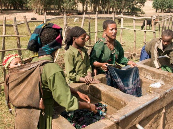
In this lesson the students will start by being introduced to the problem of water supply in Ethiopia. The students will learn about charity: water - an aid project through a series of clips and photos. Next they will undertake a story telling activity to learn about the aid project through the eyes of 3 characters. They are each given a character and key questions to listen out for the answers to. They are given a note taking sheet. After reading the story once there are comprehension / discussion questions for the students to undertake. Next they are read the story again. After that they get into groups of the same character to ensure they have all the notes from the story. They then get into groups of different characters to share information. After that they take part in an opinion line activity to assess the success of charity:water. This will help them to develop their conclusion writing skills. All resources are included.
A Level; coasts revision lesson - processes
ReallyGoodGeographyReallyGoodGeography

A Level; coasts revision lesson - processes

(0)
This lesson aims to revise the key geomorphic preocesses. Answer slides are included within the PowerPoint and all resources are at the end of the PowerPoint. Processes revised include marine/erosion, sub-aerial/weathering, mass movement, waves, wave refraction, sediment cells and LSD. resources included are definition revision cards, landform revision homework sheets. wave characteristic classification and mass movement interpretation.
GCSE 9-1; Climate - Global climates and global atmospheric circulation - atmospheric cells
ReallyGoodGeographyReallyGoodGeography

GCSE 9-1; Climate - Global climates and global atmospheric circulation - atmospheric cells

(0)
This lesson starts with an opportunity to revise ecosystems. Students are tested on climate data, photographs and ecosystems and food webs associated with different ecosystems. Next the students are introduced to the Polar, Ferrel and Haley cells, their discovery and characteristics. Next students should take notes on the weather associated with high and low pressure. After that the students are given climate graphs from around the globe and by looking at the rainfall data are asked to decided if there is high or low pressure. They then use their atlases to find out the latitude, which they label on a globe (answers provided). Finally, they are introduced to the weather between 30oN and S of the equator around the ITCZ and are asked to describe and then explain the weather that occurs (answers provided). All resources are included at the end of the PowerPoint.
GCSE 9-1; Ecosystems - Tropical rainforest location, structure and climate
ReallyGoodGeographyReallyGoodGeography

GCSE 9-1; Ecosystems - Tropical rainforest location, structure and climate

(0)
This lesson is part of a series of lessons available as a bundle. The lesson starts with an examination question about the climate, flora and fauna of different biomes. Answers are provided. Next students are required to annotate and describe a map. this provides an opportunity to see how much the students can recall about rainforest location. Next students are given information about the different layers, which they can annotate onto a diagram of the rainforest. After that there is a mini-plenary testing recall so far. After that there is a climate graph drawing and interpretation activity, with a partially completed climate graph provided. The final part of the lesson involves writing a description of the climate graph. All resources are included at the end of the PowerPoint.
Key Stage 3; sustainable development in the Amazon rainforest
ReallyGoodGeographyReallyGoodGeography

Key Stage 3; sustainable development in the Amazon rainforest

(0)
Students are introduced to the threats to the Amazon rainforest before being introduced to a sustainable development scheme- the Central Amazonian Conservation Complex. Students take notes from the worksheet in order to identify what happens in each zone. The plenary is an opinion line evaluating the success of the scheme.
GCSE 9-1; extreme flood hazard event - Storm Desmond story telling
ReallyGoodGeographyReallyGoodGeography

GCSE 9-1; extreme flood hazard event - Storm Desmond story telling

(0)
This lesson introduces Storm Desmond by asking students to tell the story of what happened to them during the floods. The pupils are then given a character (character stickers are provided) and asked to take notes on the character and a question about the flooding. The pupils will then be read a story incorporating a wide rage of factual information about the floods, told through the eyes of the 6 characters. After reading the story scramble the groups to share the information that they have collected. Writing frames for PEE paragraphs are included as are mark schemes and exemplar examination questions, based on sample assessment materials.
KS3 Geography lockdown Kenya Project- home schooling
ReallyGoodGeographyReallyGoodGeography

KS3 Geography lockdown Kenya Project- home schooling

(0)
This resource is designed to last for 11 lessons and be independently completed during lock down. It includes the following topics: location, physical features, human features, climate, employment structure, population, the Masaai and Rider’s for Health (charity case study). It is a single PowerPoint with instructions for the students to follow on each slide. The idea is that over the 11 lessons the PowerPoint will build up into a project that can then be submitted for teacher assessment. The lessons have differentiated tasks to stretch the more able. Each lesson/topic area can be graded using the mark scheme and AtL (attitude to learning) score, which can then be recorded in the student’s diary (these are all located on slides in the PowerPoint). Many of the resources are included at the end of the slide show, although a number of hyperlinks to websites and videos are also included. I have also included a version for pupils without access to the internet or a computer. I have tried to make this: Easy for the students to download - only one PowerPoint file. Easy for the students to follow - clear instructions on each slide Accessible - differentiated Challenging - differentiated Good Geography closely linked to what they would have been studying at school. Assessed - mark scheme for self and teacher assessment Well resourced - a range of media for research included.
GCSE 9-1 urban trends; solutions to sustainable transport in Leeds
ReallyGoodGeographyReallyGoodGeography

GCSE 9-1 urban trends; solutions to sustainable transport in Leeds

(0)
In this lesson pupils will become a character. During a story telling activity they will answer a specific question linked to 3 sustainable transport schemes in Leeds. They will then share their answers in scrambled groups. An exam question and plan is included along with a mark scheme. The plenary is a case study fact quiz. All resources are included at the end of the PowerPoint.
A Level; Arctic - Strategies to reduce the impacts of oil production on the water and carbon cyclesT
ReallyGoodGeographyReallyGoodGeography

A Level; Arctic - Strategies to reduce the impacts of oil production on the water and carbon cyclesT

(0)
This includes two lessons. In the first lesson students will research into strategies implemented to reduce the impact of the oil and gas industry on the water and carbon cycles. The second will involve students giving presentations, with PowerPoint presentations and information sheets. The students are split into six groups, each with a strategy such as insulated ice and gravel pads. They split up the three tasks (presentation, speech and information sheet) within their group and are given information about what to research and how they will be marked. All resources for students to use for note taking are included at the end of the PowerPoint.
Key Stage 3; rainforests - water and nutrient cycles
ReallyGoodGeographyReallyGoodGeography

Key Stage 3; rainforests - water and nutrient cycles

(0)
The pupils firstly plot the daily weather regime of the rainforest onto a time line, by listening to a diary entry. After that they are introduced to the water cycle in the rainforest and the convectional rainfall that occurs. Diagrams and a word bank are included. Next, there are a variety of nutrient cycle diagrams provided, which students can use to create their own nutrient cycle diagram. Finally there is a plenary quiz. All resources are included within the PowerPoint.
GCSE 9-1; Urban trends - re-urbanisation, Stratford and the London Olympic Park
ReallyGoodGeographyReallyGoodGeography

GCSE 9-1; Urban trends - re-urbanisation, Stratford and the London Olympic Park

(0)
This lesson is designed to get students to consider the advantages and disadvantages of re-urbanisation, using the Stratford Olympic Park as an example. To start the pupils are given a definition of re-urbanisation. Next, there are a series of photos and videos to develop the students sense of place and understanding of how the park has changed the area. After that the students are given 9 facts about the advantages of re-urbanisation and are asked to classify them as social, economic or environmental (answers included). They then use a diamond 9 to organise them from most important to least important. They then repeat this task for the disadvantages of re-urbanisation. The lesson ends with a quiz which requires the students to classify the facts into either advantages or disadvantages. All resources and answers are included in the PowerPoint.