I've worked in primary teaching for over 10 years and specialise in creating fun and engaging educational resources, particularly for Geography and History.
I've worked in primary teaching for over 10 years and specialise in creating fun and engaging educational resources, particularly for Geography and History.
This lesson is part of Investigating Rivers, a unit designed for upper KS2 (Y4-6).
It introduces many key river concepts and a wide range of related vocabulary. First the presentation recaps the main processes of the water cycle. It then introduces some of the well known features of river systems (e.g. waterfalls and lakes). There are two activities:
Group Activity:
Students are challenged to match eight features of river systems to photos, satellite images and maps. This activity can easily be differentiated by giving groups different numbers of cards.
Individual Activity:
In the worksheet activity students identify the same features on a simplified drawing of a river system. It is differentiated two ways:
Easier – Students identify river features and complete cloze procedure definitions.
Harder – Students identify river features and write their own definitions of four river features.
If you like this resource, we would appreciate a review! We will happily send you a free resource in return for a review or useful suggestions/feedback. Contact us at ed@teachitforward.co.uk.
This lesson is part of Understanding Trade, a Geography unit designed for students in upper KS2 (Y5-6).
The presentation introduces the concept of highest value exports. It then draws a link between a country’s highest value export and its human and physical resources (e.g. transport links, oil reserves). Four example countries and their highest value export are then looked at in more detail.
In the activity, students are challenged to identify the highest value exports and GDP/capita of countries around the world using Google Maps/atlases and an online map. The activity is differentiated three ways:
Easier – Students identify highest value exports of 25 countries
Medium – Students identify highest value exports and GDP/capita of 25 countries
Harder – Students identify highest value exports and GDP/capita of 30 countries
If you like this resource, we would appreciate a review! We will happily send you a free resource in return for a review or useful suggestions/feedback. Contact us at ed@teachitforward.co.uk.
This lesson is part of Understanding Trade, a Geography unit designed for students in upper KS2 (Y5-6).
The presentation starts by recapping what imports and exports are. It goes on to look at the UK’s top ten exports – mainly manufactured products – and the human and physical factors which help UK exports in this area.
In the activity, students use Microsoft PowerPoint to create a table of the UK’s top ten exports. They then use an online chart maker to produce either a pie chart or bar graph to illustrate this data. It is differentiated three ways:
Easier – Students use step-by-step instructions with some data already filled in
Medium – Students use step-by-step instructions
Harder – Minimal instructions – IT experts only!
If you like this resource, we would appreciate a review! We will happily send you a free resource in return for a review or useful suggestions/feedback. Contact us at ed@teachitforward.co.uk.
This lesson is part of Understanding Trade, a Geography unit designed for students in upper KS2 (Y5-6).
First the presentation asks students to consider how everyday products arrive in our supermarkets. It then introduces and explains the concept of supply chains, looking specifically at the chocolate supply chain. There are two activities:
Group Activity:
The group activity challenges students to order the chocolate supply chain.
Writing Activity:
An accompanying writing activity is based on ‘The Story of Our Chocolate Journey’ (available on YouTube). It challenges students to sequence and explain the processes involved in the chocolate supply chain. It is differentiated three ways:
Easier – Students use a writing frame.
Harder – Students write in an exercise book using a vocabulary prompt.
If you like this resource, we would appreciate a review! We will happily send you a free resource in return for a review or useful suggestions/feedback. Contact us at ed@teachitforward.co.uk.
This lesson is part of Understanding Trade, a Geography unit designed for students in upper KS2 (Y5-6).
First the presentation introduces the banana trade and the concept of ‘supply chains’. Students are then challenged to sequence the banana supply chain in a group activity.
The Banana Split game, produced by Cafod, is then introduced. This is a great way to help children understand the uneven distribution of power and money in the supply chains of many of every day foods. There is also an activity sheet for students to complete as they progress through the game.
Finally the Fairtrade movement is introduced as a way for consumers to improve the conditions of workers in developing countries around the world. In the plenary, Fairtrade is also linked to the UN Convention on the Rights of the Child.
If you like this resource, we would appreciate a review! We will happily send you a free resource in return for a review or useful suggestions/feedback. Contact us at ed@teachitforward.co.uk.
This lesson is part of Understanding Trade, a Geography unit designed for students in upper KS2 (Y5-6).
First the presentation helps students understand what trade is and introduces the concepts of imports and exports. It does this by linking these ideas to every day products we buy. It also looks at the different scales of trade – local, national and international.
The activity then challenges students to match up products with statements about the company which makes them and where they are produced/manufactured.
Easier – Match the products to the statements (on stickers)
Harder – Match the products to the statements (written)
Extension – Students complete a cloze procedure paragraph about trade.
If you like this resource, we would appreciate a review! We will happily send you a free resource in return for a review or useful suggestions/feedback. Contact us at ed@teachitforward.co.uk.
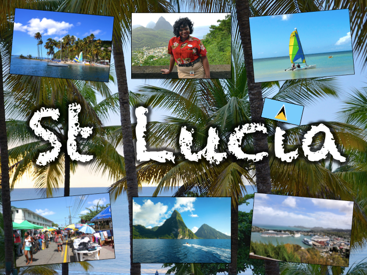
Exploring St Lucia is a Geography unit designed for students in KS2.
As a tropical island in the Caribbean, St Lucia is great for teaching about a contrasting non-European country.
The planning overview, topic title page and vocabulary page can be downloaded for free here. Lessons include:
L1 – Locating St Lucia in the Caribbean
L2 – Identifying the human and physical features of St Lucia
L3 – Investigating satellite photos of St Lucia
L4 – Using compass directions to locate places in St Lucia
L5 – Comparing the weather of St Lucia and the UK
L6 – Comparing St Lucia with the UK
Each lesson includes a presentation and differentiated activities/worksheets.
If you like this resource, we would appreciate a review! We will happily send you a free resource in return for a review or useful suggestions/feedback. Contact us at ed@teachitforward.co.uk.
This lesson is part of a wider unit called Exploring St Lucia and is designed to teach KS2 students about a contrasting non-European country.
It first introduces students to the tropical climate zone and its associated weather (i.e. high temperatures, high rainfall, dry and wet seasons) and compares this with temperate climates such as that of the UK.
Students are then encouraged to interpret data from a climate graph for St Lucia. Finally, other aspects of a tropical climate are covered including tropical storms and hurricanes.
The accompanying true or false activity helps children to recap what they have learned about the climates of St Lucia and the UK. It is differentiated two ways:
Easier – Students have 6 true or false statements.
Harder – Students have 10 true or false statements.
Extension – Students complete a cloze procedure text about St Lucia’s weather and climate.
If you like this resource, we would appreciate a review! We will happily send you a free resource in return for a review or useful suggestions/feedback. Contact us at ed@teachitforward.co.uk.
This lesson is part of a wider unit called Exploring St Lucia and is designed to teach KS2 students about a contrasting non-European country.
First the presentation introduces students to the directions of the compass. It then helps them to locate places in St Lucia using compass directions – first using the four cardinal points (N, E, S, W), then also using the four ordinal points (NE, SE, SW, NW).
The accompanying activity gives students a chance to locate places in St Lucia using the points of the compass. It is differentiated two ways.
Easier – Students locate places using the eight points of the compass (with compass direction hints).
Harder – Students locate places using the eight points of the compass (no compass direction hints).
Extension – Students complete another compass direction challenge.
If you like this resource, we would appreciate a review! We will happily send you a free resource in return for a review or useful suggestions/feedback. Contact us at ed@teachitforward.co.uk.
This lesson is part of a wider unit called Exploring St Lucia and is designed to teach KS2 students about a contrasting non-European country.
The presentation introduces the students to satellite photos. It then challenges them to use their detective skills to identify the various human and physical geographical features of St Lucia.
It is accompanied by a writing-based activity which challenges students to identify the features in the satellite photos and explain their reasoning. It is differentiated three ways:
Easier – Students identify 1 feature per satellite photo.
Medium – Students identify 2 features per satellite photo.
Harder – Students identify 3 features per satellite photo.
Extension – Students sort the features they have found into human and physical.
If you like this resource, we would appreciate a review! We will happily send you a free resource in return for a review or useful suggestions/feedback. Contact us at ed@teachitforward.co.uk.
This lesson is part of a wider unit called Exploring St Lucia and is designed to teach KS2 students about a contrasting non-European country.
It first introduces St Lucia and the wider Caribbean area, helping students to locate the island within the wider world.
The activity then challenges students to identify St Lucia and other islands in the Caribbean. It is differentiated three ways:
Easier – Students identify 8 countries (with first-letter clues).
Medium – Students identify 10 countries and 3 seas/oceans (with first-letter clues).
Harder – Students identify 10 countries and 3 seas/oceans (no clues).
Extension – Students complete a cloze procedure text about the location of St Lucia.
If you like this resource, we would appreciate a review! We will happily send you a free resource in return for a review or useful suggestions/feedback. Contact us at ed@teachitforward.co.uk.
This lesson is part of a wider unit called Exploring St Lucia and is designed to teach KS2 students about a contrasting non-European country.
The presentation explores the main geographical features of St Lucia and asks students to categorise these into human and physical.
The activity then challenges students to identify these features on a map of St Lucia. It is differentiated three ways:
Easier – Students identify human & physical features of St Lucia (with clues)
Medium – Students identify human & physical features of St Lucia (no clues)
Harder – Students identify human & physical features of St Lucia (no clues and students also have to draw arrows)
If you like this resource, we would appreciate a review! We will happily send you a free resource in return for a review or useful suggestions/feedback. Contact us at ed@teachitforward.co.uk.
This free lesson is a great way for students to learn the location of the world’s continents and oceans. It can be used as an introduction to the topic for younger students or simply to refresh older students’ core geographical knowledge.
The World Map Jigsaw is a great warm-up activity for this lesson.
First the presentation runs through the continents and oceans of the world. In the worksheet activity students then identify the world’s continents and oceans. This is differentiated four ways:
Easier – Students have initial letters, vocabulary and use an atlas/map prompt.
Medium – Students have vocabulary and use an atlas/map prompt.
Harder – Students solely use an atlas/map prompt (no vocabulary).
Hardest – Students identify continents and oceans with no vocabulary or atlas/map prompt.
Extension – Students use an atlas to work out which continents countries are in.
If you like this resource, please review it. If you have any suggestions or feedback, contact us at ed@teachitforward.co.uk.
This is the planning overview for The Great Fire of London. This exciting History unit has lessons and differentiated activities/worksheets designed for KS1. It is suitable for Year 2 children and more able Year 1 children.
All the resources described in the unit plan are available on TES, either as individual lessons or as a bundle. Lessons include:
L1 - Introduction and timeline activity
L2 - Finding out about the Great Fire of London from Samuel Pepys’ diary
L3 - Sequencing the events of the Great Fire of London
L4 - Understanding why the Great Fire of London spread so quickly
L5 - Exploring how London changed after the Great Fire
L6 - Understanding how fire safety has changed since the Great Fire
Optional FREE lesson:
Unscrambling sentences about the Great Fire of London
If you like this resource, please review it. I will happily send you a free resource of your choice in return for a review or useful feedback.
Please contact me at eddiebray@yahoo.co.uk.
If you like this resource, we would appreciate a review! We will happily send you a free resource in return for a review or useful suggestions/feedback. Contact us at ed@teachitforward.co.uk.
Great Missenden – A Village Settlement is a Geography unit suitable for upper KS2 (Y4-6).
Located in the Chilterns in Buckinghamshire, the village of Great Missenden was once home to famous children’s author Roald Dahl. It is a great case study for helping students understand the similarities and differences between urban and rural settlements.
The planning overview and topic title page can be downloaded for free here. Lessons include:
L1 – Locating Great Missenden in the UK
L2 – Investigating satellite photos of Great Missenden
L3 – Locating features of Great Missenden using grid references
L4 – Identifying the features of settlements
L5 – Surveying Great Missenden High Street using Google Street View
L6 – Interpreting a high street survey of Great Missenden
Each lesson includes a presentation and differentiated activities/worksheets.
If you like this resource, we would appreciate a review! We will happily send you a free resource in return for a review or useful suggestions/feedback. Contact us at ed@teachitforward.co.uk.
This is the free planning overview for Great Missenden – A Village Settlement. A topic title page is also included.
Located in the Chilterns in Buckinghamshire, the village of Great Missenden was once home to famous children’s author Roald Dahl. It is a great case study for helping students understand the similarities and differences between urban and rural settlements.
The unit is designed for students in KS2 from Y4 to Y6 and includes a variety of engaging lessons, differentiated activities and worksheets.
All the resources described in the planning are available on TES, either as individual lessons or as a bundle. Lessons include:
L1 – Locating Great Missenden in the UK
L2 – Investigating satellite photos of Great Missenden
L3 – Locating features of Great Missenden using grid references
L4 – Identifying the features of settlements
L5 – Surveying Great Missenden High Street using Google Street View
L6 – Interpreting a high street survey of Great Missenden
If you like this resource, we would appreciate a review! We will happily send you a free resource in return for a review or useful suggestions/feedback. Contact us at ed@teachitforward.co.uk.
This lesson is part of a wider Geography unit called Great Missenden – A Village Settlement which is designed for students in upper KS2 (Y4-6).
In this lesson, students are introduced a high street survey, a great way of looking at land use in settlements. The presentation first outlines the RICEPOTS system for categorising land use and includes many photos of real world examples to aid understanding.
The activity challenges students to use Google Street View to work out the types of land use on Great Missenden High Street. It is differentiated three ways:
Easier – Students find the business name/land use of 10 places on Great Missenden High Street (with clues).
Medium – Students find the business name/land use of 14 places on Great Missenden High Street (with clues).
Harder – Students find the business name/land use of 14 places on Great Missenden High Street (no clues).
Extension – Students use Google Street View to survey a section of Great Missenden High Street by themselves.
If you like this resource, we would appreciate a review! We will happily send you a free resource in return for a review or useful suggestions/feedback. Contact us at ed@teachitforward.co.uk.
This lesson is part of a wider Geography unit called Great Missenden – A Village Settlement which is designed for students in upper KS2 (Y4-6).
The presentation introduces students to the concept of settlements and asks them to categorise them by size (e.g. hamlet, village, town, city, conurbation). It then introduces them to a range of human geographical features found in settlements (e.g. post offices, sports stadiums).
In the activity students identify a variety of human geographical features found in settlements. It is differentiated two ways:
Easier – Students identify the features of settlements with normal clues.
Harder – Students identify the features of settlements with jumbled up clues.
Extension – Students identify which types of settlements these features are usually found in.
If you like this resource, we would appreciate a review! We will happily send you a free resource in return for a review or useful suggestions/feedback. Contact us at ed@teachitforward.co.uk.
This lesson is part of a wider Geography unit called Great Missenden – A Village Settlement which is designed for students in upper KS2 (Y4-6).
First the presentation reminds students how to find grid references. It then challenges them to locate various geographical features in Great Missenden using 4-figure grid references.
In the activity, children locate features of Great Missenden using grid-references. It is differentiated three ways:
Easier – Students locate features of Great Missenden using 4-figure grid references (with clues).
Medium – Students locate features of Great Missenden using 4-figure grid references (no clues).
Harder – Students locate features of Great Missenden using 6-figure grid references.
Extension – Students complete sentences using compass directions to describe the location of features of Great Missenden in relation to each other.
If you like this resource, we would appreciate a review! We will happily send you a free resource in return for a review or useful suggestions/feedback. Contact us at ed@teachitforward.co.uk.
This lesson is part of a wider Geography unit called Great Missenden – A Village Settlement which is designed for students in upper KS2 (Y4-6).
First the presentation introduces students to satellite photos. It then challenges them to use their detective skills to identify various human and physical geographical features in and around Great Missenden.
In the writing activity, students try to identify features in satellite photos of Great Missenden, explaining the reasoning behind their ideas. It is differentiated three ways:
Easier – Student identify one feature in each satellite photo.
Medium – Student identify two features in each satellite photo.
Harder – Student identify three features in each satellite photo.
Extension - Students sort the features they have found in the satellite photos into human and physical geographical features.
If you like this resource, we would appreciate a review! We will happily send you a free resource in return for a review or useful suggestions/feedback. Contact us at ed@teachitforward.co.uk.