The author grew up near the birthplace of the famous cartographer Gerard Mercator. Inspired by this great scientist and artist he went to study Physical Geography (BSc), Cartography (Masters) and Remote Sensing (Postgraduate). This website and its products are the result of more than 40 years of experience in Cartography, GIS and IT, both as a teacher and developer. He suffers from a form of ASD (Autism), which was only diagnosed at a late age. Please visit his Blogspot for more information.
The author grew up near the birthplace of the famous cartographer Gerard Mercator. Inspired by this great scientist and artist he went to study Physical Geography (BSc), Cartography (Masters) and Remote Sensing (Postgraduate). This website and its products are the result of more than 40 years of experience in Cartography, GIS and IT, both as a teacher and developer. He suffers from a form of ASD (Autism), which was only diagnosed at a late age. Please visit his Blogspot for more information.
Greece in 47 historical maps: 20BC-2018 (140 pages).
The name Greece means “Land of the Greeks”. The Latin name as introduced by the Romans is Graecia. Its origin is uncertain but it may be derived from the Proto-Greek word grauj (‘old age’) or the Proto-Indo-European word gere (‘to grow old’). The Greeks themselves called their country Hellas. This name refers to Hellen (son of Deucalion and Pyrrha), a figure found in ancient Greek mythology. Greece was already described by Ptolemy (ca. 150 AD) and other classical Greek and Roman scholars. The coastline and their numerous small islands were mapped more accurate on Portolan charts of the 14th and 15th century. The first separately printed maps appeared in the (early) 16th century.
Ireland in 48 historical maps: 150AD-2018 (142 pages).
The name Ireland is derived from the Celtic word Eire, meaning “the fertile place”. On ancient (world) maps the Latin name Hibernia or Ibernia (later Irlandia) was used, which refers to the wintry or cold climate of this remote place. Ireland was already described by Ptolemy in his Geographia (150AD). The accompanying maps were worked out again by European cartographers at the end of the 15th century. Being part of the British Isles, Ireland is also depicted on the Mappa Mundi in medieval times. The coastline was drawn in more detail on 15th century Portolan charts (nautical maps). The first (printed) separate maps of Ireland appeared in the 16th century.
Germany in 47 historical maps: 150AD-2018 (140 pages).
The name Germany and other similar names are all derived from the Latin word Germania. Julius Caesar was the first to use the word Germanus in his writings when describing tribes in north-eastern Gaul (region stretching out from present-day France). However, its origin remains uncertain. Some (German) historians suggest that the word has Celtic roots. E.g. it may be derived from: gair (neighbour), gar (“noisy”, referring to the tribesman) or hari (“man at arms”). In English-speaking regions, the word German first appeared in about1520, replacing earlier uses of Alman and Dutch. Germany was already described by Ptolemy in his Geographia (150AD). The accompanying maps were worked out again by European cartographers at the end of the 15th century. It is also depicted on the Mappa Mundi during the middle ages. The first printed separate maps of the country appeared in the early 16th century.
India in 48 historical maps: 1480-2018 (142 pages).
The name India is referring to the Indus river (or Sindhu) and has been in use in Greek since Herodotus (4th century BC). An alternative name is Hindustan. In the 19th century, the term as was only used to identify the northern part of present-day India. India was already described by Ptolemy in about 150AD. The accompanying maps were worked out at the end of the 15th century by European cartographers. The size and shape are not very accurate on these maps. The island of present-day Sri Lanka is relatively large and positioned at the south-west side. From 1502 onwards (Cantino map and later) India is finally depicted by its characteristic V-shape, due to new chartings by Portuguese explorers.
The United Kingdom in 49 historical maps: 150AD-2018 (144 pages).
The UK is a self-descriptive short-form name for “United Kingdom of Great Britain and Northern Ireland”. * The name Great Britain or Larger Britain, from Mediaeval Latin Britannia Maior, was first recorded by Geoffrey of Monmouth, who used it to distinguish the island from Britannia Minor (Little Britain) or Brittany in modern France. In classical times, Ptolemy also called the island Megale Brettania, in contrast to the smaller island of Ireland, which he called Mikra Brettania (Little Britain). The name Britain (or Latin name Britannia) most likely originates - via French or Welsh (Prydain) - from pretani, meaning the “painted ones”. It refers to the use of body-paint and tattoos by early inhabitants of the islands. It may also be derived from the Celtic goddess Brigid. The British Isles were already described by Ptolemy in his Geographia (150AD). The accompanying maps were worked out again by European cartographers at the end of the 15th century. The first (printed) separate maps appeared in the 16th century.
*Before the independence of Ireland in 1916, the UK comprised present-day England (plus Wales), Scotland, Northern-Ireland and the Republic of Ireland. The term British Isles is still used to identify these 5 entities.
Italy in 49 historical maps: 150AD-2018 (144 pages).
The name Italy (in Latin: Italia) can be traced back to ancient times for the peninsula, though it was initially designated for the region of the lower part of Southern Italy by Greek settlers. Most likely it is derived from the ancient word Viteliu, meaning “land of young cattle”. Italy had been a rich agricultural country since ancient times. After the fall of the Western Roman Empire and the Lombard invasions, Italia gradually became the collective name for various sovereign entities present on the peninsula. Italy was already described by Ptolemy in his Geographia (150AD). The accompanying maps were worked out again by European cartographers at the end of the 15th century. It is also depicted on the Portolan charts during the late middle ages, when the Mediterranean was a centre for navigation and trade. The first printed separate maps of Italy appeared in the early 16th century.
Scotland in 49 historical maps: 150AD-2018 (144 pages).
The origin of the name Scotland is uncertain. Most likely it was introduced by the Greeks and Romans. It may be derived from the Greek word Scotos, a term applied to the Gaels (Celtic tribe). Or from the Latin word Sco(t)ti, which means “dark”, referring to the foggy climate. By the end of the 11th century the Late Latin word Scotia (land of the Scots) was being used to refer to (Gaelic-speaking) Scotland north of the river Forth. Caledonia is also an old Latin name for Scotland, referring tot the Caledonii tribes. It is possibly based on a Brythonic word for “hard” or “tough” (represented by the modern Welsh caled). Being part of the British Isles, Scotland was already described by Ptolemy in his Geographia (150AD). The accompanying maps were worked out again by European cartographers at the end of the 15th century. The first (printed) separate maps of Scotland appeared in the 16th century.
Spain in 49 historical maps: 43AD-2018 (144 pages).
On ancient maps the Latin name Iberia is used to identify the Spanish peninsula (Spain and Portugal). It is derived from the Greek word Iberes, meaning “the Celtic people of Spain”. But it may also refer to the river Ebro in Spain. The name Spain (España) is derived from the Roman name Hispania. Most likely it refers to Spain lying at the end or western edge of the Mediterranean region. (In classical times this was the known world.) It may be evolved from the Iberian word Hispalis, meaning “city of the western world”. It may also be evolved from the Greek term Hesperia, reflecting the Greek perception of Italy as a “land of the setting sun” or “western land” and Spain, lying still further west, as Hesperia ultima. Spain and Portugal were already described by Ptolemy in his Geographia (150AD). The accompanying maps were worked out again by European cartographers at the end of the 15th century. The coastline was drawn in more detail on 14th century Portolan charts (nautical maps). The first separately printed maps appeared in the 16th century.
The author made several trips to the beautiful Emerald Isle (Ireland) at the beginning of this century. Based on this he has created an “alternative” travel guide. It includes a tour around the island where the most important places are visited from a topographic, geological and archaeological/historical perspective. Twenty-one sights on the island are visited during a counter-clockwise tour along the coast. With your own or rented car or camper, the complete tour can be done in just as many days (3 weeks).
Israel in 50 historical maps: 20BC-2018 (146 pages).
The (Latin) name Israel refers to the Jewish people and their nation. It originates from the Hebrew Bible as an appellation given to the biblical patriarch Jacob. The exact meaning of the name is uncertain. Most likely its original Hebrew name Yisra’el is derived from the words sara® and El, meaning “he who fought or contended with God”. The name was given to Jacob and extended to his descendants. They came to be known as the Israelites, eventually forming the tribes of Israel and ultimately the kingdom of Israel. Since the formation of the independent Jewish state, in 1948, it’s the official name of the country. Being the heart of the Holy Land numerous maps of the country have been made in the course of the history of cartography. On early (medieval) maps, based on the T-O concept, Israel and the capital city Jerusalem were regarded as the centre of the world. Even until the end of the 18th century cartographers incorporated biblical events and figures in their maps, referring to the time of the Old and New Testament.
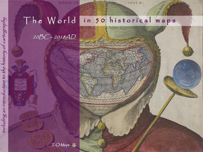
This world atlas comprises 50 carefully selected world maps plus a description of their makers. Furthermore it includes a comprehensive insight in the history of cartography and how and why maps are/were made. The e-atlas shows how the world has changed through time and how map making techniques have evolved. Each era is represented by a number of maps drawn by the most famous (European) cartographers of their time. From early classical & medieval maps, via maps of 16th/17th century atlases (Golden Age of Cartography), to contemporary computer-generated images.
Besides this world atlas, e-atlases of the 6 continents and separate e-atlases of more than 50 countries, distributed all over the world, are currently available. The provided e-atlases are not meant to replace the traditional printed atlases but are an addition and offer extra functionality (e.g. zooming in on geographic features). They can be downloaded as PDF-files; the files can be viewed using Acrobat Reader (version 10 or higher) and compatible applications.
Each historical e-atlas is composed of 4 sections. The first 3 sections describe the history of cartography and map making techniques in general. In the 4th or major section (Country maps and their Makers) the history of a specific country is visualized via a range of maps from important mapmakers in different era’s. The document is made up of duo pages; the right page displays the map of a given period, the left page contains text describing its creator and other details. Each atlas also includes an Appendix which contains a selection of common Latin terms that are used on ancient maps.
The historical e-atlases are suitable for reading and presentation purposes (in classrooms). The maps and their descriptions can be studied and printed at home or school. The main group of potential users are teachers and students in geography and history. Moreover, the atlases are useful to anyone who is interested in old maps of his/hers native or ancestors country.
For more (background) information please refer to the author’s Blogspot:
https://tomaps20.blogspot.com/
The name **Africa **may be derived from the Phoenician word afar, meaning “dust”. The name Africa Terra (“Land of the dust”) was introduced by the ancient Romans to identify the northern part of the continent that corresponds to modern-day Tunisia. (Northern) Africa was already described by classical Greek scholars; e.g. Ptolemy in his Geographia (150AD). The accompanying (world) maps were worked out again by European cartographers at the end of the 15th century. It is also depicted on the T-O based Mappa Mundi of the middle ages, being one of the 3 then known ‘old’ continents (besides Asia and Europe). During the Middle Ages, as the Europeans increased their knowledge and awareness of the size of the African continent, they progressively extended the name of Africa to the rest of the continent. Waldseemuller’s large map of 1507 - being partly based on Ptolemy’s ideas and new discoveries - was one of the first world maps depicting the whole continent, including the South-African coastline. On the earlier world map of Martellus (1490) the southern part was truly out of shape; on Cantino’s portolan chart (1502) it was corrected on account of information provided by Portuguese explorers. The first (printed) separate maps of Africa appeared in the mid 16th century. At first they were small overview maps in pocket atlases. Numerous large atlas maps made by famous cartographers would follow: e.g. Lafreri (Italy), Mercator (Belgium), Speed (England), Sanson (France), Blaeu (Netherlands) and Homann (Germany).
In classical Greek mythology, Europe (Europa) is the name of either a queen of Crete or Phoenician princess. It means “wide-gazing” or “broad of aspect”. Europe was already described by classical Greek scholars; e.g. Ptolemy in his Geographia (150AD). The accompanying maps were worked out again by European cartographers at the end of the 15th century. It is also depicted on the T-O based Mappa Mundi of the middle ages, being one of the 3 then known ‘old’ continents (besides Asia and Africa). The first (printed) separate maps of Europe appeared in the early 16th century. Numerous maps made by famous cartographers would follow: e.g. Gastaldi (Italy), Mercator (Belgium), Speed (England), Sanson (France), Blaeu (Netherlands) and Homann (Germany).
The name Asia comes from Semitic, an old language from which the current Arabic, Hebrew and Maltese languages, among others, are derived. It refers to the word asu, which means “rising of the sun”. (Western) Asia was already described by classical Greek scholars; e.g. Ptolemy in his Geographia (150AD). The accompanying (world) maps were worked out again by European cartographers at the end of the 15th century. It is also depicted on the T-O based Mappa Mundi of the middle ages, being one of the 3 then known ‘old’ continents (besides Africa and Europe). During the Middle Ages, as the Europeans increased their knowledge and awareness of the size of the Asian continent, they progressively extended the name of Asia to the rest of the continent. Waldseemuller’s large map of 1507 - being partly based on Ptolemy’s ideas and new discoveries - was one of the first printed world maps depicting the whole continent, including the far eastern coastline. The first ‘complete’ maps of Asia were still largely based on the voyages of discovery that the Venetian merchant Marco Polo had made between 1271 and 1295 to the Far East. The first (printed) separate maps of Asia appeared in the mid 16th century. At first they were small overview maps in pocket atlases. Numerous large atlas maps made by famous cartographers would follow: e.g. Lafreri (Italy), Mercator (Belgium), Speed (England), Sanson (France), Blaeu (Netherlands) and Homann (Germany).
The 4th continent is named after the Italian explorer Amerigo Vespucci. The name America was introduced by the German cartographer Martin Waldseemuller. He wrongly assumed that Amerigo Vespucci - and not Columbus – had been the first European who discovered the new western continent. The name appeared for the first time on his famous world map published in 1507. The printed wall map was lost for a long time; the only survived copy was found in Schloss Wolfegg, in southern Germany in 1901. The map, also called the “birth-certificate of America”, was purchased by the Library of Congress in 2003. The (eastern) coastline of America was drawn much more accurate on the world map of Ribero in 1527. The first separately printed map (pocket version) of the new continent (the Americas) was included in Sebastian Munster’s encyclopaedia (1540 onwards). The first (printed) separate maps of South America appeared in the mid 16th century. At first they were small overview maps in pocket atlases, e.g. by Italian cartographers Gastaldi and Ruscelli. Numerous large (atlas) maps made by famous cartographers would follow: e.g. Gutierrez/Cock (Belgium), Jansson (Netherlands), Sanson (France) and Lotter (Germany).
The 4th continent is named after the Italian explorer Amerigo Vespucci. The name America was introduced by the German cartographer Martin Waldseemuller. He wrongly assumed that Amerigo Vespucci - and not Columbus – had been the first European who discovered the new western continent. The name appeared for the first time on his famous world map published in 1507. The printed wall map was lost for a long time; the only survived copy was found in Schloss Wolfegg, in southern Germany in 1901. The map, also called the “birth-certificate of America”, was purchased by the Library of Congress in 2003. The (eastern) coastline of America was drawn much more accurate on the world map of Ribero in 1527. The first separately printed map (pocket version) of the new continent (the Americas) was included in Sebastian Munster’s encyclopaedia (1540 onwards). The first (printed) separate maps of North America appeared in the mid 16th century. At first they were small overview maps in pocket atlases, e.g. by Italian cartographer Porcacchi. Numerous large (atlas) maps made by famous cartographers would follow: e.g. Jansson (Netherlands), Sanson (France), Moll (England) and Lotter (Germany).
Gerardus Mercator: the cartographer who shaped our worldview (1512-1594)
This story is dedicated to Gerardus Mercator (1512-1594), for many – including the author of this book – the greatest cartographer of all time. His life, education and work are described. He lived in a time and region where poverty and political-religious tensions prevailed: the south-east of the Low Countries in the 16th century. Mercator’s life therefore had many setbacks, including his imprisonment and the loss of 3 of his 5 children. Nevertheless, he became proficient in all facets of map making: geographical knowledge, surveying techniques and map design and engraving. He produced both large-scale and small-scale maps, world maps and atlases. In addition, he made (earth) globes and surveying instruments.
His life, studies and work are described chronologically. His predecessors are also discussed: in particular, the geographers from classical antiquity who inspired him during his studies and work. His two greatest achievements receive special attention: his world map from 1569 with a projection named after him for navigation purposes and the “first” structured collection of maps in book form from 1585, for which he coined the term Atlas. Numerous renowned cartographers have subsequently elaborated on Mercator’s map projection and atlas. Even today, his projection is still used. He has thus shaped the worldview of countless people…
Cuba in 52 historical maps: 1502-2018 (150 pages).
The origin of the name Cuba is uncertain. Most likely it is means Taino cubao (“abundant fertile land” or coabana (“great place”). On early maps of Cuba and other Caribbean islands they were called the West Indies by European cartographers. This in contrast to the East Indies of present-day SE Asia. The region appeared for the first time on the manuscript map of Juan de la Cosa (1500), who had sailed to the West together with Columbus, and the Cantino world map (1502). The first separately printed maps were published at the end of the 16th century. The capital city Havana dates back to the 16th century. Being an important sea port it was founded in 1515 by Diego Velázquez.+
+NOTE: Cuba was discovered by Columbus (1492), but only concurred on the native Indians by Velásquez in 1511.