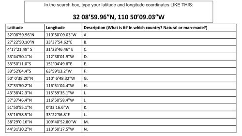

An introduction activity to using Google Maps or Earth. Students practise entering latitude and longitude in a standardised co-ordinates format to find interesting shapes and landforms visible in Google’s satellite and aerial imagery.
1xworksheet, self-guided.
Something went wrong, please try again later.
This resource hasn't been reviewed yet
To ensure quality for our reviews, only customers who have downloaded this resource can review it
Report this resourceto let us know if it violates our terms and conditions.
Our customer service team will review your report and will be in touch.
£0.00