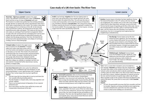
This is a graphic organiser to show the impact of geomorphic processes and human activities on the River Tees. It can be used for KS3 and KS4. It locates and describes the river landforms in the upper course (waterfall and gorge at High Force and V-shaped valley in the Pennine hills) and lower course (meander at Yarm). It focuses on human impact at Cow Green reservoir, Yarm, Stockton and on the floodpalin around Middlesbrough.
Something went wrong, please try again later.
This resource hasn't been reviewed yet
To ensure quality for our reviews, only customers who have purchased this resource can review it
Report this resourceto let us know if it violates our terms and conditions.
Our customer service team will review your report and will be in touch.
