Hero image

The Flash Store

Average Rating4.37
(based on 253 reviews)

I am a teacher specialising in Geography and Religious Studies with over 4 years experience to date. I pride myself on designing lessons that engages students in their learning, with an enquiry-based focus being at the forefront. Any lesson that you download is fully resourced and differentiated ready to use in a flash. I hope they make a real contributing to your own classroom like they have done to mine.

222Uploads

271k+Views

358k+Downloads

I am a teacher specialising in Geography and Religious Studies with over 4 years experience to date. I pride myself on designing lessons that engages students in their learning, with an enquiry-based focus being at the forefront. Any lesson that you download is fully resourced and differentiated ready to use in a flash. I hope they make a real contributing to your own classroom like they have done to mine.
What Is Longshore Drift
occold25occold25

What Is Longshore Drift

(0)
This contains a fully resourced, differentiated lesson on the process of longshore drift. The main activities include a class discussion, video note taking task and a group drama activity. This lesson can easily be used by non-specialists as all answers are included. Learning Objectives: To understand the forces of transportation and deposition. To explain the process of longshore drift. To analyse how human activity can affect this process.
School Microclimate Survey
occold25occold25

School Microclimate Survey

(0)
This contains a fully resourced, differentiated set of lessons in order to carry out a microclimate survey around a school environment, although it could be adapted to suited others. The first lesson helps students to prepare for their microclimate survey, paying particular attention to how two major pieces of equipment work and to construct hypotheses for their survey. The second lesson involves students going around a school environment, in groups, collecting their microclimate data. Differentiated recording sheets are provided for students. The third lesson involves students writing up their report to show the results of their survey. I hope you find these resources helpful.
What Makes A Good Site For A Settlement
occold25occold25

What Makes A Good Site For A Settlement

(0)
This contains a fully resourced, differentiated lesson on the factors that make a good site for a settlement. The main part of the lesson involves a brief written exercise to consider the factors that are important when considering the site of a settlement, then an interactive group task (involving dice!) where students create the location of a site of a settlement and have to discuss its advantages and disadvantages, and lastly decide whether it is an appropiate site for a settlement or not. Learning Objectives: To describe the factors that can influence the site of a settlement. To explain the advantages and disadvantages of these factors. To evaluate whether these factors make it an appropriate site or not.
How Is Land Used In Urban Areas
occold25occold25

How Is Land Used In Urban Areas

(0)
This contains a fully resourced, differentiated lesson on how land is used in urban areas, paying particular attention to the Burgess Model. The main part of the lesson involves students drawing a sketch of the Burgess Model accompanied by a written paragraph describing what it shows, then working in pairs to study visual information sheets of each zone (CBD, Inner City, Inner Suburbs, Outer Suburbs) to explain the characteristics of each zone - this involves a very enquiry based approach and a heavy emphasis on them having to justify their answers based on the visual evidence provided). Learning Objectives: To describe the different zones that can be found in urban areas. To explain how these zones can be used and why they are located there.
Settlement Test
occold25occold25

Settlement Test

(0)
This contains an end-of-unit test that can be used to assess progress on the core content in a Settlement unit, aimed primarily at KS3 level. This test covers the following topics: settlement hierarchies, services, factors that can affect the site of a settlement, functions of a settlement, Burgess model and urban land use, urbanisation. It can easily be adapted to suit your own school’s local Geography if desired.
Settlement Scheme Of Work
occold25occold25

Settlement Scheme Of Work

6 Resources
This contains a scheme of work designed to cover the key content of settlement. It is aimed at KS3 to give students a good grounding in preparation for the more rigorous GCSE's and so contains demanding exercises in a fun, interesting and innovative fashion. Content covered: settlement hierarchies, services, site factors, settlement functions, Burgess model, urban land uses, urbanisation patterns and reasons. It should be taught in the following order: 1. What Is A Settlement? 2. What Makes A Good Site For A Settlement? 3. What Different Functions Can A Settlement Have? 4. How Is Land Used In Urban Areas? 5. Why Is The World Increasingly Urban? 6. Settlement End-Of-Unit Test
What Different Functions Can A Settlement Have
occold25occold25

What Different Functions Can A Settlement Have

(0)
This contains a fully resourced, differentiated lesson on settlement functions. The main part of the lesson involves a simple matching exercise of the different settlement functions, then complete a grid shading exercise of the different indicators of the various functions that a settlement can hold (they are required to justify what they consider the most important indicator for each function as part of this). Learning Objectives: To describe the different functions a settlement can have. To explain the indicators of each type of settlement function. To explore how the function of a settlement can be dependent upon the physical environment.
What Is A Settlement
occold25occold25

What Is A Settlement

(0)
This contains a fully resourced, differentiated lesson which acts as an introduction to settlement. The main part of the lesson involves a brief class demonstration to illustrate the meaning of a hierarchy, a fact finding task on the characteristics of a settlement hierarchy and an O.S. map task where students consider the link between the size of a settlement and the number of services it provides. PLEASE NOTE: DUE TO COPYRIGHT THE OS MAP CANNOT BE PROVIDED. Learning Objectives: To describe the characteristics of a settlement hierarchy. To explain the link between the size of a settlement and the number of services it has.
Global Poverty
occold25occold25

Global Poverty

(0)
This contains a fully resourced, differentiated lesson on global poverty. In the main part of the lessons students have to consider a range of definitions to decide what they believe is the best one, use a range of pictures to explain the impacts of global poverty, and finally complete a written evaluation as to whether they believe it is possible to end global poverty. Learning Objectives: To describe the meaning of poverty. To explain the impacts of global poverty. To speculate whether it is possible to end global poverty.
Map Skills Assessment
occold25occold25

Map Skills Assessment

(0)
This contains a fully resourced, differentiated assessment on Map Skills. This resource involves students creating a guide book for visiting Geography students to the town of Framlingham. The activities are included below, although this can easily be adapted for other towns/cities in the UK: • Map(s) to locate Framlingham in Suffolk and the UK • Description of Framlingham’s location in Suffolk and the UK • A sketch map of Framlingham, using symbols and a grid • Planned route around the town, using 4 or 6 figure grid references and compass directions
Why Is The World Increasingly Urban
occold25occold25

Why Is The World Increasingly Urban

(0)
This contains a fully resourced, differentiated lesson on why the world is increasingly urban. The main part of the lesson involves a Quiz-Quiz trade task to define the key terms linked to the 'Urban Futures' unit, followed by a task where they plot a line graph to describe the overall trends in urbanisation between richer and poorer countries, and lastly a task where students have to develop explanations as to why urbanisation is faster in poorer countries than richer countries. Learning Objectives: To identify key terms linked to the ‘Urban Futures’ unit. To describe how the rates of urbanisation vary globally. To explain reasons for these trends.
What Processes Occur In And At The Surface Of The Earth
occold25occold25

What Processes Occur In And At The Surface Of The Earth

(0)
This contains a fully resourced, differentiated lesson on the processes that occur in the interior of the earth and at plate boundaries. The main part of the lesson involves annoating a diagram with the key properties of each interior layer of the earth, working in pairs to produce a revision tool on one of the plate boundaries and then peer teaching to produce a set of notes on all four types of plate boundary. Learning Objectives: To describe the structure of the earth. To explain the processes that operate at tectonic plate boundaries.
Why Do Tectonic Plates Move
occold25occold25

Why Do Tectonic Plates Move

(0)
This contains a fully resourced, differentiated lesson on why tectonic plates move. The main part of the lesson involves a mapping task where students plot the main tectonic and earthquake plate boundaries and describe its distribution, then use a clip to order statements in order to explain the process of continental drift, followed by image analysis to deduce forms of evidence for this movement. Learning Objectives: To describe the global distribution of earthquake and volcanic activity. To explain how the process of continental drift causes tectonic plate movement. To investigate the evidence for this movement.
Why Did The Haiti Earthquake Cause So Much Devastation
occold25occold25

Why Did The Haiti Earthquake Cause So Much Devastation

(0)
This contains a fully resourced, differentiated lesson on the impacts of the Haiti earthquake, 2010. The main part of the lesson involves students using a map to describe the cause of the earthquake, colour code the impacts of the earthquake and explain the effect they would have, then working in pairs to justify the importance of certain factors in contributing to the devastating nature of the Haiti earthquake. Learning Objectives: To describe the cause of the Haiti earthquake. To explain the effects of the Haiti earthquake. To assess why the earthquake caused so much devastation.
What Challenges Does London Face
occold25occold25

What Challenges Does London Face

(0)
This contains a fully resourced, differentiated lesson on the challenges (problems) facing London as a world city in the 21st Century. The main part of the lesson involves students working in groups, using visual prompts, to discuss and explain how each challenge could affect residents, businesses and the environment, after which they draft a short email to the Mayor of London recommending which challenge they think should be addressed first and why. Learning Objectives: To explain the different challenges that London faces. To assess the importance of these challenges. To investigate how these challenges could be tackled.
Map Skills Scheme Of Work
occold25occold25

Map Skills Scheme Of Work

10 Resources
This contains a fully resourced, differentiated scheme of work on 'Map Skills'. All lessons contain a set of clear activities to meet a set of differentiated learning objectives. They should be taught in the following order: 1. What is Geography all about? 2. Why is it important to study Geography? 3. What are the fundamentals of maps? (Compass directions and map scales) 4. Where in the world are we? (Global Geography) 5. How do we know where we are? (Geography of the British Isles) 6. How can symbols be used on an O.S. map? 7. How do we find places on a map? (Four-figure grid references) 8. How do we find specific places on a map? (Six-figure grid references) 9. Treasure Island (Consolidation task) 10. How do we show height on a map? 11. Contour Island practical
River Processes
occold25occold25

River Processes

(0)
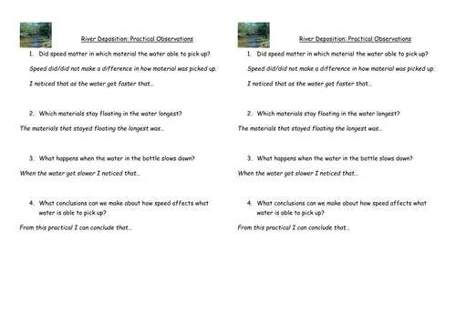
A fully resourced lesson used for an observation lesson on river processes. In the starter they have to decide which type of material would be the easiest to move downstream, create diagrams to show how material can be eroded, and includes a practical designed to show the settling rates of different size materials (sand, gravel, and clay). The instructions for that are contained on the powerpoint, and could be easily adapted to make a task sheet for students to carry out group work! Finally, they then make observations to analyse what they observed from the practical.
How a dam generates electricity
occold25occold25

How a dam generates electricity

(0)
This is an activity where pupils work out how a dam generates electricity, using a video as a source material. Use this link. http://www.youtube.com/watch?v=rnPEtwQtmGQ