A fully resourced and up to date lesson on body image and body dysmorphia, an introduction into what body image is, what social media can do.
Task 1: Starter - Knowledge recap on what students previously learnt about hygiene.
Task 2: Create a spider diagram about what is body image using prompts on the board.
Task 3: Using example of filters, students have to identify what has changed and why that person may have changed it.
Task 4: What can be done to promote body positivity?
Task 5: Plenary - On whiteboards, students to give ideas on how to reduce inequality.
**Download contains PowerPoint and worksheet for the lesson. **
A fully resourced and up to date lesson on the different cartographic skills for students at GCSE. This lesson includes:
Atlas Skills including reading longitude and latitude and identification of physical and human atlas maps.
Ordnance Survey Maps including using a key, scale, four and six figure references and reading contours and spot height.
Maps in association with photographs including direction of photograph, identification of features, use of satellite imagery and sketch/ field maps.
Task 1: Identify the longitude and latitude of 12 points on an atlas.
Task 2: Measuring the distance between features on an OS map
Task 3: Identifying four and six figures on a simple OS map
Task 4: Identify the maximum and minimum height of the OS map
Task 5: Identify the direction the photograph was taken
Task 6: Explain the social, economic and environmental impacts of a earthquake from satellite imagery.
If you get time you could take your students outside and get them to do a sketch map of the school ground and a birds eye view of the school.
**Download contains PowerPoint and worksheet for the lesson. **
A fully resourced and up to date lesson on plate tectonics, plate boundaries and the different features and hazards found at each boundary
Task 1: Starter: Knowledge recall on previous topic (Coasts)
Task 2: Draw a diagram and label it on destructive plate margins, fill in information and features found here.
Task 3: Draw a diagram and label it on constructive plate margins, fill in information and features found here.
Task 4: Watch the video to recap what they have just learnt.
Task 5: Exam question: “using a diagram, explain what happens at a constructive boundary (4 marks)”
Task 6: Plenary- Revision on how a sea stack is formed.
**Download contains PowerPoint and worksheet for the lesson. **
Students to define what sustainability is and how social, economic and environmental factors must be taken into account to make something sustainable. Then students will read through the worksheet and choose which option is the best for sustainability. Finally, students will put everything they have learnt together in a final secondary assessment.
Task 1: Starter - Recap on previous learning
Task 2: On whiteboards, come up with a definition of sustainability
Task 3: Identify which management strategy is the most sustainable and why.
Task 4: Main Task - Secondary Assessment - Evaluate the protection of the Amazon Rainforest.
Task 5: Plenary: 3,2,1 - Class Discussion - Why do people cut down the rainforest?
Lesson 8 out of 8
Students will be able to describe the distribution of population across Russia, using key terms such as dense and sparse to describe the spread. Students will then be able to use human and physical evidence as to why humans are distributed this way.
Starter: True or False
Task 1: Describe the distribution of population density using a map
Task 2: True or False
Task 3: Human and physical factors that affect population
Task 4: Main Task: Explain one physical and one human factor to why Russia’s population is distributed this way.
Task 5: Plenary: Peer assessment- swap books with partner and mark the question.
Lesson contains one powerpoint and one worksheet.
A fully resourced and up to date lesson on how physical geography and its features can effect conflict. A recap on what physical geography is, features of physical geography that can affect conflict.
Task 1: Starter - Recap on previous learning with 5 questions.
Task 2: Define physical geography
Task 3: Read through the battle of hastings and identify how the physical geography of the area affected the battle.
Task 4: Match up the key terms and how they affect conflict
Task 5: Main Task- Using an Atlas students to look at global maps and topographical maps and decide which country would be easiest and hardest to invade and why.
Task 6: Plenary - What are some of the ways countries avoid being invaded.
**Download contains PowerPoint and worksheet for the lesson. **
A fully resourced and up to date lesson on expectations in relationships. Students will be able to define what expectations are, identify situations where people may have expectations of them and how to discuss expectations.
Task 1: Starter - Knowledge recall about what are some of the verbal ways people can ask for consent.
Task 2: Define what expectations are
Task 3: Students to label things that they want from a relationship with someone.
Task 4: Main Task - Students to identify if the ten scenarios are a negative or positive in the relationships.
Task 5: Plenary - Discussion on how to reaffirm expectations in relationships.
**Download contains PowerPoint and worksheet for the lesson. **
A fully resourced and up to date lesson on the reasons why people live in tectonically active regions, why the effects of natural hazards are greater in LICs than HICs and creating a scientific hypothesis to check the statements.
Task 1: Starter: Knowledge recall on previous topic (Coasts)
Task 2: Recap on what the effects on natural hazards are.
Task 3: Create a scientific hypothesis to investigate why the effects on natural hazards are greater in LICs than HICs
Task 4: Watch the news video about the way Naples monitors Vesuvius.
Task 5: Either prove or disprove the scientific hypothesis.
Task 6: Exam question: Describe and explain how planning for a tectonic hazard might help to reduce the effects of an earthquake or volcanic eruption in Naples
(6 marks)
Task 7: Peer Feedback
Task 8: Revision on geographical skills
**Download contains PowerPoint and worksheet for the lesson. **
A fully resourced and up to date lesson on the structure of the Earth along with plate tectonic theory. A great introductory lesson into natural hazards and tectonic hazards.
Task 1: Theorize why the Earth is like an egg.
Task 2: Describe the characteristics of the structure of the Earth.
Task 3: Quick video to recap the structure of the Earth.
Task 4: Watch the video about slab pull and convectional currents
Task 5: Describe the global distribution of earthquakes and volcanoes (4 marks)
Task 6: Peer mark
**Download contains PowerPoint and worksheet for the lesson. **
Students will identify the location of Brazil globally, continentally and the physical features of Brazil such as the Andes, Atacama desert and the Amazon. Students will then create a climate graph to show the temperature of Brazil and the climate. Finally, they will identify why Brazil is an important country internationally.
Task 1: Located and describe Brazil
Task 2: Using the worksheet students will draw on where the physical features of South America and Brazil are.
Task 3: Climate graph of Brazil (Amazon Rainforest)
Task 4: Main Task: Describe the location of Brazil and explain Rio de Janeiro’s importance.
Task 5: Plenary: Class question- why do people what to move to Rio?
Lesson 1 out of 8
A fully resourced and up to date lesson on the distribution of global inequalities, a look into why global inequalities have occurred and long form written assessment at the end to assess students comprehension.
Task 1: Starter - Answer true and false questions about previous learning
Task 2: On white boards students to come up with reasons why some countries develop better than others.
Task 3: Read through the different reasons for global inequalities on the worksheet and PowerPoint slides.
Task 4: Main Task - Long form writing assessment- students to discuss why development is important to developing countries and how countries develop unequally.
Task 5: Plenary - On whiteboards, students to give ideas on how to help countries develop equally.
**Download contains PowerPoint and worksheet for the lesson. **
A fully resourced and up to date lesson on Typhoon Haiyan, the location, case study, primary and secondary effects along with planning, preparation and monitoring.
Task 1: Starter - Answer true and false questions about previous learning
Task 2: Students to accurately describe the path of the typhoon.
Task 3: Read through the information sheet and add the effects and responses on their sheet.
Task 4: Main Task - Exam question practice, "Using an example, describe the primary and secondary effects of a tropical storm. (6 marks)
Task 5: Exam Question Practice - "Using an example, describe the short-term responses to a tropical storm (4 marks)
Task 6: Plenary - Explain why planning and preparation is the best option for reducing the effects of tropical storms.
**Download contains PowerPoint and worksheet for the lesson. **
Students will be able to describe the location of Afghanistan, outline how conflict can affect development of a country and will finally explain in a mini essay how geography in the Middle East and conflict is linked.
Task 1: Starter- Recall Activity
Task 2: Define key words
Task 3: Locate Afghanistan
Task 4: Describe bar graph of development of Afghanistan
Task 5: Explain how geography in the Middle East and conflict are linked
Students will learn where Iraq is located, its physical geography and then explain how physical geography affected the war in Iraq. Task 1- Describe where Iraq is
Task 2- Watch video about Iraq war
Task 3- Create timeline about the Iraq War
Task 4- Colour in physical map about Iraq
Lesson 5 out of 9.
Students will compile what they have learnt over the past 9 lessons to understand how people in the UK affect conflicts, how conflict affects us and then evaluate the effect of conflict.
Task 1: Starter/ recall of knowledge
Task 2: How do we personally affect conflicts?- Fill in the sheet
Task 3: Evaluate the effects of conflict
Lesson 9 of 9
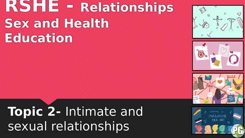
A fully resourced and up to date lesson introducing students to intimacy and sexual relationships. This should form the basis of discussions about what intimacy is and how to prepare for intimacy in a relationship.
Task 1: Starter - Create class ground rules on SRE
Task 2: Students to discuss what intimacy is and what it means to them
Task 3: In pairs come up with 5 or more characteristics of a positive intimate relationship.
Task 4: What are the positives of having healthy intimacy, what are the negatives of intimacy.
Task 5: Main Task: Students must give advice to 4 different scenarios.
Students will be able to accurately locate Chernobyl and be able to discuss the time-line of events that led to the Chernobyl disaster. Students will begin to look at the magnitude of the event and the effects of the disaster.
Task 1: Starter- True or False- Knowledge recap of previous learning
Task 2: Located Ukraine/ Chernobyl on maps
Task 3: Watch various clips about Chernobyl
Task 4: Sort the effects of Chernobyl into social, economic and environmental effects
Task 5: Choose which of the effects are most significant and why.
Task 6: Main Task:Outline what happened in Chernobyl, identify which effect is most significant and describe its size, severity and length of time.
Task 7: Plenary: Write a sentence about how they, thought, liked, hated, wanted to learn more.
Lesson contains powerpoint and worksheet.
Students to identify where the world’s tropical rainforests are located and where in South America does the largest amount of the Amazon Rainforest is found.
Task 1: Starter - Recap on previous learning
Task 2: On whiteboards, come up with as many reasons you think the Amazon Rainforest is important.
Task 3: Which of the benefits of the Amazon Rainforest is most important and why?
Task 4: Main Task - Describe the importance of the Amazon Rainforest
Task 5: Plenary: 3,2,1 - Class Discussion - Why do people cut down the rainforest?
Lesson 6 out of 8
Students to define what deforestation is and the economic reasons that deforestation occurs. Then students will interpret a pie chart showing the reasons for deforestation. Then after reading through the information students must choose which is the most impactful reason for the amazon rainforest being deforested and why.
Task 1: Starter - Recap on previous learning
Task 2: On whiteboards, come up with as many reasons you think the Amazon Rainforest is important.
Task 3: Which of the benefits of the Amazon Rainforest is most important and why?
Task 4: Main Task - Explain how development in tropical rainforests creates economic advantages
Task 5: Plenary: 3,2,1 - Class Discussion - Why do people cut down the rainforest?
Lesson 7 out of 8
Students will identify the increase in urbanisation over time and predicted increases. Then will investigate the social, economic and environmental challenges of urbanisation in Rio, and how they will impact the area.
Task 1: Starter - Recap on previous learning
Task 2: Describe the trend on the graph on screen (3 marks)
Task 3: Using the factors on the worksheet identify which is the most important social, economic and environmental challenges.
Task 4: Main Task - Describe how urbanisation has created challenges in Rio de Janeiro.
Task 5: Plenary: Class question- What are some of the negatives about living in favelas in Rio.
Lesson 3 out of 8