Hero image

The Flash Store

Average Rating4.37
(based on 253 reviews)

I am a teacher specialising in Geography and Religious Studies with over 4 years experience to date. I pride myself on designing lessons that engages students in their learning, with an enquiry-based focus being at the forefront. Any lesson that you download is fully resourced and differentiated ready to use in a flash. I hope they make a real contributing to your own classroom like they have done to mine.

222Uploads

263k+Views

353k+Downloads

I am a teacher specialising in Geography and Religious Studies with over 4 years experience to date. I pride myself on designing lessons that engages students in their learning, with an enquiry-based focus being at the forefront. Any lesson that you download is fully resourced and differentiated ready to use in a flash. I hope they make a real contributing to your own classroom like they have done to mine.
How Do We Know Where We Are (Geography of the British Isles)
occold25occold25

How Do We Know Where We Are (Geography of the British Isles)

(0)
This contains a fully resourced, differentiated lesson on the key geographical features of the British Isles. The main part of the lesson consists of a mapping task (cities and towns, seas and oceans) which is assessed through an interactive quiz included. It also includes a section on students writing a paragraph to describe the location of an English town using appropriate geographical methodology (this start with a class discussion on how this is best approached to create a list of success criteria on the board), leading to peer assessment as a plenary. Learning Objectives: To plot the key Geographical features of the British Isles. To describe our location using appropriate Geographical terminology.
Why Is It Important To Study Geography
occold25occold25

Why Is It Important To Study Geography

(0)
This contains a fully resourced, differentiated lesson on the importance of studying Geography. It would act particularly well as an early lesson at the start of Year 7. In the main part of the lesson students have to generate their own responses to the question, using small case studies and prompts on the Powerpoint to guide them. This then leads to the second main task where students have to produce a piece of work persuading other Year 7's that it is an important subject to study. Learning Objectives: To explain how Geography can help us to make sense of the world. To analyse how it can affect the actions we make in life.
Where In The World Are We
occold25occold25

Where In The World Are We

(0)
This contains a fully resourced, differentiated lesson on global geography - the key focus being on able to plot and recognise key geographical features on a world map including continents, countries, seas and oceans, and mountain ranges. This is assessed primarily through an interactive quiz which can be easily self assessed. Learning Objectives: To describe terminology linked to Geographical mapping. To plot the key Geographical features onto a map of the world. To explain patterns in country characteristics
What Is Geography All About
occold25occold25

What Is Geography All About

(0)
This contains a fully resourced, differentiated lesson which acts as an introduction to Geography at KS3, although it can be easily adapted for KS3. It primarily focuses on the different branches of Geography, in which students have to group different Geographical topics and then explain potential connections between them. Learning Objectives: To describe the different types of Geography. To explain connections between different Geographical topics.
What Are The Fundamentals Of Maps (Compass Directions and Map Scales)
occold25occold25

What Are The Fundamentals Of Maps (Compass Directions and Map Scales)

(0)
This contains a fully resourced, differentiated lesson on the fundamentals of maps - compass directions and scale. The main part of the lesson involves students being able to identify and use a compass confidently, which includes a mini-game assessment task, and how to use scale to work out distances between places (including curvature). Learning Objectives: To identify the different points of the compass. To understand why and how scale is used on maps.
Treasure Island
occold25occold25

Treasure Island

(0)
This contains a fully resourced, differentiated lesson on consolidating map skills, including compass directions, scale, symbols, and four/six-figure grid references. This is done by students having to create their own treasure islands with a hidden treasure that can only be found by carefully following their designed set of instructions. Learning Objective: To apply map skills learned so far to produce a treasure map.
Physical or Human Feature
occold25occold25

Physical or Human Feature

(0)
This is a simple task where students have to classify features into physical or human categories. A simple starter designed for my less able students, it can also be used as a re-cap or introductory activity.
Coastal Protection DME
occold25occold25

Coastal Protection DME

(0)
This is a decision making exercise where students have to decide how they are going to protect the coastal settlement of 'Broadchurch'. Feedback on this particular task would be appreciated.
Growth of Urban Areas
occold25occold25

Growth of Urban Areas

(0)
This lesson covers why cities grow and some of the problems it can cause.\n\nUrbanisation, push factors, pull factors, urban areas, urban problems, growing cities
Solar Energy in Norfolk
occold25occold25

Solar Energy in Norfolk

(0)
This lesson explores the proposal to build Norfolk's largest solar farm at Bridgham, South Norfolk.\n\nSolar energy, solar photovoltaics, green energy, renewable, renewables, solar power.
Poverty in China
occold25occold25

Poverty in China

(0)
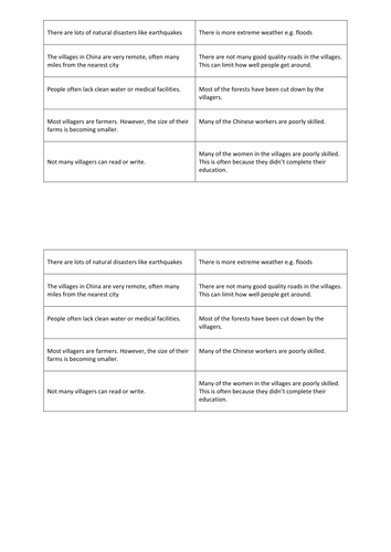
A lesson which explores the concept of poverty and the reasons behind it, in particular focusing on the rural regions. This lesson was designed in addition to the GA China SOW.
Sources of Deforestation
occold25occold25

Sources of Deforestation

(0)
This contains a fully resourced lesson on the sources of deforestation, focusing on research, group work and consolidation. Worked very well with my Year 9 groups. Learning Objectives are: To identify different sources of deforestation. To investigate the reasons for deforestation. To draw tentative conclusions about the effects of deforestation.
How is the UK linked with the rest of the world
occold25occold25

How is the UK linked with the rest of the world

(0)
A fully resourced lesson on how the UK is linked with the rest of the world (interdependance). *Starter- Students listen to the story of Lizzie, and how morning routine is linked to products worldwide. *Main- Students produce an ideas map showing how the UK is linked to the rest of the world, categorising those links. *Main- They then use the task sheet to create an informative poster to explain why countries are reliant on each other for food. *Plenary- What might happen if we cut off our links to the rest of the world?
Why are Deserts called an Extreme Environment
occold25occold25

Why are Deserts called an Extreme Environment

(0)
This fully resourced, differentiated lesson focuses as an introduction to extreme environments, namely the challenges that face groups of people that live in hot arid (desert) environments. Students complete a set of tasks, including a picture analysis task, an information gathering and comprehension task, and an indepdent learning task focusing on the potential future impacts of climate change on the physical environment and the Bedouin tribe.
Types Of Clouds
occold25occold25

Types Of Clouds

(0)
This contains a fully resourced, differentiated lesson on the different types of cloud. In this lesson students have to read the fictional account of Will Smith's aerial journey tracking an alien, encountering different types of cloud in the process. They use to complete a worksheet explaining their different characteristics. Learning Objectives: To understand the different types and features of clouds. To explain how they are classified.
Climate of the UK
occold25occold25

Climate of the UK

(0)
This contains a fully resourced lesson on how the climate of the UK varies. The main component of the lesson involves choropleth mapping to show how temperature and rainfall varies between winter and summer. Extension tasks are included throughout. Learning Objectives: To describe what the climate of the UK is like. To explain the reasons for these differences.
What Is Longshore Drift
occold25occold25

What Is Longshore Drift

(0)
This contains a fully resourced, differentiated lesson on the process of longshore drift. The main activities include a class discussion, video note taking task and a group drama activity. This lesson can easily be used by non-specialists as all answers are included. Learning Objectives: To understand the forces of transportation and deposition. To explain the process of longshore drift. To analyse how human activity can affect this process.
School Microclimate Survey
occold25occold25

School Microclimate Survey

(0)
This contains a fully resourced, differentiated set of lessons in order to carry out a microclimate survey around a school environment, although it could be adapted to suited others. The first lesson helps students to prepare for their microclimate survey, paying particular attention to how two major pieces of equipment work and to construct hypotheses for their survey. The second lesson involves students going around a school environment, in groups, collecting their microclimate data. Differentiated recording sheets are provided for students. The third lesson involves students writing up their report to show the results of their survey. I hope you find these resources helpful.
What Makes A Good Site For A Settlement
occold25occold25

What Makes A Good Site For A Settlement

(0)
This contains a fully resourced, differentiated lesson on the factors that make a good site for a settlement. The main part of the lesson involves a brief written exercise to consider the factors that are important when considering the site of a settlement, then an interactive group task (involving dice!) where students create the location of a site of a settlement and have to discuss its advantages and disadvantages, and lastly decide whether it is an appropiate site for a settlement or not. Learning Objectives: To describe the factors that can influence the site of a settlement. To explain the advantages and disadvantages of these factors. To evaluate whether these factors make it an appropriate site or not.
How Is Land Used In Urban Areas
occold25occold25

How Is Land Used In Urban Areas

(0)
This contains a fully resourced, differentiated lesson on how land is used in urban areas, paying particular attention to the Burgess Model. The main part of the lesson involves students drawing a sketch of the Burgess Model accompanied by a written paragraph describing what it shows, then working in pairs to study visual information sheets of each zone (CBD, Inner City, Inner Suburbs, Outer Suburbs) to explain the characteristics of each zone - this involves a very enquiry based approach and a heavy emphasis on them having to justify their answers based on the visual evidence provided). Learning Objectives: To describe the different zones that can be found in urban areas. To explain how these zones can be used and why they are located there.