Hero image

GeographyFocus Shop

Average Rating4.55
(based on 40 reviews)

I am a geography teacher with 36 years experience in Years 7 to 12 in high schools in New South Wales and Western Australia. I am now retired but maintain a strong interest in producing resources for the subject for which I have a passion. This shop features a range of geography resources suitable for upper primary school and high school. Free resources are available for you to use within your school to trial the quality of my work.

121Uploads

95k+Views

9k+Downloads

I am a geography teacher with 36 years experience in Years 7 to 12 in high schools in New South Wales and Western Australia. I am now retired but maintain a strong interest in producing resources for the subject for which I have a passion. This shop features a range of geography resources suitable for upper primary school and high school. Free resources are available for you to use within your school to trial the quality of my work.
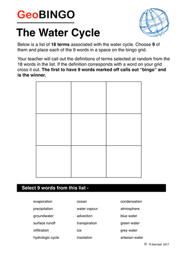
Water Cycle GeoBingo
swintrekswintrek

Water Cycle GeoBingo

(0)
A fun way for your students to become familiar with the terms associated with the water cycle. To help the teacher definitions are given on the second page.
European Wordsearch and Mapping Exercise Bundle
swintrekswintrek

European Wordsearch and Mapping Exercise Bundle

3 Resources
European countries in three sets of wordsearches and mapping exercises. Requires students to find 30 countries (10 in each exercise) and locate them in the map at the centre of the word search.
Climate Graph Exercises - UK Cities
swintrekswintrek

Climate Graph Exercises - UK Cities

(0)
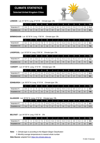
A three page set that includes: Page 1 - Tables of climate statistics for seven UK cities Page 2 - Climate graph blanks to fill in from statistics plus location map Page 3 - Complete climate graphs for teachers Cities include London, Glasgow, Edinburgh, Birmingham, Cardiff, Belfast, Liverpool
Extreme weather event - Cold front eastern Australia June 2021
swintrekswintrek

Extreme weather event - Cold front eastern Australia June 2021

(0)
This worksheet is an extreme weather case study that gets students to investigate a cold front that impacted the eastern seaboard of Australia on 9th June 2021 causing an immense amount of property damage, widespread snowfall/rain and flooding in the hinterland. Students are taken to the Australian Bureau of Meteorology’s website where they will be able to obtain information about cold fronts and an Australian news’ website where they will get information of the impact of this extreme weather event. Three pages in the worksheet. An answer key is provided.
Sharing Geographical Views
swintrekswintrek

Sharing Geographical Views

(0)
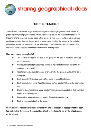
These worksheets I have used to get some meaningful sharing of geographic ideas, issues or problems in my Geography lessons. These worksheets require the students to record their thoughts and to negotiate shared ideas within groups of two, four or six to arrive at a group position which can then be shared with the whole class. I collect the sheets at the end of a lesson and review the contribution of each to the group process and use them as proof of classwork done if needed for feedback to students and/or parents. There are four sheets in the package - one explanation page for teachers and one each for groups of two, four or six students.
Investigating Hurricane Matthew - October 2016
swintrekswintrek

Investigating Hurricane Matthew - October 2016

(2)
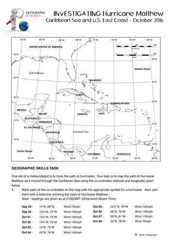
This is a worksheet (5 pages including 2 answer pages) that will get your students to investigate Hurricane Matthew (October 2016). The first page is a latitude and longitude exercise where the students will be the meteorologist and map the track of the hurricane from September 29 through to October 8th. On the second page students will answer general questions on hurricanes as background to the third page where they will look at the impact of Hurricane Matthew more closely. An answer sheet is provided for teachers.
Topographic Map Skills 5 - Landforms
swintrekswintrek

Topographic Map Skills 5 - Landforms

(1)
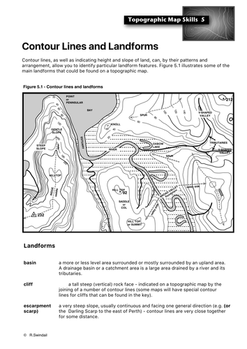
Photocopiable handout that introduces students to the various landforms that can be identified on a topographic map using the arrangement of contour lines. Also available in a bundle of all topographic mapping skills plus 10 graded exercises (with answers) at this link:https://www.tes.com/teaching-resource/topographic-map-skills-11564811
Topographic Map Skills 8 - Measuring distance
swintrekswintrek

Topographic Map Skills 8 - Measuring distance

(1)
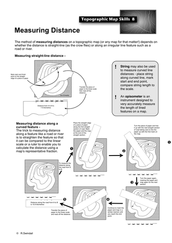
Photocopiable handout that shows students how to use the scale to work out straight-line and curved-line distances on a topographic map. Also available at a vastly reduced price as part of my Topographic Maps Skills Bundle that includes all of the basic topographic map skills as well as a set of graded exercises to practice your students in all of the skills : https://www.tes.com/teaching-resource/topographic-map-skills-11564811
Investigating Hurricane Harvey
swintrekswintrek

Investigating Hurricane Harvey

(2)
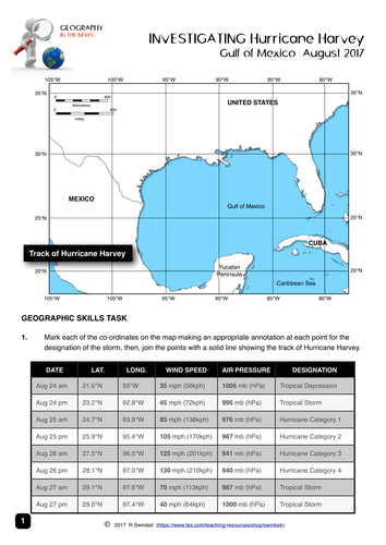
This is a worksheet (3 pages) that will get your students to investigate Hurricane Matthew (August 2017). The first page is a latitude and longitude exercise where the students will be the meteorologist and map the track of the hurricane from August 24 to August 28. On the second page students will answer general questions on hurricanes as background to the third page where they will look at the impact of Hurricane Matthew more closely. An answer sheet is provided for teachers as a separate file.
Investigating Cape Town's Water Crisis
swintrekswintrek

Investigating Cape Town's Water Crisis

(0)
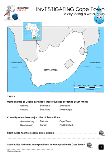
This is a five page worksheet that allows students to investigate the water crisis in Cape Town as it approaches “Day Zero”. The worksheet provides good websites that provide information on the topic as well as asking students to find their own websites. Could be useful at all levels of high school.
Where in the World? - a latitude/longitude exercise
swintrekswintrek

Where in the World? - a latitude/longitude exercise

(0)
This is a latitude and longitude exercise that requires students to find the places indicated by latitude and longitude using the website given in the worksheet OR an atlas. A blank world map is also provided to allow the students to accurately locate and label the places using the latitude and longitude grid. Answers are provided for the benefit of teachers.
Where in Europe? - a latitude/longitude exercise
swintrekswintrek

Where in Europe? - a latitude/longitude exercise

(0)
This is a latitude and longitude exercise that requires students to find capital cities of Europe indicated by latitude and longitude using the website given in the worksheet OR an atlas. A blank map of Europe is also provided to allow the students to accurately locate and label the places using the latitude and longitude grid. Answers are provided for the benefit of teachers.
New Zealand Earthquake 13th November 2016
swintrekswintrek

New Zealand Earthquake 13th November 2016

(1)
This is a worksheet that asks students to investigate the 7.8 magnitude earthquake that struck New Zealand's South Island on 13th November 2016 (UTC). There are three pages to the worksheet: Page 1: Background of New Zealand - students will locate important features of NZ's physical landscape on a map and fill out a fact file. Page 2: Features a map of New Zealand (same as this worksheet's cover image) with a number of questions on the size of the earthquake, location of the epicentre and the major tectonic plates involved. Page 3: Mainly questions on the impact of the earthquakes and the NZ government response and that of the international community. This worksheet will help develop your students enquiry and internet skills.
Geographical Enquiry: Asking geographical questions
swintrekswintrek

Geographical Enquiry: Asking geographical questions

(0)
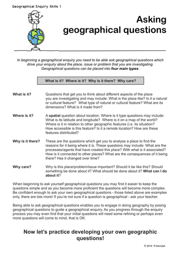
A five page handout that takes your students through the initial step of geographical enquiry, developing their own geographical questions. The first page gives students an idea of what types of questions are geographical ones and the last four pages practise students in developing their own geographical questions by studying photographs from Pompeii, Santorini, Cappadocia and Greenwich.
Investigating Cities - Shenzhen, China
swintrekswintrek

Investigating Cities - Shenzhen, China

(0)
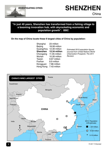
This is a 4-page worksheet that gets students to investigate the city of Shenzhen in China which has grown from little more than a fishing village in the 1970s to an expanding metropolis of 11 million people today. Shenzhen is commonly known as the "Silicon Valley of China". The worksheet has some mapping questions that look at Shenzen's location and changes in land use over time, some statistics on the climate of the city, and a series of questions on the growth of the city and its impact that can be answered from the BBC News (link is provided). An answer key is provided for teachers. The worksheet would be useful for the Australian Curriculum unit on Liveability and for those jurisdictions where urban development is a focus, perhaps from lower to upper high school Geography.
2017 South Asian Monsoon Floods
swintrekswintrek

2017 South Asian Monsoon Floods

(1)
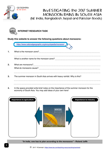
This is a worksheet (5 pages) that will get your students to investigate the 2017 South Asian Monsoon Floods. The first page students are taken to a website where they can answer general questions on the Asian monsoon. Page 2 has a map that shows the average arrival dates of the monsoon across the sub-continent as well as climate statistics for three cities (Mumbai, Dacca and New Delhi) that students are asked to create climate graphs in the grids provided. Page 3 has a climate table for students to fill in from the statistics on page 2, a question where they have to give a written description of Mumbai's climate as well as a creative writing piece about life before and after the arrival of the monsoon. On page 4 students will write notes on the impact of this year's monsoon on the countries of South Asia using information from weblinks provided. Page 5 has a number of questions that your more able students may want to investigate with again some useful weblinks. An answer sheet is provided for teachers as a separate file. You may want to give your students a couple of lessons to complete this worksheet or perhaps give it to them as a homework assignment.
Investigating Italy and the earthquake of 24th August 2016
swintrekswintrek

Investigating Italy and the earthquake of 24th August 2016

(0)
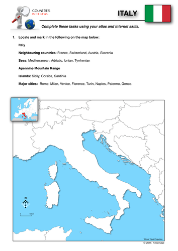
This is part of a series of worksheets that focuses on countries that make the news headlines and gets students to study them from a geographic perspective.. This three page worksheet on Italy asks students to use their atlas and internet skills to locate important natural and cultural features on a map, gather background information on Italy and then encourages them to investigate the earthquake that hit central Italy on the night of 24th August, 2016..
Climate Graphs
swintrekswintrek

Climate Graphs

4 Resources
This bundle includes two instruction sheets on how to draw a climate graph and how to interpret a climate graph. In addition the bundle includes two worksheets on the climates of two European cities: London and Rome.
Geography Lesson Fillers No.1
swintrekswintrek

Geography Lesson Fillers No.1

(0)
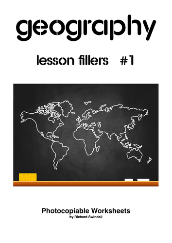
A series of five worksheets with answers that will help you fill in that extra few minutes you might have left at the end of a lesson or for those keen students who simply zoom through their set work and need a little extra to keep them engaged. Worksheets include: 1. Place Geography - a list of nicknames of world cities that students have to identify and place on a world map. 2. Country Silhouettes - outlines of countries that students have to identify. 3. Geography True or False - a list of geographical statements that students have to decide whether true of false. 4.Weather and Climate Odd One Out -rows of four to do with weather and climate, students have to decide which of the four is the odd one out. 5.Easy Geodoku - based on sudoko but using topographic map symbols instead of numbers
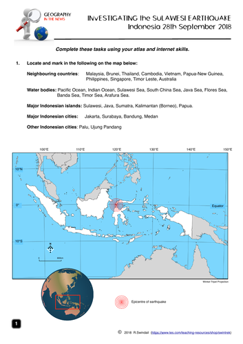
Sulawesi Earthquake and Tsunami 2018 - worksheets
swintrekswintrek

Sulawesi Earthquake and Tsunami 2018 - worksheets

(0)
A four page worksheet focusing on the Sulawesi earthquake and tsunami on 28th September 2018 that helps develop student’s internet skills. Page 1 - simple mapping question to familiarise students with the geographic setting of Indonesia Page 2 - students to complete a fact file on Indonesia from internet research AND define basic terms associated with earthquakes as well as completing the labelling of an earthquake diagram Page 3 - a map of the earthquake area including tectonic plates - students to answer questions on the earthquake using the map and the other websites. Page 4 - students answer questions on the impact of the earthquake, the Indonesian government’s response and a question from the internet An answer key is provided for teachers.