How is Height shown on a map?Quick View
DanGooding

How is Height shown on a map?

(1)
<p>A geography skills map concentrating on relief maps. This lesson is Harry Potter themed and uses the grounds of Hogwarts to help students to understand what countour lines are, how we use them to show differences in gradient. There a number of activities, with literacy and maths skills also incorporated.</p>
How and why are cold environments under threat?Quick View
DanGooding

How and why are cold environments under threat?

(0)
<p>Students explore the different reasons as to how and why cold environments are under threat linking the threats to the 4 key opportunities for development from previous lessons.</p> <p>Lesson includes:<br /> Knowledge Retrieval activity<br /> Keyword Glossary activity keyword glossary is included as attachment with first lesson of this SOL.<br /> Main Activity- Double sided worksheet focusing on the 4 main threats of cold environments. Tasks include photo analysis skill questions.<br /> Video included to show the environmental effects of off road driving in Alaska.<br /> GCSE style 6 mark question included along peer assessment activity success criteria.<br /> Plenary for student’s to sum up their learning.</p> <p>*Video link and 4 information slides of the four main threats are included in the ppt.</p>
What are the opportunities for development in Svalbard?Quick View
DanGooding

What are the opportunities for development in Svalbard?

(0)
<p>1-2 lessons depending on ability of class.</p> <p>Students explore the 4 opportunities for development in Svalbard.</p> <p>Lesson includes sorting activity of the benefits and costs of the 4 opportunities for development in Svalbard, with students identifying the 4 opportunities.</p> <p>Two videos to get students to visualise some of the opportunities for development in Svalbard.</p> <p>Students then complete a worksheet on describing each of the four opportunities and explaining how they help Svalbard to develop.</p> <p>Lesson includes a 6 mark GCSE past paper question, with success criteria and peer marking activity and criteria.</p>
What are the challenges for development in Svalbard?Quick View
DanGooding

What are the challenges for development in Svalbard?

(0)
<p>Students explore the 4 main challenges for development within Svalbard.</p> <p>Lesson includes:</p> <p>Knowledge Retrieval activity<br /> Keyword Glossary activity- keyword glossary included with first lesson of this SOL.<br /> Photograph analysis task- students have to identify, label and annotate the key challenges they can see in the photo.<br /> Main Activity- students use 4 main information sheets to answer Qs 1-2 per challenge and extension question included.<br /> 6 mark GCSE style question on challenges is included along with peer marking activity and success criteria.</p> <ul> <li>Worksheets and information sheets are included within the ppt.</li> </ul>
AQA Geography Rivers Revision GridQuick View
DanGooding

AQA Geography Rivers Revision Grid

(0)
<p>Revision grid for the Rivers topic as part of the AQA Geography GCSE specification.</p> <p>This revision resource ois suiotable for student’s of all abilities. It includes a variety of questions ranging from 1-4 points. The point system corresponds to bloom’s taxonomy and the more difficult skills set e.g. analysis, synthesis and evaluation for example are worth 3-4 points per question.<br /> The questions also include a good range of different command words. Can be used as a standalone revision tool for yr 11s in preparation for thier exam, or as a end of topic tool to assess student’s understanding, progress and if and where any misconceptions may still exist.</p>
AQA Geography Tropical Rainforests & Ecosystems Revision GridQuick View
DanGooding

AQA Geography Tropical Rainforests & Ecosystems Revision Grid

(0)
<p>Revision grid on Tropical Rainforests &amp; Ecossytems for the AQA Geography GCSE spec.</p> <p>This resource includes a range of questions that correspond to bloom’s taxonomy covering a range of skill sets and a good mix of command words.</p> <p>Can be used as a stand alone revision tool for yr 11s in preparation for their exams, or can be used a revision tool at the end of topic as part of a revision lesson; to enable you to assess student’s progress, understabnding and if, where and whether any misconceptions still exist.</p>
AQA Geography Cold Environments Revision GridQuick View
DanGooding

AQA Geography Cold Environments Revision Grid

(0)
<p>Fully differentiated revision grid for students of all abilities covering the whole AQA topic of Cold Environments.<br /> The resource covers the entire topic and is split into a variety of questions based on blooms taxonomy and a range of differing command words.<br /> Can be used as a standalone revision tool for yr 11s in prepartion for their exams, or can be used as a tool for an end of topic revision lesson to assess student’s understanding, progress and if and where any misconceptions still may exist.</p>
Lesson 6 Measuring EarthquakesQuick View
DanGooding

Lesson 6 Measuring Earthquakes

(0)
<p>Part of sow for KS3.</p> <p>This lesson looks at comparing the richter scale versus the Mercailli scale. It enables students to identify what each scale it is, describe what it is and explain how it is used and assess its usefuleness and limitations.</p> <p>Video links inlcluded as well as an information sheet comparing both scales and differentiated worksheets.</p> <p>S/C activity inlucluded to stretch HA students.</p>
AQA Characteristics of Cold EnvironmentsQuick View
DanGooding

AQA Characteristics of Cold Environments

(0)
<p>1-2 lessons maybe 3 depending on ability of GCSE class.</p> <p>Lesson explores the characteristics of cold environments looking at both Tundra and Polar environments.</p> <p>Lesson includes:<br /> 2-3 Knowledge Retrieval activities with answers included<br /> Mapping task- students have to identify, locate and label named examples of cold environments and describe their distribution.<br /> Statement sorting sheet of characteristics for both Tundra and Polar environments.<br /> Photo deduction AFL task- students apply their knowledge of Tundra and Polar environments to the photos.<br /> Assessment question with success criteria and peer assessment activity.</p> <p>Worksheets are included as slides under subheading ‘To print’ at the end of ppt.</p>
How have fauna and flora adapted to survive in Cold EnvironmentsQuick View
DanGooding

How have fauna and flora adapted to survive in Cold Environments

(0)
<p>AQA Cold Environments Adaptations of Plants and Animals lesson</p> <p>Students explore how both fauna and flora have adpated to survive in Cold Environments.</p> <p>The lesson covers:</p> <p>Flora adaptations and specifically looks at the Bearberry within the Tundra<br /> Fauna adaptations specifically looking at both the Polar Bear and Penguin.</p> <p>Flora adaptation table activity sheet is included in ppt as a ‘to print’ slide.<br /> Differentiated worksheets included as attachments.</p>
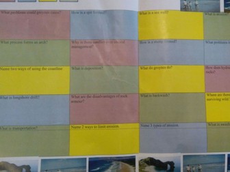
AQA Geography Coasts Revision GridQuick View
DanGooding

AQA Geography Coasts Revision Grid

(0)
<p>Fully differentiated revision question grid for students of all abilities. Range of questions included covering the whole of the AQA Coasts topic as well as covering a variety of different skill sets including diagram questions and a range of different command words.</p> <p>Good resource as a standalone revision tool in preparation for yr 11s for their exams or as an end of topic tool to be used to assess student’s understanding and progress of the topic, and if and where misconceptions lie to inform your future planning!</p>
AQA Geography Plate Tectonics Revision GridQuick View
DanGooding

AQA Geography Plate Tectonics Revision Grid

(0)
<p>Revision grid for Plate Tectonics topic of the AQA Geography GCSE Spec.<br /> This resource is fully differentiated for students of all abilities, as the questions are worth 1-4 points. They cover a range of skill sets in line with bloom’s taxonomy and a variety of different command words.</p> <p>Can be used as a standalone revision tool for yr 11s in preparation for thier exams, or a revision tool at the end of the topic as part of a revision lesson, to assess student’s progress, undersatnding, and if and where any misconceptions still exist.</p>
Volcanoes and Earthquakes bookletQuick View
DanGooding

Volcanoes and Earthquakes booklet

(0)
<p>This is a booklet on volcanoes and earthquakes that follows the Hodder KS3 scheme of learning.</p> <p>It includes 8 sections and includes a range of activities and tasks that enable student’s to develop and consolidate both their geographical knowledge and skills.</p> <p>This booklet is suitable to be used as a home learning resource, as it includes all the information within it, or can be used as a homework booklet.</p>
Nigeria- NEEQuick View
DanGooding

Nigeria- NEE

(0)
<p>This is a revision grid on Nigeria (NEE) for paepr 2 of the AQA Geography GCSE Specification, that is ideal for students of all abilities including EAL. The grid is made up of different types of questions(ranging from (1-4 points), using a range of command words and vary in diificulty in tems of the skill set and content knowledge that is required to successfully answer them. This resource is useful foran end of unit revision lesson or alternatively it can be used as a stretch and challenge activity during the course of a topic.</p>
What is the climate like in Svalbard?Quick View
DanGooding

What is the climate like in Svalbard?

(0)
<p>Students explore what the climate is and like in Svalbard.<br /> 1-2 lessons.<br /> Lesson includes:</p> <p>Svalbard Factfile task<br /> Discussion and recap of what climate graphs show and are used for.<br /> Students use calculators to calculate the average temperature for each month for Svalbard and its average rainfall.<br /> Students then use their green penned data sheet to construct and complete a climate graph of Svalbard.<br /> Assessment question- ‘Describe the climate of Svalbard’ (4 marks)<br /> Student have a success criteria to help them structure their answer and to use to peer assess.</p> <p>Svalbard Climate Data table included in ppt.<br /> Peer Assessment Success Criteria attached as separate worksheet.</p>
Why do we have different types of maps?Quick View
DanGooding

Why do we have different types of maps?

(0)
<p>A lesson on some of the different types of maps geographers use. As part of the KS3 Hodder SOW (Unit 1) or can be used and adapted as part of a yr 7 map skills/ introduction to geography unit.</p>
How are cold environments being managed?Quick View
DanGooding

How are cold environments being managed?

(0)
<p>Students explore 4 different ways that cold environments are managed.</p> <p>Lesson includes:</p> <p>Knowledge retrieval activity<br /> Keyword glossary activity- keyword glossary sheet is included in first lesson of this SOL.<br /> Main activity- students use the information sheets to describe and explain the four key protection strategies used within cold environments.<br /> Videos- question students on some of the key strategies and get to assess how the benefits and costs of each strategy.<br /> Ranking exercise- students use their own knowledge and ideas from the videos and Q&amp;A to rank the strategies from 1-4. (1 being the most effective management strategy).</p> <p>9 mark GCSE Past paper question included on how can management strategies help to reduce environmental damage within cold environments.<br /> Writing template included.<br /> Plenary- student’s sum up their learning from the lesson.</p> <p>*Worksheets (two versions) and information sheets are included in the ppt.</p>
Cold Environments Revision Clock LessonQuick View
DanGooding

Cold Environments Revision Clock Lesson

(0)
<p>Double lesson<br /> Students consolidate their knowledge of cold environments by using the task sheets with various geographical skills based questions on them to make notes and complete their revision clock.</p> <p>Lesson includes:<br /> 2 knowledge retrieval activities<br /> Task/Question sheets</p> <p>Revision Clock attached as hard copy.</p>
The Development Gap Revision Challenge GridQuick View
DanGooding

The Development Gap Revision Challenge Grid

(0)
<p>This is a revision grid on the Development Gap for paper 2 of the AQA Geography GCSE Specification, that is ideal for students of all abilities including EAL. The grid is made up of different types of questions (ranging from 1-4 points), using a range of command words that vary in diificulty in tems of the skill set and content knowledge that is required to successfully answer them. This resource can be used for an end of unit revision lesson or alternatively it can be used as a stretch and challenge activity during the course of a topic, or for extra-curricular sessions with year 11 in prepaartion for their exam.</p>
AQA Geography Extreme Weather Revision GridQuick View
DanGooding

AQA Geography Extreme Weather Revision Grid

(0)
<p>Revision resource that covers the entire extreme weather topic for the AQA Geography GCSE Spec.</p> <p>Is suitable for students of all abilities as the questions are fully differentiated in terms of their skill set in accordance with bloom’s taxonomy and they also cover arange of different command words. The questions are worth different points so all students can access it.</p> <p>This resource can be also used as a end of topic revision revision tool, to help you assess student’s progress, understanding and if and where any misconceptions may still exist.</p>
AQA Rivers Homework & Revision BookletQuick View
DanGooding

AQA Rivers Homework & Revision Booklet

(0)
<p>Homework Booklet designed for the AQA Rivers topic.<br /> The booklet consists of 7 sections which can be used as a weekly or fortnightly homework resource.<br /> Each section consists of a variety of questions listed below that equates to 15 marks, so students can track their scores over time and comment on the their areas of strength and improvement to inform their revision.</p> <p>Markschemes for each of the 7 sections included in the notes of the ppt.</p> <p>Each section has a variety of questions from the AQA spec including:<br /> Knowledge retrieval questions of key river processes as simple (1, 2 and 3 mark questions)<br /> Keyword definition questions (1 mark)<br /> Keyword gap fill questions (2 and 3 marks)<br /> Multiple choice questions (1 and 2 marks)<br /> OS map skills questions (1, 2 and 3 marks)<br /> Formation of river landforms (4 marks)<br /> Photograph questions (3 and 4 marks)<br /> Labelling figures and diagram questions (3 and 4 marks)<br /> Analysis questions (6 marks)</p>