Mapping Deforestation - GIS LessonQuick View
robertmoffat

Mapping Deforestation - GIS Lesson

(0)
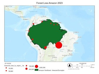
<p>Bring geography to life with this engaging, hands-on lesson. Mapping tree cover loss in the Amazon Rainforest with ArcGIS Online offers a dynamic exploration of deforestation through real-world data, guiding students to map, analyse, and understand deforestation rates in the Amazon. Perfect for teachers seeking an easy-to-implement digital resource, this ArcGIS-based lesson introduces students to GIS tools and spatial analysis.</p> <p>The download includes a PowerPoint that introduces geographical information systems and cartography for those who may not have encountered it, detailed instructions walking through the use of GIS, questions to encourage analysis and critical thinking, and a finished example.</p> <p>The lesson is suitable for KS3, GCSE and A Level students and links to topics across all exam boards e.g., tropical rainforests, water and carbon, climate change.</p> <p>NB, for this lesson your school will need access to ArcGIS Online. This is free and instructions on how to sign up can be found in the downloads.</p>
Mapping Volcanoes and Plates - GIS LessonQuick View
robertmoffat

Mapping Volcanoes and Plates - GIS Lesson

(0)
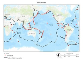
<p>Bring geography to life with this engaging GIS Lesson. Mapping Volcanoes and Plate Boundaries with ArcGIS Online offers a dynamic exploration of tectonic activity through real-world data, guiding students to map, analyse, and understand the global distribution of volcanoes and tectonic boundaries. Perfect for teachers seeking an easy-to-implement digital resource, this ArcGIS-based lesson introduces students to GIS tools and spatial analysis.</p> <p>The download includes a PowerPoint with an introduction to geographical information systems and cartography, detailed instructions guiding students through the use of GIS, questions to encourage critical thinking, and a finished example.</p> <p>The lesson has clear links to all GCSE and A-Level specifications related to natural hazards and ties into many KS3 schemes of work. It can be used by any secondary-aged students.</p> <p>NB for this lesson, you will need access to ArcGIS online. It is free for schools and can be obtained following the instructions in the download.</p>