Maps & ICT
Maps & ICT
4.001 reviews

The author grew up near the birthplace of the famous cartographer Gerard Mercator. Inspired by this great scientist and artist he went to study Physical Geography (BSc), Cartography (Masters) and Remote Sensing (Postgraduate). This website and its products are the result of more than 40 years of experience in Cartography, GIS and IT, both as a teacher and developer. He suffers from a form of ASD (Autism), which was only diagnosed at a late age. Please visit his Blogspot for more information.

zip, 7.1 MB
zip, 7.1 MB
zip, 942.38 KB
zip, 942.38 KB
jpg, 143.57 KB
jpg, 143.57 KB
jpg, 78.16 KB
jpg, 78.16 KB
jpg, 173.57 KB
jpg, 173.57 KB
jpg, 277.89 KB
jpg, 277.89 KB
jpg, 305.12 KB
jpg, 305.12 KB
jpg, 200.81 KB
jpg, 200.81 KB
jpg, 251.6 KB
jpg, 251.6 KB
jpg, 216.6 KB
jpg, 216.6 KB
jpg, 203.42 KB
jpg, 203.42 KB
jpg, 141.06 KB
jpg, 141.06 KB
jpg, 82.4 KB
jpg, 82.4 KB
jpg, 153.32 KB
jpg, 153.32 KB
jpg, 126.35 KB
jpg, 126.35 KB
jpg, 88.69 KB
jpg, 88.69 KB
jpg, 123.29 KB
jpg, 123.29 KB
jpg, 131.4 KB
jpg, 131.4 KB
jpg, 131.9 KB
jpg, 131.9 KB
jpg, 116.01 KB
jpg, 116.01 KB

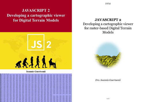
Developing a cartographic viewer for raster-based Digital Terrain Models

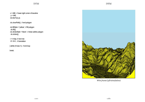
In the past, the collection, processing and presentation of elevation data (in the form of maps) was an extremely time-consuming and a specialized activity. The story in this book shows that today, through the application of advanced remote sensing techniques and computer graphics, this can be almost completely automated. Even a “simple” programming language like JavaScript can be used for the final presentation.

Reviews

Something went wrong, please try again later.

This resource hasn't been reviewed yet

To ensure quality for our reviews, only customers who have purchased this resource can review it

Report this resourceto let us know if it violates our terms and conditions.
Our customer service team will review your report and will be in touch.