Hero image

All Things Teaching

Average Rating3.90
(based on 13 reviews)

Creative and innovative resources that meet the needs of every learner in every lesson. Why create numerous resources when one can do it all. Most resources are for geography lessons, but many are for whole-school too and cross over into numerous subjects.

276Uploads

102k+Views

9k+Downloads

Creative and innovative resources that meet the needs of every learner in every lesson. Why create numerous resources when one can do it all. Most resources are for geography lessons, but many are for whole-school too and cross over into numerous subjects.
drought cause effects responses lesson geography science role play news
andymcstumpandymcstump

drought cause effects responses lesson geography science role play news

(0)
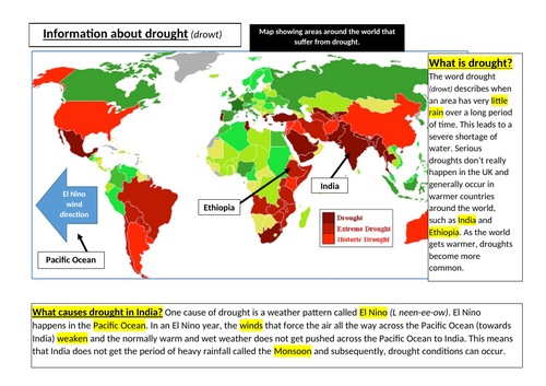
Information created for easy access for pupils to gain an understanding of the causes, effects and adaptations to drought. It is designed to allow pupils to work independently (in small groups) to create their own news broadcast role play. Show them the news clip from youtube. Discuss what makes a great roleplay news broadcast. Show info sheet (I like them printed in A3 & in colour) Pupils makes notes on the information. A mindmap works well with 3 branches (causes, effects & responses). Once notes are done, they then create their news broadcast. Very simple to teach & kids love it.
mcdonalds obesity population india china plastic environment geography science SMSC PSE RE
andymcstumpandymcstump

mcdonalds obesity population india china plastic environment geography science SMSC PSE RE

(0)
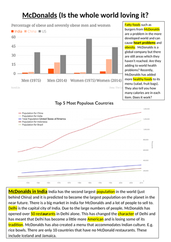
Information about the impact that McDonalds is having upon the planet. Links brilliantly to SMSC, geography and Science. The lesson is designed to give students an understanding of obesity related to fast food, the reasons for its growth in Asia and the environmental impacts (both good & bad). I provided the pupils with the information sheet (printed in colour & on A3). They read it & made notes. They then had to present a 2 minute talk to the class without repetition, hesitation or saying ummm or ok or like. It truly promotes oracy, literacy and presentation skills along with independent and creative learning. The kids loved it and it is incredibly simple and easy to teach.
GCSE Geography AQA Ecosystems rainforest desert distribution map skills analysis GIS climate graphs
andymcstumpandymcstump

GCSE Geography AQA Ecosystems rainforest desert distribution map skills analysis GIS climate graphs

(0)
A fully resources lesson to provide students with and overview of the distribution of rainforests & deserts. Students describe the distribution and then look at effective ways to describe graphs. This is an important geographical skill that supports pupils in picking up those easy marks in assessments. The lesson has a focus upon the climate & location of deserts & tropical rainforests, but another layer for other ecosystems can easily be added. I print the rainforest map onto tracing paper which the kids then put the base map in order to create a very simplified GIS map.
geography map skills compass direction grid references  scale height contour lines
andymcstumpandymcstump

geography map skills compass direction grid references scale height contour lines

(0)
A great lesson that allows pupils to develop and apply a range of map skills. Scale Direction 4 figure grid references 6 figure grid references Contour lines Height OS maps Symbols There is an overlay that needs printing onto tracing paper and stuck onto the OS map. This enables pupils to create their own (basic) GIS map. I’ve used this for both KS3 & 4.
future of jobs industry development geography careers pshce note taking skills
andymcstumpandymcstump

future of jobs industry development geography careers pshce note taking skills

(0)
A lovely and simple lesson that allows pupils to understand what jobs may be available in the future. It also enables pupils to practice and develop their note-taking skills. With particular reference to putting texts into their own words. It was planned as an integral part of the KS3 Geography curriculum, but can also be used for PSHCE at a whole-school level.
data presentation analysis of development indicators
andymcstumpandymcstump

data presentation analysis of development indicators

(0)
A full lesson (powerpoint & resources) that enables pupils to develop a wide range of skills alongside learning about development indicators and how the world is so uneven. Pupils analyse statistics and data. Present the data in a number of ways using the scaffolded frameworks. Look at analysis strategies. Explain some of the data to explain why it varies. This is best printed on A3.
gcse Geography fluvial processes weathering AQA full lesson
andymcstumpandymcstump

gcse Geography fluvial processes weathering AQA full lesson

(0)
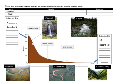
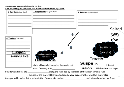
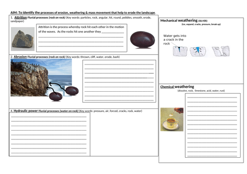
A lesson (actually 3 lessons) that enables pupils to gain an understanding of the processes that shape the landscape. This is designed for AQA, but can be easily amended for other exam boards. It has all the materials needed. It has independent learning, scaffolding and application of knowledge. All sheets are best printed in A3.
school grounds fieldwork study project geography
andymcstumpandymcstump

school grounds fieldwork study project geography

(0)
Small (mini) projects designed to be conducted around your school grounds. They require students to conduct data collection, presentation, methods, evaluate and create conclusions. The maps used will need changing for your school, but this is simply just a matter of copying it from Google maps. This will save you a lot of time and effort. I have included one PowerPoint to enable you to amend it as you see fit. My kids loved doing these and we schedule them in for the end of the year.