Hero image

Mister Mitchell's Education Resources

Average Rating4.86
(based on 30 reviews)

I would describe my teaching style as "21st century facilitator." As a true facilitator, I believe students should be responsible for their own learning and be more independent. I strive to allow my students to reach these goals by designing dynamic lessons, heavy on technology, with real world applicability. When I design my lessons, I stress this real world aspect, because I believe students must understand the basic purpose of a lesson before they will consider the message behind it.

151Uploads

44k+Views

2k+Downloads

I would describe my teaching style as "21st century facilitator." As a true facilitator, I believe students should be responsible for their own learning and be more independent. I strive to allow my students to reach these goals by designing dynamic lessons, heavy on technology, with real world applicability. When I design my lessons, I stress this real world aspect, because I believe students must understand the basic purpose of a lesson before they will consider the message behind it.
Use Cardinal and Intermediate Directions: Map Skills Assignment
mistermitchell3mistermitchell3

Use Cardinal and Intermediate Directions: Map Skills Assignment

(0)
This is a map skills assignment for young students that teaches students how to properly use cardinal directions (north, east, south, west) and intermediate directions (northeast, northwest, southeast, southwest) with a map of Europe. So, what makes this assignment different from all of the others that you have used? The assignment is written so that students must interact with the map before they use cardinal and intermediate directions. They must first properly label the cardinal and intermediate directions on the included map's compass rose. Then, they must locate and label 15 European cities and 10 bodies of water. After successfully locating these places, there are 10 questions that require them to think about how people move from one city to another.
Let's Explore America! Find American States & More on a Map: Map Skills
mistermitchell3mistermitchell3

Let's Explore America! Find American States & More on a Map: Map Skills

(0)
This packet is titled "Let's Explore America! Use a Map to Find American States, Cities, Landforms, and Bodies of Water." It includes seven assignments you can use to teach essential geography skills. Please see the full preview! This would make a great introduction to young students preparing to study the United States for the first time. You might even consider them "substitute assignments" and leave them for a substitute teacher on a day you are away from the classroom. These assignments will work well individually or as a partner assignment.
If I Could Fly Anywhere in the World - Geography Research Assignment
mistermitchell3mistermitchell3

If I Could Fly Anywhere in the World - Geography Research Assignment

(0)
This project contains 15 questions for younger researchers to consider when planning a trip to a new place. These questions will test students' abilities to think about geography skills like location and direction as well as provide opportunities to learn about new cultural experiences. Students will need either access to age-appropriate Internet resources or books about the countries of their choice. The final results might pair well with a bulletin board or poster display.
World Cultures Theme Park Map Project - Social Studies/Substitute Lesson
mistermitchell3mistermitchell3

World Cultures Theme Park Map Project - Social Studies/Substitute Lesson

(0)
This is a five-page packet that provides detailed instructions for the world cultures theme park project. In this project, students will apply information they know about world cultures and then create a theme park reflecting those cultures in a unique, fun way. I use it to reinforce students' knowledge about world cultures and to brush up on their mapmaking skills. This would also make an excellent project to leave with a substitute teacher, as I have provided very detailed instructions that are easy to follow. This project encourages creativity and critical thinking. You might consider using it as an alternative to a test or an essay. Students will create a theme park that demonstrates their acquired knowledge of a nation's culture, while also demonstrating an ability to accurately create and label a map. You can adapt this assignment to fit any culture (or cultures) that you have taught.
Landforms & Bodies of Water - Vocabulary Matching Assignment + 6 Puzzles
mistermitchell3mistermitchell3

Landforms & Bodies of Water - Vocabulary Matching Assignment + 6 Puzzles

(0)
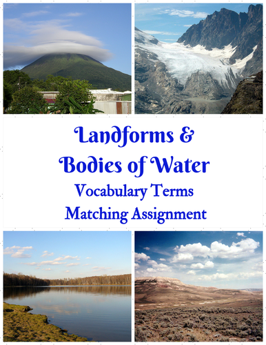
Consider purchasing this quick vocabulary assignment to introduce your students to some basic geography terminology about landforms and bodies of water. You might even use it as a vocabulary quiz. The choice is yours! There are twenty terms found in the complete assignment, with kid-friendly definitions, and an answer key for quick, simple grading. The vocabulary words included are: Basin, Bay, Butte, Canyon, Cataract, Delta, Fjord, Flood Plain, Glacier, Island, Isthmus, Mesa, Peninsula, Plain, Plateau, River Mouth, Strait, Tributary, Valley, and Volcano. Also included, please find 6 puzzles: 2 crossword puzzles, 2 word search puzzles, and 2 cryptogram puzzles. For the puzzles, I divided the 20 vocabulary words into two segments. Therefore, each puzzle contains ten vocabulary words. I found that dividing the terms in this manner made retention easier for my students.
Let's Explore the Middle East Map Activity
mistermitchell3mistermitchell3

Let's Explore the Middle East Map Activity

(0)
This assignment is titled "Let's Explore the Middle East! Use a Map to Find Countries, Cities, Landforms, and Bodies of Water." This assignment includes 20 questions that require students to analyze a map of the Middle East for national borders, capital cities, landforms, and bodies of water. Here are two sample questions: "In which country is Mount Demavend located?" and "Name at least three countries that border the Red Sea." This would make a great introduction to young students preparing to study world regions for the first time.