Powerpoint and activities outlining how the mechanisation of farming and commercial fishing provide food
Blooms and 9-1 differentiated questions/activities
eg Grades 1-2 (Knowledge): You each have at least one clue… swap ideas to help you complete the following task. Describe how modern farming affects the environment by completing the labels surrounding the photo
Grades 8-9 (Evaluation): Use the picture of ‘The Environmental Effects of Commercial Fishing’ to: (a) Identify six problems caused by fishing (number them on the picture). (b) In your book, assess the harm done to ocean ecosystems by trawlers, then explain the criteria you would use to assess the six impacts
Find out how the farms we get our food from damages the environment (annotate photo)
Find out how eating fish causes damage to the environment
Powerpoint and activities investigating how reservoirs help secure water supplies (but also damage the environment)
“Chat/info stations” about the Three Gorges Dam in China:
Location
Water supply
Sediment
Waste
Wildlife
Forced migration
Each info station has Blooms and 9-1 differentiated questions/activities
eg Grades 1-2 (Knowledge): Describe the location of the Three Gorges Dam. Make a list of the ways in which the Three Gorges Dam has harmed Chinese wildlife
Grades 8-9 (Evaluation): Explain the criteria you would use to assess the siting of the Three Gorges HEP project. Justify your choice of ONE animal to protect that is endangered by the Three Gorges Dam
Powerpoint and activities outlining the factors leading to demand outstripping the supply of food, energy and water
Blooms and 9-1 differentiated questions/activities
eg Grades 1-2 (Knowledge): Complete the line graph showing World population growth. Describe how the World’s population has changed since 1800 (try to write two paragraphs for 6 marks)
Grades 8-9 (Evaluation): Complete the line graph showing Global water consumption’. Complete the table showing ‘Global oil extraction’. Which resource (oil or water) would be the most important to find new source for the 21st century? Justify your answer
Drawing and analysing line graphs
This resource includes a variety of lesson activities to pick and choose:
*** Starters**
(1) Illustrated glossary of four key settlement terms relevant to Portsmouth - Students draw their own interpretation of the definitions.
(2) Odd-one-out Powerpoint slided - Students discuss and write about four key physical terms relevant to Portsmouth.
(3) 5Ws & 1H - Students discuss the illustrations and their relevance to the founding of Portsmouth in 1194. (Second slide gives possible answers).
Inter-Galactic Address
(1) Can you be in more than one place at once? Sheet of (up to) 19 features such as your school, Portsmouth, Eurasia, the Milky Way. Students cut them up and arrange them in order of size. They can then write their classroom’s or their home’s inter-galactic address. Template allows the place names to be personalised to your own location.
(2) Link to interactive ‘Scale of the Universe’ which goes from sub-atomic to extra-galactic!
Location Factors
(1) Worksheet of classic ‘find the best location for a settlement’ activity, but specific to the Portsmouth area.
Students assess five potential sites against eight location factors (eg shelter, sunlight, defence).
(2) Worksheet - allows written conclusion to the ‘choosing the best site’ activity.
(3) Powerpoint slide - Students discuss: ‘Can you suggest where A to E might be in Portsmouth?’. Second slide gives potential answers.
Portsmouth Site & Situation Mystery
(1) Thirty-two clues to cut up and distribute amongst the class. Includes references to France, Portsdown, marshes, Portsea Island).
(2) Students swap info to enable them to annotate a historic map of Portsmouth to explain why Portsmouth was a good location for Britain’s main Naval Base. (Two versions of the map are included - one with more scaffolding for the annotation, one with an example).
(3) Worksheet - Students write a response to the hypothesis: ‘Portsmouth was an excellent site for a town and dockyard to be built’.
(4) Worksheet - Alternative conclusion: Students make links between six images arranged in a set of hexagons.
Home of the Royal Navy
Why did the naval base move from Portchester to the Port’s Mouth?
(1) Concept map - Students discuss and colour code thirty-five facts according to named locations, negatives about Portchester, positives about Portsmouth. Includes reasons why the Roman’s chose Portchester, deforestation, silt, narrow harbour entrance.
(2) Worksheet - Students can use the info they have learned to annotate a map of the Portsmouth area… Or can simply write an extended conclusion as exam practice.
(3) Powerpoint slide: photographic analysis - Portsmouth Harbour aerial view to be discussed as a plenary. (What does the photo tell us? What can be inferred? WHat does the photo not tell us?). Second slide gives possible answers.
Place names
(1) Powerpoint slides introducing the value of place name etymology to geographical understanding of a place (Hilsea as an example).
Geography Case Study
Can the situation be summed up? Possibly.
Israel wants to safeguard the security that Jews have fought for since the Holocaust of the 1940s.
The Palestinians of Gaza and the West Bank want to live in their own independent land that they feel was stolen from them in 1948.
But is either situation likely to happen?
This resource includes a variety of lesson activities to pick and choose:
Which geographical area is the odd one out?
(Gaza - Israel - Palestine - Jerusalem)
Class discussion & written response.
Which disaster is the odd one out?
(Afghanistan 2001-2021 - Warsaw 1944- Indian Ocean 2004 - Worldwide 2035)
Class discussion & written response.
Lateral Thinking about the Geography of War.
How are these four photographs linked?
(Resources - military - refugee camp - ‘stop the boats’
Class discussion & written response.
Worksheet: Critical Thinking: Israel-Gaza War.
What do I know? How do I know? What is important? What is missing? What is my plan of action? How did I do?
Links to videos explaining the situation:
“The Hamas attack on the Supernova festival 2023” (BBC)
“Israel, Palestine and Hamas explained” (Channel 4)
Photographic Analysis: Israel-Palestine 7th October 2023.
Class discussion of initial satellite image from the day.
Follow-up slides asking: “What can we say about the geography inside of the Gaza Strip?” (Densely populated)
“What is this land mostly used for?” (Farms, kibbutzim)
“What is happening here?” (Fires, smoke)
Photographic Analysis: 21st century Gaza.
Six photos showing life in the years before the 2023 attacks (developed cityscape; park; refugee child; beach; nightlife; modern hospital)
Worksheet: Analyse the photos -definite, inference, missing info.
Photographic Analysis: Israel-Palestine (since 7/10/23).
Six photos showing the situation since the attacks (hostage taking, IDF, bomb damage, the missing, funerals, foreign aid)
Worksheet: Analyse the photos -definite, inference, missing info.
Living Graph: Israel-Palestine Population.
Worksheet: line graph of total population of Israel-Palestine, incomplete line graph of Jewish population.
Data for Jewish population since 1930.
Living Graph clues: Israel-Palestine Population (21 pieces of info to read, sort, select).
Follow-up slides: completed graph, questions for class discussion - analyse key changes in the graphs (low steady population to WW1; post-Ottoman collapse + Balfour + Holocaust + declaration of the State of Israel; diverging lines, infer reasons for rapid growth of Jewish poulation vs very rapid growth of non-Jewish population).
Worksheet: Living Graph conclusion: Israel-Palestine.
(Debrief
Worksheet - Hexagons: Israel-Palestine.
Explain in detail how each image is linked geographically.
(Magen David, Nazi swastika, star & crescent, weapon, death, running person, family).
Teachers’ Background Information: Includes links to original BBC article, academic articles.
Geography Case Study
We are meant to eat our Five a Day.
The UK only produces 17% of the fruit
and 55% of the vegetables that are bought in British shops.
40% of UK food is produced abroad.
Between 2023 and 2024, the Trussell Trust food banks distributed three million food parcels
to British people.
So what is going on?
This resource includes a variety of lesson activities to pick and choose:
Which Geography keyword (farming types) is the odd one out?
Which grass (cereals) is the odd one out?
In which photo of farming are you most likely to see agrichemicals being used? (vs Golden Rice).
%Ws & 1H - Battery hens (for class discussion).
Comparison of farming today with a 14th c. illustration.
Link to Channel 4 News video: ‘Millions in UK need to double income to escape poverty’.
Lateral Thinking about food supplies - ‘Discuss how these four photographs are linked… Then write three sentences to explain your ideas’ (climate change, floods, empty shekves, container ship).
Development compass worksheet: ‘Food security’.
Info sheet: ‘UK Food Security’ - to help complete…
Question Grid: ‘UK Food Security’.
Role play group sheets:
HM Government
UK farmers
Egyptian farmers
UK families
UK supermarkets
UK food bank organisers
Each sheet has some background info, two possible questions and space for students’ own questions to prepare before the role play itself.
Stakeholders’ conclusions: Worksheet folowing the role play
Worksheet: complete a divided bar graph showing ‘UK Food Imports’. Then students read the text, highlighting the main reasons why the UK’s food security is a problem.
Finally, they write a conclusion to explain what they have learned about the UK’s food security.
Worksheet: ‘Geo-Hexagons: Food Security’ - war, climate, money, Europe, inflation, shopping. Students explain in detail how each image is linked geographically.
Worksheet - Living Graph: ‘UK Households Experiencing Food Insecurity’ (with 20 clues to choose from).
Point, Evidence, Explanation, Link activity - ’ Food Imports to the UK’ (info sheet including proportional area map, worksheet to complete bar graph showing origin of foodstuffs, PEEL worksheet to complete).
Worksheet - ‘True for who? UK Food Security’
Worksheet - deBono’s ‘Six Hats: Food Security in the UK’.
Worksheet - ‘Thought Chains: Food Security in the UK’. Activity trains students to analyse data in detail using connectives. (Imports, sustainability, food bank use in the UK).
Food Security mystery: ‘Why are UK food prices so high?’
32 clues to distribute amongst students. Includes Ukraine War, changing diets, inflation, food waste).
Worksheet - ‘Geography Web: Food Security in the UK’.
Part filled-in to show how students should complete the activity. Links to be made between: Food supplies, the UK, Ukraine, Russia, migrant workers, petrochemicals).
Teachers’ Background Information: Includes links to original BBC article, academic articles.
Each page is set up so there is room to add revision notes. The idea is that each page contains one case study so that exam revision can be condensed and is hopefully generic enough for any school’s chosen case studies. Topics are straight from the AQA syllabus…
TECTONIC HAZARDS IN A DEVELOPED COUNTRY
TECTONIC HAZARDS IN A DEVELOPING COUNTRY
TROPICAL STORMS
EXTREME WEATHER IN THE UK
CLIMATE CHANGE IN THE QUATERNARY PERIOD
SMALL SCALE UK ECOSYSTEMS
TROPICAL RAINFORESTS
HOT DESERTS
COLD ENVIRONMENTS
COASTAL LANDFORMS IN THE UK
COASTAL MANAGEMENT IN THE UK
RIVER LANDFORMS IN THE UK
FLOOD MANAGEMENT SCHEMES IN THE UK
GLACIAL LANDFORMS IN THE UK
TOURISM IN A GLACIATED UPLAND AREA OF THE UK
A MAJOR CITY IN A DEVELOPING COUNTRY
IMPROVING QUALITY OF LIFE FOR THE URBAN POOR
A MAJOR CITY IN THE UK
AN URBAN REGENERATION PROJECT
GROWTH OF TOURISM IN DEVELOPING COUNTRIES
RAPID ECONOMIC DEVELOPMENT (Parts One & Two)
SUSTAINABLE INDUSTRY IN THE UK
A LARGE-SCALE AGRICULTURAL DEVELOPMENT
SUSTAINABLE FOOD AND WATER IN DEVELOPING COUNTRIES
A LARGE-SCALE WATER TRANSFER SCHEME
EXTRACTION OF FOSSIL FUELS
RENEWABLE ENERGY IN DEVELOPING COUNTRIES
GEOGRAPHICAL APPLICATIONS: PHYSICAL FIELDWORK
GEOGRAPHICAL APPLICATIONS: HUMAN FIELDWORK
GLOSSARY OF KEY GEOGRAPHICAL TERMS IN THE AQA SYLLABUS
I have made a range of topic-specific resources based upon activities in David Leat’s ‘Thinking Through Geography’. They can be dropped into individual lessons or a ‘Russia’ scheme of work.
RUSSIA OR BRITAIN
Pairs of images for students to discuss, with interesting Russian trivia
WHAT COMES NEXT?
Six sets of Russia-related photos to discuss and suggest the next feature
ODD-ONE-OUT
Six sets of Russia-related keywords, place names, etc. Can be used as starters
LATERAL THINKING
Six Russia-related dilemmas to solve (if possible!)
ODD-ONE-OUT
Six sets of Russia-related photos, can be used as starters
LIVING GRAPH
Choose 10 clues from 20 to annotate demographic graphs of Russia
MIND MOVIE STORYBOARD
Script (and images) about the the volcanoes and industry in Kamchatka
CLASSIFICATION
32 facts about the Siberian industry to sort into a Case Study sheet
MOST LIKELY TO…
Five sets of Russia-related photos with a decision making element
WHO? WHAT? WHY? WHEN?
Photos of Russia to help formulate ‘W’ questions and prompt discussion
IT’S A MYSTERY
32 facts for a pair-share activity about the Russian annexation of Crimea
MIND MOVIE SCRIPT
Choices facing a Nenets teenager in rapidly-developing Siberia
THOUGHT CHAINS
Using a concept map about Siberian Tigers to construct logical analysis
HEXAGONS AND GEOG WEB
Make links to explain the effects of climate change on Russia’s Polar Bears
MAKING A…
Choose from a menu of features to design a sustainable Black Sea resort
DECISION MAKING
Use a variety of resources to decide on the best Russian city for UK tourists
ROLE PLAY
Resources to help decide on the exploitation of Siberian fossil fuel reserves
Reading Photos
Twelve photos to promote discussion and connect Geographical features
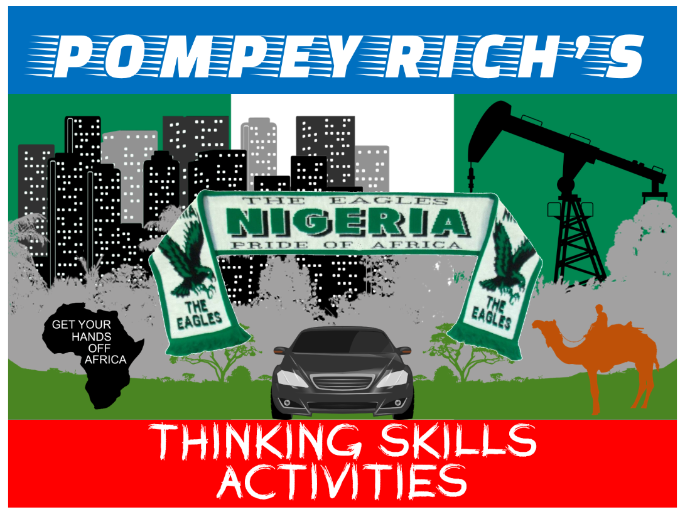
I have made a range of topic-specific resources based upon activities in David Leat’s ‘Thinking Through Geography’. They can be dropped into individual lessons or into a ‘Nigeria’/‘Africa’ scheme of work.
NIGERIA OR BRITAIN
Pairs of images for students to discuss, with interesting Nigerian trivia
WHAT COMES NEXT?
Six sets of Nigeria-related photos to discuss and suggest the next feature
ODD-ONE-OUT
Six sets of Nigeria-related keywords, place names, etc. Can be used as starters
LATERAL THINKING
Six Nigeria-related dilemmas to solve (if possible!)
ODD-ONE-OUT
Six sets of Nigeria-related images, can be used as starters
LIVING GRAPH
Choose 10 clues from 20 to annotate graphs of Nigeria’s oil revenues
MIND MOVIE STORYBOARD
Script (and images) about a family affected by the oil industry in the Niger Delta
CLASSIFICATION
32 facts about malaria in Nigeria to sort into a Case Study sheet
MOST LIKELY TO…
Six sets of Nigeria-related photos with a decision making element
WHO? WHAT? WHY? WHEN?
Photos of Nigeria to help formulate ‘W’ questions and prompt discussion
IT’S A MYSTERY
32 facts for a pair-share activity about high-level corruption in Nigeria
MIND MOVIE SCRIPT
The story of a Nigerian migrant attempting to reach Europe
THOUGHT CHAINS
Using a concept map about the Great Green Wall to construct logical analysis
HEXAGONS AND GEOG WEB
Make links to explain terrorism (Boko Haram, Niger Delta Avengers) in Nigeria
MAKING A…
Choose from a menu of features to design a sustainable Sahelian school
DECISION MAKING
Use a variety of resources to choose a low tech way to halt desertification
ROLE PLAY
Resources to help decide if the Eko Atlantic development should be completed
Reading Photos
Twelve photos to promote discussion and connect Geographical features
I have made a range of topic-specific resources based upon activities in David Leat’s ‘Thinking Through Geography’. They can be dropped into individual lessons or a ‘China’ scheme of work.
WHAT COMES NEXT?
Four sets of China-related photos to discuss and suggest the next feature
ODD-ONE-OUT
Six sets of China-related keywords, place names, etc. Can be used as starters
LATERAL THINKING
Six China-related dilemmas to solve (if possible!)
ODD-ONE-OUT
Six sets of China-related photos, can be used as starters
LIVING GRAPH
Choose 10 clues from 20 to annotate demographic graphs of China
MIND MOVIE STORYBOARD
Script (and images) about the plight of the Uyghurs in China
CLASSIFICATION
32 facts about the Great Sichuan earthquake to sort into a Case Study sheet
MOST LIKELY TO…
Five sets of China-related photos with a decision making element
WHO? WHAT? WHY? WHEN?
Photos of China to help formulate ‘W’ questions and prompt discussion
IT’S A MYSTERY
32 facts for a pair-share activity about the effects of the Three Gorges Dam
MIND MOVIE SCRIPT
The immediate after-effects of a typhoon hitting the Yangtze Delta
THOUGHT CHAINS
Using a concept map about Foxconn electronics to construct logical analysis
HEXAGONS AND GEOG WEB
Make links to explain China’s territorial claims in the South China Sea
MAKING A…
Choose from a menu of urban features to design a sustainable Chinese city
DECISION MAKING
Use a variety of resources to locate a new electronic car factory in China
ROLE PLAY
Resources to help decide on ‘Pandas or profit’ in China
Reading Photos
Twelve photos to promote discussion and connect Geographical features