293Uploads
176k+Views
179k+Downloads

AQA A Level - Hazards - 20 lessons
These fully resourced lessons cover the whole of the hazards topic - introduction to hazards, vulcanicity, seismicity, tropical storms and wildfires.
Fully resourced lessons. Included with this bundle:
Over 30 hours of lessons
Various activities - card sorts, reading tasks, retrieval quizzes, exam questions and mark schemes, multiple choice questions, forms quizzes and lots more.
Bundle

AQA 9-1 Geography Case study booklets
2 resources included in this bundle:
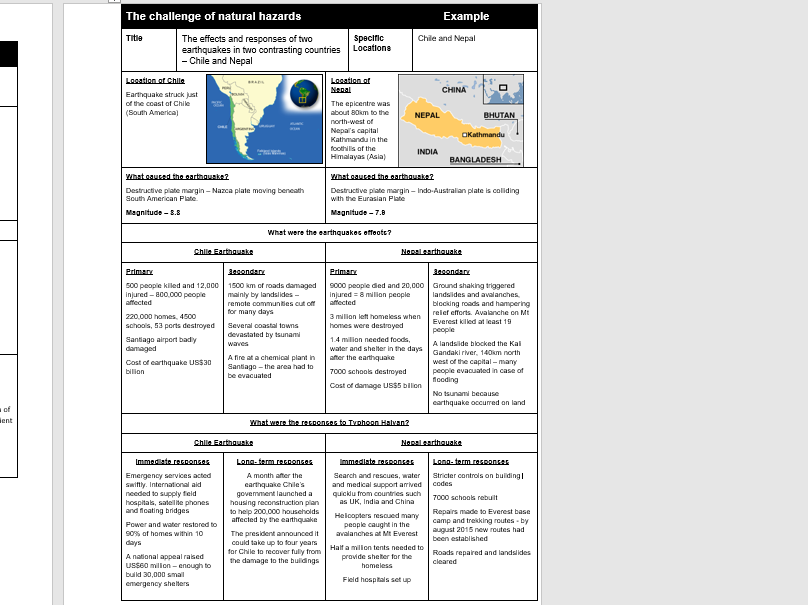
1: A thorough case study booklet including all of the case studies needed for Paper 1 - Living with the Physical environment.
Case studies include:
Tectonic hazards - Chile and Nepal
Tropical storm - Typhoon Haiyan
Extreme weather in the UK - Somerset levels
Small scale ecosystem - Overton Lake, Peterborough
Tropical rainforest - Malaysia
Hot desert - Sahara
Coastal landforms - Dorset coast
Coastal management - Lyme Regis
River landforms - River Tees
Flood management - Banbury
2. A thorough case study booklet including all of the case studies needed for Paper 2 - Challenges in the human environment
Case studies include:
Rio de Janeiro
Favela Bairro Project
Bristol
Temple Quarter Regeneration
Tourism in Jamaica
Nigeria
Hanson Cement

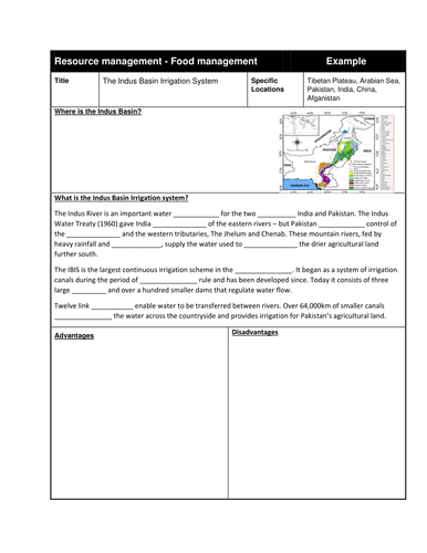
The Indus Basin Irrigation system lesson with example study sheet - AQA Geography GCSE
Fully resourced lesson

AQA A Level Geography - Physical Geography case studies booklet
A comprehensive case study booklet for the Hazards and Coasts sections of Paper 1 - Physical Geography. Case studies included:
Coastal systems and landscapes:
• Case study(ies) of coastal environment(s) at a local scale to illustrate and analyse fundamental coastal processes, their landscape outcomes as set out above and engage with field data and challenges represented in their sustainable management. – Holderness Coastline
• Case study of a contrasting coastal landscape beyond the UK to illustrate and analyse how it presents risks and opportunities for human occupation and development and evaluate human responses of resilience, mitigation and adaptation - Odisha
Hazards:
• Impacts and human responses as evidenced by a recent volcanic event – **Mt Etna **
• Impacts and human responses as evidenced by a recent seismic event – Japan (2011)
• Impacts and human responses as evidenced by two recent tropical storms in contrasting areas of the world (Sandy and Winston)
• Impact and human responses as evidenced by a recent wild fire event.(Alberta wildfires)
• Case study of a multi-hazardous environment beyond the UK to illustrate and analyse the nature of the hazards and the social, economic and environmental risks presented, and how human qualities and responses such as resilience, adaptation, mitigation and management contribute to its continuing human occupation. (Haiti)
• Case study at a local scale of a specified place in a hazardous setting to illustrate the physical nature of the hazard and analyse how the economic, social and political character of its community reflects the presence and impacts of the hazard and the community’s response to the risk - Montserrat

OCR B - Geographical exam skills revision ppt with example questions
Revision ppt and exam question booklet helping students with their exam skills.
Past exam questions covered to go with each map/graph type.
Takes approximately 2 hours to complete the revision session.
Includes the following content:
Labelling and comparing
Describing distributions on maps
Describing locations on maps
Describing what graphs show - bar charts, line graphs, scatter graphs, triangular graphs
Maps - topological, proportional, isolines, choropleths, flowlines and desire lines
OS Maps - common symbols, grid references, contour lines and 4 and 6 figure grid references.

GCSE Geography - Coastal and river landforms sequencing revision cards
16 double-sided landform formation sequencing cards.
Landforms included:
V-shaped valleys and interlocking spurs
Waterfalls
Meanders
Ox-bow lakes
Floodplains
Levees
Wave cut platforms
Wave cut notches
Headlands and Bays
Sand dunes
Spits
Bars
Caves, arches, stacks and stumps.
Instructions for students:
Print out double sided/copy onto your own revision cards.
Practice sequencing the processes involved in the formation of coastal and river landforms – use look, cover, write and repeat until you know them off by heart.

Revision hexagons - AQA Geography - Climate change, tropical storms and extreme weather in the UK
Students use the key points from the specification in the hexagons to annotate and add revision notes to each area.

Indian Ocean Tsunami - case study lesson Geography
Fully resourced lesson covering:
The causes of the tsunami
The spatial and temporal setting
The impacts
The responses
Includes a double sided case study sheet for students to complete.
Bundle

Volcanoes and Earthquakes Scheme of Work- Progress in Geography
8 lessons covering the topic from the progress in Geography textbook - Can we ever know enough about volcanoes and earthquakes to live safely?
Fully resourced - no need for any other resources.
A wide range of different activities:
Videos
Mystery
Information hunt
Odd one out tasks
Retrieval quizzes
Comprehension tasks
Case study sheets
Hexagon tasks

A Level Changing Places - Lesson 6 - Management and manipulation of place meaning
Fully resourced lesson covering this area of the specification:
Meaning and representation:
How external agencies, including government, corporate bodies and community or local groups make attempts to influence or create specific place-meanings and thereby shape the actions and behaviours of individuals, groups, businesses and institutions.
A wide variety of tasks including a sorting activity, tables to complete, case studies and an exam question with markscheme at the end. Focuses on regeneration, rebranding, reimaging and place meaning.

A-Level Geography Changing Places - Lesson 7 - Representations of place
Fully resourced lesson covering this area of the specification:
How places may be represented in a variety of different forms such as advertising copy, tourist agency material, local art exhibitions in diverse media (eg film, photography, art, story, song etc) that often give contrasting images to that presented formally or statistically such as cartography and census data
Range of activities included e.g true or false, table to complete, geo-spatial data and exam question with mark scheme

KS3 Rivers Progress in Geography - Lesson 1 Why are rivers important?
A fully resourced lesson covering the first lesson from the KS3 Progress in Geography text book. No need for text book - fully resourced lesson.
Range of tasks included - why are rivers important diagram to complete, pop-up drainage basin task and map skills tasks using the River Tees as an example.

Plate tectonics - Earthquakes and volcanoes
A brilliant selection of resources I have created to teach plate tectonics. I have included easy to follow PowerPoint's for each lesson and attached the relevant worksheets/printouts. The students loved the diversity of the activities which includes maps from memory, desk mat tasks, market place, card sorts, earthquake proof building design, timelines, cartoon strips, a mid unit test and lots more interesting tasks. I have included starter tasks for each lesson, learning objectives using what, why and how, main tasks and consolidate/plenary tasks. They are really easy to follow. I have included lessons on the following topics:
The structure of the Earth
Japanese earthquake and tsunami
Earthquake hazard management
Supervolcano
What are earthquakes and how are they measured?
Pompeii 79 AD
What are the hazards associated with volcanoes?

Tectonic hazard management fully resourced lesson
A PowerPoint with various tasks used to teach how the risks from tectonic hazards can be reduced.

Animal and plant adaptations in the hot desert - fully resourced lesson
Animal and plant adaptations in the hot desert - fully resourced lesson

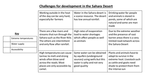
Challenges for development in the Sahara desert - fully resourced lesson
Challenges for development in the Sahara desert - fully resourced lesson

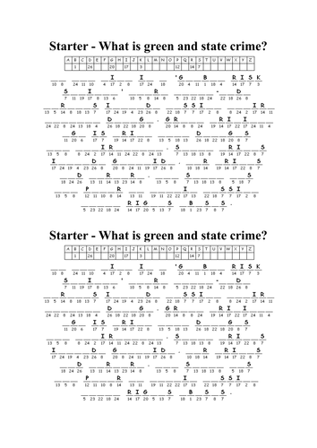
A-level crime and deviance - Durkheim's Functionalist theory
A-level crime and deviance - Durkheim's Functionalist theory

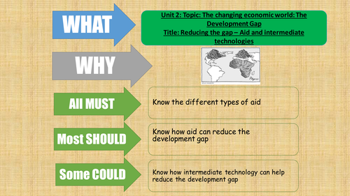
AQA Geography 2016 - The development gap - lesson 8 - what is aid
Fully resourced lesson - types of aid table fill, various videos introducing aid and looking at Goat Aid, Is aid good for LICs dilemma task and a practise exam question.

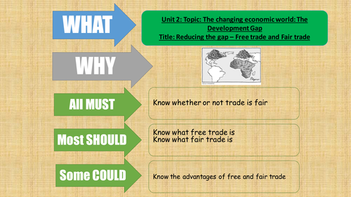
AQA Geography 2016 - The changing economic world - Free trade and Fairtrade
A fully resourced lesson for the new AQA Geography specification looking at free and Fairtrade.
Lots of tasks included:
Videos and questions
Sorting task
Gap fill spider diagram
Table to complete
Exam question
Discussions

