Providing quality tested Geography resources at an affordable price. Take the stress out of your teaching and enjoy what many teachers joined the profession for, working with young people. Please follow & review to help me grow my store!
Providing quality tested Geography resources at an affordable price. Take the stress out of your teaching and enjoy what many teachers joined the profession for, working with young people. Please follow & review to help me grow my store!
If you like my work, please follow me for more resources and leave a review!
This 1 hour KS3 lesson helps pupils to better understand why globalisation occurs. Pupils use images to reflect on why globalisation occurs and engage in a card sort activity, designed to encourage learners to elaborate their ideas! The lesson includes a video link, allowing visual learners to better understand this complex process.
Check out some of my other products relating to Globalisation:-
What are products and services?
What are producers and consumers?
How has employment structure changed in the UK?
What is globalisation?
What factors have caused globalisation?
Why is Apple such a successful global brand?
How do conflict minerals affect people living in Africa?
Does slavery still exist? (Investigating Apple’s iPhone factories)
This 2 hour KS3 lesson teaches pupils about the detrimental impacts of rapid urbanisation. Pupils start the lesson describing the location of Chongqing, Chinas most polluted city. A video and question worksheet is used to set the scene. Pupils then learn how to elaborate statements through a mix and match exercise. A card sort tasks is used to evaluate the causes and effects and of overpopulation, as well as potential solutions.
Check out some of my other products relating to China:-
Where is China?
What physical and human Geography exists across China?
How is the population distributed across China?
What is rural to urban migration and why does it occur?
How developed is China?
Was China’s one child policy an example of successful population control?
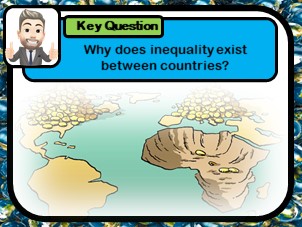
In this 2 hour KS3 lesson pupils investigate why the global development gap exists. Carefully selected video clips are used to highlight the origins of inequality. Students analyse sources to discover social, political, geographical, historical and economic factors that have influenced development. A differentiated worksheet is included, in which pupils are required to explain the various causes of this pressing issue.
**Bundle and save! This lesson is part of a larger bundle:- **
Development topic bundle
Check out some of my other products relating to weather and climate:-
What is development?
How can we measure development?
What is Africa like?
What are Africa’s climate zones?
How do squatter settlements affect peoples quality of life?
How does quality of life differ between HIC & LIC countries?
How can fair trade help to reduce the development gap?
If you like my work, please follow me for more resources and leave a review!
This 1 hour KS3 lesson teaches pupils how to measure distance on maps using a scale bar. A spot the difference style exercise is used to introduce the concept of scale. A step by step guide shows students how to measure both straight and curved lines. A video worked example supports pupil understanding. Pupils are then to attempt a worksheet activity. Questions are scaffolded to challenge pupils of all abilities. Answer slide provided.
Bundle and save! This lesson is part of a larger bundle:-
Geographical skills topic bundle
Check out some of my other products relating to Geographical skills:-
Where are the major oceans, countries, continents, rivers and mountains?
How can we use a compass?
What are lines of latitude and longitude?
How can we use 4 & 6 figure grid references?
Why are map symbols useful?
How is height represented on a map?
If you like my work, please follow me for more resources and leave a review!
This** two hour KS3 lesson** investigates why global tourism has increased over time. Pupils learn how to analyse stacked line graphs and identify patterns in world travel. Writing frames are included to support weaker pupils. A card sort task is included to help pupils explain the reasons for such changes. Pupils then complete a categorising task where life in the 1950s is compare to present day, to explore the socio-economic reasons for tourism growth. Students finally undertake a duel coding task where images are used to prompt discussion regarding technological factors that have promoted tourism growth. Students learning is tested through an extended writing assessment. A source graph and model answer is included, as well as differentiated copy for weaker students.
Bundle and save! This lesson is part of a larger bundle:-
Tourism topic bundle
Check out some of my other products relating to Tourism:-
What types of tourism exist?
Why do coasts, mountains and cities attract visitors?
How do glaciers shape the land?
What are the features of a glaciated landscape?
Why does conflict exist in national parks?
How can conflict in national parks be managed?
Where is the Amazon Rainforests & what is it like?
Why is the Amazon Rainforests under threat?
How can eco-tourism help to manage rainforests sustainably?
Why do tourists visit extreme environments?
How does tourism impact Antarctica?
If you like my work, please follow me for more resources and leave a review!
This 2 hour KS3 lesson investigates the sequence of evolution on planet Earth. The lesson teaches to appreciate the scale of geological timelines. Literacy strategies are included to support weaker students. Pupils arrange the emergence of key species through a timeline task. Students use comic cards to sequence the key events throughout the last 4.5 billion years. A supporting video link is also included and accompanying question sheet.
Bundle and save! This lesson is part of a larger bundle:-
Earth’s Story topic bundle
Check out some of my other products relating to Earth’s history:-
What was the Big Bang?
How did life on Earth evolve?
What killed the dinosaurs?
In this 1-2 hour lesson pupils learn to describe weather in an interactive cut and stick activity. Pupils are required to create their own weather maps using sentences from a news weather forecast! An additional weather dominoes game is included for lower ability pupils.
**Bundle and save! This lesson is part of a larger bundle:- **
Weather topic bundle
Check out some of my other products relating to weather and climate:-
What is the difference between weather and climate?
What is the water cycle?
How can symbols be used to show weather patterns?
Is all rainfall produced in the same way?
Why does the UK experience the weather it does?
Why do floods occur and what are the effects?
If you like my work, please follow me for more resources and leave a review!
This 3 hour KS3 lesson teaches pupils about evolution through fun and engaging activities. Pupils first guess the lesson focus after watching a video clip. Pupils consider the meaning of adaptation, variation, genes in order to better understand the concept of survival of the fittest. A fun class game is included to test the understanding of these key terms. Cartoon images are used to present difficult concepts. Students then take part in a evolution of the blob game to help explain natural selection. Pupils design a comic strip detailing Darwin’s life, improving understanding of Darwin’s theory of evolution. A video task is included and supporting question sheet.
Bundle and save! This lesson is part of a larger bundle:-
Earth’s Story topic bundle
Check out some of my other products relating to Earth’s history:-
What was the Big Bang?
What is evolution?
What killed the dinosaurs?
If you like my work, please follow me for more resources and leave a review!
This 2 hour KS3 lesson looks at how the damage from natural hazards can be reduced. A card-sort task is used to provide examples of prediction, protection and planning. A research task is used to look into how retrofitting and modern building techniques can reduce the chance of structural damage. An 8 mark exam question is included, with guidance and a basic writing frame for weaker pupils.
Bundle and save! This lesson is part of a larger bundle:-
Tectonic Hazards Topic Bundle
Check out some of my other products relating to Tectonic Hazards:-
What factors effect the risk from natural hazards?
What are the layers of the Earth?
What are tectonic plates?
Why are earthquakes and volcanoes found at plate boundaries?
What are earthquakes?
Are tsunamis the deadliest natural hazard?
Why live in tectonically active regions?
How can hazard risk be mitigated?
If you like my work, please follow me for more resources and leave a review!
This two hour KS3 lesson develops Geographical skills, teaching pupils to identify height and topographic changes on maps. The lesson overviews colour shading, spot heights and contour lines. Pupils describe changes to elevation across India using a choropleth map. Students then learn how contour lines can be used to describe topography and undertake an activity in which they draw their own topographic map. A mix and match task requires pupils to match hill shapes to their respective topographic (contour) map.
Bundle and save! This lesson is part of a larger bundle:-
Geographical skills topic bundle
Check out some of my other products relating to Geographical skills:-
Where are the major oceans, countries, continents, rivers and mountains?
How can we use a compass?
What are lines of latitude and longitude?
How can we use 4 & 6 figure grid references?
Why are map symbols useful?
How can we measure distance using maps?
If you like my work, please follow me for more resources and leave a review!
This two hour KS3 lesson teaches pupils about the worlds major physical Geography. Pupils engage in a fun ‘odd one out’ activity to test initial understanding. A jigsaw of the worlds continents teaches pupils about the differences between a country and a continent. Students then face off in a game of ‘splat’ to test their location knowledge of oceans an continents. A mix and match task is use to develop pupils awareness of the worlds important physical features. An additional homework task is included, to develop learning outside the classroom, as well as a cross word puzzle.
Bundle and save! This lesson is part of a larger bundle:-
Geographical skills topic bundle
Check out some of my other products relating to Geographical skills:-
How can we use a compass?
What are lines of latitude and longitude?
How can we use 4 & 6 figure grid references?
Why are map symbols useful?
How is height represented on a map?
How can we measure distance using maps?
In this 2 hour KS3 lesson pupils will learn why areas flood through a heads and tails exercise. They investigate the social, economic and environmental impacts of flooding through a role play task. Teacher role play prompt questions are included here to direct discussion. A lesson worksheet is used to organise pupils learning throughout the lesson.
**Bundle and save! This lesson is part of a larger bundle:- **
Weather topic bundle
Check out some of my other products relating to weather and climate:-
What is the difference between weather and climate?
What is the water cycle?
How can symbols be used to show weather patterns?
How can we describe weather patterns using weather symbols?
Is all rainfall produced in the same way?
Why does the UK experience the weather it does?
This 1 hour KS3 lesson teaches pupils to locate China at a range of scales. The worksheet, requiring access to an atlas, requires learners to identify key Geographical elements such as the hemispheres equator and specific countries. These are then used to describe Chinas location. Differentiated writing frames are included to support weaker students, as well as model answers to exemplify good practice.
Check out some of my other products relating to China:-
What physical and human Geography exists across China?
How is the population distributed across China?
What is rural to urban migration and why does it occur?
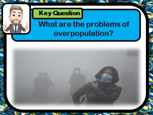
What are the problems of overpopulation?
How developed is China?
Was China’s one child policy an example of successful population control?
In this 1-2 hour KS3 lesson pupils undertake a role play exercise in which they report on UK weather. Template weather scripts, base map and weather symbols are all included as well as a self and peer assessment sheet.
**Bundle and save! This lesson is part of a larger bundle:- **
Weather topic bundle
Check out some of my other products relating to weather and climate:-
What is the difference between weather and climate?
What is the water cycle?
How can we describe weather patterns using weather symbols?
Is all rainfall produced in the same way?
Why does the UK experience the weather it does?
Why do floods occur and what are the effects?
If you like my work, please follow me for more resources and leave a review!
This 2 hour introductory KS3 lesson to tectonics looks at the structure of the Earth, investigating the crust, mantle and core. The lesson includes a music video to help pupils remember the Earth’s layers, as well as a card-sort task and several learning games.
Bundle and save! This lesson is part of a larger bundle:-
Tectonic Hazards Topic Bundle
Check out some of my other products relating to Tectonic Hazards:-
What factors effect the risk from natural hazards?
What are the layers of the Earth?
What are tectonic plates?
Why are earthquakes and volcanoes found at plate boundaries?
What are earthquakes?
Are tsunamis the deadliest natural hazard?
Why live in tectonically active regions?
How can hazard risk be mitigated?
If you like my work, please follow me for more resources and leave a review!
This lesson looks at the factors affecting risk from natural hazards. The lesson uses image analysis to invoke independent thinking and later looks at how geographical position influences the impacts of various hazards. There is a challenging group question task, where pupils reflect on how damages may be reduced, as well as an exam question and mark scheme to be used as a homework task. This lesson investigates what hazards are and how they impact on human settlements. There independent thinking tasks included as well as example exam questions.
If you like my work, please follow me for more resources and leave a review!
This 1 hour KS3 lesson investigates the useful but problematic properties of plastic. Pupils consider why plastic is so versatile and reflect on why this makes plastic so hazardous. Students create a timeline to show how long it takes various pieces of house hold waste to break down, and reflect on whether this should have more of an influence on our choice of materials.
Bundle and save! This lesson is part of a larger bundle:-
India & The Plastic Problem
Check out some of my other products relating to India & The Plastic Problem:-
Why is plastic hazardous?
Where is India and what is it like?
How does India’s physical Geography influence the location of its major cities?
Why does India have a monsoon climate?
How do ocean gyres move plastic pollution?
How developed is India?
Why does India have so many squatter settlements?
What are the impacts of marine plastic waste?
How can plastic waste be reduced?
If you like my work, please follow me for more resources and leave a review!
This 2 hour KS3 resource looks at both 4 and 6 figure grid referencing. Clean instructional slides are provided on how to demonstrate such skills. Two respective worksheets are provided as well as some whole class tasks.
Bundle and save! This lesson is part of a larger bundle:-
Geographical skills topic bundle
Check out some of my other products relating to Geographical skills:-
Where are the major oceans, countries, continents, rivers and mountains?
How can we use a compass?
What are lines of latitude and longitude?
Why are map symbols useful?
How is height represented on a map?
How can we measure distance using maps?
If you like my work, please follow me for more resources and leave a review!
This 1-2 hour KS3 lesson teaches pupils to use latitude and longitude. The lesson includes learning strategies, which allow pupils to remember key differences with ease. Pupils are required to plot the location of key countries using latitude and longitude values. Students then play a ‘battle ships’ style game developing their newly learnt skills in a fun kinaesthetic activity. Pupils reflect on their learning and use a key term box to describe lines of latitude and longitude. Students are required to then move themselves around the room into specific areas using latitude an longitude values. This allows teachers to assess learning with ease.
Bundle and save! This lesson is part of a larger bundle:-
Geographical skills topic bundle
Check out some of my other products relating to Geographical skills:-
Where are the major oceans, countries, continents, rivers and mountains?
How can we use a compass?
How can we use 4 & 6 figure grid references?
Why are map symbols useful?
How is height represented on a map?
How can we measure distance using maps?
If you like my work, please follow me for more resources and leave a review!
In this** 2 hour KS3 lesson**, pupils investigate extreme tourism in Antarctica. Students watch a video clip to understand why tourists visit this extreme but beautiful continent. Source images are used to teach pupils about the conflicts caused by tourists. A card sort activity is included in which pupils categorise the positive and negative impacts of tourism. Students are taught about the strategies being use to make Antarctica tourism more sustainable.
Bundle and save! This lesson is part of a larger bundle:-
Tourism topic bundle
Check out some of my other products relating to Tourism:-
What types of tourism exist?
Why has the tourism industry grown?
Why do coasts, mountains and cities attract visitors?
How do glaciers shape the landscape?
What are the features of a glaciated landscape?
Why does conflict exist in national parks?
How can conflict in national parks be managed?
Where is the Amazon Rainforests & what is it like?
Why is the Amazon Rainforests under threat?
How can eco-tourism help to manage rainforests sustainably?
Why do tourists visit extreme environments?
How does tourism impact Antarctica?