Welcome to my shop. My aim is to provide high quality teaching, learning and assessment resources. In the case of GCSE and A Level resources I am adding examination questions to my resources as more become available. Please come in and browse. Feel free to contact me about any of the resources that you buy or if you are looking for something in particular.
Welcome to my shop. My aim is to provide high quality teaching, learning and assessment resources. In the case of GCSE and A Level resources I am adding examination questions to my resources as more become available. Please come in and browse. Feel free to contact me about any of the resources that you buy or if you are looking for something in particular.
This lesson starts by testing the student’s knowledge of the location of major cities in the UK. It then introduces the concept of core and periphery. Pupils then have to apply this to explain the patterns on two UK maps. Next, the students research 4 causes of uneven development (infrastructure, economic change, government policy and geographical location), using information sheets incorporated into the PowerPoint. The lesson also incorporates an examination question and mark scheme. The plenary is an opinion line about the impact of government policy on addressing uneven development through the creation of a Northern Powerhouse.
This lesson contains a worked example followed by a series of exercises where the students can practice and apply their knowledge. Included within the PowerPoint are worksheets for the students to fill in and a full set of answers, including worked calculations. I designed these to be used either as homework tasks or as an introductory lesson / skill practice lesson. They are also designed to encourage the students to memorise the formulae as these will not be included in the exam papers even at GCSE level.
Firstly, there is a white board quiz linked to the causes and effects of flooding. This is designed to recap previous knowledge. Next the students are introduced to the River Eden and it’s key features. After that the students are asked to collect facts about the different human activities that occur around the river from information sheets. Once these are complete introduce the students to the impacts that human activity can have on the river landscape. Next, arrange the students into small groups. Using the information sheets and a planning sheet they need to plan out PEE paragraphs as a team. After that the students need to write their own 8 mark examination response to a human activity question using their planning sheets to help them. There is a writing frame and mark scheme to accompany this. Finally, the students are asked to demonstrate their understanding of how the human activity changes along the whole river. All resources are included at the end of the PowerPoint.
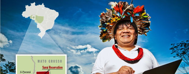
Firstly students are introduced to shifting cultivation, as a sustainable way for tribes to live in the rainforest. Students are then asked to use the information provided to undertake comprehension activities on 3 schemes; reforestation, conservation and improvements in agriculture in the Amazon. there is also a youtube video link to accompany the conservation scheme. Students are provided with note taking sheets and should ensure their notes focus on the impacts of the 3 schemes on the carbon and water cycles. To finish students evaluate the 3 schemes before reaching a conclusion as to which is the most effective. This is part of a series of lessons and is available as a bundle.
This is a debate / decision making exercise and should take place over a three of lessons, two to plan and one to undertake the debate. Firstly, there are two video clips about the oil industry in Prudhoe Bay, Alaska in order to develop the students sense of place. Next, based on a geofile (website for access supplied) students should evaluate the advantages and disadvantages of oil and gas production and consumption in Prudhoe Bay. After that students are split into 4 groups. Each group is given a character card with details about their viewpoint and a writing frame. Using the writing frame and geofile students should develop a speech about their views on oil and gas production and exploration in Prudhoe Bay. This will take 2 lessons.
In the third lesson the groups should give their presentations. whilst speaking sheets are provided to take notes on the viewpoints of others and writing down questions to ask them. After every speech undertake a discussion activity based on what has been said. Then debate the two key questions once everyone has spoken. Next the students will be asked to suggest compromises and work towards and agreement, before final voting. At the end pupils will be asked to complete and opinion line task for both the questions and to feedback the reasons for their opinions. To increase student engagement each student is assigned two other students to observe using the engagement tally chart, they should record the student’s engagement at 3 points in the lesson. At the end of the lesson the students can give feedback to the students that they have observed. There are also ask and answer stickers for the studnets to stick on themseves. they can take these off once the have asked/answered a question.
I have added an essay question at the end of the powerpoint which could be planned in the lesson and completed for homework. There are planning sheets and fact sheets to help the students to produce high quality essays. All resources are included at the end of the PowerPoint.
This lesson will focus on students producing high quality explanatory written work. To start students explain the greenhouse effect and global warming to one another in pairs. Next they discuss why sea level has risen over the last 20 years. The prediction on the next slides shows students what their answer is likely to be and how you plan to develop and improve their answers during the lesson. Next split the students into 8 groups of 3-4. Give each group a resource and ask them to read it and interpret the images in silence for 2 minutes. They then discuss it as a group to develop the understanding of the weaker students. Finally, they use the writing frame to produce a high quality PEE paragraph. This is repeated for each of the 4 resources/effects of global warming. Next there are some exemplar examination questions for pupils to discuss / attempt. The plenary is a ‘pimp my answer’ activity. There is a poorly written answer, which they have to improve form memory to make it amazing. All resources are included at the end of the PowerPoint.
This lesson is part of a series of lessons available as a bundle. The lesson starts with an examination question about the climate, flora and fauna of different biomes. Answers are provided. Next students are required to annotate and describe a map. this provides an opportunity to see how much the students can recall about rainforest location. Next students are given information about the different layers, which they can annotate onto a diagram of the rainforest. After that there is a mini-plenary testing recall so far. After that there is a climate graph drawing and interpretation activity, with a partially completed climate graph provided. The final part of the lesson involves writing a description of the climate graph. All resources are included at the end of the PowerPoint.
This lesson is part of a series of lessons that can be bought as a bundle. In this lesson the students are asked to think first about how a range of biotic and abiotic factors in the rainforest are interdependent. Some are modelled for the students, who will need to add to the diagram. Next the students are required to locate the Peruvian Amazon and note down some facts about it, as background information to their case study. Next the students are asked to complete a top and tail activity to identify the value of the rainforests to humans. The main activity of the lesson involves the students working in small groups to interpret a range of images about 4 threats to biodiversity (gas production, oil production, gold mining and forest clearance for farm land) before independently writing their own PEE paragraphs. There is a writing frame and set of connectives to help the students to structure their written work if they need it. Finally there is a mark scheme to allow the students/teach to assess the students work.
Included are a range of urban fieldwork data collection sheets that can easily be used in any urban environment. They include index of decay, housing density, housing age, counter-urbanisation.
This bundle includes a range of data collection resources that can be adapted to any location studied. In addition there is a follow up fieldwork booklet incorporating a range of skills including methods, data presentation and analysis. Each section includes a GCSE mark scheme to assess the students work.
In this lesson pupils will learn about the geology of the river Eden, Cumbria. The lesson incorporates maps, photos and diagrams to help the pupils to develop their understanding. They record their information on a work sheet about the river landscape. They are the required to use their notes on river management (human activity) and river landforms to complete the rest of the river landscapes work sheet. There are a range of examination questions based on the sample assessment materials to show the pupils how they could be asked about the landscape. There is also a mark scheme and a quiz with answers.
In this lesson pupils will learn about the geology of the Swanage area of Dorset. The lesson incorporates maps, photos and diagrams to help the pupils to develop their understanding. They record their information on a worksheet about the coastal landscape. there are also photos and factual information about coastal management (human activity) in Swanage. Pupils should use their knowledge of coastal landforms to complete the rest of the coastal landscapes work sheet. There are a range of examination questions based on the sample assessment materials to show the pupils how they could be asked about the landscape. There is also a mark scheme and a quiz with answers.
This lesson develops the pupils understanding of how headlands and bays are formed on concordant and discordant geology coastlines. It then goes onto coves and geos. There is a mark scheme to assess the pupils At the end there is a Swanage Map quiz with answers.
This lesson is designed to teach the students about the different types of aid and to identify the advantages and disadvantages of different types of aid. To start the students are asked to consider where aid is needed at the moment and what type of aid they have given recently. Next there is a video clip introducing the different types of aid. After that they are given definitions of the main types of aid including multi-lateral aid, bilateral aid and voluntary aid. They are then asked to classify the advantages and disadvantages of this aid. Next, there is a recall quiz to test the students understanding of these terms. After that the class is split into groups of four. Each group is given a disaster card, aid costs sheet and aid package sheet. The students are asked to identify which aid is needed in the immediate, short and long term. They are then asked to refine their ideas to fit a budget of 700 units. You can also dish out chance cards to groups, which may benefit or disadvantage their aid package. Some groups can share their aid package plans with the class. The plenary is a cartoon interpretation activity. All resources are included at the end of the PowerPoint.
In this lesson students are introduced to a range of strategies to manage the carbon cycle. these include afforestation, wetland restoration, improving agricultural practices, the Kyoto protocol and the Paris agreement. Students work in groups with flip chart paper or on computer to design a presentation to teach each other about their management strategy. Information about each strategy can be found on slides at the end of the PowerPoint presentation. the students are reminded of some dos and don’t when giving speeches. There is a note taking sheet for pupils to complete and a 3 step guide on how to complete it. Also included is a gap fill paragraph about carbon trading by REDD+ in the Amazon. Further info on this scheme is included in a lesson as part of the Amazon case study: https://www.tes.com/teaching-resource/a-level-case-study-of-a-rainforest-impacts-of-management-on-water-and-carbon-cycles-11694328. After that the students are required to evaluate the schemes and decide which 2 schemes would have the biggest impact on the global carbon cycle and why. All resources are included within the PowerPoint
The lesson introduces students to reading and giving 4 figure grid references.
Firstly, the pupils are introduced to giving and reading four figure grid references, with examples to work through included on the PowerPoint and in the map skills booklet. On slide 15 there is a grid of different symbols, which can be used to test the pupils understanding using white boards.
Next there is a 40 question grid reference quiz, with answers linked to the Cambridge OS map. I have included a copy of the map. I enlarged these to 2cm = 1km and made laminated set to use with the class. I have also included a pacman template which I use to help the pupils with their 4 and six figure grid references. The quiz is also in the map skills booklet.
Finally there are two more extension quizzes relating to the Cambridge map.
In the lesson Students will recap 4 figure grid references before being introduced to giving and reading 6 figure grid references. There are map quizzes (with answers) based on Lyme Regis (Miss Reynolds’ crazy day) and Cambridge maps .
There are a number of other maps skills quizzes and answers included in this PowerPoint which will allow you to fill two or more lessons these include:
Santa’s day out - River Wye Maps
Map skills quiz - Nant Francon & Wastwater / West Cumbria Maps
Map skills revision Avery Hill maps
All tasks are included in the map skills booklet and all maps are included but will need enlarging so 2cm = 1km.
This lesson includes details of the Mercalli and Richter scale, with activities including ranking, living graph, map analysis, seismic trace analysis and table analysis. the lesson updates both scales, with current scales being widely used nationally and globally including the Moment magnitude scale, the JMA seismic intensity scale and PAGER. The lesson also incorporates faulting and examination questions.
This bundle is a series of lessons designed to teach students about the water and carbon cycles in the rainforest, the natural and human impacts on these cycles and the way in which the impacts can be managed. It is designed to accompany the new A Level syllabi
This lesson allows pupils to develop their understanding of headland and bays formation. It incorporates photos, geology maps and writing frames. There is a mark scheme for students to peer / self assess their answers. the plenary is a Swanage OS map quiz with answers.