I'm a Geography teacher with experience educating at various levels, ranging from mainstream schools, SEN and extra-curricular tuition. I also have experience in teaching humanities, English and PSHE topics. My resources are designed primarily as schemes of works for mainly Geographical topics with all levels considered
I'm a Geography teacher with experience educating at various levels, ranging from mainstream schools, SEN and extra-curricular tuition. I also have experience in teaching humanities, English and PSHE topics. My resources are designed primarily as schemes of works for mainly Geographical topics with all levels considered
This unit of work helps students to explore the Amazon Rainforest from the definition of what a rainforest is through to how we and others utilise it. The booklet begins by looking at the world’s biomes, their characteristics and where they are found. The difference between these and ecosystems is investigated, alongside the ecosystem diamond. What defines a rainforest is learnt through drawing and interpretating climate graphs and the nutrient cycle which runs the rainforest.
The structure of the rainforest is investigated through poetry before looking into how plants have adapted to thriving in the rainforest as well as its inhabitants, including animals and tribes’ people – The Kayapo Tribe, The Yanomami Tribe, The Matsés Tribe and The Awá Tribe. The students develop their fieldwork skills by field sketching the Iguazu Falls.
Some of the foods the rainforest provides us are explored through a taste session while other items which are commonly found at home are explored including medicines. Positive and negative impacts we have on tropical forests are discussed with the students debating which strategies would be best to use going forward.
The booklet concludes with the students being given background, the Brazilian governments plan and the effects on the areas environment for them to answer what the benefits there would be for developing the gas resources found at Urucu.
A range of individual and group activities are incorporated within this booklet, including, gathering research from print and video, interpretating poetry, drawing a storyboard, annotating maps, their thoughts, and ideas, drawing graphs and field sketches, completing word-fill paragraphs, asking and answering questions put to others, comparing lifestyles and the completion of an entertaining ‘could you survive in the rainforest?’ quiz.
Please like and follow us on Facebook @WillsonEducation, Instagram @willsoneducation and Pinterest @willsoned for more exciting resources, activities, and upcoming events to incorporate into your lessons.
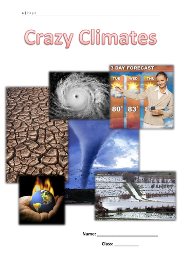
This booklet has lots of different types of activities for children to learn about the difference between weather and climate, hurricanes, tornadoes, thunderstorms, flooding, drought and climate change
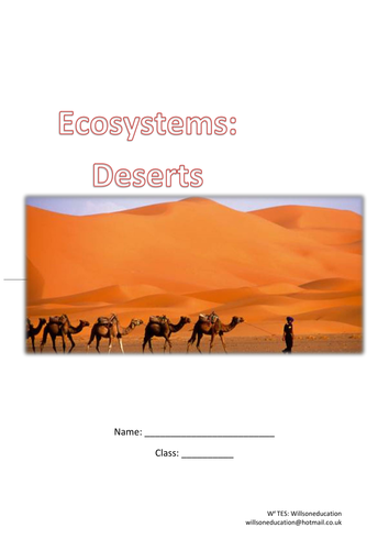
This printable booklet helps students to understand what an ecosystem is, where the world deserts are and their climates. They also look at life in the desert through plants, animals and the San People
This booklet looks primarily at the rainforest and covers how plants adapt to their environments, food webs, the water cycle, how humans us the rainforest and how it can be sustainable. Tasks include wordsearchs, word fills, match ups, comprehension and writing a report
These worksheets help students to explore the fruits, vegetables, medicines, and other everyday objects found in the rainforest. Students are presented with a list of items commonly found at home to highlight how resourceful the rainforest is, and they can try five of these themselves (fruits and nuts). The worksheets conclude with descriptions of the properties of medicine plants with the students having to link these to the recommended symptoms.
A range of individual and group activities are incorporated within this worksheet including food tasting, and annotating their thoughts and ideas.
Please like and follow us on Facebook @WillsonEducation, Instagram @willsoneducation and Pinterest @willsoned for more exciting resources, activities, and upcoming events to incorporate into your lessons.
Eco-tourism refers to responsible travel to natural areas which conserves the environment and sustains the livelihood of the local people and their economy.
These worksheets look specifically at the Galapagos Islands and the Gorilla Safari Trekking Tours available there.
The students use a range of mediums including gathering their own research and research from video and print to produce a podcast about eco-tourism and create their own rules for eco-tourism.
Whether eco-tourism is always beneficial is discussed alongside whether the students would consider this when booking their next holiday.
Please like and follow us on Facebook @WillsonEducation, Instagram @willsoneducation and Pinterest @willsoned for more exciting resources, activities, and upcoming events to incorporate into your lessons.
Living within the freezing Arctic Circle isn’t everyone’s idea of home, however about 4 million people do, with 400,000 of these having indigenous origins. These worksheets look specifically at the Inuit People’s homes, involving building a sugar cube igloo, their clothing, beliefs, and how to encourage future generations keep their traditions alive.
A range of individual and group activities are incorporated within these worksheets, including, gathering research from video, drawing a story board, annotating their thoughts, and ideas.
Please like and follow us on Facebook @WillsonEducation, Instagram @willsoneducation and Pinterest @willsoned for more exciting resources, activities, and upcoming events to incorporate into your lessons.
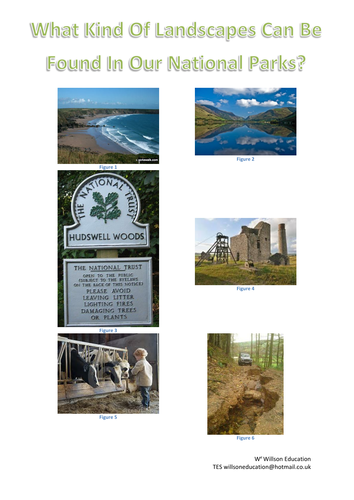
This 17 page booklet allows students to investigate our National Parks. It covers a number of Geographical topics including map work, impacts of tourism and solutions to these and discussion on whether National Parks are still considered important.
Some of the titles included in this booklet are:
What Is A National Park?,
What Makes The New Forest National Park A Honey Pot Site?,
What Impacts Can Visitors Have On Our National Parks?,
Should The South Downs Have Been Included In Britain’s National Parks?
Do We Still Need National Parks?
Living in the rainforests and mountains of northern Brazil and southern Venezuela, the Yanomami are the largest relatively isolated tribe in South America. Today their population stands at around 32,000 and their territory covers 9.6 million hectares, twice the size of Switzerland.
These worksheets help the students to explore the set up of the Yanomami village, the daily lives and rolls of the girls/mothers and boys/fathers, as well as investigating the use of paint to decorate their faces and bodies.
Coastal management depends on the understanding and pulling together of the different people who use the coastline to cope with the physical processes impacting on the area. The different techniques used will have positive and negative impacts depending on their interests.
Tourism, industry, fishing, trade and transport are all land uses along the coastline but with varying interests. These worksheets helps students to understand these different interests and how they can cause problems to one another. The different types fo hard and soft enginerring techniques are discussed as well as whether they think our coastlines should be protected or left to develop naturally.
These worksheets look at the large companies and their locations around the work, then focus primarily on a Nike case study in China and the positives and negatives it brings to LEDCs
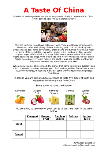
When many think of Chinese food, the dishes that come to mind are typically egg rolls, chow mein, or sweet and sour pork. Fruit and vegetables from China are not usually considered, though we might eat some without realising it originated from China.
These worksheets look at foods which originate from China and gives the students a chance to taste five different fruits and vegetables which originate from China.
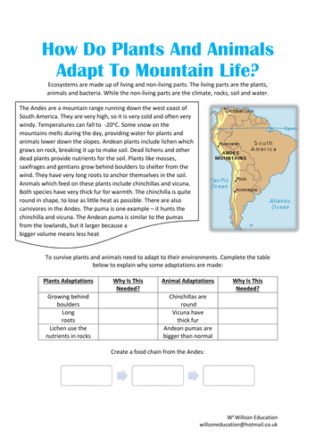
This six page worksheet helps students to understand how plants and animals adapt to living in mountainous areas. The activities include research, designing their own plants and animals as well as peer assessment
This unit of work begins with how mountains are defined, where they are located and how they are formed. We look at the weather in mountainous areas and its effects on shaping mountains. We explore the human and physical influences on landslides, avalanches, and glaciers. An investigation delves into how we use mountainous areas, specifically The Alps and Atlas Mountains. This leads to exploring Everest Base Camp and the Chagga people who live on Mount Kilimanjaro.
The social, economic, and environmental impacts of visitors is discussed with a look at how negative impacts could be diminished within the Lake District. The foreign influence on the Sherpas way of life is studied. We see how plants and animals’ can adapt to life in the Andes which leads to the future of our mountains in terms of climate change and global warming.
The students build on the fieldwork techniques of interpretating photographs and field sketches with Sugarloaf Mountain and Table Mountain. This concludes with asking: “are there monsters in our mountains?” looking at evidence for and against the existence of The Yeti…
A range of individual and group activities are incorporated within this booklet including annotating maps, completing flow diagrams, gathering research independently and from provided print, hands on experiments, case studies, and a peer assessment task.
Please like and follow us on Facebook @WillsonEducation or Pinterest @willsoned for more exciting resources, activities, and upcoming events to incorporate into your lessons.
This 50 page booklet allows students to explore China through a variety of activities both students and teacher lead. Chapters include, amongst others:
Where Are We Talking About?
What Do You Know About China?
Why Travel to China?
What Is The Climate Like in China?
What Is our Population Like?
What’s Happening To China’s Population?
What’s Happening To The Age Of China?
China’s Culture
A Taste Of China
Gung Hey Fat Choy!
Playing With Paper
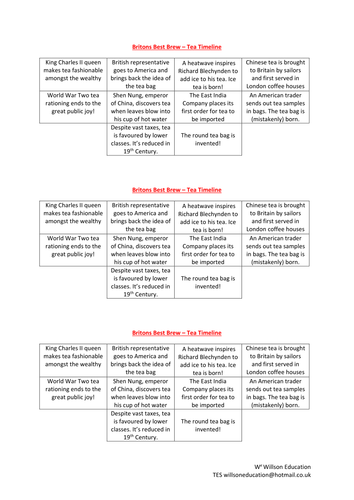
Britain’s Best Beverage
China’s Threatened Wildlife
The Great Wall
The Terracotta Army
The Forbidden City
Tiananmen Square
Three Gorge Dam
Transnational Companies In China
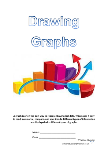
This booklet introduces students to the essential graphs used in most subjects including Maths, Science and Geography, and how to draw them.
Graphs discussed are:
Line Graphs
Bar Graphs
Divided Bar Graphs
Pie Charts
Pictograms
Proportional Arrows
Please like and follow us on Facebook @WillsonEducation and Pinterest @willsoned for more exciting resources, activities, and upcoming events to incorporate into your lessons.
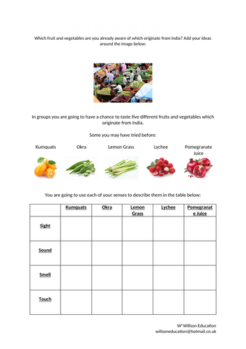
This lesson allows students to identify different fruits and vegetables which originate from India. They sample the foods and give a detailed description of specific fruits. They also have the opportunity to compare differences between ours and traditional Indian meal times
When looking at maps we can find it difficult to imagine what the landscape looks like if we were actually there. This worksheet explains how to draw a cross-section of Jeju Island, South Korea, by using the contours on a map and following a simple flow diagram.
Please like and follow us on Facebook @WillsonEducation or Pinterest @willsoned for more exciting resources, activities, and upcoming events to incorporate into your lessons.
This booklet introduces and teaches the students how to read longitude and latitude, as well as help students develop their descriptive, sensory and research skills. The students investigate the two teams who raced to the poles in in 1911 and study the problems caused by the increasing number of tourists visiting Antarctica. Ways to reduce these impacts are discussed in addition to whether the students think Antarctica should be protected or not. The booklet is concluded with the students designing a leaflet to help promote funding to preserve the huts used by Robert Scott’s Antarctic Exhibition team.
A range of individual and group activities are incorporated within this booklet, including, gathering research from print and video, annotating thoughts, and ideas, and using senses to describe their findings.
Please like and follow us on Facebook @WillsonEducation or Pinterest @willsoned for more exciting resources, activities, and upcoming events to incorporate into your lessons.
This unit of work introduces students to the significance of water from its source through to it being bottled and being a course of conflict. The features of rivers are explored along with the hydrological cycle and how rivers are used. The students carry out and write up an investigation studying how different surfaces react to water which leads into the human and physical causes of flooding, looking specifically at the Queensland Floods and the social, economic, and environmental impacts. Hard and soft engineering techniques are discussed within a ‘decision making exercise.’
Water as a right and conflict is debated. Drawing upon The Ilisu Dam, Turkey, the students debate from various countries points of view its construction. This leads to the debate around bottled water and how fact and opinion can sway viewpoints. The human and physical impacts of shortage of water are reviewed in addition to short and long-term aid.
A range of individual and group activities are incorporated within this booklet, including, gathering research from print and video, annotating maps, students thoughts and ideas, drawing graphs, participating in group investigations and discussions, and writing up their findings appropriately.
Please like and follow us on Facebook @WillsonEducation or Pinterest @willsoned for more exciting resources, activities, and upcoming events to incorporate into your lessons.