I am a Geography specialist who has also been teaching GCSE history for the past few years. I have uploaded some lessons for History and Geography. I hope people find them useful.
I am a Geography specialist who has also been teaching GCSE history for the past few years. I have uploaded some lessons for History and Geography. I hope people find them useful.
This bundle includes all lessons on Lagos for the AQA specification Unit 2 section A.
Lessons include a variety of activities, video clips, exam-style questions and worksheets ready to print or copy.
the sequence of lessons is :
Introducing Lagos
Growing Lagos
Social challenges in Lagos
Economic challenges in Lagos
Improving Lagos’ environment
Managing Squatter Settlements in Lagos
Urban planning in Lagos
Hope this saves you some valuable planning time.
https://www.tes.com/teaching-resources/shop/markthegeographer
Key Stage 3 lesson for a scheme of work on The Rise of The Dictators. In this lesson we look at the Russian Revolution of 1917 and its causes. We begin by looking at Tsar Nicholas II, we then watch a video clip on the reasons for the Revolution. We use info cards and visual hexagons to examine the causes in more detail. We then look at the rise of the Bolsheviks and the pupils create a scroll through history to explain the events of the rise of Bolshevism. We look at a source featuring Lenin and finish on a “to what extent” question.
I hope this proves useful and saves you some time.
https://www.tes.com/teaching-resources/shop/markthegeographer
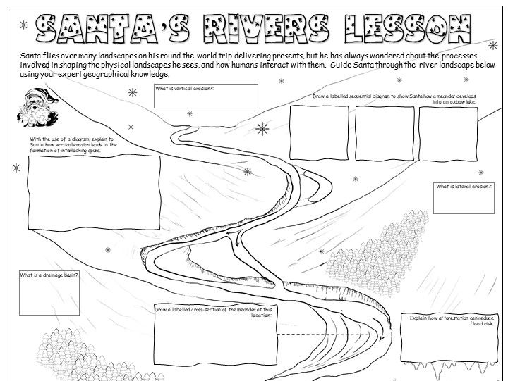
GCSE christmas activity sheet on rivers. The pupils inform Santa all about the wonderful river features he flies over using their geographical knowledge. It also includes colouring activities so is perfect for a more relaxed final lesson of the term, yet still includes real geography!
Needs to be printed or photocopied as A3 for best results!
https://www.tes.com/teaching-resources/shop/markthegeographer
AQA GCSE Geography lesson for the new specification Unit 1C: In this lesson we look at the different types of weathering and mass movement.
We start with a true or false retrieval practice quiz on wave types from the previous lesson.
We then introduce the concept of weathering and proceed to look at mechanical, biological and chemical weathering. The pupils have a variety of annotation, drawing and question tasks to complete on the worksheet.
Moving on to mass movement, the pupils get a second worksheet with 4 different slopes on. The pupils then are given information on each type of mass movement. They sketch the type of mass movement onto their slope and add labels. We finish with a simple GCSE-style question which I get the pupils to answer on a post-it note.
In a nutshell lesson includes:
True or False starter on wave types
Weathering activity sheet with diagrams and questions.
Mass movement ‘change the slope’ activity sheet.
Video clips where appropriate
GCSE-style question plenary
Hope this saves you some valuable planning time.
https://www.tes.com/teaching-resources/shop/markthegeographer
AQA GCSE Geography lesson for the new specification Unit 2A: In this lesson we look at the increasing number of the global population living in urban areas.
We start with a quick quiz on global populations and a video to put global population increase into context for the pupils. We then look at how urbanisation varies around the world by plotting data on a graph. The pupils then describe the trends they have found.
We then look at a map of the urban populations around the world and the pupils can tackle several different questions depending on ability. We then discuss how these patterns might be explained. We then answer a GCSE-style question looking at the percentage of people living in urban areas on different continents using a bar chart. The pupils have guidance on how to answer the question if needed. We finish with a plenary quiz where the pupils have to find the countries with an urban population of over 50%.
In a nutshell lesson includes:
Quiz starter
Video clip
Graph plotting exercise with questions
Map interpretation task
GCSE-style question using graph with guidance
Plenary quiz.
Hope this saves you some valuable planning time.
https://www.tes.com/teaching-resources/shop/markthegeographer
AQA GCSE Geography lesson for the new specification Unit 2A: In this lesson we look at the what traffic management strategies are available to reduce congestion in urban areas and some examples of how this can be done.
The lesson has a retrieval practice starter. We then introduce the problems of traffic congestion in urban areas. In the first task the pupils use hexagons to think about the impacts of traffic congestion. We then introduce ‘carrot’ and ‘stick’ stratgeies and the students go through a range of example strategies and categorise them into ‘carrot’ and ‘stick’ strategies, ranking them in order of effectiveness and explaining their top choices. We then look at two examples of cities (Singapore and Beijing) that have adopted both of these strategies. Using a variety of videos and information slides the pupils makes notes of whether they are ‘carrot’ or ‘stick’ stratagies. We finish with a GCSE-style practice question with some guidance and structure provided for the students.
Hope this saves you some valuable planning time.
https://www.tes.com/teaching-resources/shop/markthegeographer
AQA GCSE Geography lesson for the new specification Unit 1C: In this lesson we look at what managed retreat is and we also consider an example at Medmerry in West Sussex.
The starter is a a simple true or false quiz that is used for retrieval practice, but is easily edited. We introduce the concept of coastal management schemes first and then we explore the definition of managed retreat with a simple fill in the gap task and the pupils consider when it might be appropriate as a strategy and when not. We introduce Medmerry, the pupils write a description of it’s location before we look at the scheme and why it was needed. The pupils have a worksheet, the questions are answered whilst the pupils watch a video clip on the scheme. They then complete a visual plan map of the scheme to show how the area is flooded. We then consider the benefits and costs of the scheme in a categorising task.
We finish with a 6 mark question on the effectiveness of coastal management schemes. The pupils have some guidance on this if you feel they need it.
In a nutshell lesson includes:
Retrieval practice starter
Short tasks on definition of managed retreat and location of Medmerry.
Worksheet tasks with questions and a plan view map of the scheme.
Information categorising task on costs and benefits of the scheme.
6-mark GCSE-style question with guidance should the pupils need it.
Hope this saves you some valuable planning time.
https://www.tes.com/teaching-resources/shop/markthegeographer
AQA GCSE Geography lesson for the new specification Unit 2A: In this lesson we look at the emergence of megacities and the reasons for urbanisation.
We start with a quick photo starter of Tokyo. We introduce the two concepts of natural increase and rural-urban migration. The pupils have a worksheet to fill in regarding push/pull factors, firstly adding their own ideas, then with some input from the teacher, then they categorise into social, economic and environmental.
We then look at megacities, with a introductory video. the pupils then plot the location of the megacities as of 2018 using longitude and latitude coordinates. The pupils then have some extension tasks around their map. We then have a brief interlude to consider what living in a megacity might be like and watch a short clip on Tokyo and living in such a high density population. We then finish with a comparison of a map showing megacities from 1975 and answer a GCSE-style question.
In a nutshell lesson includes:
Photo starter
Video clip
Push/pull worksheet exercise with questions.
Long & lat skills task followed by map interpretation.
Video of Tokyo
GCSE-style question using map with guidance
Plenary quiz
Hope this saves you some valuable planning time.
https://www.tes.com/teaching-resources/shop/markthegeographer
AQA GCSE history lesson for The Power & The People thematic unit. In this lesson we look at the long and short term causes of the American Revolution.
We start with a retrieval practice instagram themed starter on the Peasants Revolt, but works with any historical event. We then look at the set-up of the colonies in America in the mid 1700’s. We then look at the overall causes of the colonists grievances and arguments for independence with a card sort categorising task. We then look at some of the important legislation and acts that were passed in the British Parliament that were detrimental to the colonists and contributed the the revolution. the pupils rate the possible reactions of the colonists and then rank the acts on order of significance. We then complete an Iceberg analysis of the causes. The short term trigger events are above water, the longer term causes are below water. We then finish on some questions and a countdown plenary complete with pressurising music.
I hope that this saves you some valuable planning time.
https://www.tes.com/teaching-resources/shop/markthegeographer
AQA GCSE Geography lesson for Unit 1a. in this lesson we start with a photo starter of a pyroclastic flow where the pupils can design their own GCSE style question then answer. We then move on to look at interpreting photographs of natural hazards which is something we do more of later in the unit. We practice on the landslides in Burundi in 2015. We then look at when a natural event becomes a natural hazard. We progress to categorising various hazards to introduce the categories of hazards. We watch a short video clip on human interaction with natural hazards before the students complete a mind map using hexagons of the factors that increase hazard risk. We finish with a practice question with guidance should the students need it.
In a nutshell, the lesson includes:
Create a question starter
Photo interpretation task
Hazard categorising shaded grid task
Video clip
Factors mind map task
GCSE practice question with writing frame.
Hope this saves you some valuable planning time.
https://www.tes.com/teaching-resources/shop/markthegeographer
AQA GCSE Geography lesson for the new specification Unit 1A: In this lesson we look at the events, effects and responses of Cyclone Idai on Mozambique, Malawi and Zimbabwe.
The lesson has a retrieval practice starter based around a field sketch of a coastline. We firstly introduce Cylone Idai and there is a video clip of the impafts to give students an understanding of the context. The students then undertake a colouring by numbers exercise to create a choropleth map of the rainfall accumulations of the tropical storm. We then consider the effects. The students complete a simple classification exercise categorising the effects into primary and secondary as well a SEE effects. We then look at the responses to the cyclone. There is a worksheet for this activity where the students read the repsonses and tick the appropriate boxes to determine if it was immediate or long-term and how long they think the response took. We finish with a GCSE-style practice question with some guidance and structure provided for the students.
Hope this saves you some valuable planning time.
https://www.tes.com/teaching-resources/shop/markthegeographer
Key Stage 3 lesson on the Black Death. In this lesson which is approximately 1 hour, we introduce the disease, the symptoms and practice some source interpretation as well. We start with an enquiry mystery around uncovering a plague pit where the pupils are given more and more information to try to work out what the story behind the burials might be. We then introduce the disease, its origins and how it is transmitted through watching a film clip. We then create an annotated diagram around the outline of a body. The pupils will listen to the symptoms of the Black Death at various stages throughout the illness of a victim. The slides have sound effects that the pupils always enjoy. We then look at a source from medieval times and the pupils answer the question about the sources usefulness. This is supported with a writing frame and some ideas to help the pupils. We then finish by playing the game “would you have survived the plague?”. Here the pupils choose numbers that correspond to actions a medieval person may take to help them avoid catching the plague. Some work and some don’t.
In a nutshell included in the lesson is:
Time team investigation starter around uncovering a plague pit
Video clip on the origins of the plague and symptoms
Annotated diagram task around the symptoms
Source task for extended writing with writing frame
“Would you survive the plague?” Bingo.
Hope this saves you valuable planning time.
https://www.tes.com/teaching-resources/shop/markthegeographer
AQA GCSE Geography lesson for the new specification Unit 1C: In this lesson we look at beaches and how their profiles can be altered and sand dune succession and formation…
We start with a simple retrieval practice grid which is good for spaced practice.
We then discuss why some beaches have different profiles to other beaches and what difference the size of sediment makes. We then look at the different types of waves and how they affect beach profiles. The pupils will make annotated diagrams of winter and summer beaches. We move onto sand dune systems. The pupils have an outline profile of sand dune succession. We use info slides which can either be teacher led, or use as a round the room activity, group activity etc, the pupils add the appropriate info onto the diagram from the slides. We then look at what conditions are needed for the dune system to form. The pupils have a hexagon task. I usually get the pupils to think about each factor first, the next slide has the answers but they still need to match them up
We finish with a GCSE-style question on the formation of sand dunes with some guidance on how to answer.
In a nutshell lesson includes:
Retrieval practice starter
Beach profile diagram activity
Sand dune succession annotated round the room/group diagram task.
Formation of sand dunes hexagon task.
4 mark GCSE-style question with guidance should the pupils need it.
Hope this saves you some valuable planning time.
https://www.tes.com/teaching-resources/shop/markthegeographer
AQA GCSE Geography lesson for Unit 1A. We start with a simple retrieval quiz, before then looking at the situation of Naples and asking why such a large city has developed near a clear potential threat. We explore this by completing a photo challenge activity with differentiated questions. Pupils will then complete a question wheel about the different reasons why people would choose to live in areas of tectonic hazards. We move on to consider Iceland and the benefits that the country has experienced by living on a plate margin. We then tackle a GCSE-style question with some guidance on structure should the students need it.
In a nutshell the lesson includes:-
Retrieval starter
Photo challenge differentiated activity on Naples and Vesuvius
Question wheel for explaining reasons for living in a hazardous area.
Video on Iceland’s geothermal energy.
Activity exploring benefits for Iceland
GCSE-style question with guidance
I hope this saves you valuable planning time.
https://www.tes.com/teaching-resources/shop/markthegeographer
GCSE christmas activity sheet on coasts. The pupils inform Santa all about the wonderful coastal features he flies over using their geographical knowledge. It also includes colouring activities so is perfect for a more relaxed final lesson of the term, yet still includes real geography!
Needs to be printed or photocopied as A3 for best results!
https://www.tes.com/teaching-resources/shop/markthegeographer
AQA GCSE history lesson from the Reform and Reformers section of the Power & The People unit.
In this lesson we first look at why Britain got involved in the slave trade. The pupils then go on to learn about who the significant abolitionists were. The four we look at are William Wilberforce, Thomas Clarkson, Olaudah Equiano and Granville Sharp. The pupils complete a significance circles activity where they decide who the most significant abolitionists were and why. We then go onto a “How useful is…” source question with guidance on how to respond.
Included is:
Starter activity
Video clips
Activity on reasons for slavery
Abolitionist character cards
Significance circles activity
source question.
Hope this helps
https://www.tes.com/teaching-resources/shop/markthegeographer
AQA GCSE Geography lesson for Unit 2C. The lesson is approximately one hour but can be extended over 2 lessons.
The lesson is designed to work with the AQA Oxford textbook but does work without
We start with a retrieval practice quiz from the previous lessons on the provision of food and water. After introducing the concept of energy mix and energy security the pupils then complete the A3 differentiated worksheet that covers the main aspects of the lesson.
The pupils then finish the lesson with a GCSE style question with guidance on how to answer it should you wish them to use it.
Hope this helps and saves planning time.
https://www.tes.com/teaching-resources/shop/markthegeographer
AQA GCSE history lesson for The Power & The People thematic unit. In this lesson we look at the events, tactics used and consequences of the General Strike in 1926.
We start with a retrieval practice starter. We then have a recap on the causes of the General Strike. the pupils are given some pictures, then if needed some worded prompts. We then, after a brief recap of events, look at the tactics used by both sides in the general strike. The pupils assess the effectiveness, on a visual scale, of these tactics and explain their reasons. We then look at the ending of the strike, and the consequences. The pupils complete a text analysis and look for political and economic reasons. We then briefly look at the impact of the strike on the Unions before finishing with an exam-style question on a source published in Punch satirising the TUC’s ineffectiveness to shift the government,
I hope that this saves you some valuable planning time.
https://www.tes.com/teaching-resources/shop/markthegeographer
Requires the blue AQA GCSE Geography Oxford textbook
AQA GCSE Geography lesson for Unit 1A. In this lesson we compare the Chilean earthquake of 2010 with the Nepalese earthquake of 2015. The lesson includes and photo interpretation starter and video clips where appropriate. the main body of the lesson is used by the pupils to fill out their differentiated worksheets on each earthquake. We then answer a GCSE-style question using a worksheet to help the pupils learn how to structure their answers.
I hope this saves you valuable planning time.
https://www.tes.com/teaching-resources/shop/markthegeographer