My shop is a non profit making concern & it supports homeless charities (Crisis, The Salvation Army & The Berwick Youth Project). Teaching has been my life & I continue to support learning around the World. My subjects were: History, Geography and Physical Education. I have competed in a wide variety of sports inc.: Gymnastics, Badminton, Rugby, Football, Athletics & many others. Check out my recent bundle with 11 of my best publications. A vast amount of support material on offer.
My shop is a non profit making concern & it supports homeless charities (Crisis, The Salvation Army & The Berwick Youth Project). Teaching has been my life & I continue to support learning around the World. My subjects were: History, Geography and Physical Education. I have competed in a wide variety of sports inc.: Gymnastics, Badminton, Rugby, Football, Athletics & many others. Check out my recent bundle with 11 of my best publications. A vast amount of support material on offer.
Advice and a Warning … Please note that this play makes use of sound effects like irate animals, a rather mad parrot and a deaf old lady who breaks wind!! If you use this resource, I recommend using it in the final lesson of the day. It is not for use by teachers who are faint hearted or do not have a good rapport with their students. Read on if you are interested.
This is both a short story and a short play about Diego the Parrot. The title of the play is “My Neighbour Has A Parrot”. I used to enjoy interactive lessons with my students and in partnership with my classes we used to produce plays, drama sketches and pantomimes. These were the most memorable experiences in my career as a teacher. This resource targets English and Drama or it can be used as a platform for a short stage production. Acting out plays has always been a winner for me. There are lots of sound effects included in this production and it affords the opportunity to have lots of fun with your students. As a play it would last between 10 and 15 minutes. The main characters in this production could include a narrator, old man, old lady, parrot and possibly a sound effects expert! I would target this resource at Key Stage 2 and 3 (Ages 8 to 14 year old). Initially I would read the story to the class (with the sound effects) and then develop the production as a whole class exercise and then, perhaps, in groups of between 4 and 5 children. The main aim of this classroom activity is 1) Building inner confidence and 2) Having fun in the classroom. Further developments can involve creative writing about Diego the parrot. One in particular that I have used in the past would be “Diego and the Ventriloquist”. Each child can have a go at performing and writing a small individual sketch for fun. A toy parrot strapped to the shoulder would be a useful extra. I hope you have fun with this resource.
My shop supports the Berwick Youth Project. This charity helps to keep young people safe and tries to prevent them from ending up on the streets or homeless.
This chapter highlights the structure and content of an Orienteering Event and it is presented as a Power Point Presentation. The key elements include: The map and planning, Orienteering controls and the officials (the people behind the scenes), Preparing the maps and checking out the lay of the land, Advertising the event and taking in the entries, Setting up a suitable start and finish zone. Other interesting features include aspects of coaching, working with young competitors and also the benefits of family participation.All in all a sport with a healthy outlook and well worth trying.
This resource is part of a larger coaching document and all presentations will serve to support three homeless charities.
The sport of Orienteering needs to be broken down into bite-size skills so that the beginner can establish the most important principles of this incredible activity. In this presentation I have selected ten elements that I believe to be essential learning steps for the novice orienteer. I have included the following topics in order to lay the foundations for success in this activity:
Knowing your north from your south! 2. Translating the symbols into an accurate mental image of the land features. 3. Making the most of the map key. 4. Getting to grips with scale and distances. 5. Understanding contours and being able to convert the patterns into mental pictures. 6. Keeping in touch with your exact location by using your thumb! 7. A personal understanding of your stride distancing. 8. Making use of rough bearings. 9. Knowing how to use map handrails. 10. On a navigation leg, make the most of the collecting or gathering features between control points.
These key principles of navigation and map reading skills will serve you well in this incredible sport. As with all my resources, I offer this resource at minimum cost in order to support my three chosen homeless charities. I am grateful to the Malaga Orienteering Club for permission to use many of the images and videos on offer in this presentation.
This resource is offered as an introduction to how maps evolved and the subsequent development of Orienteering as a sport. It is offered as a Power Point Presentation and it lays the foundation for a programme of 9 more presentations that highlight the many skills and coaching topics to be experienced in this amazing sport (Orienteering). The ten presentations have been written in both English and Spanish. Many of the slides show the diversity of the Spanish landscape as captured by the many members of “The Malaga Orienteering Club in Spain.” The presentations can be adapted for viewing by Upper junior students (9 - 10 yrs.) through to adult age groups. This presentation includes topics such as: Comparisson of ancient maps through to modern day orienteering maps; Early maps and cartography; The compass rose; The Earth’s magnetic field, The magnetic compass and how it can be used with the Orienteering map. The presentation sets the foundation for many more coaching aspects covered in the follow up programme of wide ranging topics. These resources are a non profit making venture and any income will be forwarded to three selected homeless charities (Crisis, The Berwick Project and the Salvation Army). As an extension to the use of this resource, teachers may wish to use the text, images and possible video links to other topics such as: Geographical landscapes, The Spanish language, The History of Maps and as an introduction to the sport of Orienteering. The introductory videos (one of two in the presentation), gives a true taste of this amazing outdoor sport. Permission to show the videos in this and all ten presentations has been granted by Malaga Orienteering Club with the gratitude of (Ian Patterson) the author of this presentation.
A Taste of Orienteering - Getting Ready for Your First Event. This chapter aims to help the beginner to become familiar with the many experiences and challenges facing the newcomer to this exciting outdoor sport.
This Power Point Presentation is the second in a series of coaching notes for this amazing sport of Orienteering. It is dedicated to our departed friend, James Ross who was an established and successful Orienteer. He was a member of the well-established Malaga Orienteering Club. All commission gained from this resource will be donated to selected Cancer organisations.
So where do we start? Here is a list of the topics covered in this presentation:
Checking out your local Club and what is on offer. 2. Make contact and find out the many activities and experiences available. 3. Events can be either “Town and Country” (Urban or Rural), a huge contrast. 4. Become familiar with the Club websites. 5. What might we expect to find at the start line? 6. The first few seconds of any test or race are vitally important especially for novices! 7. As we progress, we will become familiar with both the map and the compass. 8. Gradually we will gain confidence and become familiar with directions, distances and many contrasting landscapes. 9. A clever thumb will improve our navigational skills!? 10. At the end of each event we will become familiar with the finish line and checking in at the download station. 11. Finally we should show gratitude to the planners and organisers who give of their time freely for the benefit of others and this incredible outdoor sport.
Orienteering is very much a family sport, and it offers huge benefits to young and old alike. Check out this presentation and become involved in something very special.
Orienteering - PPP7
Symbols - Quiz One
In order to navigate an Orienteering map, it is essential to have a fair grasp of the map symbols. Presentation 7 is offered in the form of a Quiz. Included are 25 contrasting examples.
Included are: Vegetation types, man-made structures, water features, natural formations and a variety of other common inclusions that can be found on Orienteering maps.
Orienteering - PPP8
Symbols - Quiz Two
As with Presentation 7 this is the second of two presentations that will help the Orienteer to become familiar with the map symbols. Presentation 8 again offers a selection of 25 map symbols. They are presented as a quiz challenge that can be repeated several times. This will help individual orienteers to become familiar with the many symbols included on Orienteering maps. A mixture of all symbol types has been included.
Orienteering - PPP9
Navigation, Gathering Points and Handrails.
This Power Point Presentation aims to help competitors in the art of navigation. Two ways of making the navigation challenge easier, involves making the most of gathering points and Handrails. The use of these navigation skills can help the novice to progress into an experienced, confident and successful competitor. The presentation offers the following: 1. Map examples of linear map symbols that help the runner to maintain a parallel track to the intended control point. Examples of linear features might be a) a fence, b) a wall, c) the edge of woodland. These are a few of many possibles. 2. In contrast gathering points are a number of isolated map symbols that can also help the runner to progress accurately between two control points. This is particularly useful when following a compass bearing. Isolated map features might include a) a large rock, b) a small thicket, c) an isolated tree d) a ditch running across the direction of travel, etc. There are many more examples. Long navigational legs may have as many as 5 or more gathering points. Gathering points also helps to sub-divide the leg into specific distances.
This presentation also includes a section on how to set a compass bearing using the Silva (plate) compass. As long as you have the map and compass in your hand you will not be lost! However, you may be unsure of your exact location - In these circumstances - check the orientation of the map and look for prominent physical or man made objects nearby to relocate.
Handrails and gathering points help to create bite size challenges. Learning these advanced skills help to establish stress free progress in an Orienteering event. Enjoy the challenges.
What would you do and who would you turn to if you found yourself homeless at this time next year?!
This resource supports three homeless charities. For only £2 you will receive a resource that highlights both Geography and History across the length and breadth of Britain. At the same time you will be helping people who find themselves on the streets and need our help to survive. The resource comes in two files. One is in Power Point format and the other is a word file that includes both a quiz challenge and an extended fact file about many different topics. These topics include: Coventry Cathedral, Edinburgh Castle and the geological feature known as a “Crag and Tail”, the Holy Island of Lindisfarne, Titanic, William Shakespeare, Isambard Kingdom Brunel, Oliver Cromwell and the “New Model Army”, Hadrian’s Wall and Features of intrusive, extrusive volcanic activity and many more.
The resource can be used for children between the ages of 10 and 16 as either a review of “The Geography and History of the British Isles” or as a Power Point quiz challenge. Many of the individual topics can be used to introduce stand alone lessons or to stimulate discussions.
Income for this resource will go to homeless charities. The work serves to satisfy the type of work associated with field studies and research. The content targets Geography, Travel and Tourism and Business Studies students from 14 to 16 years of age. They will gain experience in handling data related to service industries. The work serves to satisfy the type of work associated with field studies and research. The data is presented on a spreadsheet that highlights the Service Industry of Poole in Dorset. Using the information, students will be able to propose a hypothesis and then attempt to prove or refute the chosen statement.
Within the folder there is a power point presentation that can be used independently as a collection of Geography topics about the English County of Dorset. Specifically it addresses the concepts of Site, Situation and Function of a settlement. The power point presentation alone can be used to support up to 10 contrasting lessons. The photographs can be used for introductions to a number of Human and Physical Geography topics including the following specifics and links:
Poole Port, Service Industry, Tourism, Shopping Streets, Spreadsheet statistics, Bays and Headlands, Lulworth Cove, Lulworth Village, Swanage Bay, Groynes, Stair Hole, Durdle Door, Corfe Castle, Dorset Geology, Settlements, Site, Situation, Function and finally a number of excellent photographs that can be converted to field sketch diagrams.
This is a Power Point Presentation about Poole, Dorset and the Jurrasic Coast. Within the commentary boxes each slide offers fairly simple writing or sketching challenges for students from Year 6 through to GCSE level. The study is presented in such a way that individual students can work through each challenge from home on a PC or lap top. The geographical skills involve drawing of maps, field sketches and analytical writing that will give each student familiarity with common geographical terminology. Working for between 1 and 2 hours per day, this project should last for about 7 session but may last up to 10 one hour sessions in total. There is potential for extension work using the many images that lend themselves to field sketch drawings. This resource is offered at a minimum price of £3 and all income will be forwarded to homeless charities in 2021. It is also offered at this time especially for parents and teachers who are providing children at home with appropriate educational challenges during the Covid crisis.
Home Study 2020. Have you got an Atlas at home? All homes need an Atlas. This resource is ideal for doing work linked to pages from an Atlas.
All income from this resource in 2020 will go to Homeless charities.
A 268 page document with over 50 outline maps from around the World. This resource book is to be used in conjunction with a school atlas. There are a multitude of exercises and challenges for students to use as homework or in the classroom with guidance from the teacher. Also included, there are over 180 photographs from the UK and around the World that can be used individually for lesson starters or as independent slide shows.
National Curriculum, Geography - This teaching resource offers a large proportion of the main elements included in the Key Stage 1, 2, 3 and 4 specifications. Location knowledge, Place knowledge, Human and Physical Geography and also elements of fieldwork skills have been covered in many different ways.
Almost every page has a Geographical question, exercise or challenge for a wide range of ability levels. Many of the photographs could also be used in PSHE lessons or Tutor Time to inspire discussion, comments and possibly written work.
Special areas of interest: China, Spain, France, Belgium, Malaga, Palm Springs, London, Bristol, WW1 Picardie and Flanders.
Geography Bundle - Price Reduction - Amazing value for money!
All income in 2021 will go to Homeless Charities.
This Geography resource is ideal for home learning.
It is everything I needed when I first started teaching Geography. It targets children from the age of 8 through to 16 and it includes: 1) World Mapwork Skills & literacy. Every possible outline map for Britain, Europe and the rest of the World is included. 2) Basic Skills for teaching OS - mapwork.
3) How to interpret pictures and then convert them into field sketch images.
There are also many challenges offered for writing sentences and passages using geographical terminology and vocabulary. This bundle is a special offer to young teachers of Geography in the Secondary sector. It also targets (KS3 and KS4) . Junior School Teachers responsible for delivering Humanities at Key Stage 2 Level will also find this resource invaluable. The whole package makes up 100’s of lessons.
A 268 page document with over 50 outline maps from around the World. This resource book is to be used in conjunction with a school atlas. There are a multitude of exercises and challenges for students to use as homework or in the classroom with or without guidance from the teacher. Also included, there are over 180 photographs from the UK and around the World that can be used individually for lesson starters or as topic slide shows.This resource work book can be used with a wide range of age groups. The outline maps and questions are suitable for children between the age of 9 to 16 years. The content has a wide degree of differentiation for more and less able children. The many pictures included in this document are ideal as introductions to new topics. Although the main focus of this resource is on Geography, much of the content can be linked to, Travel and Tourism, History, English and Social Studies. Special featured sections: China, London, Spain, Bristol and WW1 Flanders. All income from this resource will be donated to 3 Homeless Charities in 2021 . The Salvation Army, Crisis and The Berwick Project.
A pack of 11 General Knowledge quizzes in support of the Crisis homeless charity. These quizzes are targeted at children between the ages of 9 and 16. The answer sheets act as a fact file for learning about the wider world. Please support the Crisis Charity with your £2 donation.
Children at Home can learn about the time line of events during WW1. Teachers can offer this resource to children who are studying WW1. Younger students may need to watch alongside their parents.
What is included … 2 Presentations, 4 Quiz Challenges and information pages.
and how to use this resource:
This resource can be used for students between the ages of 9 and 16 years.
It contains 2 power point presentations that cover the first and second half of WW1 in a chronological continuum. Each presentation has 25 slides with detailed notes included below. The commentary is most suitable for 14 to 16 year old History students but it can be easily adapted for children who are 10 to 13 years of age.
Both presentations are offered as thumbnail and note pages that can be printed and used as revision sheets for examination students who are studying WW1.
Other pages on offer include two relatively easy quiz pages with 25 questions for all age groups and two picture quizzes with ten related images (The quizzes can be attempted** with or without** the fact sheets).
Finally there is a page with 25 short writing projects that are offered as challenges for developing historical writing in preparation for examinations.
How to Use the Power Point Presentations:
Part 1 - Show as a brief introduction for various topics about WW1. The presentation can be concluded by an easy quiz (using the resource to find the answers). Testing from memory - Students can mark their own so that they can note facts and concepts that they did not learn during the presentation.
The quiz pages can act as a script for the main discussion topics whilst the presentation is being given. The second presentation can be used in the same way.
Individual slides can be used as lesson starters for initial discussion and then lead into writing challenges.
I envisage this resource being used for perhaps up to 6 lessons with 9 to 12 year old children.
Examination students might use this resource as a foundation for studying all aspects of WW1.
The picture quizzes can be used as standalone challenges using the information sheets or as an internet challenge.
Another option would be to use certain pages as Homework material.
Target groups are … GCSE History and Key Stage 2 and 3 studies.
This resource targets students studying the Weimar Republic during the period 1918 to 1933. They are most likely to be involved in learning about History in Germany for GCSE examinations in the time period between the two World Wars. Specifically it is aimed at learning time order in this complicated and rapidly changing period of History. There are two main elements to this resource. It starts with a timeline presentation that can be taught as two introductory lessons. After this initial introduction the 48 revision cards can be used to create a wall display and then followed up with a series of revision games that help students to learn the correct order of events during the Weimar years in Germany. As the end of Key Stage 4 examinations get closer the revision cards will be very useful for individual, partner and group revision sessions.
Adolf Hitler 1889 to 1918 – His Early Years and WW1 - This resource comes in the form of a fact file and a selection of classroom exercises that are aimed at 13 to 16 year old students of 20th Century History. In addition to this there is a small section (images) that would be suitable for the PSHE programme especially in the month of November. The material in this 21 page resource documents the birth of Adolf Hitler through to the conclusion of WW1. It contains written information, pictures, maps, quiz questions and research challenges. The research challenges are ideal for perhaps two internet sessions where students need to search for extra information. The contents are best suited for Key Stage 3 and students in Key Stage 4 preparing for History examinations, particularly the topics “The Rise of Adolf Hitler”, “Development of a Dictatorship” and “The Events of WW1”. The resource materials offered should satisfy between 4 and 8 hours of work in the classroom. As an alternative it may also be offered as a home research project in preparation for GCSE examinations.
This resource can be linked and used alongside - Adolf Hitler - Early Years (Powerpoint Presentation created by this same author).
Lock Down Picture Quiz prepared for youngsters between the ages of 9 and 16 years of age. Clues have been added to give them every chance of answering most of them. The answer page includes a fact file for additional learning whilst checking the answers.The pictures include famous people from History as well as familiar faces from 2020’s.
A power point presentation created by one of my 15 year old students (Carlos Soriano Jiménez). Topic includes what caused the cold war and the main events during the first 5 years.
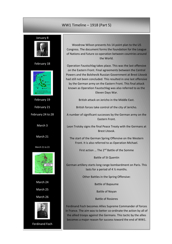
This folder can be used as a revision document or as a resource for teaching topics about WW1 from the year 1918. Resources include topics like: German Spring Offensive, 100 Days Offensive and the End of the War. There are a number of links to web sites and video footage for delivering lessons to both KS 3 and KS 4 History students. Year 11 History examination students will be able to use specific sections of this folder to revise from. Note … hyperlinks have been disabled but can be easily restored.