

201Uploads
517k+Views
606k+Downloads
Geography

introductory lesson to weather and climate
Intro lesson to establish understanding of difference between weather and climate and methods of measurement and forecasting.
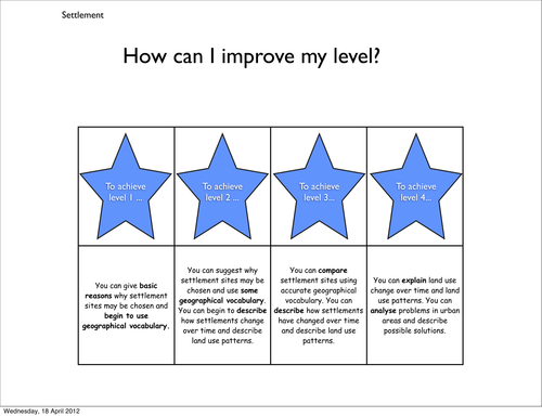

plate boundaries comic/revision
plate boundary diagrams and definition activity. Created using Comic Life so file as JPEG.

How do we measure the weather grid
Grid for students to complete showing conditions measured, equipment and units
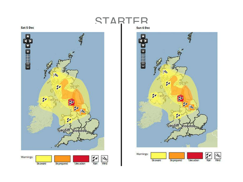
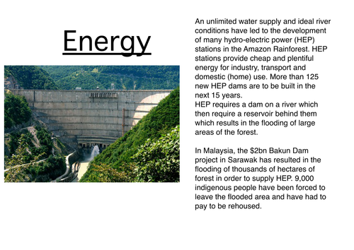
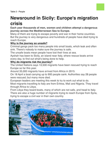
Storm Desmond
Students investigate the impacts of Storm Desmond using news reports and then produce their own report.

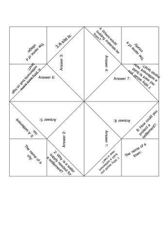
A chatterbox template for settlement development
Simple questions for students to fill and construct their chatter box relating to basic settlement triggers such as water supply, highland etc.

Self and peer assessment comment banks
Simple placements with common comments for pupils to use when peer and self assessing.
UK and map skills 9 lesson series
A 9 lesson unit for the start of the year. Baseline test, global and national locational knowledge, UK and EU, GIS, map skills and end of unit assessment.
Lesson 1 and the SOL is at the bottom for some reason! :s
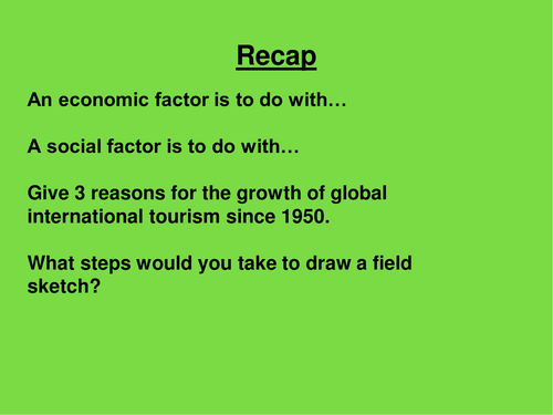
AQA Tourism - Importance of tourism/contribution to economy
13.2 - AQA GCSE Geog A
Importance of tourism as a contribution to GDP.
Dubai and Kenya case studies.
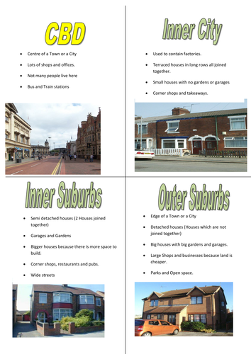
Burgess model zone cards. High and low level
A set of cards about the burgess model zone. Suitable for high and low levels.

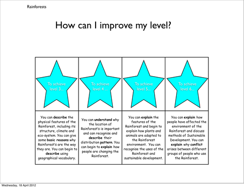
Africa population distribution
Students produce a map to show population across Africa and link this to physical landscape and climate.
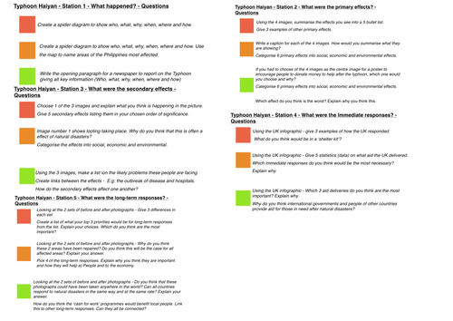
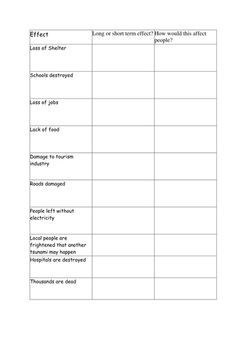
Typhoon Haiyan case study and exam application
2 lessons. In the first lesson students complete RAG questions at 5 stations in order to gather case study information. The 2nd lesson students complete exam questions, generating success criteria and self assessing against model answers.
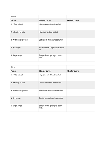
Flood hydrographs
Flood hydrographs lesson - drawing and analysing.
Based on resources from North West Regional Flooding Resource