I'm a teacher and the Author of the Amazon e-book;' Time Smart Teaching' and my mission is to create Geography resources to help teachers save time and reduce their workload. I am sharing additional time saving tips for teachers on my YOUTUBE channel ' Time Smart Teaching' if you fancy dropping by!
I'm a teacher and the Author of the Amazon e-book;' Time Smart Teaching' and my mission is to create Geography resources to help teachers save time and reduce their workload. I am sharing additional time saving tips for teachers on my YOUTUBE channel ' Time Smart Teaching' if you fancy dropping by!
This full lesson and associated worksheets examine the causes effects and responses to his UK based extreme weather flooding event. This lesson includes a fact file of key information like dates, times and damage impacts to help students complete a case study mind map or overview sheet. Could be used as a revision exercise or introducing this natural hazard event for the first time.
This full lesson gets students thinking about describing and explaining where most of the world’s ice is found. The Tundra biome is found at far north and south latitudes where the days are short and the winters are long. Permafrost and taiga forests are located here and only well adapted plants and animals survive, hence the name ’ treeless mountain tract’. The lesson has a differentiated map task where student must shade and label places within the tundra biome. There is also a match-up activity where they must link up definitions of icy landscape features with their pictures: glaciers, ice sheet, ice caps and snow patches.
A bundle of examination support resources created for the 2019 summer examination pre-release material about road building through the Peru Amazon. The bundle includes an A3 revision poster plus workbooklet to help students analyse each page of the booklet. IN addition there is a revision poster on Tropical Rainforest management.
The river Tees flows for 85 miles through Northern England from Cross Fell in the Pennines, to the North sea near Middlesbrough. It shows typical valley features of the long profile of a river and is an important example to study for the new AQA GCSE Geography curriculum. This 6 part storyboard activity allows students to make notes independently at key stages along the river’ journey from the BBC bitesize website amongst others. This was written for lower to middle ability students in mind to give them lots of visual references to remember key facts about the river Tees. There are 3 exam type extension questions at the bottom of the worksheet to stretch the more able students in the class. To complete the task they must show skills such as field-sketching, map reading and comprehension.
Land use refers to what is built on the land at a specific point or the way in which humans use it; for example- residential, industrial, commerce and so on. Land use patterns vary considerably between HIc’s and Lic’s and this lesson examines the Hoyt and Burgess model with a focus task on Brazil. Students must place phototgraphs around their models base on their knowlege of land use patterns. They will start with a quick recap on keywords linked to the theme of urbanisation and urban environments. Fiinally a 4 mark exam question wil test their ability to compare land use between HIc’s and LIC’s. Written for the older AQA GCSE Geography syllabus, but still relevant today.
This odd-one out activity encourages students to consider key terms, important concepts and processes within hot deserts and tropical rainforests. There are 8 sets of 4 words/ phrases and students must critically think about which one does not fit the overall pattern. Answers are provided with simple explanations. This works well as a starter activity for GCSE groups but could easily be set as a homework task for independant study.
A bundle of map skills activities for KS3 classes, of mixed ability including using maps to create stories, and analyse human and physical landscapes. Map skills developed includes reading contour lines, using compass directions, concordant coastlines, maps symbols to describe land use and grid references with scale.
Map skills are enabling people to make sense of the world around them by studying spatial patterns and change in a variety of natural and man made landscapes.
This 6th lesson in our cold climate series aimed at year 7 / 8 examines why Arctic sea ice is reducing year on year due to climate change. Students develop their timeline skills to collect information on how ice cores show changes in air quality over time. Students then utilise their completed time line on sea ice to answer questions to test their understanding of the issues presented in the lesson.
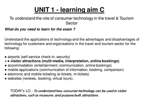
This lesson is part of the examination assessed unit 1 2013 onwards specification. It covers the role of consumer technologies ; multimedia and online booking systems and their advantages and disadvantages for consumers and businesses. There is so very little out there on this that I hope someone else may benefit from my hours of preparation!
A differentiated main activity to allow students to find important places within the city of Manchester using an OS map. Could easily be adapted to other cities. Good for a range of abilities and incorporates 4 and figure grid references and extention task for independant work of more able using online Bing maps GIS free website.
This is a great visual revision resource for GCSE AQA Spec, covering the basics on causes, effects and sustainable management strategies for the Amazon Rainforest case study. I initially gave students blank copies of a tree and asked them to fill in their own knowlege, then gave my filled out version to lower ability students. They then used this infomation to help answer a range of past paper questions on the case study. There are 2 exam questions below the work sheet to test their understanding.
Coastal Processes in Action - GCSE Physical Geography Lesson
Immerse your students in the dynamic world of coastal processes with our engaging GCSE physical geography lesson. Focused on the impacts of key coastal phenomena such as long shore drift, deposition, and transportation, this session encourages hands-on learning through small group activities.
Key Features:
Interactive Learning: Facilitate understanding of coastal processes by employing small group work, allowing students to use body movements or coded sign language to vividly demonstrate their comprehension.
Focus on Transportation: Delve into the specifics of beach sediment transportation, exploring how constructive waves play a crucial role in moving sand and pebbles along the coast.
Exam Readiness: Evaluate students’ knowledge with a 4-mark exam question, providing a practical application of the concepts learned during the lesson.
Sketching and Image Analysis: Develop essential sketching and image analysis skills, empowering students to interpret and annotate coastal process-related visuals.
Why Choose This Resource?
Kinesthetic Learning: Enhance learning through movement and interaction, making coastal processes come alive for students through physical demonstrations.
Comprehensive Assessment: Assess students’ understanding through a range of activities, from group work to exam-style questions and visual analysis.
Skill Development: Hone sketching and image analysis skills, preparing students for a well-rounded approach to physical geography examination tasks.
Ideal for:
Geography teachers looking to make coastal processes more engaging and interactive.
Educators seeking a comprehensive lesson that incorporates group activities and diverse assessment methods.
Bring coastal processes to life in your geography classroom. Download this lesson now to provide an immersive learning experience and build essential physical geography skills!
Unveiling the Complexities of Climate Change - GCSE Geography Lesson with True or False Plenary
Description:
Explore the multifaceted factors influencing climate change with our comprehensive lesson designed to align seamlessly with the new Oxford blue GCSE textbooks. Delve into the intricate world of global temperature fluctuations, examining not only the impact of increased CO2 emissions but also the intriguing influences of super volcano eruptions and solar cycles.
Key Features:
Comprehensive Understanding: Equip your students with an in-depth knowledge of the greenhouse effect and various natural causes contributing to both global warming and cooling.
Textbook Synergy: Aligned with the new Oxford blue GCSE textbooks, this lesson seamlessly integrates with existing coursework, providing a supplementary and enriching learning experience.
Engaging Plenary: Wrap up the session with an interactive TRUE or False plenary, allowing students to consolidate their understanding in a lively and enjoyable manner.
Bonus Link: Enhance learning beyond the classroom with a bonus lesson link to a documentary, offering students a deeper exploration of the topics covered.
Why Choose This Resource?
Holistic Perspective: Move beyond textbook theories and explore a range of factors influencing climate change, offering students a more comprehensive understanding.
Interactive Assessment: Reinforce learning through an engaging TRUE or False plenary, promoting active participation and knowledge retention.
Ideal for:
Geography teachers looking to enhance climate change education with a well-rounded perspective.
Educators seeking engaging and interactive resources to complement standard textbooks.
Elevate your geography classroom with this illuminating lesson on climate change causes. Download now to empower your students with a nuanced understanding of global temperature dynamics!
A collection of lessons, activities and revision knowledge organisers linked to the AQA GCSE Geography topic ’ of resource management '. Includes the following;
A3 Revision poster on energy that students need to fill-out using infographics.
Past paper questions for revision/ intervention/ assessment
Case study on increasing water supplies
Factors effecting food supplies and how they can be improved in Jakarta and Ghana.
Absolutely, let’s optimize your resource description for better SEO and increased visibility. Here’s a revised version:
Title: Exploring Human Impacts on Cold Climates - Antarctica Lesson Plan
Description:
Discover the delicate balance between humanity and the pristine Antarctic environment with our engaging lesson, the fifth installment in our ‘Pol to Pole’ cold climate series. Building upon the thrilling insights gained from Lesson 4 on Antarctic Cruise and extreme tourism, students delve deeper into understanding human impacts on cold climates and specifically Antarctica.
Key Learning Objectives:
Evaluate and prioritize human threats to cold climates through a dynamic diamond 9 activity.
Develop critical thinking skills by identifying the most pressing and urgent challenges faced by Antarctica.
Encourage environmental stewardship by crafting an international code of conduct for Antarctic scientists and visitors.
Why Choose This Resource?
Rigorous analysis: Engage students in thoughtful discussions as they assess and rank human threats to Antarctica.
Practical application: Foster a sense of responsibility as students contribute to the creation of an international code of conduct for those interacting with this fragile ecosystem.
Ideal for:
Geography teachers seeking interactive and impactful lessons.
Educators looking to instill environmental awareness and responsibility in their students.
Boost your geography class with this immersive lesson on the human impact on Antarctica. Download now and empower your students to be environmental stewards!
As part of the AQA spec A GCSE Geography curriculum, ’ the challenge of resource management’, food is a major focus. All student must know the reasons for increased demand for food, as well as geographical areas of food surplus and food deficit. This lesson covers both. There are a full set of answers to the map/ graph starter question which asks students to analyse the bar chart on regional food production.
This lesson could be independantly self-taught, or done as remote learning via webinar as there are lots of video and signpost links to research areas on the internet, however the lower and Middle Abilities would need more structured classroom guidence.
This lesson focuses on skills such as graph analysis, independant study skills, and creating a mind map which gives an overview on the 4 main reasons for pushing up food demands globally. There is a 6 mark question to test students understanding.
This lesson includes simple tasks to work through and was designed for year 7 / 8 Geography at Ks3. The lesson focusses on the Geograhy of the North West England region to build up understanding in preparation for the GCSE Geography focus on the UK. Suitable for distance or remote learning.
This structured talking exercise can take place between small groups of 2 or more people. Each person rolls 2 die to be directed to co-ordinates on a grid which lead to a question or discussion point. Most questions are intended to be reflective and make connections between geographical understanding at GCSE level ( years 9-11) and the current pandemic lockdown and social distancing measures. This encourages students to form opinions and make wider connections with their geographical knowledge. It is appropriate for a classroom, or distance /home based learning and could be done with a parent or carer.
Tropical storms form over warm seas close to the equator. Their large size brings many wide-ranging impacts to coastal areas. Students studying the AQA spec A course must have a detailed knowlege and understanding on the formation of tropical storms, and be able to recall key information from a real named storm example. This 4-in a row revision game lets students take charge of their learning. It can be played in pairs or teams of 4, and be done with or without book notes. Keep revision fun! This game could also be played over their phones/ laptops via facetime and live video calls if needed.