All resources needed are in the PPT. The lesson contains:
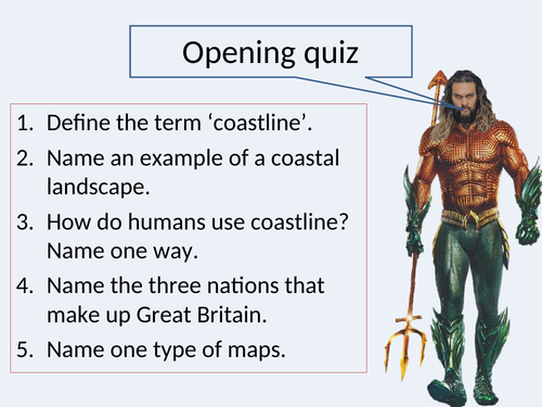
knowledge rich quiz for a starter
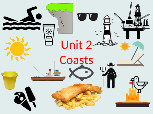
definition of coasts
types of coastal landscapes
examples of coastal cities and how coastline is used there
assessment type question
knowledge quiz at the end
Enjoy teaching
AQA GCSE Geography. All resources in the PPT + one worksheet attached.
This lesson covers the following aspects:
social, economic and environmental challenges and opportunities
GCSE type question ‘explain’ + sample answer
Enjoy teaching
GCSE lesson, AQA specification, case study of Rio. All resources are in the PPT.
This lesson covers the following aspects:
location
regional, national and international
Enjoy teaching
KS3 lesson. All resources are in the PPT.
The lesson covers the following aspects:
Reasons why areas like the Lake District should be managed
Strategies used to manage the challenges in the Lake District
Evaluation of management strategies
Enjoy teaching
KS3 lesson. All resources are in the PPT.
The lesson covers the following aspects:
Key terminology
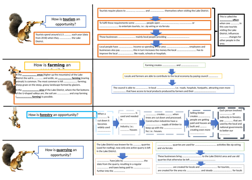
Economic opportunities
challenges
assessment type question ‘to what extent’
Enjoy teaching
Lesson designed for KS3. All resources are in the PPT.
The lesson cover the following aspects:
importance of glaciers
results of melting of glaciers
assessment type question ‘explain’
Enjoy teaching.
Lesson designed for KS3. All resources are in the PPT.
The lesson cover the following aspects:
types of moraines
drumlins
kames
eskers
erratics
assessment type question ‘label’
Enjoy teaching.
Lesson designed for KS3. All resources are in the PPT.
The lesson cover the following aspects:
Characteristics of an arete and a pyramidal peak
Identifying aretes and pyramidal peaks and their characteristics on an OS map and a satellite image
formation of an arete and a pyramidal peak
assessment type question ‘label’
OS map, diagrams and photos
Enjoy teaching.
Lesson designed for KS3. All resources are in the PPT.
The lesson cover the following aspects:
Characteristics of an arete and a pyramidal peak
Identifying aretes and pyramidal peaks and their characteristics on an OS map and a satellite image
formation of an arete and a pyramidal peak
assessment type question ‘name’
OS map and satelite images
diagram drawing
Enjoy teaching.
Lesson designed for KS3. All resources are in the PPT.
The lesson cover the following aspects:
Characteristics of a corrie
Identifying corrie and its characteristics on an OS map and satellite image
formation of a corrie
assessment type question ‘explain’
OS map and satelite images
Enjoy teaching.
The lesson was designed for KS3 students. All resources are in the PPT
The lesson covers the following aspects:
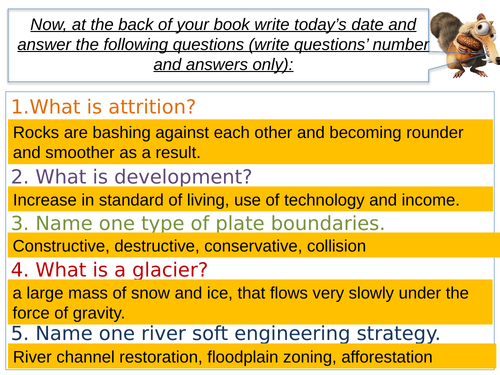
Key terminology
Freeze-thaw weathering
Erosion
Transportation
Deposition
Long profile of a glacier
work with an OS map
Enjoy the teaching.
The lesson was designed for KS3 students. All resources are in the PPT
The lesson covers the following aspects:
Key terminology: accumulation, zone of accumulation, ablation, zone of ablation, crevasses, snout
Ice shelfs and icebergs
resource based assessment type question
Enjoy the teaching.
Lesson designed for KS3, worksheets are in the PPT. The lesson starts with a knowledge rich quiz and then introduces terminology related to glaciation.
Aspects covered within the lesson:
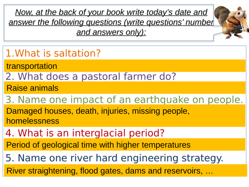
Key terminology: glacial period, glacial time, interglacial period
Temperature fluctuation in the last 400 000 years
Glacial advance and retreat
Key facts about the last ice age
Ice coverage in British Isles and Europe in the last ice age
Enjoy the teaching.
Lesson made for KS3. Covers definition of a glacier, examples of glaciers, map work to locate glaciers, assessment type question ‘describe’, assessment type question ‘explain’, factors needed for a glacier to form and sequence of a glacier’s formation.
All resources needed are in the PPT, all tasks have answers provided and the lesson starts with the knowledge rich quiz.
Enjoy teaching.
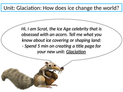
A set of 12 lessons (PPTs and worksheets within PPTs) and scheme of work on Glaciation aimed at KS3 students. All worksheets/ photos/ graph outlines are included within PPTs.
lesson 1: What are glaciers?
lesson 2: Ice age and the UK
lesson 3: How does glacier move?
lesson 4: What do glaciers do? erosion, transportation and deposition
lesson 5: Corrie: characteristics and formation
lesson 6: Arete and pyramidal peak: characteristics and formation
lesson 7: U-shaped valley: characteristics and formation; ribbon lake, hanging valley, truncated spur and misfit river are also mentioned
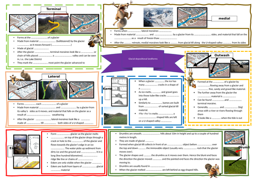
lesson 8: Depositional landforms: terminal, medial and lateral moraines, kames, eskers, drumlins and erratics
lesson 9: importance and results: why glaciers are important and what the potential results may be/are as they retreat
lesson 10: Lake District: economic opportunities and social, economic and environmental challenges
lesson 11: Lake District management: how the Lake District is managed to keep up with the ever growing tourists number
lesson 12: Svalbard: opportunities and challenges
Feel free to message me if you have any questions about these resources.
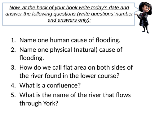
Lesson 11 focuses on the Five Year Flood plan for York following the 2015 flood.
Key ideas:
Geographical skills: selecting information, decision making
Exam skills: assessment type question ‘justify’, time management, knowledge recall, information selection from unknown source, reading comprehension, decision making
Knowledge: key terms definitions, the five-year flood plan for York
Lesson 10 focuses on hard and soft management strategies for rivers.
Key ideas:
Geographical skills: selecting information
Exam skills: assessment type question ‘assess’, time management, knowledge recall, information selection from unknown source, reading comprehension
Knowledge: key terms definitions, different hard and soft river management strategies
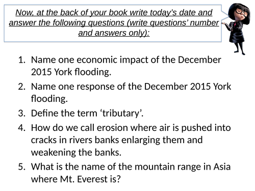
Lesson 9 concentrates on impacts and responses of 2015 flood in York.
Key ideas:
Geographical skills: selecting information, differentiating information into impacts and responses
Exam skills: assessment type question ‘justify’, time management, knowledge recall, information selection from unknown source, reading comprehension
Knowledge: key terms definitions, facts and figures about the December 2015 flood in York