The lesson is split into two: first lesson, students create an academic poster, second lesson, students answer 12 mark question from past papers (I am completing live marking as they are answering it). Student friendly mark scheme and information sheet for the academic poster are included.
The lesson is based on a research that students complete and then there is a discussion planned where students use the information they found (feedback); the lesson finishes with a 4 mark question. All resources included.
The lesson is based on Nancy’s story that shows time-space compression, ends up with a 4 mark past paper exam question. All resources are included within the PPT.
A set of lessons focusing on Russia, China and the USA.
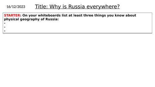
L1: Russia: location and physical features
L2: Russia: energy resources
L3: China: location and physical features
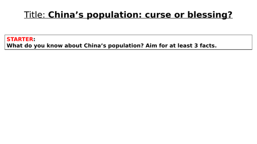
L4: China: population: research
L5: China: Tibet
L6: China: the South China Sea
L7: China: Opium wars with the British Empire
L8: the USA: location and physical geography
L9: the USA: Cuba
L10: the USA: the Mississippi
L11: the USA: Alaska
Those lessons were designed for Y9 as part of the Superpower unit. My students greatly enjoyed them and I teach a mixture of abilities.
All resources needed are included in the PPTs, the atlas my department is using is Collins Student atlas but you can use any other one that your school uses. Some lessons last longer than one lesson. In my school a lesson lasts for 60 min and I had to use two to go through some of the lessons.
Enjoy teaching
This is a set of four lessons with resources about the USA:
L8: location and physical features
L9: Cuba and the USA
L10: the Mississippi Rivers social and economic importance
L11: Alaska
The atlas that is mentioned in those lessons is the Collins Student Atlas but any other atlas can also be used.
Enjoy teaching
This lesson is a part of a Superpower unit made for Y9.
The lesson explains how and why Alaska ended up in the USA’s hands and why it wasn’t considered a great buy by Americans for a several decades.
All resources included in the PPT.
Enjoy teaching
This lesson is a part of the Superpower Unit made for my Y9.
The lesson covers the social and economic importance of the Mississippi River.
All resources are included in the PPT.
Enjoy teaching
This is lesson 9 in the Superpower unit I made for my Y9.
The lesson has a go at explaining why the USA has to keep an eye on Cuba and how easily Cuba could negatively impact US’s trade if powerful enough.
All resources are included. The atlas mentioned in one of the tasks is the Collins Students Atlas but can be easily exchanged with an atlas that your school has.
Enjoy teaching
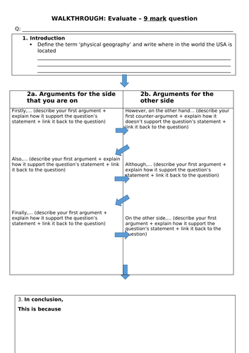
This lesson is part of the Superpower Unit made for Y9. It is L8 in the series of 18 lessons.
The lesson covers the USA’s location in the world, physical geography, great lakes and ends up with a 9 mark ‘evealuate’ question.
All resources are included, the atlas that the lesson refers to is Collins Students Atlas but any atlas with a political map of the world and physical map of the USA will do.
Enjoy teaching
Those lessons are part of the Superpower Unit made for Y9:
L1: Russia: location and physical features
L2: Russia: energy resources
L3: China: location and physical features
L4: China: population: research lesson
L5: China: Tibet
L6: China: the South China Sea
L7: China and the British Empire
Those lessons have a variety of tasks: map work, research, video, reading comprehension, explain, evaluate, describe questions.
My students loved them.
Enjoy teaching
A set of 5 lessons about China.
L3: Location and physical features
L4: Population: research lesson
L5: China’s relationship with Tibet
L6: The South China Sea
L7: Opium Wars: China and the British Empire
All resources are in PPTs, the atlas that is referred to in the Collins Student Atlas. Evaluate, explain and describe answered are practiced in those lessons.
My students enjoyed it, hope yours will too.
Enjoy teaching
The lesson covers the tense and unfriendly relationship between China and the British Empire that resulted in the two Opium Wars.
The lesson also explains how to answer an ‘explain’ question.
The lesson is a part of a Superpower unit designed for Y9 students.
All resources are in the PPT.
Enjoy teaching
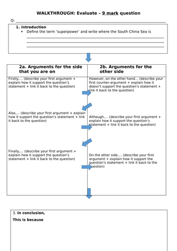
The lesson is part of a Superpower unit made for Y9 students.
This lesson covers the importance of the South China Sea to China’s economy and teaches the kids how to answer and ‘evaluate’ 9 mark question.
The atlas that one task refers to is the Collins Student Atlas but any other with a map of the South China Sea will do.
All resources are included in the PPT and one is attached as a Word document.
Enjoy teaching
The lesson was made for Y9. It is part of a Superpower unit.
The lesson covers the history of Tibet and explanation of its relation with China.
All resources are in the PPT.
Enjoy teaching
The lesson is based on research that students are completing. Based on the information they collected the final ‘evaluate’ question should be answered.
My Y9 students loved the lesson.
All resources are included in the PPT
The lesson is part of a Superpower unit that includes lessons about Russia, China, the USA, and the Middle East.
Enjoy teaching