Geography Case Study
NEOM is a planned urban development in north-west Saudi Arabia
When completed it will cover 26,500 km² which is larger than the whole of Wales
Why does Saudi Arabia want to build Neom?
Why is the Huwaitat tribe extremely worried?
Abdul Rahim al-Hwaiti: terrorist or martyr?
This resource includes a variety of lesson activities to pick and choose:
Photographic Analysis: The Line (includes worksheet)
Which Geography keyword is the odd one out?
Which country is the odd one out?
Several slides to project and set the scene (locational knowledge, artists’ impressions of the planned districts)
Links to videos of the Neom development: ‘Saudi Arabia’s mega project’; ‘“The Line” under construction in Saudi Arabia’; ‘Neom: The dark side’
Question Grid: Neom (Who? What? Where? etc, vs is… did… can… etc)
The death of Abdul Rahim al-Hwaiti, a Huwaitat tribesman from the area where the Saudi government wants to build Neom. Abdul posted a video on YouTube saying he did not want money to leave his home. A day later and he was shot dead by the Saudi Army
Concept Map: Neom (35 facts, to be colour coded - Locations; Causes; Effects; Management; Supporting Data
Illustrated glossary: Neom (Peak Oil; Economic diversification; Population density; Desalination plant) - definitions given, students to draw their understanding
Thought Chains: Neom - using knowledge learned so far, students complete boxes (because… and so… Therefore… For example…) to show understanding using scaffolding for higher level answers (eg ‘Saudi Arabia needs to DIVERSIFY its industries…’; ‘The region currently has a POPULATION DENSITY of just 6 people per km²’; ‘Neom is / is not ENVIRONMENTALLY sustainable
(‘Planet’)…’)
Geo-Trinity: Neom - students show similarities and differences between the Saudi government, Huwaitat tribespeople and foreign tourists
‘Six Hats’: Neom: - de Bono’s critical thinking technique
Design a sustainable hotel for Neom - choose five (from twenty-four) features of a sustainable resort, then explain the decision (eg eShuttle buses between the hotel and public transportation hubs; Install ‘smart’ showers that limit their usage to a pre-set time; Stock locally-made Fair Trade hotel souvenirs rather than branded/designer items)
Stakeholders conclusion: Neom - students compare different opinions of the development with their own
Teachers’ background information: links to websites, including the original BBC News story and the official Neom site
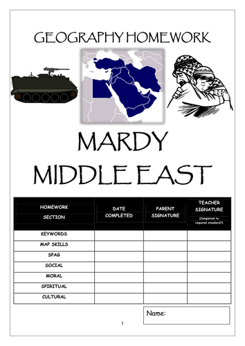
Eight page booklet : define Geographical keywords; map the main national religions of the Middle East; SPAG exercise about the earliest civilisations; complete a multiplier effect of the oil industry; moral dilemma about letting refugees come to Britain; research the family tree of religions to find their founding dates; describe the importance of four Middle Eastern locations to religious people
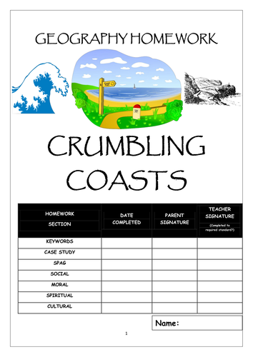
Eight page booklet : define coastal keywords; complete a fact file about a seaside resort; SPAG exercise about Holderness erosion; annotate a map to show human uses of the Humber region; family dilemma about using fossil fuels; write a poem based on a beautiful coastal scene; explain how transport changes have affected holiday habits over time
Two part fieldwork/coursework booklet
Made with the 2016 GCSE syllabus changes in mind
Follows Footsteps to Investigation (Hypothesis; Expected Outcomes; Methodology; Results; Analysis; Conclusion; Evaluation) plus the chance to write a simple risk assessment for the trip
Part One: COASTAL investigation to answer the hypothesis "Hornsea needs sea defences"
Includes destructive/constructive waves; beach cross section; annotated landscape sketch; tally chart; angle data chart
Part Two: ECONOMIC investigation to answer the hypothesis "Tourism is important for Hornsea"
Includes: Land use survey; bipolar landscape evaluation; visitor questionnaire; sphere of influence; cumulative frequency graph; bar graph; pie graph; Butler's Model
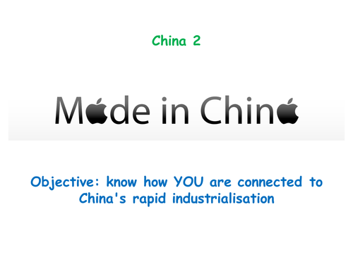
Powerpoint inspired by the RGS scheme of work "China Today". Whole lesson, includes starter (multinational companies), comparison of Shenzhen in 1970 with today, Geographical mystery about Apple's involvement ion China (WHAT were the reasons for moving iPhone production to China? HOW were the Foxconn workers treated? WHY are there nets outside Foxconn factory windows? WHO benefits from Apple products being made in China? ), differentiated questions (Explain why Apple was so interested in making its products in China; Compare the opinions of a Foxconn worker in China with an Apple customer in the UK. Then give your opinion of Foxconn/Apple; Describe the living and working conditions inside a Chinese factory like Foxconn) and plenary (the suicide of Ma Xiang Qian )
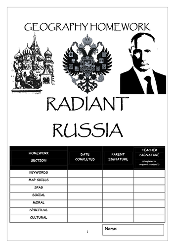
Eight page booklet : define keywords, Latitude/Longitude map skills, a SPAG exercise about Russia, space for pupils to analyse Russia's citizenship policy, a moral dilemma based on renewing the UK's nuclear weapons, a page to write about the pupil's photo of Russia and finally a chance to research and design a Russian doll
Eight page booklet : define keywords, create a factfile about an African country, a SPAG exercise about the continent, a short piece of research about the UN's work in Africa, an opinion piece about whether or not the UK still owes a moral debt to Africa for colonialism, a page to decorate an outline map of Africa with traditional patterns and finally a page to show how modern music is related to African rhythms
Powerpoint and worksheets explaining the Enhanced Greenhouse Effect
Starter is an odd-one-out quiz of various human activities which affect climate
Students draw a pie chart showing sources of greenhouse gases from human activities then memorise and sketch the Enhanced Greenhouse Effect
The main work involves constructing a mind map of the effects caused by major greenhouse pollutants (carbon dioxide, water vapour, nitrous oxide, methane and halocarbons)
Differentiated questions:
1-3: How does (a) industry and (b) farming make climate change worse?
4-6: How do humans add to the Greenhouse Effect and climate change?
7-9: Using named chemical compounds, explain how human actions increase the rate of climate change
Plenary: affects of contrails on the short-term weather
Enough for two lessons
Powerpoint looking at the effect of glaciers on the UK's landscapes
Starter: Ben Nevis as a modern day example of a cold British landscape. Differentiated questions about the formation of u-shaped valleys
Main activities: step-by-step annotated sketch of Malham's limestone landscape. Powerpoint slides explain how the pavement, dry valleys and the Cove were formed
Plenary: looks at how the limestone of Malham became temporarily impervious due to rainwater saturation (and the subsequent short-lived waterfall)
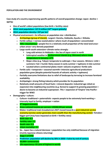
Case study of a country experiencing specific patterns of overall population change: Japan- decline + ageing
Case study of a specified local area: place, health and well-being- Hook, Hart, Hampshire
Colour coded: green statistics; yellow definitions; blue dates
Eight page booklet : define rivers keywords, comparison of the Rivers Severn and Nile; a SPAG exercise about the Humber Estuary; a page to annotate a map of the Colorado to show the importance of the river basin; a moral dilemma based on the water conflict between the USA and Mexico; a look at the holiness of the Ganges; and finally research to find the etymology of British river names
Eight page booklet : define glacier keywords; map skills page to locate and name glacial areas around the World; SPAG exercise about the glaciers on Mars; page to compare advantages and disadvantages of tourism in the glacial landscape of the Lake District; moral dilemma about whether people in the UK should be concerned with the melting of Himalayan glaciers; research page about glaciers in World cultures; and finally a page about Ötzi the Iceman and how his body was analysed by archaeologists
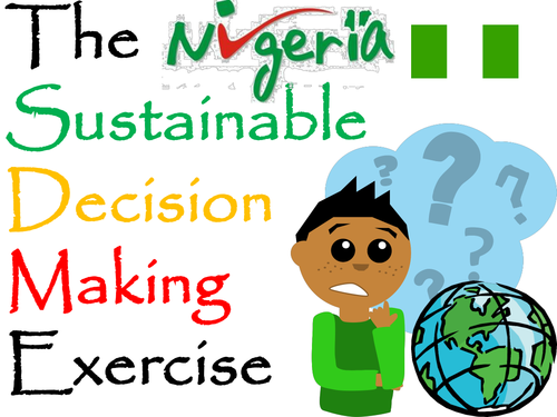
A decision making exercise (set up as a lesson) based around transnational corporations and developing countries.
How can Nigeria meet the United Nations set a Millennium Development Goal of ‘Halve the proportion of people without sustainable access to safe drinking water’?
The Nigerian Government has four options…
-Encourage the use of bottled water in partnership with a transnational company like Nestlé
-Educate Nigerian school pupils to understand the importance of water hygiene
-Form a partnership with a non-government organisation such as Water Aid
-Invest government resources into clean water supplies and sewage treatment works
Includes resources and questions
First Powerpoint in a series looking at the River Tay (Britain's largest river by discharge)
Starter: A comparison of the Tay with the Severn and the Thames and using maps to locate the Tay
Main activities: sketch of a typical river basin, then annotate to show main features (eg tributary, confluence, source, mouth)
Graphing activity to construct the long profile of the Tay (including locating the three stages of the river)
Worksheet and mystery clues comparing the Upper and Lower Stages of the Tay with Bradshaw's River Model
Differentiated questions comparing the Upper and Lower Stages of the Tay Valley
Plenary: video link recapping the long profile of a river