I'm a teacher and the Author of the Amazon e-book;' Time Smart Teaching' and my mission is to create Geography resources to help teachers save time and reduce their workload. I am sharing additional time saving tips for teachers on my YOUTUBE channel ' Time Smart Teaching' if you fancy dropping by!
I'm a teacher and the Author of the Amazon e-book;' Time Smart Teaching' and my mission is to create Geography resources to help teachers save time and reduce their workload. I am sharing additional time saving tips for teachers on my YOUTUBE channel ' Time Smart Teaching' if you fancy dropping by!
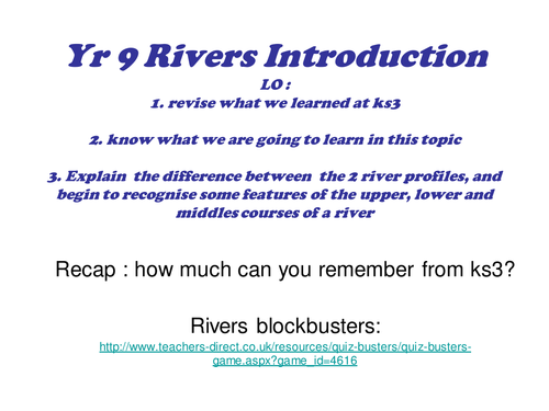
This is a full lesson introducing the water on the land topic. It covers a recap game from KS3, an overview of the course content from exam specification and some activities relating to the long and cross profile of a river. Can be used for other exam boards.
Review slides recapping on how the following features are made:ask asks students to work in groups to produce a poster presentation to deliver to the class on one of the features
A great fun kinesthetic task. Students cut out and make a learning wheel to help them remember some of the European flags. There is a mini memory test to go with it.
This 3 lesson bundle covers the reasons why earthquakes occur at plate boundaries, with map skills developed. Then 2 lessons comparing the primary and secondary effects earthquakes at 2 contrasting levels of development: Chile in South America and Sumatra Indonesia. These case studies complement the ones in the popular Oxford GCSE course textbooks.
Manchester is a rapidly growing economic centre in the heart of Northern England. It is therefore an appropriate case study example to study for the GCSE Geography ‘Urban Issues & Challenges’ topic for the AQA spec. This internet research and study lesson focuses on 6 key characteristics of Manchester ( tourism, education, culture, Industry, Transport & religion), and how they come together to build the city as an important both nationally and globally. There are website links for each of these factors, so this lesson is suitable for home-study if needed. There is a grid for students to make notes on all 6 key areas. This lesson was originally designed so that small groups could each take a factor, and go away and build a presentation to bring back to the rest of the group. In that way, they become experts on one specific facet of the city. This framework could easily be adapted for a different HIC case study, if desired.
This odd-one out grid tests the understanding of student’s vocabulary/ keywords for the paper 3 fieldwork and issue evaluation section of the GCSE examination specification for AQA curriculum. There are a full set of answers to explain which one does not fit the pattern- so students can self-assess (AFL) their knowledge. It’s makes them think about the connections between different concepts and ideas, and therefore helps to develop important synoptic links.
There is also my Top-Tip’s for students on preparing them for their paper 3 exam, which may be useful. This worksheet task would make an ideal lesson starter, or revision intervention activity. Ideally, you should print out the slide, and ask students to circle and annotate the decisions with a brief explanation, so it can be stuck into their books for future reference.
This test paper is made up of previous examination questions which involve the study and analysis of a range of maps. The ability to read, interpret and draw conclusions from maps is an important skill for success in any GCSE geography specification. There is a complete examiners mark scheme for the test paper, which pupils, parents or tutors can use to assess work ( AFL). The topics covered are linked to tourism, global distribution of biomes & migration. This worksheet is suitable for home study and remote learning.
Written for year 7, this lesson has a literacy focus and introduces students to some of the physical geography and landscape characteristics of the Tundra Biome and it’s cold environment. Students analyse the descriptive vocabulary and adjectives used to describe Svalbard, then build a bank of keywords as a class to use independently in their travel writing. The aim of the lesson is to complete an extended piece of writing to take the reader on an imaginary journey through the tundra around the archipelago of Svalbard ( travel journalism skills). There is a writing frame worksheet to support students write about the physical and human geography using the 5 senses. This differentiated lesson could easily be adapted for year 8 or 9 and gets student familiar with cold environments at GCSE geography.
Whilst students and parents are at home during the Spring and Easter time they can work through this bee project booklet offline, simply print it out and complete. It has been designed for distance/ remote learning.
Understanding the concept of an ecosystem being made up of both living and living things is important at Ks2 to prepare students for science and Geography at KS3 and high school. This geography based project is suitable for ages 7-10.
The global and national population of bees is falling, and this is unsustainable as they play an important part on pollination and growing crops that sustain humans. There is a movement now to protect and care for bees as an important part of nature and ecology.
By the end of the project , students will know;
the living and non-living parts in a garden ecosystem
The jobs that honey bees do
How to classify 3 types of bees based on their appearance
define some keywords linked to bees
The types of plants that attract bees
How to encourage bees into your garden
How to build a wild-bee house
Label the different parts/ anatomy of a bee
There is a printable completion certificate and bee-themes greeting card also.
This comprehensive lesson explores the concept of Urban farming, and how it improves food security in the developing city of Jakarta. Urban farming is the use of limited or marginalised city spaces ( for example roof tops) to grow a range of crops for sale in local markets or for self . This can be done by collective group efforts or individually.
Through a series of video tasks, photo analysis and problem solving, students will learn the needed facts and statistics needed for their GCSE Geography paper 2 ’ Human Exam’. This lesson fits in with the wider curriculum of the topic of the AQA spec ’ challenge of resource management '.
The main task involved writing a letter with stem prompts in the margin, to practice extended writing and literacy skills.
Food insecurity is where there is not enough physical, or financial access to a range of safe, nutritious food to keep a person healthy. The rise of global production chains and international food trading and export, has created food stress in various regions of the world, This has been made worse by climate change.
This GCSE lesson links to the topic ’ Challenge of Resource Management’ under the AQA spec A curriculum for GCSE Geography.
Each group will be given a different impact of food insecurity ( rising prices, social unrest, malnutrition, environmental degredation). They must explain the impact and come up with at least 3 ideas/ ways in which the problem can be alleviated. Think policy/ technology/ education. They are given 3 internet links to use may use in addition to textbooks to help.
When the group presents their ideas/ solutions back to the group, each student must chose and write the best one and write this on their worksheet grid. This lesson is about students leading learning and teaching each other.
Irrigation is the human process of artificially watering crops on a large scale using networks or canals ans sprinkler systems. Although irrigation can improve water availability and yield of crops in arid areas, it can also lead to contamination of local drinking water supplies which in turn creates substantial health problems.
This lesson is appropriate for self-study/ remote learning from home and is designed for the AQA GCSE Geography specification A curriculum. It has tasks with lots of prompts, a card sort with answers and a 9 mark exam practice question with a detailed PEEL structure to follow;
“(9marks) For a large scale agricultural scheme you have studied, explain how successful you think it has been in improving food supplies.”
The lesson looks at the positive and negative impact of the Rajasthan Canal in India on agriculture and the local population. Students have to evaluate whether overall they think that the canal is good or bad for the region.
An environmental quality survey ( or EQS) is a popular method of fieldwork. It involved measuring different aspects of the urban area by analysing a series of photographs from in and around Manchester ( although you could easily subsidize your own photo’s from your own local town or city). This GCSE focussed lesson takes students on a virtual journey from Manchester’s CBD to the urban rural fringe, showing them buildings and homes from along a transect. The students have to analyse the photographs carefully in order to make decisions on the appearence, safety and amount of green open space etc and fill in the pre-designed bi-polar grid accordingly. They can them choose to display their results on a radial graph ( template provided) or make a bar chart. The lesson ends with an exam questions, and gets them to evaluate the methods used to gather their primary data.
This lesson would be good at KS3 to prepare them for fieldwork requirements of GCSE, or as a preparation lesson prior to EQS fieldwork at GCSE.
The characteristics of sustainable cities must encompass social/ environmental / economic advantages to be holistic. This lesson introduces the concept of a sustainable city, by looking at the Bedzed zero carbon residential development in London. The lesson is aimed at the middle ability. mains tasks involve a gap fill to complete statements on what sustainable cities should look like, and be doing. Following this there is a video to make notes on Bedzed, which they then annotate around an image of the development. Finally there is a 9 mark GCSE past exam question with a mark scheme for peer assessment. This lesson fits in with the Urban Issues and Challenges topic, where students must know an example of a sustainable city.
This GCSE Geography lessons looks in-depth at the land use patterns around the edge of Manchester’s city, or the urban-rural fringe. This area is where the city meets the countryside and is desirable for a range of development opportunities including golf courses, airports and out of town shopping centres.
This lesson looks at an OS map of Manchester for the starter task, although using BING maps online will substitute if you do not have hard copies. The lesson develops map skills and annotation skills. There is a brownfield site card sort activity also to help students understand the advantages and disadvantages of building on brown field sites.
This lesson was written to compliment the AQA spec A GCSE curriculum, and briefly touches on the Burgess model, and how Manchester fits into this framework. It is part of other Manchester-based case study resources, also available from my shop. To go with the Urban Issues and Challenges topic SOW.
This worksheet allows students to test their knowlege and understanding on their chosen developing city case study and the causes, effects and responses to ward environmental pollution and over-crowing in slums. The sheet comprises of a range of short and longer GCSE exam type questions. The 6 and 8 mark questions have a hint-link underneath so that if the student struggles, they can click on it and be taken to the right part of the GCSE geography BBC bitesize revision page to answer it. Once complete there is an accompanying mark scheme at the back, so the student can self-assess their progress.
Quiz -Quiz trade is a card trading learning game, encouraging students to ask each other questions in order to learn from one another. A type of peer lead learning. It involves student getting out of their seats and checking other student’s understanding on the topic ’ Living World’ and ecosystems knowledge for AQA exam specification. Tropical Rainforests are a core topic , which means that this content is likely to be more broadly tested in their GCSE Geography examination series. There are 15 separate quiz cards linked to rainforest climate, soils, challenges and characteristics. These quiz cards provide fairly in depth information and responses, and are suited to the middle and higher ability levels generally.
Threats to the tropical rainforest stem from population pressure and climate change. This fragile biome is used for subsidence farming mineral extraction and hydro-electric power. This code breaking resource can be used to introduce threats for the first time, or as a revision activity. This worksheet is designed for Edexcel B specification, however it is suitable for AQA also/ The completion requires access to the textbook 'Edexcel geography B - pages 270-271 in the Pearson Textbook by John Hopkin et al ISBN: 9781446927762. ( page copy available with this resource) The resource is a reading comprehension exercise where they find relevant information from the 2 page of text and images.
This game has been adapted to encourage students to use the proper GCSE Geography language of ’ DESCRIBE’ in order to cross off landforms on the sheet such as wave cut platforms, beaches bars, tombolo’s arches and stumps. Instead of pupils asking the questions on the features of people, they ask each other questions on the features of the landforms; is it made by erosion? Is it tall or flat? Is it exposed at low tide? etc. This will encourage students to become lead learners and have dialogue about their knowlege. perfect for an easy, no plan revision or intervention schedule. The best way to play the game is to insert each coloured sheet into a clear plastic wallet and hand each student one of these and a wipeable marker pen. That way you don’t end up continually photocopying and wasting resources.
Extreme weather can be defined as atmospheric conditions that lie outside what is normal or expected based on location and previous climatic averages. Some experts argue that climate change is leading to more extreme weather events becoming more common in the UK and globally. This lesson examines the role of the turbulent jet stream as a key influencer on UK climates, and how if it gets ’ stuck’ our weather patterns also become static leading to heatwaves, droughts and flooding. This lesson includes article analysis from the Guardian, the use of the blue Oxford GCSE textbooks to fill in a table plus infographic analysis. Past paper worksheet included. Full lesson.