Welcome to my shop! I have lesson resources here for all age groups in secondary education. All my resources are all in one ppt lessons. That means they all have starters, different learning activities, reading resources (if required) and plenaries. Most of the lessons also have model answers for learning tasks which can aid your marking or promote self-assessment. The lessons are reviewed regularly so they are continually being improved. Just download and teach!
Welcome to my shop! I have lesson resources here for all age groups in secondary education. All my resources are all in one ppt lessons. That means they all have starters, different learning activities, reading resources (if required) and plenaries. Most of the lessons also have model answers for learning tasks which can aid your marking or promote self-assessment. The lessons are reviewed regularly so they are continually being improved. Just download and teach!
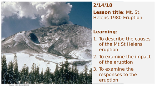
This is a case study lesson on the Mt St Helens 1980 eruption. The lesson is planned to GCSE standards but can be used for KS3 as well. Key facts about the lesson are:
The content covered by the lesson are; location of Mt St Helens volcano, identifying the plate boundary that caused the eruption, the primary and secondary impact of eruption and analysis of the economic, social and environmental impact of the eruption.
Learning resources used in the lesson are; Map task to identify the location of the Mt St Helens volcano and its boundary, case study worksheet, factsheets on different aspects of the 1980 eruption, writing task and video clips.
Differentiation used in the lesson are: challenge tasks and differentiated information sheets and group discussion.
The lesson is planned in detail and all the resources for teaching the lesson are included in the ppt; starter, learning activities with resources, clear outline of learning tasks and a plenary. Just download and teach!
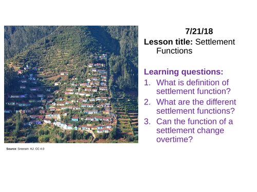
This is a KS3 lesson on settlement functions however, it can be easily adapted for a KS2 group. Key facts about the lesson are:
The content covered by the lesson are; Definition of settlement function, description of different types of settlement functions and map analysis skills.
Learning resources used in the lesson are; picture analysis, maps, short writing tasks and quiz.
The lesson is planned in detail and all of the resources for teaching the lesson are included in the ppt; starter, learning activities with resources, clear outline of learning tasks and a plenary. Now just download and teach!
This is a KS3 lesson on population structure. It can also be used with a GCSE group. Key facts about the lesson are:
The content covered by the lesson are; definition of population structure (including definitions of the terms young dependent, elderly dependent and working age group), description on how to use population pyramids, comparing population pyramids of HICs and LICs, advantages and disadvantages of an ageing population.
Learning resources used in the lesson are; Keyword matching task, graph analysis, peer discussion and writing task.
The lesson is planned in detail and all of the resources for teaching the lesson are included in the ppt; starter, learning activities with resources, clear outline of learning tasks and a plenary. Now just download and teach!
There are 4 lessons in this bundle.
Qualities of a good map: This lesson covers what is a map, what should all good maps have, how to draw sketch maps and what are mental maps
Map symbols: This lesson covers what are map symbols, how to use symbols to learn about a place, identifying different OS map symbols.
Map sclaes: This lesson covers what are scales, how are scales used, types of map scales, scaling things up and scaling things down.
Compass coordinates: This lesson covers 4, 8 and 16 point compass, how to use compass and what are hemispheres.
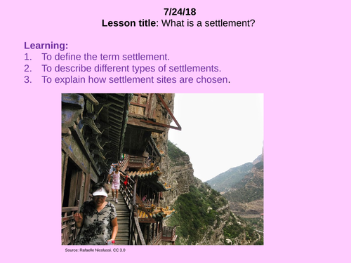
This is a KS3 / KS2 introduction lesson on settlements. It is an excellent lesson for teaching students about their local area. Key facts about the lesson are:
The content covered by the lesson are; Definition of the term settlement, discussion of different types of settlements (including the international space station and refugee camps), definition of site, factors that influence the site of a settlement (basic introduction of sustainability here) and description of the site of their local settlement.
Learning resources used in the lesson are; Unscramble the keyword task, picture study, sketch map analysis task, a short writing task and a fill in the blank task.
The lesson is planned in detail and all of the resources for teaching the lesson are included in the ppt; starter, learning activities with resources, clear outline of learning tasks and a plenary. Now just download and teach!
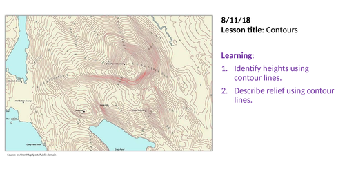
This is a KS3 / KS2 lesson on reading contours. It is a very good practical lesson that will get students really involved in map work. Key facts about the lesson are:
The content covered by the lesson are; Definition of the term contours, how to use contour lines, practice giving height using contours, how do contours show steep and gentle slopes, creating your own map with contour lines.
Learning resources used in the lesson are; quiz, contour map work using grid references, matching contour lines with shape of land task, drawing contour lines on a map.
Other facts; The answers for the practice activities are included on the ppt which makes it even easier for non specialists to deliver.
What do you get in the package? The lesson is planned in detail all of the resources for teaching the lesson are included in the ppt; starter, learning activities with resources, clear outline of learning tasks and a plenary. Now just download and teach!
This is a KS3 lesson on population growth with India used as a case study. It can also be used with a GCSE group. Key facts about the lesson are:
The content covered by the lesson are; definition of population growth & natural increase, location of India (site and situation), India’s population growth trend since 1950, historical reasons for population growth in India, reasons for current population growth in India.
Learning resources used in the lesson are; keyword association task, map task, graph analysis task (numeracy here), video clip, pair discussion and writing task.
Answers to most of the task are in the note section below each slide of ppt. This will make it easy for non-specialist to deliver the lesson.
The lesson is planned in detail and all of the resources for teaching the lesson are included in the ppt; starter, learning activities with resources, clear outline of learning tasks and a plenary. You will only need atlases with maps of Asia. Now just download and teach!
This is a KS3 lesson on population density. It is also a good lesson for a KS2 group. Key facts about the lesson are:
The content covered by the lesson are; definition of population density, explanation of the concepts densely and sparsely populated, UK population density, world population density and factors that influence population density.
Learning resources used in the lesson are; Starter quiz, sketching task, picture study, cartograms (UK and world) and short writing tasks.
The lesson is planned in detail and all of the resources for teaching the lesson are included in the ppt; starter, learning activities with resources, clear outline of learning tasks and a plenary. Now just download and teach!
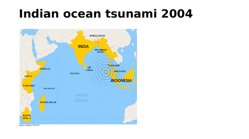
This is a two part A-level lesson on Indian Ocean tsunami in 2004. Key facts about the lesson are:
The content covered by the lesson are; Location of the tsunami area, tectonic forces that caused the tsunami, key features of the tsunami, analysis of distribution of wave arrival times & wave height & severity of damage of the tsunami, examination of the effects of the tsunami, classification of the effects in terms of severity and social, economic and environmental, evaluation of responses to the tsunami.
Learning resources used in the lesson are; Quiz, images, map task, video clip, diagram task, written task, analysis tasks and exam focus questions. Answers are included for some of the tasks for self assessment.
What do you get in the package: The lesson is planned in detail and all of the resources for teaching the lesson are included in the ppt; starter, learning activities with resources, clear outline of learning tasks and a plenary. However, students should always be encouraged to use their text book to broaden their understanding. Now just download and teach!
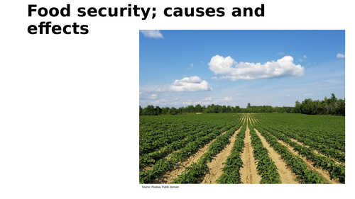
This is a GCSE lesson on food security and the factors that influence food consumption and supply. It meets the AQA specification however, it can be adapted easily for other exam boards. Key facts about the lesson are:
The content covered by the lesson are; Trends in food and meat consumption, Reasons for increase food consumption, Food security definition, Distribution of food security and average calorie intake, Evaluation of factors that influence food supply, Effects of food insecurity.
Learning resources used in the lesson are; Starter quiz with answers, Data analysis and graph tasks, Several distribution map tasks, Writing tasks with sentence starters and model answers, Matching tasks with answers, Several past paper questions.
What do you get in the package: The lesson is planned in detail and all of the resources for teaching the lesson are included in the ppt; starter, learning activities with resources, clear outline of learning tasks and a plenary. However, students should be encouraged to use their text book to broaden their understanding. Now just download and teach!
This is an GCSE lesson on the key characteristics of tropical rainforests including their location and climate. It is suitable for all specification but specifically designed for the Edexcel B specs, Paper 3; Forests under Threat. Key facts about the lesson are:
The content covered by the lesson are; Distribution of tropical rainforests. Climate of tropical rainforest. Relationship between temperature and rainfall in tropical rainforest regions. Key characteristics of tropical rainforests.
Learning resources used in the lesson are; Starter quiz with answers. Rainforest distribution map analysis with answers. Analysis of a climate chart of a tropical rainforest region. Video clip analysis. Written tasks. Exam focus question.
What do you get in the package: The lesson is planned in detail and all of the resources for teaching the lesson are included in the ppt; starter, learning activities with all resources, clear outline of learning tasks and a plenary. Students however, should be encourage to use their standard GCSE text book as background reading. Now just download and teach!
This is a 2 part A-level lesson on the theories on the rise of superpowers. This lesson meets the requirements of the new A-level specifications. Key facts about the lesson are:
The content covered by the lesson are:
The heartland theory
World systems theory
Dependency theory
Modernisation theory using Rostow model
Criticisms of each theory
Learning resources used in the lesson are;
Video clips
Web links to reading material
Past paper question and structure for response
Images and maps
Lesson plan
The lesson is planned in detail and all the resources for teaching the lesson are included in the ppt; starter, learning activities with resources, clear outline of learning tasks and a plenary. Just download and teach!
There are different types of resources to cater for different learning styles.
This is a GCSE lesson on strategies used manage tropical rainforests. It meet the needs of the AQA exam board but can be adapted to other exam boards as well. Key facts about the lesson are:
The content covered by the lesson are; the concept of sustainable management of rainforests, some strategies used to management rainforests namely selecting logging, debt for nature swop deals, replanting, conservation, public education, international hardwood agreements (FSC) and ecotourism.
Learning resources used in the lesson are; a quiz, a video clip, management strategies hand out and analysis activity, peer learning.
The lesson is planned in detail and all of the resources for teaching the lesson are included in the ppt; starter, learning activities with resources, clear outline of learning tasks and a plenary. If you have a textbook on deforestation in the Amazon rainforest then this can be used instead of the case study resources included on the ppt. Now just download and teach!
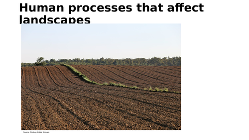
This is an GCSE level lesson on the human processes that affect upland and lowland landscapes in the UK. It is suitable for all specification but was prepared with the Edexcel B specs in mind. Key facts about the lesson are:
The content covered by the lesson are; Description of human activities on landscapes such as agriculture, forestry and settlements. The impact of each human activity on the natural landscape. Assessing the advantages and disadvantages of each human activity on the landscape.
Learning resources used in the lesson are; Quiz, images, written task, analysis tasks, and an exam focus question. Answers are included for the quiz for the purpose of self assessment.
What do you get in the package: The lesson is planned in detail and most of the resources for teaching the lesson are included in the ppt; starter, learning activities with resources, clear outline of learning tasks and a plenary. However, students will need to use their text book for one of the activities. This won’t be a problem though as the information is covered can be found in all GCSE textbooks for the new specification. Now just download and teach!
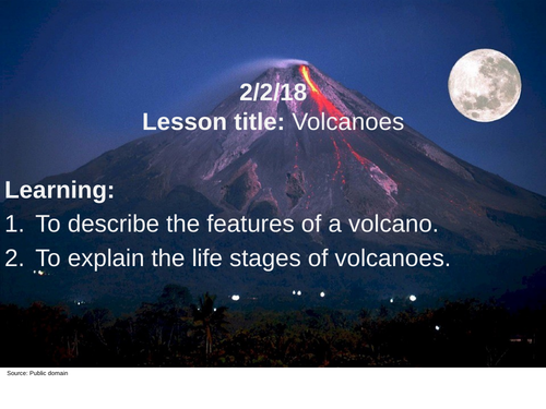
This is a KS3 lesson on volcanoes. Key facts about the lesson are:
1. The content covered by the lesson are; definition of a volcano, features of a volcano and life stages of a volcano.
2. Learning resources used in the lesson are; diagrams, video clip, sketching task, quiz and challenge tasks.
3. Differentiation used in the lesson are: challenge tasks, diagrams (for those who find drawing these difficult), model answers, differentiated resources.
4. The lesson is planned in detail and all the resources for teaching the lesson are included in the ppt; starter, learning activities with resources, clear outline of learning tasks and a plenary. Just download and teach!
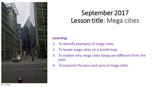
This is a GCSE lesson on mega cities which is an integral part of the urbanisation unit on the new specifications. The lesson allows students to examine the definition, location and impact of mega cities. Key facts about the lesson are:
1. The lesson starts by exploring the features of a mega city with a carefully planned starter. It then moves on two map tasks which are relevant to the learning. Students will be engage with both activities. A video clip is then used as a stimulus for students to examine the pros and cons of mega cities before moving on to the plenary.
2. The starter, mini-plenary and main plenary were carefully planned to reinforce the key objectives of the lesson.
3. The lesson is a practical one where students will be sharpening their map and thinking skills.
4. The lesson meets the requirements of the new GCSE specifications. However, it can be adapted for a top set year 9 group.
2. The lesson is planned in detail and all the resources for teaching the lesson are included in the ppt; starter, learning activities with resources, clear outline of learning tasks and a plenary. Just download and teach!
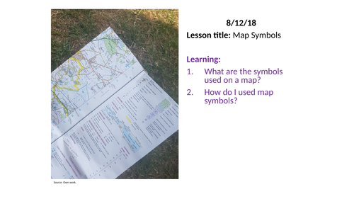
This is a KS3 / KS2 lesson on OS map symbols. It is an excellent lesson to peak students’ interest in maps and to pass on valuable map skills. Key facts about the lesson are:
The content covered by the lesson are; Definition of the term map symbol, identification of symbols for human and physical geographic features on a map, using symbols to collect facts about an an area on a map.
Learning resources used in the lesson are; map quiz, sketching task, map symbol story task and a short writing task.
The lesson is planned in detail and most of the resources for teaching the lesson are included in the ppt; starter, learning activities with resources, clear outline of learning tasks and a plenary. You will need copies of the OS map symbol key which can be found in textbooks or on OS maps. Now just download and teach!
Ten lessons on plate tectonics; processes, hazards and the management of these hazards. The bundle covers everything in this unit of study. All the resources you need to deliver this unit are included. The bundle include case studies on earthquakes and volcanoes as well. The lessons in the bundle are all differentiated and include challenge task. As a matter of fact these lessons can be used with GCSE groups with minor tweaking.
This bundle has three lessons. The first lesson is on the earth's formation and structure. The second lesson is on the plate tectonics theory and evidence of tectonic movement. The final lesson is on plate boundaries and what happens at each boundary. The lessons are all planned in detail with everything you need to deliver them. This bundle as designed for KS3 but the lessons can be adapted easily for GCSE.
This is KS3 lesson designed to expose students to the use of maps in understanding our place in the world. It’s essentially a map skill lesson where students move from local to global using different maps. Key facts about the lesson are:
1. All the resources for teaching the lesson are included. The ppts have everything from starter to plenary including all the geography resources for delivery. Download and just teach!
2. The lesson is differentiated with support for learners of varying abilities.
3. The lesson is a practical lesson so students will be engage in active learning throughout.