I've worked in primary teaching for over 10 years and specialise in creating fun and engaging educational resources, particularly for Geography and History.
I've worked in primary teaching for over 10 years and specialise in creating fun and engaging educational resources, particularly for Geography and History.
This lesson is part of Exploring the United Kingdom, a Geography unit designed for KS1 and lower KS2 (Y2-4).
First the presentation introduces children to the flags of the United Kingdom and their names.
Students then complete one of two differentiated activity worksheets:
Easier – Students complete cloze procedure sentences about UK flags (with clues)
Harder – Students complete cloze procedure sentences about UK flags (no clues)
Extension – Students colour in the three UK national flags which together make up the Union Jack.
If you like this resource, we would appreciate a review! We will happily send you a free resource in return for a review or useful suggestions/feedback. Contact us at ed@teachitforward.co.uk.
This resource is part of Tropical Rainforests, a Geography unit designed for students in KS2, but can also be taught as a stand alone lesson. All resources are compatible with both Microsoft Office and Google Workspace.
The presentation starts by recapping the issue of deforestation and its detrimental impact on rainforests around the world. It then challenges students to think of practical ways we can all help protect tropical rainforests (e.g. buying sustainable products, using less paper).
Next, it introduces some of the charities working to save the world’s tropical rainforests including the Rainforest Trust and WWF. If your students wish to organise a fundraising event, there are lots of ideas and inspiration.
For their activity, students create a ‘Save the Rainforests’ poster to advertise your fundraising event and/or raise awareness of ways we can all help protect tropical rainforests.
If you like this resource, we would appreciate a review! We will happily send you a free resource in return for a review or useful suggestions/feedback. Contact us at ed@teachitforward.co.uk.
Great Missenden – A Village Settlement is a Geography unit suitable for upper KS2 (Y4-6).
Located in the Chilterns in Buckinghamshire, the village of Great Missenden was once home to famous children’s author Roald Dahl. It is a great case study for helping students understand the similarities and differences between urban and rural settlements.
The planning overview and topic title page can be downloaded for free here. Lessons include:
L1 – Locating Great Missenden in the UK
L2 – Investigating satellite photos of Great Missenden
L3 – Locating features of Great Missenden using grid references
L4 – Identifying the features of settlements
L5 – Surveying Great Missenden High Street using Google Street View
L6 – Interpreting a high street survey of Great Missenden
Each lesson includes a presentation and differentiated activities/worksheets.
If you like this resource, we would appreciate a review! We will happily send you a free resource in return for a review or useful suggestions/feedback. Contact us at ed@teachitforward.co.uk.
This lesson is part of a wider unit called Exploring St Lucia and is designed to teach KS2 students about a contrasting non-European country.
It first introduces students to the tropical climate zone and its associated weather (i.e. high temperatures, high rainfall, dry and wet seasons) and compares this with temperate climates such as that of the UK.
Students are then encouraged to interpret data from a climate graph for St Lucia. Finally, other aspects of a tropical climate are covered including tropical storms and hurricanes.
The accompanying true or false activity helps children to recap what they have learned about the climates of St Lucia and the UK. It is differentiated two ways:
Easier – Students have 6 true or false statements.
Harder – Students have 10 true or false statements.
Extension – Students complete a cloze procedure text about St Lucia’s weather and climate.
If you like this resource, we would appreciate a review! We will happily send you a free resource in return for a review or useful suggestions/feedback. Contact us at ed@teachitforward.co.uk.
This lesson is part of Exploring Spain, a Geography unit designed for upper KS2 students (Y4-6), but can also be taught as a stand alone lesson.
The presentation first shows students how to work out a 4-figure grid reference.
The activity then challenges students to describe the position of different cities in Spain using 4-figure grid references. It is differentiated two ways:
Easier – Students locate Spanish cities using 4-figure grid references (with clues).
Harder – Students locate Spanish cities using 4-figure grid references.
Extension – Students identify Spanish cities using compass direction and grid reference clues.
If you like this resource, we would appreciate a review! We will happily send you a free resource in return for a review or useful suggestions/feedback. Contact us at ed@teachitforward.co.uk.
This lesson is part of a wider Geography unit called Great Missenden – A Village Settlement which is designed for students in upper KS2 (Y4-6).
In this lesson, students are introduced a high street survey, a great way of looking at land use in settlements. The presentation first outlines the RICEPOTS system for categorising land use and includes many photos of real world examples to aid understanding.
The activity challenges students to use Google Street View to work out the types of land use on Great Missenden High Street. It is differentiated three ways:
Easier – Students find the business name/land use of 10 places on Great Missenden High Street (with clues).
Medium – Students find the business name/land use of 14 places on Great Missenden High Street (with clues).
Harder – Students find the business name/land use of 14 places on Great Missenden High Street (no clues).
Extension – Students use Google Street View to survey a section of Great Missenden High Street by themselves.
If you like this resource, we would appreciate a review! We will happily send you a free resource in return for a review or useful suggestions/feedback. Contact us at ed@teachitforward.co.uk.
This resource is part of Tropical Rainforests, a Geography unit designed for students in KS2, but can also be taught as a stand alone lesson. All resources are compatible with both Microsoft Office and Google Workspace.
This comprehension activity is based on the BBC’s My World Amazon Special. It is a great way for students to learn more about the effect of deforestation on a native Amazon tribe, the Arara.
It also introduces students to other key groups with an interest in the Amazon including a ranching family, student protestors and a conservationist.
In the activity, students answer questions about the documentary:
Easier - Students answer comprehension questions with time hints to help them find answers in the video.
Harder - Students answer comprehension questions with no time hints.
A transcript of the documentary is also included in case computers are in short supply.
If you like this resource, we would appreciate a review! We will happily send you a free resource in return for a review or useful suggestions/feedback. Contact us at ed@teachitforward.co.uk.
This resource is part of Exploring Australia, a Geography unit designed for students in upper KS1 and lower KS2 (Y2-Y4). All resources are compatible with both Microsoft Office and Google Workspace.
This lesson is a great introduction to any Austalia topic. First the presentation looks at Australia’s location in the Southern Hemisphere before exploring the country’s vast size and the countries surrounding it.
In the activity, students are challenged to locate Australia on a world map and label other significant features:
Easier - Students label a world map (with hints).
Harder - Students label a world map (no hints)
Extension - Students use a map to identify countries surrounding Australia.
If you like this resource, we would appreciate a review! We will happily send you a free resource in return for a review or useful suggestions/feedback. Contact us at ed@teachitforward.co.uk.
This lesson is part of Tropical Rainforests, a Geography unit designed for students in KS2, but can also be taught as a stand alone lesson. All resources are compatible with both Microsoft Office and Google Workspace.
First, the presentation introduces students to some of the animals which live in tropical rainforests around the world. Many of these are endangered species so the concepts of extinction and conservation are also covered.
Group Activity:
The group activity then challenges students to match photos of rainforest animals to their names and fact files.
Finally, students learn about a conservation success story - the mountain gorillas of the Congo River Rainforest.
If you like this resource, we would appreciate a review! We will happily send you a free resource in return for a review or useful suggestions/feedback. Contact us at ed@teachitforward.co.uk.
This lesson is part of Exploring Brazil, a Geography unit designed for students in KS2 (Y4-6), but can also be taught as a stand alone lesson.
It gives students a chance to find out all about Brazil. The presentation introduces key vocabulary (e.g. population, currency) and then asks students what they know about Brazil and how they could find out more.
There are two activities:
Research Activity:
Students research Brazil using information sources (e.g. information books or suggested websites).
Easier – Students research famous landmarks, people, wildlife and Brazilian food.
Harder – Students choose their own topics to research.
Extension: – Students draw pictures for each topic or find appropriate images online.
Writing Activity:
Students write a fact file using the information they have found.
Easier – Students write about famous landmarks, people, wildlife and Brazilian food.
Harder – Students write about their own topics.
Extension – Students draw pictures or stick photos into the boxes for each topic.
If you like this resource, we would appreciate a review! We will happily send you a free resource in return for a review or useful suggestions/feedback. Contact us at ed@teachitforward.co.uk.
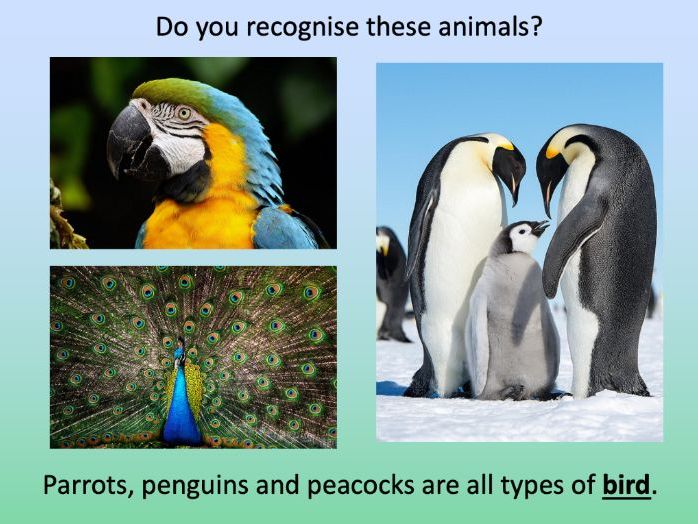
This lesson is part of a wider cross-curricula unit called London Zoo which is designed for KS1 and lower KS2 students (Y2-4).
The colourful presentation introduces students to some of the animal groups children might see at London Zoo including mammals, fish, insects, birds, reptiles and amphibians.
The activity then takes students on a tour of the zoo and challenges them to record the animals they would see at different points in their journey. It is differentiated two ways:
Easier – Students identify 20 different animals (with first-letter clues).
Harder – Students identify 20 different animals (no clues).
N.B. The activity worksheet can be photocopied to A3 size to allow for children with larger handwriting.
If you like this resource, we would appreciate a review! We will happily send you a free resource in return for a review or useful suggestions/feedback. Contact us at ed@teachitforward.co.uk.
This lesson is part of Exploring Spain, a Geography unit designed for upper KS2 students (Y4-6), but can also be taught as a stand alone lesson.
In the presentation students embark on a tour of Madrid, learning interesting facts about Spain’s capital city along the way. They visit sites including the famous Royal Palace, the Sun Gate and the Santiago Bernabeú Stadium, home of Real Madrid.
The lesson has two activities:
Quiz activity:
Students use an online encyclopedia to answer questions about Madrid.
Guided tour writing activity:
Students give their very own guided tour of Madrid.
Easier – Students write a guided tour of Madrid using a writing frame.
Harder – Students write a guided tour of Madrid by sticking images into their exercise books.
If you like this resource, we would appreciate a review! We will happily send you a free resource in return for a review or useful suggestions/feedback. Contact us at ed@teachitforward.co.uk.
This lesson is part of a wider Geography unit called Great Missenden – A Village Settlement which is designed for students in upper KS2 (Y4-6).
First the presentation reminds students how to find grid references. It then challenges them to locate various geographical features in Great Missenden using 4-figure grid references.
In the activity, children locate features of Great Missenden using grid-references. It is differentiated three ways:
Easier – Students locate features of Great Missenden using 4-figure grid references (with clues).
Medium – Students locate features of Great Missenden using 4-figure grid references (no clues).
Harder – Students locate features of Great Missenden using 6-figure grid references.
Extension – Students complete sentences using compass directions to describe the location of features of Great Missenden in relation to each other.
If you like this resource, we would appreciate a review! We will happily send you a free resource in return for a review or useful suggestions/feedback. Contact us at ed@teachitforward.co.uk.
This resource is part of Exploring Australia, a Geography unit designed for students in upper KS1 and lower KS2 (Y2-Y4). All resources are compatible with both Microsoft Office and Google Workspace.
The display pack comes in A4 and A2 sizes and contains the following:
-Exploring Australia title banner
-A map of Australia
-The Australian flag
-14 famous Australian landmarks
-10 famous Australian animals
If you like this resource, we would appreciate a review! We will happily send you a free resource in return for a review or useful suggestions/feedback. Contact us at ed@teachitforward.co.uk.
This lesson is part of a wider unit called Exploring St Lucia and is designed to teach KS2 students about a contrasting non-European country.
First the presentation introduces students to the directions of the compass. It then helps them to locate places in St Lucia using compass directions – first using the four cardinal points (N, E, S, W), then also using the four ordinal points (NE, SE, SW, NW).
The accompanying activity gives students a chance to locate places in St Lucia using the points of the compass. It is differentiated two ways.
Easier – Students locate places using the eight points of the compass (with compass direction hints).
Harder – Students locate places using the eight points of the compass (no compass direction hints).
Extension – Students complete another compass direction challenge.
If you like this resource, we would appreciate a review! We will happily send you a free resource in return for a review or useful suggestions/feedback. Contact us at ed@teachitforward.co.uk.
This lesson is part of a wider cross-curricula unit called London Zoo which is designed for KS1 and lower KS2 students (Y2-4).
The presentation first introduces students to grid references. It then challenges them to give grid references for animals on a map of London Zoo.
In the activity, students are challenged to describe the position of animals at London Zoo using grid references. It is differentiated two ways:
Easier – Students have six colour coded questions so they can locate animals easily.
Harder – Students have to find the animals themselves.
Extention – Students find the grid references of other locations at the zoo (e.g. the gift shop).
If you like this resource, we would appreciate a review! We will happily send you a free resource in return for a review or useful suggestions/feedback. Contact us at ed@teachitforward.co.uk.
This lesson is part of Exploring Spain, a Geography unit designed for upper KS2 students (Y4-6), but can also be taught as a stand alone lesson.
In the presentation students recap the 8 points of the compass and locate Spanish cities using these compass directions. They also learn how to locate cities in relation to each other (e.g. Valencia is north of Alicante).
The activity challenges students use all 8 compass directions to locate Spanish cities. It is differentiated three ways:
Easier – Students locate Spanish cities (with answer clues + cities marked on the map)
Medium – Students locate Spanish cities (with answer clues)
Harder – Students locate Spanish cities (no answer clues)
Extension – Students locate Spanish cities in relation to each other.
If you like this resource, we would appreciate a review! We will happily send you a free resource in return for a review or useful suggestions/feedback. Contact us at ed@teachitforward.co.uk.
This lesson is part of The Seaside, a Geography unit designed for students in KS1 and lower KS2, but can also be taught as a stand alone lesson.
The presentation introduces students to the seaside topic and then challenges them to identify features of the seaside (e.g. sandcastle, lifeguard) from partial picture clues.
In the activity, students identify and label seaside features:
Easier – Students label photos of seaside features (with initial letter clues).
Harder – Students label photos of seaside features (no clues)
Extension:
Easier – Students label seaside features in photos of Brighton Beach and a beach on the Isle of Harris.
Harder - Students write sentences about seaside features in photos of Brighton Beach and a beach on the Isle of Harris.
If you like this resource, we would appreciate a review! We will happily send you a free resource in return for a review or useful suggestions/feedback. Contact us at ed@teachitforward.co.uk.
This lesson is part of a wider cross-curricula unit called London Zoo which is designed for KS1 and lower KS2 students (Y2-4).
The presentation first locates London Zoo within the UK and London itself. Students then find out a variety of interesting facts about the zoo.
The activity challenges students to write a fact file about London Zoo. It is differentiated four ways:
Easier – Students write cloze procedure sentences (one word per sentence)
Medium – Students write cloze procedure sentences (students write whole sentences)
Harder – Students write their own London Zoo fact file (using a sentence starter and vocabulary prompt)
Hardest – Students write their own London Zoo fact file (using just a vocabulary prompt)
If you like this resource, we would appreciate a review! We will happily send you a free resource in return for a review or useful suggestions/feedback. Contact us at ed@teachitforward.co.uk.
This lesson is designed for KS2 children. It can be taught as a stand alone lesson but is also available as part of two wider units, both of which are available on TES:
-Earthquakes
-Volcanoes & Earthquakes
The presentation first asks students how they would go about finding information about earthquakes. It then introduces them to the online encyclopedia Wikipedia.
The activity then challenges students to research the world’s 12 biggest earthquakes:
Easier – Students use Wikipedia to find one piece of information per earthquake.
Harder – Students use Wikipedia to find two pieces of information per earthquake.
Extension – Students answer questions about the world’s famous earthquakes using Wikipedia.
If you like this resource, we would appreciate a review! We will happily send you a free resource in return for a review or useful suggestions/feedback. Contact us at ed@teachitforward.co.uk.