
66Uploads
152k+Views
57k+Downloads

River landforms - waterfall sequencing
Sequencing activity: River landforms - waterfalls
This is suited to KS3 but does work with KS4 - you'll need to add more detail (processes of erosion etc.).
There are four slides to help the teacher explain the processes involved and introduce the keywords.
The activity sheet requires students to complete three activities.
1. Cut out and arrange the tiles.
2. Add the labels from the sheet.
3. Add the descriptions from the sheet.
There is also an animated consolidation slide to allow teacher/students to check accuracy.
For higher ability - ask the students to underline the key terms, add more key terms and write their own descriptions.
Two version of the sheet are included; one in colour and one in outline black & white.
Every review we've received for a premium resource has been 5/5* (As of February 20th 2017)
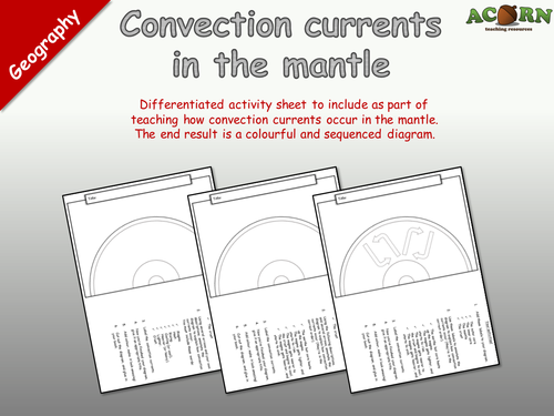
Geography - Natural hazards - Convection currents in the mantle
"Differentiated activity sheet to include as part of teaching how convection currents occur in the mantle. The end result is a colourful and sequenced diagram."
An activity requiring students to draw an annotated diagram to show how and why convection currents occur in the mantel.
The sheet has several activities built around this including; labeling the key features, adding arrows, explaining the processes, including a title and colouring it in.
There are three versions to suit higher, middle and lower ability groups / students.
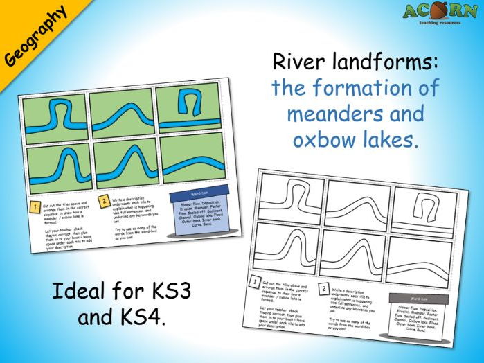
Geography - Meanders and oxbow lakes activity
Ideal for KS3 and KS4. Could be used to teach or consolidate.
Six tiles are jumbled up on the sheet - the students need to cut these out and arrange them in the correct sequence. The next task is to write a description underneath each tile - there is a word-box to help the students explain each stage. Prior knowledge / understanding will be needed to complete.
Could be used as a mystery – see if students can work out why the oxbow lake formed before you explain.
Two version are included; one in colour and one in outline black & white.
Every review we've had for a premium resource has been 5/5* (As of February 21st 2017)
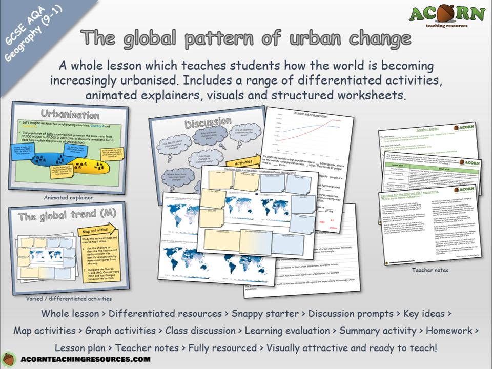
Urban issues and challenges - The global pattern of urban change
AQA GCSE Geography - Unit 2 Section A - Urban issues and challenges - The global pattern of urban change
A whole lesson which teaches students how the world is becoming increasingly urbanised. Includes a range of differentiated activities, animated explainers, visuals and structured worksheets.
Whole lesson > Differentiated resources > Snappy starter > Discussion prompts > Key ideas >
Map activities > Graph activities > Class discussion > Learning evaluation > Summary activity > Homework > Lesson plan > Teacher notes > Fully resourced > Visually attractive and ready to teach!
The main aim is…
To describe how the world is urbanising, and at what rate - key patterns / trends.
To use geographical language and specific examples.
Key ideas and content…
The world is becomingly increasingly urbanised.
Change occurs in different regions at different times.
To differentiate…
Activities are mostly differentiated. This lesson could be made more collaborative in many areas to aid lower and middle ability students.
Model answers for higher students using L and M resources.
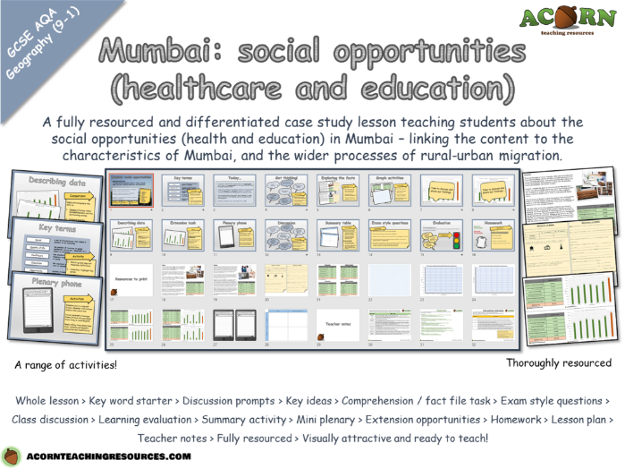
Urban issues and challenges - Mumbai (social opportunities - healthcare and education)
A fully resourced and differentiated case study lesson teaching students about the social opportunities (health and education) in Mumbai – linking the content to the characteristics of Mumbai, and the wider processes of rural-urban migration.
Whole lesson > Key word starter > Discussion prompts > Key ideas > Comprehension / fact file task > Exam style questions > Class discussion > Learning evaluation > Summary activity > Mini plenary > Extension opportunities > Homework > Lesson plan > Teacher notes > Fully resourced > Visually attractive and ready to teach!
The main aim is…
For students to explore how Mumbai offers better social opportunities in terms of healthcare and education to it’s citizens and people migrating there.
To apply specific information about healthcare and education in Mumbai.
Key ideas and content…
Mumbai offers social opportunities people cannot find in surrounding rural areas.
Healthcare and education are both much more accessible in Mumbai than in surrounding rural areas.
These opportunities drive rural-urban migration.
To differentiate…
Several resources have been differentiated so all students can take part in each activity.
Paired and group work might be appropriate for the graph work.
WAGOLLS and model answers for writing a comparison.
Peer assess the plenary phone, using something such as two stars and a wish.
To extend…
Students could remove the Mumbai hospitals from the Maharashtra state total, and explain the significance of this upon rural-urban migration. Essentially this further proves the point about access to healthcare because Mumbai props Maharashtra up in terms of number of hospitals.
Students could form sentences using the key terms from the starter.
Instead of the plenary phone, students could write a formal letter allowing for more detail and application.
Students could develop their own mark scheme for the exam style questions.
To assess…
Use the exam style questions or the discussion prompts.
The plenary phone offers a mini-plenary assessment opportunity.

The Geography of Autumn
The Geography of Autumn gives students the opportunity to explore the interaction between people & environment and the Autumn season.
Students will apply atlas skills and explore interactions including: Autumn tourism, the impacts of global warming, animal migrations and cultural celebrations.
This is a structured and visually attractive lesson where the outcome is an informative piece of display work or a booklet. There are several ways the work could be completed over a range of time scales.

Urban issues and challenges - The emergence of megacities
AQA GCSE Geography - Unit 2 Section A - Urban issues and challenges - The emergence of megacities
An activity packed and differentiated lesson teaching students about the characteristics of a megacity, their growth and their location. Included is a wide range of resources which can be applied in many ways.
Whole lesson > Key concept starter > Discussion prompts > Key ideas > Map/distribution activity > Graph skills > Photo analysis > Exam style questions > Class discussion > Learning evaluation > Summary activity > Homework > Lesson plan > Teacher notes > Fully resourced > Visually attractive and ready to teach!
The main aim is…
To teach students about the characteristics of a mega city, their location, their growth (and reasons for it)
To link to key concepts such as urbanisation and migration.
Make it clear ‘world cities’ share many of the same characteristics – it’s the population, the magic number, which makes it a mega city.
Statistics and population data vary. For example, Paris has a population a little over 2 million, however, in some figures a wider area is taken into account. Make this clear to the students. The emphasis should really be on the growth (the emergence) of megacities in NEE’s.
Key ideas and content…
Mega cities have a population of over 10 million people.
They have similar characteristics – similar to those of world cities.
Their emergence is mostly in Asia and more recently, Africa. There is a pattern!
The number of mega cities has grown significantly over the last 50 years.
Rural-urban migration and natural increase are driving rapid urbanisation in LIC/NEE’s.
To differentiate…
Several activities have been differentiated already – use sheets as appropriate.
Discuss and model the exam style questions.
Allow independent / group thinking time for the discussion.
Provide the key terms as a checklist when answering questions.
To extend…
Students can add information / data to the maps.
The data could be presented in different ways.
Actual examples can be added to the photo analysis activity.
Students could develop their own mark scheme for the exam style questions.
To assess…
Use the exam style questions as an assessment opportunity.
Assess the distribution description to assess distribution questions.
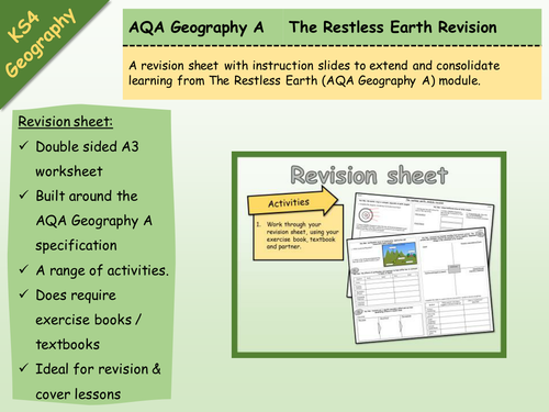
AQA Geography A - The Restless Earth - Revision Sheet
Double sided A3 revision sheet built around the AQA Geography A Restless Earth module.
The sheet is structured around the Key Ideas, and has a range of activities.
Essentially, they're just populating the sheet as a revision tool
Does require exercise books / internet / textbooks.
Ideal as module revision, exam revision or lesson cover.
English - Phonics - Split digraph (a_e) board game
FREE and ready to print in A3, this board game will teach students to read words containing the split digraph a_e sound. A fun and colourful game to use as part of your teaching / small group interventions.
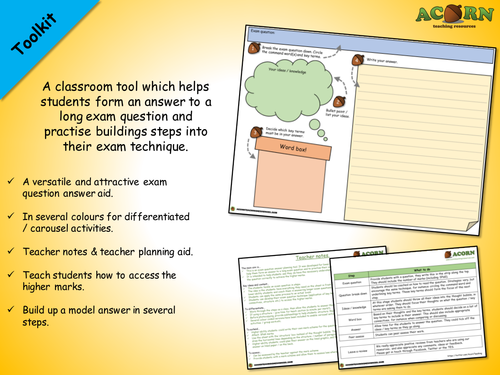
Exam question technique sheet
The main aim is…
This is an exam question answer planning tool. It was developed for lower ability students; to help them form an answer to a long exam question and to practise their exam technique.
It is intended to help students see they do have the necessary understanding, but also answer the question correctly to achieve the higher marks.
Key ideas and content…
The students tackle an exam question in steps.
The idea is the students have everything they need on the sheet in front of them, to help focus lower ability students and coach them in answering longer exam questions.
Students can apply the same process to an actual exam.
Students can develop their exam question technique (application of key terms, use of connectives, structure etc.) to access the higher marks.
To differentiate…
Work through the steps as a class, then allow the students to answer the actual question.
If using a structure – give time for teach section (a minute per mark?).
Before photocopying, provide subheadings to help students structure their answer.
Several colour coded versions have been included to enable carousel activities / differentiated activities / group work etc.
To extend…
Higher ability students could write their own mark scheme for the question on the back.
Attach SPaG marks.
Use the sheet with the ‘structure’ box instead of the thought bubble. The students will have to draw the horizontal lines depending on the structure / number of paragraphs.
Higher ability students could plan their answer on the lined graphic, and then write their actual answer on lined paper / on the back.
To assess…
Can be assessed by the teacher against the mark scheme.
Provide students with a mark scheme and allow them to assess/see where the marks come from.
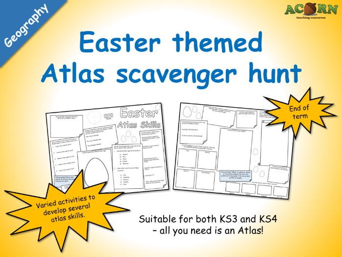
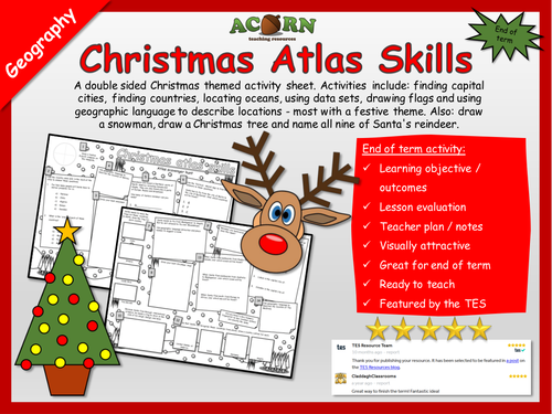
Geography - Easter Atlas Skills (scavenger hunt activity sheet)
Geography - Easter Atlas Skills (scavenger hunt activity sheet)
A double sided worksheet intended to use with pairs and small groups - all they need is an Atlas or two. Teacher notes are included with some suggestions. Basically, they are required to use an Atlas in several ways to find out a range of information (some of which is linked to Easter). There are a few other activities on the sheet (such as design an Easter egg).
Great for end of term activities, and will work with KS3 and KS4 students.
All reviews for our premium products have been 5/5* (As of February 21st 2017).
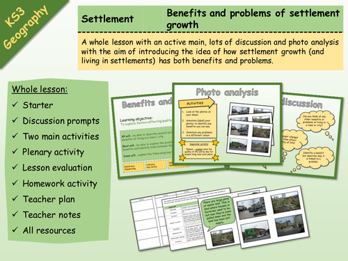
KS3 Geography - Settlement - Problems and benefits of settlement growth
Whole lesson with all resources included.
Learning objective: To explore factors affecting quality of life in large settlements.
Whole lesson:
Starter
Discussion prompts
Two main activities
Plenary activity
Lesson evaluation
Homework activity
Teacher plan
Teacher notes
All resources
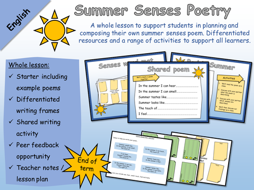
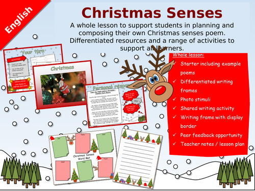
English - Poetry - Summer Senses Poem
A whole lesson to support students in planning and composing their own summer senses poem. Differentiated resources and a range of activities to support all learners.
Ideal for supporting SEN pupils in the writing of a summer senses poem.
This resource would be a great activity for the end of term.
A great way to introduce poetry to KS1 or SEN learners.
Whole lesson:
Starter including example poems
Differentiated writing frames
Shared writing activity
Differentiated resources
Peer feedback opportunity
Teacher notes / lesson plan
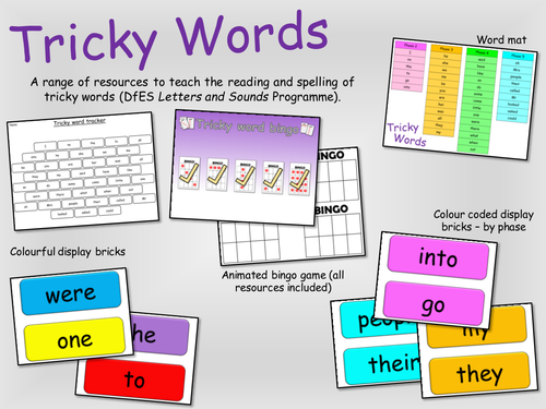
Tricky Word Bundle
A range of resources to teach the reading and spelling of tricky words (DfES Letters and Sounds Programme).
* animated bingo game
* colourful display bricks
* colour coded display bricks (by phase)
* word mat
* tricky word tracker
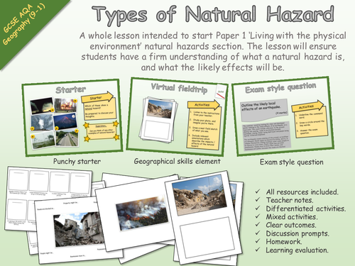
GCSE Geography - AQA - Living with the physical environment - Types of natural hazard
New 9-1 AQA Geography
Living with the physical environment
A whole lesson intended to start Paper 1 ‘Living with the physical environment’ natural hazards section. The lesson will ensure students have a firm understanding of what a natural hazard is, and what the likely effects will be.
All resources included.
Teacher notes.
Differentiated activities.
Mixed activities.
Clear outcomes.
Discussion prompts.
Homework.
Learning evaluation.
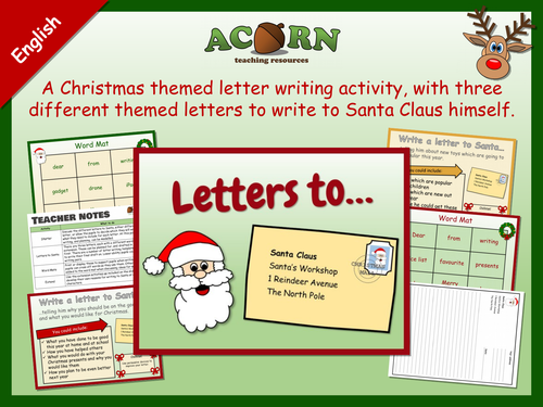
Letters to Santa - English lesson - Christmas writing activities
Letters to Santa - English lesson - Christmas writing activities
A Christmas themed letter writing activity, with three different themed letters to write to Santa Claus himself.
There are three letters, each with a different word mat and extension.
There are a number of letter writing templates for the pupils to write their final draft on.
Fully resourced, visually attractive and ready to teach.
Ideal for fun end of term lessons / teach key skills from the curriculum.

English - Christmas themed writing activity - Santa's job applications
A whole Christmas themed lesson where pupils can practise their persuasive writing skills by applying for jobs at the North Pole.
Great end of term literacy activity for a range of ages and abilities.
Fully resourced and ready to teach with a range of visually attractive resources.
Includes teacher notes and lesson plan.
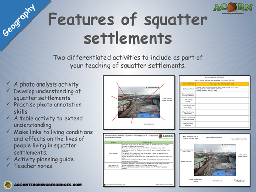
Features of squatter settlements - differentiated activities
Two differentiated activities to include as part of your teaching of squatter settlements.
A photo analysis activity
Develop understanding of squatter settlements
Practise photo annotation skills
A table activity to extend understanding
Make links to living conditions and effects on the lives of people living in squatter settlements.
Activity planning guide
Teacher notes
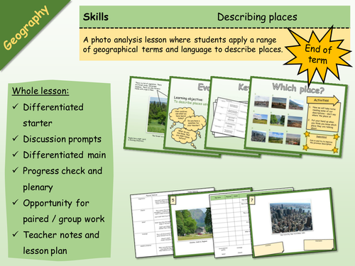
Geography - Skills - Describing Places
A big lesson with lots of opportunity for differentiation and engagement, as well as paired or group work.
Basically, students learn how to describe places, and then apply this skill. It would work well as a skills building lesson in KS3, or as an end of term type lesson with either KS3 or KS4.
There are differentiated resources for lower and higher, and a number of ways in which the activities could be undertaken (which are in the lesson plan). There are teacher notes and a lesson plan. The activities are clear, and there are Superstar extension activities.
---
The main aim is…
This is a big lesson which could be used as an end of term activity, or as a skills building lesson.
Students either learn or develop their geographical terminology and then apply / demonstrate using photos of actual places.
Key ideas and content…
We can describe places using geographical language.
It is more effective to use the correct key terms and descriptive language.
To differentiate…
Pass the sheets round on a timer, with the challenge of either adding more key terms or improving existing ones.
Stick the sheets on the wall around the room, give each student a different key term to look for. Students go round the room.
Insist on certain terms being applied.
To extend…
Insist on a description of features which aren’t necessarily visible.
Students find their own photos and analyse them.
Peer assessment.
There are some tricky terms in the key terms activity, use to stretch students.
To assess…
Discussion points.
The work produced.
Peer assessment opportunity.
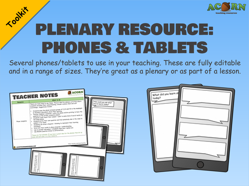
Plenary phones
Several phones/tablets to use in your teaching. These are fully editable and in a range of sizes. They’re great as a plenary or as part of a lesson.
There are many ways to use these. They’re ideal for plenary activities where students can show their understanding. Choose a phone style and edit accordingly. Suggestions include:
Students pass the phone between groups of 2,3,4 and fill in the messages to develop a discussion about their learning.
Teacher displays a question / edits the phone before printing to have the question on the screen, students answer.
Students could tweet their answer / post to some kind of social media on the blank phone.
Students write their own question and find somebody else in the class to answer it for them.
Students can draw a diagram / drawing to represent their learning (included).
Stick into their books to show progress / understanding.
Use to prompt discussion / students read their replies out.
Use Blooms question stems to differentiate.
These are full editable. If you have a great idea for the phones then let us know and we’ll add it to this resource.