16Uploads
1k+Views
300Downloads
All resources

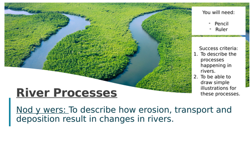
What are the processes that happen in rivers?
Full resource to understand erosion, transport and deposition in rivers. Encouragement of students to draw out diagrams in books to avoid cutting and sticking in worksheets.

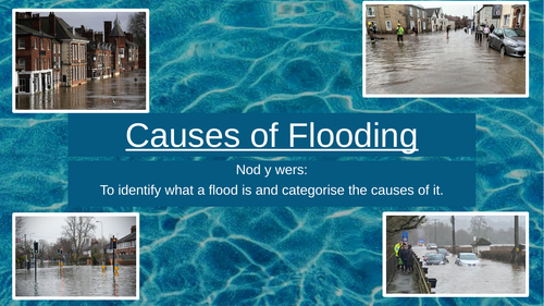
Categorising the Causes of Flooding
Full lesson going through the causes of flooding. Works well with my class, students are expected to copy out the definitions of various factors which have emojis instead of words.

Why do rivers have bends?
Success criteria:
To apply my understanding of processes to real life scenarios.
To label diagrams to describe processes.
To be able to illustrate the processes which lead to meanders and ox-bow lakes.
Nod y wers: To describe how meanders and ox-bow lakes form through labelled diagrams.
What 3 questions can you ask about the picture?
Definition
Drawing out a diagram of a meander, using colours and a key to show where river processes are.
Drawing a cross-section of the meander.
The BIG Question: How is a meander formed?
Ox-bow lakes - animated image to highlight how an Ox-bow lake forms to show how their shape changes over time.

Volcanoes
Success criteria:
To identify the key features of a volcano.
To make a comparison between shield and stratovolcanoes.
To explain why these volcanoes are different.

California Heatwave and Drought (2015)
California Heatwave and Drought (2015)
LI: To understand the causes and consequences of the 2015 drought.
Starter - how can an avocado cause drought?
Map task - describe the location of California.
Map task - Describe the distribution of states affected by extreme and exceptional drought conditions. Encouraging students to understand what the colour represents and ensuring they read the question.
Causes of the California drought.
Impacts of the drought.
Responses to drought.
Homework task - 5Ws.
Excellent resource for KS4 Geography on the WJEC specification looking at high pressure extreme weather. Or just a lesson for KS3 looking at the impacts of weather.

Strengths and Weaknesses of Fairtrade
Nod y wers/Learning Intention: Identify the positive impact of the Fairtrade Foundation and explain why we need to protect farmworkers in developing countries from exploitation.
Starter: Which one doesn’t belong? Odd one out.
Clear setting of learning outcomes.
What is Fairtrade? Identify the definition by replacing emojis.
Is it fair? Using a video (up until 4 mins 8) to decide. How are cocoa farmers treated unfairly? What other challenges do cocoa farmers face? How is Fairtrade minimum price helping farmers in the Ivory Coast (Cote d’Ivoire)?
Build up the chocolate bar to £1 to show how much each party makes in the creation of chocolate.
Who are the stakeholders?
Plenary: Consolidation station with 7 questions for student to answer to show understanding.

Location of Population KS4
Population Distribution of the UK and Wales
Learning Intentions:
To be able to identify where most people live in the UK
To be able to explain the reasons for this distribution

Causes of Migration
Learning intention - to understand the process of migration and categorise the reasons for it.
clear success criteria
news links to encourage discussion
definitions crucial for the topic of migration
clear description of push and pull factors
colour coding causes table for students to complete - visual aid for students
consolidation answer at the end to encourage more extended answer and the skill of explaining their opinion

Introduction to the Tropical Rainforest
1 hour lesson
Includes spelling test of commonly misspelled words
Map skills - students can use atlases to name countries which have rainforests
How have plants adapted to the tropical rainforest - science cross curricular links
Homework - researching how 3 animals have adapted to the rainforest

Tectonic Plates and their Movement
Success criteria:
To describe and illustrate the three different types of plate boundary.
To describe Wegener’s theory of plate movement.
To understand convection currents in the mantle.
Fully resources with extra revision material to support students who may have missed this lesson.

WJEC GCSE Geog Theme 1 Revision Notes
Complete A4 - Can be sized up to A3 - knowledge organisers for theme 1 of the 2016 WJEC Geography GCSE.
Contains: Distinctive landscapes, River landscapes and coastal landscapes.

Unit 1 Revision GCSE/WJEC Geography
A4 workbook for students to complete and use to revise for the WJEC Specification GCSE Geography.
Contains:
Landscape and Physical Processes
Rural Urban Links
Tectonic Landscapes and Hazards
Students can use resources from online or in lessons to complete this to provide them with an A4 booklet which may support revision for exams. It keeps all of their revision in one place and provides a nice summary for a large amount of information.
Recommend printing it as a booklet on A3 paper so students have an A4 workbook.

WJEC Theme 7; Social Development Issues Workbook
Workbook based off the WJEC Theme 7 for Unit 2 assessment. Contains:
Homework tasks which can either be done in the book/lined paper/set online
Past paper questions
Strong focus on numeracy and interpreting/drawing graphs
Revision based learning
Contains revision booklet (separate) to provide students to work on past paper practice.
Once completed this workbook essentially doubles up as a revision guide for the students to use for their exam in year 11. The front of the workbook covers the Specification set by WJEC.
Can be edited however you want once downloaded.

Distinctive Lanscapes WJEC GCSE Geography
Full resource pack for Theme 1.1 Distinctive Landscapes which is part of the WJEC Geography GCSE Syllabus. All of the powerpoints are uploaded as well as a workbook which you could use instead of exercise books. Every resource is completely editable and feel free to change as you see fit. Lessons are designed for an hour slot but may take more than one lesson to go through per powerpoint.
Lessons contain: video links, past paper questions, success criteria, resource analysis. Also contains a PPE which students can complete.
Content:
What makes landscapes distinctive in Wales?
Distinctive landscapes case studies - Eryri and Caerdydd
Impacts of Human Activity on the landscape
Changing rural economies and societies
Strategies to manage the landscape - Eryri and Ynyslas

WJEC Tectonic Landscapes Complete Resource Pack
Fully resourced lessons on Tectonic Landscapes to match the WJEC GCSE Geography syllabus, includes editable workbook to use instead of exercise books and a mock paper.
The structure of the Earth
Tectonic plates
Volcanoes
Earthquakes
Why live near tectonic activity?
Tsunamis
Mount Merapi Case Study
Christchurch Case Study
Reducing the Risks

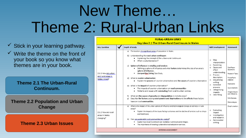
Theme 2: Rural Urban Links - Fully Resourced
Fully resources scheme of learning for WJEC 2016 Syllabus.
2.1 The Urban Rural Continuum
2.2 Population and Urban Change
2.3 Urban Issues
Bonus resources for streamlined teaching:
Student workbook - so no need for use of school textbooks.
Revision workbook.
28 lessons of resources.
Summary pages to support revision.
Scheme of learning for school admin.


