I'm a Geography teacher with experience educating at various levels, ranging from mainstream schools, SEN and extra-curricular tuition. I also have experience in teaching humanities, English and PSHE topics. My resources are designed primarily as schemes of works for mainly Geographical topics with all levels considered
I'm a Geography teacher with experience educating at various levels, ranging from mainstream schools, SEN and extra-curricular tuition. I also have experience in teaching humanities, English and PSHE topics. My resources are designed primarily as schemes of works for mainly Geographical topics with all levels considered
Halong Bay, Vietnam, is a beautiful limestone landscape in a tranquil sea. Amongst the islands are examples of cracks, arches, caves, and stumps. The student’s first task is to mould and build their own structures of these using Play-Doh, with their own explanation of their formation. Second is to produce an informative brochure about the limestone formations and its surrounding area for tourists.
Please like and follow us on Facebook @WillsonEducation or Pinterest @willsoned for more exciting resources, activities, and upcoming events to incorporate into your lessons.
These worksheets look at the food web of the Amazon Rainforest, identifying producers, herbivores, and carnivores. The students will study positive and negative human intervention statements, identifying them as social, political, or economical. The lesson concludes with writing a report on the best strategies to protect the rainforest and a discussion on which would be the most successful.
Please like and follow us on Facebook @WillsonEducation or Pinterest @willsoned for more exciting resources, activities, and upcoming events to incorporate into your lessons.
These worksheets introduce students to what is meant by the conservation scale and the meaning of ‘endangered’. We look at the human and physical aspects which threaten our wildlife, specifically Komodo Island and its Komodo Dragon, and the attempts to overcome these threats.
Please like and follow us on Facebook @WillsonEducation or Pinterest @willsoned for more exciting resources, activities, and upcoming events to incorporate into your lessons.
Table Mountain is one of South Africa’s most iconic tourist attractions. It is admired for its backdrop, views and unique flora and fauna, most notably the penguins! These worksheets give students the opportunity to look at how animals adapt to an environment they would not be expected to be found.
Please like and follow us on Facebook @WillsonEducation or Pinterest @willsoned for more exciting resources, activities, and upcoming events to incorporate into your lessons.
This project-based unit can be used as an individual or group activity, or assessment. The students are tasked to create a leaflet for the United Kingdom Antarctic Heritage Trust to help promote fund-raising and raise awareness to preserve the Antarctic huts used by explorers of the past.
A breakdown of the leaflet is given which includes the format to be used, including the colour scheme of the Antarctic tartan. Each page is assigned a topic including the front cover, who the AHT are, information about Antarctica and a set of rules to be followed by visitors and tourists.
Several websites are given to help with research, although independent research is encouraged, and a 3 minute film looking at why people wish to visit Antarctica, and the impacts they can have, has been included. In addition, a 22-page booklet produced by the Britain’s Antarctic Heritage gives an insight to their aims, the history of the area and what they wish to accomplish in the future.
A range of activities can be incorporated within this project, including, gathering research from print and video, annotating maps, their thoughts, and ideas.
Please like and follow us on Facebook @WillsonEducation or Pinterest @willsoned for more exciting resources, activities, and upcoming events to incorporate into your lessons.
This booklet introduces and teaches the students how to read longitude and latitude, as well as help students develop their descriptive, sensory and research skills. The students investigate the two teams who raced to the poles in in 1911 and study the problems caused by the increasing number of tourists visiting Antarctica. Ways to reduce these impacts are discussed in addition to whether the students think Antarctica should be protected or not. The booklet is concluded with the students designing a leaflet to help promote funding to preserve the huts used by Robert Scott’s Antarctic Exhibition team.
A range of individual and group activities are incorporated within this booklet, including, gathering research from print and video, annotating thoughts, and ideas, and using senses to describe their findings.
Please like and follow us on Facebook @WillsonEducation or Pinterest @willsoned for more exciting resources, activities, and upcoming events to incorporate into your lessons.
This PowerPoint lesson plan introduces the students to what an avalanche is, the categories and their triggers – both physical and human. During the lesson the students have the opportunity to demonstrate an avalanche using flour and instant mash potato! The lesson concludes with a choice of activities including a cartoon style answer, comic strip, information sheet or blog for tourists, newspaper article or short essay answering why avalanches happen and their impacts.
Want to receive credits for future purchases? Please go to ‘My Purchases’ and select ‘Provide Feedback,’ fill out the quick form and each time you leave feedback, TPT will give you credits towards your future purchase. We really value your comments to help us create products to help you in the classroom – Thank you in advance.
Please follow us on TPT by clicking on the green star next to our store name, and like and follow us on Facebook @WillsonEducation and Pinterest @willsoned for more exciting resources, activities, and upcoming events to incorporate into your lessons.
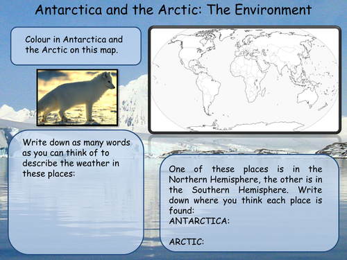
This unit consists of three double-sided worksheets which look to investigate the differences between Antarctica and the Artic, the animals to be found there and how humans are affecting these delicate environments through the impact of global warming.
A range of individual and group activities are incorporated within this booklet, including, gathering research, annotating maps, their thoughts, and ideas and completing a wordsearch.
Please like and follow us on Facebook @WillsonEducation or Pinterest @willsoned for more exciting resources, activities, and upcoming events to incorporate into your lessons.
This PowerPoint lesson plan introduces students to drawing, – with step-by-step instructions -interpreting and finding patters in climate graphs.
Please like and follow us on Facebook @WillsonEducation and Pinterest @willsoned for more exciting resources, activities, and upcoming events to incorporate into your lessons.
This unit of work helps students to investigate the many aspects of weather and climate, beginning with their differences, why it’s important for us to study and try to understand it and how we observe and record weather. We study climate by reading and drawing climate graphs and maps. We look at Britain’s physical features and the effect this has on climate. The students study the hydrological cycle, why it rains, the various types of rainfall, and how we use rainwater. Depressions, anticyclones and whether thunderstorms are our friend or foe are investigated as well as the clothing associated with extreme weathers.
A range of individual and group activities are incorporated within this booklet, including, gathering research from print, word-fills, reading and drawing climate graphs, map reading, personification, picto and flow diagrams and personal observation.
Please like and follow us on Facebook @WillsonEducation or Pinterest @willsoned for more exciting resources, activities, and upcoming events to incorporate into your lessons.
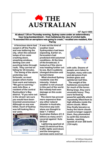
This 30-minute lesson investigates how thunderstorms are created, the four main characteristics of a thunderstorm – thunder and lightning, hail, wind, and rain – and their positive and negative effects. The students use the information gathered to individually answer ‘Thunderstorms: Friend or Foe?’ and are encouraged to debate their answers.
The students take part in a group activity to gather research from printed articles and discuss their points of view after individually answering the lessons chief question.
Please like and follow us on Facebook @WillsonEducation or Pinterest @willsoned for more exciting resources, activities, and upcoming events to incorporate into your lessons.
This unit of work introduces students to the significance of water from its source through to it being bottled and being a course of conflict. The features of rivers are explored along with the hydrological cycle and how rivers are used. The students carry out and write up an investigation studying how different surfaces react to water which leads into the human and physical causes of flooding, looking specifically at the Queensland Floods and the social, economic, and environmental impacts. Hard and soft engineering techniques are discussed within a ‘decision making exercise.’
Water as a right and conflict is debated. Drawing upon The Ilisu Dam, Turkey, the students debate from various countries points of view its construction. This leads to the debate around bottled water and how fact and opinion can sway viewpoints. The human and physical impacts of shortage of water are reviewed in addition to short and long-term aid.
A range of individual and group activities are incorporated within this booklet, including, gathering research from print and video, annotating maps, students thoughts and ideas, drawing graphs, participating in group investigations and discussions, and writing up their findings appropriately.
Please like and follow us on Facebook @WillsonEducation or Pinterest @willsoned for more exciting resources, activities, and upcoming events to incorporate into your lessons.
Seven fun brainteasers and images which could be used as lesson starters or displayed in the classroom and corridor in a Geography department.
Please like and follow us on Facebook @WillsonEducation or Pinterest @willsoned for more exciting resources, activities, and upcoming events to incorporate into your lessons.
This 50 page booklet allows students to explore China through a variety of activities both students and teacher lead. Chapters include, amongst others:
Where Are We Talking About?
What Do You Know About China?
Why Travel to China?
What Is The Climate Like in China?
What Is our Population Like?
What’s Happening To China’s Population?
What’s Happening To The Age Of China?
China’s Culture
A Taste Of China
Gung Hey Fat Choy!
Playing With Paper
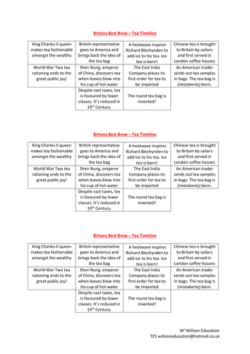
Britain’s Best Beverage
China’s Threatened Wildlife
The Great Wall
The Terracotta Army
The Forbidden City
Tiananmen Square
Three Gorge Dam
Transnational Companies In China
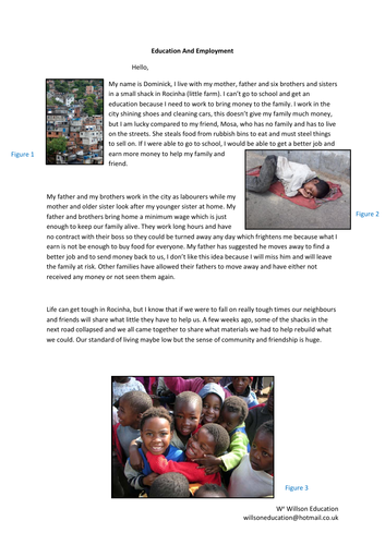
This booklet introduces students to the global links within sports, specifically football. We investigate the origin of top players and how these have changed over twenty years. Child labour, shanty towns and The Atlanta Agreement are discussed in relation to Brazil readying itself to host the 2014 Word Cup. The unit concludes with the students considering whether they think Brazil should have held the World Cup having considered the social economic and environmental impacts.
A range of individual and group activities are incorporated within this booklet including map reading and annotating, gathering research from print and students drawing their own conclusions from materials gathered.
Please like and follow us on Facebook @WillsonEducation or Pinterest @willsoned for more exciting resources, activities, and upcoming events to incorporate into your lessons.
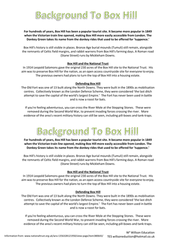
This 13 page booklet helps students to develop their fieldwork skills but looking at a specific location, Box Hill in Surrey. Titles include:
Where Is Box Hill?
Background To Box Hill
A Hill For All Seasons
Sketching Box Hill
Environmental Survey At Box Hill
Measuring Litter At Box Hill
Box Hill Flowers
This is one of my favourite units with my students as it is predominantly student led which helps build confidence, trust, and responsibility as they work in groups outside of the classroom, independently from the teacher.
The unit walks the students through carrying out an investigation around their school breaking down the different components (Introduction, Aim, Hypothesis, Method, Presenting Data, Discussion, Conclusion and Evaluation), explaining the purpose of each, the expected length and giving some sentence starter suggestions. The unit concludes with the student’s peer assessing each other’s group presentations of their investigations.
This resource includes the student workbooks, a class PowerPoint presentation and a booklet describing different graphs and their uses which can aid the students in their data presentation.
Please like and follow us on Facebook @WillsonEducation and Pinterest @willsoned for more exciting resources, activities, and upcoming events to incorporate into your lessons.
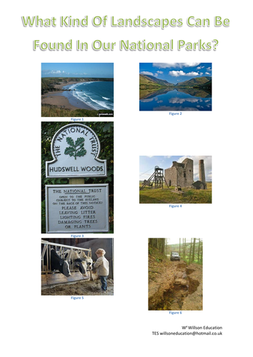
This 17 page booklet allows students to investigate our National Parks. It covers a number of Geographical topics including map work, impacts of tourism and solutions to these and discussion on whether National Parks are still considered important.
Some of the titles included in this booklet are:
What Is A National Park?,
What Makes The New Forest National Park A Honey Pot Site?,
What Impacts Can Visitors Have On Our National Parks?,
Should The South Downs Have Been Included In Britain’s National Parks?
Do We Still Need National Parks?
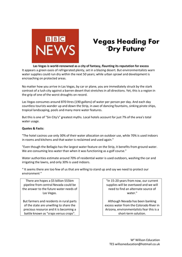
This five page activity allows students to explore where Las Vegas is, whether it is sustainable, why it is so dry and how they are trying to over come this by using Xeriscaping
This 46 page booklet gives students the opportunity to explore Africa as a continent, who lives there, how it was discovered by Westerners and some of the following titles:
What’s Africa’s Environment Like?,
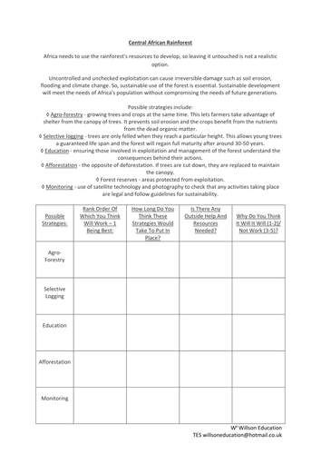
Central African Rainforest,
Lake Victoria,
Great Valley Rift,
Victoria Falls,
Kalahari Desert,
A Taste Of Africa,
African Tribal Face Painting,
Recycling In Africa,