My shop is a non profit making concern & it supports homeless charities (Crisis, The Salvation Army & The Berwick Youth Project). Teaching has been my life & I continue to support learning around the World. My subjects were: History, Geography and Physical Education. I have competed in a wide variety of sports inc.: Gymnastics, Badminton, Rugby, Football, Athletics & many others. Check out my recent bundle with 11 of my best publications. A vast amount of support material on offer.
My shop is a non profit making concern & it supports homeless charities (Crisis, The Salvation Army & The Berwick Youth Project). Teaching has been my life & I continue to support learning around the World. My subjects were: History, Geography and Physical Education. I have competed in a wide variety of sports inc.: Gymnastics, Badminton, Rugby, Football, Athletics & many others. Check out my recent bundle with 11 of my best publications. A vast amount of support material on offer.
This is the thirteenth in a series of quiz challenges. A General Knowledge Quiz prepared for my two grand-daughters Emilia and Florence. They are 9 and 11 years old. It will be suitable for children between the age of 9 and 15 years. Free to all for use as a home study exercise. Try answering them without assistance for 3 points and then receive 1 point for finding the answers using the internet or other sources. I hope you have some family fun.
Study at home with this quiz - This is the ninth (009) in a series of quiz challenges. It is a General Knowledge Quiz prepared for my two grand-daughters Emilia and Florence. They are 9 and 11 years old. It will be suitable for children between the age of 9 and 15 years. Free to all for use as a home study exercise. Try answering them without assistance for 3 points and then receive 1 point for finding the answers using the internet or other sources. I hope you have some family fun. Ask the children to study the answers after completing the quiz. This is when they find out about things they did not know. Have fun and stay safe.
This is the sixth in a series of quiz challenges. It is a General Knowledge Quiz prepared for my two grand-daughters Emilia and Florence. They are 9 and 11 years old. It will be suitable for children between the age of 9 and 15 years. Free to all for use as a home study exercise. Try answering them without assistance for 3 points and then receive 1 point for finding the answers using the internet or other sources. I hope you have some family fun. Ask the children to study the answers after completing the quiz. This is when they find out about things they did not know. Have fun.
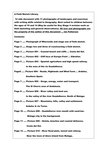
A Field Sketch Library.
12 side document with 11 photographs of landscapes and exercises with writing skills related to Geography. Best suited to children between the ages of 10 and 14 (May be useful for Key Stage 4 revision work on field sketching and landscape observations). All text, sketches and photographs the property of the author of this document … Ian Patterson
PTA - QUIZ NIGHT RESOURCE.
This resource would be ideal for an organiser of a PTA social evening and targets both the Primary and Secondary sector. In my opinion it is perfect for a family night out courtesy of the PTA. I am adding an extra resource with higher level quiz material about WW1. This includes 4 quizzes and 2 power point presentations about WW1, worth £3 in my TES Shop (Times Educational Supplement).
My TES shop can be found on a TES search with “IanPCostaDelSol”. All my resources will support charity this year and beyond.
In total there are at least 650 quiz questions and all with answers and fact sheets to support the content. Content includes: General knowledge, people, places, History, Geography and a host of other topics, too many to mention. The target age group was 9 to 16 but I am sure they would be ideal for a family quiz night in a school hall.
More detail about the offer follows:
2020 has been a challenging year and perhaps when we get to 2021 the Schools and Colleges will get back to having social functions in support of all of the young people in the UK and around the World. This resource is everything in the way of quizzes that I have created over the last 6 months. I offered them free of charge during the Covid crisis specifically for home learning. This time I ask that you donate £2 for my Homeless Charity Appeal so that you may download this sizeable resource. My chosen charities include Crisis, Salvation Army Homeless Fund and the Berwick Project. The latter helps keep young people off the streets and gives the children much needed support, hope and ambition for their future.
This Salvation Army Charity Quiz targets children between the ages of 10 and 16 years but may also be suitable as a pub quiz. The Charity quiz includes general knowledge questions, pictures and a few puzzles. The file also includes 10 free general knowledge quizzes also targetting young school students. For a small donation of £2 toward the Salvation Army Homeless Charity, I hope that with your help we can make a difference to a few people who have fallen on difficult times. Perhaps some of the Primary Schools out there might consider running a Family Charity Quiz Social Evening using this resource when the World gets back to some kind of social normality. Thank you for your support. Ian Patterson (August 2020).
A pack of 11 General Knowledge quizzes in support of the Crisis homeless charity. These quizzes are targeted at children between the ages of 9 and 16. The answer sheets act as a fact file for learning about the wider world. Please support the Crisis Charity with your £2 donation.
What would you do and who would you turn to if you found yourself homeless at this time next year?!
This resource supports three homeless charities. For only £2 you will receive a resource that highlights both Geography and History across the length and breadth of Britain. At the same time you will be helping people who find themselves on the streets and need our help to survive. The resource comes in two files. One is in Power Point format and the other is a word file that includes both a quiz challenge and an extended fact file about many different topics. These topics include: Coventry Cathedral, Edinburgh Castle and the geological feature known as a “Crag and Tail”, the Holy Island of Lindisfarne, Titanic, William Shakespeare, Isambard Kingdom Brunel, Oliver Cromwell and the “New Model Army”, Hadrian’s Wall and Features of intrusive, extrusive volcanic activity and many more.
The resource can be used for children between the ages of 10 and 16 as either a review of “The Geography and History of the British Isles” or as a Power Point quiz challenge. Many of the individual topics can be used to introduce stand alone lessons or to stimulate discussions.
This resource is a mini project about Africa. It is presented as a 25 question quiz that can be expanded for perhaps 3 to 6 lessons encompassing a wide variety of topics. The main theme of the resource targets Africa as a continent. Sub-themes (mainly Geography but also some History), includes topics such as: Biomes, Ecosystems, Climate, wildlife, River Basins, Deltas, Mountains, Natural Vegetation, Global Warming as well as several other Geographical themes.
There are many ways for delivering this material:
Each lesson can start with a question-and-answer session with the use of atlases or a projected image of Africa (The focus can be on Physical Geography, Human Geography or both.)
Focus on the first 5 questions in discussion. After 15 minutes discussion and directed teaching, Ask the children the first 5 questions as a mini challenge. As an immediate follow up show the first 5 answers from the fact file presentation. The test result is not as important as the discussion and the follow up discussion. Using this framework there is the possibility for six very contrasting lessons.
There are World map outline challenges at the end of the resource file.
Any commission from this resource will be sent to the homeless charity “CRISIS” UK.
Have fun and enjoy the teaching experience.
Orienteering - PPP7
Symbols - Quiz One
In order to navigate an Orienteering map, it is essential to have a fair grasp of the map symbols. Presentation 7 is offered in the form of a Quiz. Included are 25 contrasting examples.
Included are: Vegetation types, man-made structures, water features, natural formations and a variety of other common inclusions that can be found on Orienteering maps.
Orienteering - PPP8
Symbols - Quiz Two
As with Presentation 7 this is the second of two presentations that will help the Orienteer to become familiar with the map symbols. Presentation 8 again offers a selection of 25 map symbols. They are presented as a quiz challenge that can be repeated several times. This will help individual orienteers to become familiar with the many symbols included on Orienteering maps. A mixture of all symbol types has been included.
Orienteering P5 & 6 - Types of Landscape & Control Descriptions.
PPP5 - The outdoor adventure sport of Orienteering makes the most of all types of landscape. This presentation explores the many types of geographical environments that have been captured on orienteering maps. The competitor in Orienteering has the opportunity to experience the following and many other varieties of landscapes: 1. Forests with many different trees. 2. Runnable woodland. 3. Thick vegetation with slow progress. 4. Farmland meadows and orchards. 5. Open parkland and scrubland. 6. Moors and land with rocky outcrops. 7. Urban landscapes with alleys, back lanes and many stairways. These can make navigation very challenging with the many twists and turns! This presentation gives you a taste of how diverse the scenery in this amazing sport can be.
PPP6 -
This presentation entitled “Making the most of Control Descriptions” explores the connection between the shape of the landscape and the symbolic representation of the physical features with how they appear on the map. The sport of orienteering involves visiting a number of actual locations pin-pointed on the orienteering map being used. The event organisers must prepare races for each different age group. Each set of control descriptions are set out in numerical order. The presentation starts with an experienced orienteer who explains the basics to any beginners so that they know what to expect. It also highlights how control descriptions help all orienteers to become successful. The following aspects are covered: 1. Early guidance on what to expect at your first event. 2. There are at least 8 different types of control descriptions on the guidance sheet. 3. Images and symbols are used to give a visual picture linking the landscape with the map symbols. 4. A few examples of control descriptions and map types are included. 5. The examples can be used to challenge and test the group or individual.
These two presentations will help both the beginner and the intermediate to make good progress. They will soon progress to advanced levels in this incredible sport.
Any income made from these two power point presentations will be donated to three different homeless charities (Crisis, Salvation Army and The Berwick Project).
All income on this resource will go to Homeless Charities in 2020. Perfect for students who are studying WWI, Adolf Hitler and political struggles in Germany. Massive price reduction!!
This bundle is aimed at combining a wealth of information about both the Weimar Republic and the part played by Adolf Hitler in its downfall. The following resources have been combined:
Free Resource - Development of a Dictatorship 1918 to 45 (A comprehensive timeline tracking the highs and lows of Germany from the end of WW1 to the end of WW2)
1 - The Rise and Fall of the Weimar Republic (A Presentation)
2 - The Rise and Fall of the Weimar Republic (Timeline, Revision Cards, Game and Wall Display)
3 - Adolf Hitler 1889 to 1918 (Factfile & Tasks)
4 - Adolf Hitler 1889 to 1918 (A Presentation)
Resource 3 & 4 highlight Hitler’s background and looks into the reasons why he followed a path to disaster. These resources are targeted at Years 9 through to Year 11.
A Taste of Orienteering - Getting Ready for Your First Event. This chapter aims to help the beginner to become familiar with the many experiences and challenges facing the newcomer to this exciting outdoor sport.
This Power Point Presentation is the second in a series of coaching notes for this amazing sport of Orienteering. It is dedicated to our departed friend, James Ross who was an established and successful Orienteer. He was a member of the well-established Malaga Orienteering Club. All commission gained from this resource will be donated to selected Cancer organisations.
So where do we start? Here is a list of the topics covered in this presentation:
Checking out your local Club and what is on offer. 2. Make contact and find out the many activities and experiences available. 3. Events can be either “Town and Country” (Urban or Rural), a huge contrast. 4. Become familiar with the Club websites. 5. What might we expect to find at the start line? 6. The first few seconds of any test or race are vitally important especially for novices! 7. As we progress, we will become familiar with both the map and the compass. 8. Gradually we will gain confidence and become familiar with directions, distances and many contrasting landscapes. 9. A clever thumb will improve our navigational skills!? 10. At the end of each event we will become familiar with the finish line and checking in at the download station. 11. Finally we should show gratitude to the planners and organisers who give of their time freely for the benefit of others and this incredible outdoor sport.
Orienteering is very much a family sport, and it offers huge benefits to young and old alike. Check out this presentation and become involved in something very special.
This resource is offered as an introduction to how maps evolved and the subsequent development of Orienteering as a sport. It is offered as a Power Point Presentation and it lays the foundation for a programme of 9 more presentations that highlight the many skills and coaching topics to be experienced in this amazing sport (Orienteering). The ten presentations have been written in both English and Spanish. Many of the slides show the diversity of the Spanish landscape as captured by the many members of “The Malaga Orienteering Club in Spain.” The presentations can be adapted for viewing by Upper junior students (9 - 10 yrs.) through to adult age groups. This presentation includes topics such as: Comparisson of ancient maps through to modern day orienteering maps; Early maps and cartography; The compass rose; The Earth’s magnetic field, The magnetic compass and how it can be used with the Orienteering map. The presentation sets the foundation for many more coaching aspects covered in the follow up programme of wide ranging topics. These resources are a non profit making venture and any income will be forwarded to three selected homeless charities (Crisis, The Berwick Project and the Salvation Army). As an extension to the use of this resource, teachers may wish to use the text, images and possible video links to other topics such as: Geographical landscapes, The Spanish language, The History of Maps and as an introduction to the sport of Orienteering. The introductory videos (one of two in the presentation), gives a true taste of this amazing outdoor sport. Permission to show the videos in this and all ten presentations has been granted by Malaga Orienteering Club with the gratitude of (Ian Patterson) the author of this presentation.
The sport of Orienteering needs to be broken down into bite-size skills so that the beginner can establish the most important principles of this incredible activity. In this presentation I have selected ten elements that I believe to be essential learning steps for the novice orienteer. I have included the following topics in order to lay the foundations for success in this activity:
Knowing your north from your south! 2. Translating the symbols into an accurate mental image of the land features. 3. Making the most of the map key. 4. Getting to grips with scale and distances. 5. Understanding contours and being able to convert the patterns into mental pictures. 6. Keeping in touch with your exact location by using your thumb! 7. A personal understanding of your stride distancing. 8. Making use of rough bearings. 9. Knowing how to use map handrails. 10. On a navigation leg, make the most of the collecting or gathering features between control points.
These key principles of navigation and map reading skills will serve you well in this incredible sport. As with all my resources, I offer this resource at minimum cost in order to support my three chosen homeless charities. I am grateful to the Malaga Orienteering Club for permission to use many of the images and videos on offer in this presentation.
Home Study 2021. Improve your map skills at home. All income from this resource goes to homeless charities during 2021.
Map Skills - 50 page document with exercises and maps that can be photo-copied and re-used in different ways. Best suited to children between the ages of 10 and 14 (May be useful for Key Stage 4 revision work on map skills). All text, maps, photographs, sketches and graphics by the author … Ian Patterson
**Home Studies - 2021. All income for this resource will go to homeless charities. **
I believe that this project is perfect for Key Stage 2 and 3. The children will reap the benefits in their geographical studies when they progress to examination level in Key Stage 4. The Project offers an insight into the characteristics of the Yorkshire Dales National Park and it encompasses a taste of the History and the Geography of this diverse area of Northern England. There is a mix of written material, diagrams, maps challenges and photographs. The main target area is the subject of Humanities but in particular it is best suited for studies in Geography, Travel and Tourism and some aspects of History. Throughout this resource there is an offering of tasks for students to attempt. These challenges involve discussion, descriptive and analytical writing, drawing skills, numerical assimilation and all aspects of the requirements for satisfactory coverage of the National Curriculum in the UK. Sub topics include: Glaciation, Geology, Industrial Roots, Roads and Railways, Town and Countryside, Limestone Scenery, Farming, Mapwork Skills and a few others. In total there is enough work for at least 10 lessons that will encompass the full range of geographical skills within the one project. I believe that this resource would be best suited for children between the ages of 10 and 16 years and it can be adapted for a wide range of abilities. The work offered to the children can be carried out in the classroom and some sessions could make use of the IT room in order to extend the project. I would start by using an atlas and looking at its worldwide location as part of the bigger picture and then zoom in on its site and situation within the UK National Parks organisation. At this point I would introduce the children to one of the maps on offer within the project (Page 25). From this point onward the project can make full use of the 61 page resource document. I hope you enjoy studying this wonderful part of Northern England as much as I have both on the ground and under the ground over the past 35 years.
Learning at home or in the classroom - British Cities - Geography at home - Parents and teachers can easily set their children mini projects using this resource.
All income on this resource will go to Homeless Charities.
British Cities Fact File Challenge
This project offers a research opportunity to find out more about the cities of Aberdeen, Belfast, Birmingham, Bristol, Cardiff, Dublin, Edinburgh, Glasgow, Liverpool and London.
The resource is aimed at children from Years 5 to Year 9 and it provides an opportunity to combine Information Technology with Geography. It is an ideal opportunity to use a presentation to introduce the topic of British Cities. This can be extended to perhaps 4 introductory lessons with a collection of smaller challenges. After an initial introduction the students can then gather their own selected information about all ten of the cities included in the study. At the end of the project they should have a document consisting of 10 fact files and a much better knowledge of cities in both the United Kingdom and The Republic of Ireland.
Children at Home can learn about the time line of events during WW1. Teachers can offer this resource to children who are studying WW1. Younger students may need to watch alongside their parents.
What is included … 2 Presentations, 4 Quiz Challenges and information pages.
and how to use this resource:
This resource can be used for students between the ages of 9 and 16 years.
It contains 2 power point presentations that cover the first and second half of WW1 in a chronological continuum. Each presentation has 25 slides with detailed notes included below. The commentary is most suitable for 14 to 16 year old History students but it can be easily adapted for children who are 10 to 13 years of age.
Both presentations are offered as thumbnail and note pages that can be printed and used as revision sheets for examination students who are studying WW1.
Other pages on offer include two relatively easy quiz pages with 25 questions for all age groups and two picture quizzes with ten related images (The quizzes can be attempted** with or without** the fact sheets).
Finally there is a page with 25 short writing projects that are offered as challenges for developing historical writing in preparation for examinations.
How to Use the Power Point Presentations:
Part 1 - Show as a brief introduction for various topics about WW1. The presentation can be concluded by an easy quiz (using the resource to find the answers). Testing from memory - Students can mark their own so that they can note facts and concepts that they did not learn during the presentation.
The quiz pages can act as a script for the main discussion topics whilst the presentation is being given. The second presentation can be used in the same way.
Individual slides can be used as lesson starters for initial discussion and then lead into writing challenges.
I envisage this resource being used for perhaps up to 6 lessons with 9 to 12 year old children.
Examination students might use this resource as a foundation for studying all aspects of WW1.
The picture quizzes can be used as standalone challenges using the information sheets or as an internet challenge.
Another option would be to use certain pages as Homework material.
Target groups are … GCSE History and Key Stage 2 and 3 studies.
Home Study 2020. Have you got an Atlas at home? All homes need an Atlas. This resource is ideal for doing work linked to pages from an Atlas.
All income from this resource in 2020 will go to Homeless charities.
A 268 page document with over 50 outline maps from around the World. This resource book is to be used in conjunction with a school atlas. There are a multitude of exercises and challenges for students to use as homework or in the classroom with guidance from the teacher. Also included, there are over 180 photographs from the UK and around the World that can be used individually for lesson starters or as independent slide shows.
National Curriculum, Geography - This teaching resource offers a large proportion of the main elements included in the Key Stage 1, 2, 3 and 4 specifications. Location knowledge, Place knowledge, Human and Physical Geography and also elements of fieldwork skills have been covered in many different ways.
Almost every page has a Geographical question, exercise or challenge for a wide range of ability levels. Many of the photographs could also be used in PSHE lessons or Tutor Time to inspire discussion, comments and possibly written work.
Special areas of interest: China, Spain, France, Belgium, Malaga, Palm Springs, London, Bristol, WW1 Picardie and Flanders.