Providing quality tested Geography resources at an affordable price. Take the stress out of your teaching and enjoy what many teachers joined the profession for, working with young people. Please follow & review to help me grow my store!
Providing quality tested Geography resources at an affordable price. Take the stress out of your teaching and enjoy what many teachers joined the profession for, working with young people. Please follow & review to help me grow my store!
If you like my work, please follow me for more resources and leave a review!
This lesson looks at the factors affecting risk from natural hazards. The lesson uses image analysis to invoke independent thinking and later looks at how geographical position influences the impacts of various hazards. There is a challenging group question task, where pupils reflect on how damages may be reduced, as well as an exam question and mark scheme to be used as a homework task. This lesson investigates what hazards are and how they impact on human settlements. There independent thinking tasks included as well as example exam questions.
If you like my work, please follow me for more resources and leave a review!
This 1 hour KS3 lesson investigates the useful but problematic properties of plastic. Pupils consider why plastic is so versatile and reflect on why this makes plastic so hazardous. Students create a timeline to show how long it takes various pieces of house hold waste to break down, and reflect on whether this should have more of an influence on our choice of materials.
Bundle and save! This lesson is part of a larger bundle:-
India & The Plastic Problem
Check out some of my other products relating to India & The Plastic Problem:-
Why is plastic hazardous?
Where is India and what is it like?
How does India’s physical Geography influence the location of its major cities?
Why does India have a monsoon climate?
How do ocean gyres move plastic pollution?
How developed is India?
Why does India have so many squatter settlements?
What are the impacts of marine plastic waste?
How can plastic waste be reduced?
If you like my work, please follow me for more resources and leave a review!
This 1 hour KS3 lesson investigates the influence of India’s physical Geography on the distribution of its major cities. Pupils produce a choropleth map to show how elevation changes across the country. Students describe this map, developing analytical skills and consider why Indian cities may contribute significantly to ocean plastic.
Bundle and save! This lesson is part of a larger bundle:-
India & The Plastic Problem
Check out some of my other products relating to India & The Plastic Problem:-
Why is plastic hazardous?
Where is India and what is it like?
How does India’s physical Geography influence the location of its major cities?
Why does India have a monsoon climate?
How do ocean gyres move plastic pollution?
How developed is India?
Why does India have so many squatter settlements?
What are the impacts of marine plastic waste?
How can plastic waste be reduced?
If you like my work, please follow me for more resources and leave a review!
This 2 hour KS3 lesson investigates what an earthquake is, as well as how they are measured and recorded. A map task used for pupils to reflect on where earthquakes occur. A flow diagram task is included on the causes of earthquakes as well as interactive slides of how seismometers work. A student led role play task is used to teach the Richter scale and card sort task for the Mercalli scale. Additional homework task included.
Bundle and save! This lesson is part of a larger bundle:-
Tectonic Hazards Topic Bundle
Check out some of my other products relating to Tectonic Hazards:-
What factors effect the risk from natural hazards?
What are the layers of the Earth?
What are tectonic plates?
Why are earthquakes and volcanoes found at plate boundaries?
What are earthquakes?
Are tsunamis the deadliest natural hazard?
Why live in tectonically active regions?
How can hazard risk be mitigated?
If you like my work, please follow me for more resources and leave a review!
This 2-3 hour KS3 lesson introduces the two crust types as well as the four plate boundaries. Pupils learn through a game, as well as a dance, the names of and movement at the different boundaries. A wide range of differentiated worksheets for higher and lower abilities are included on each boundary as well as catchphrase and taboo games as plenary tasks.
Bundle and save! This lesson is part of a larger bundle:-
Tectonic Hazards Topic Bundle
Check out some of my other products relating to Tectonic Hazards:-
What factors effect the risk from natural hazards?
What are the layers of the Earth?
What are tectonic plates?
Why are earthquakes and volcanoes found at plate boundaries?
What are earthquakes?
Are tsunamis the deadliest natural hazard?
Why live in tectonically active regions?
How can hazard risk be mitigated?
If you like my work, please follow me for more resources and leave a review!
In this 2 hour KS3 lesson, pupils explore why plastic moves through the open ocean to accumulate in ‘garbage patches’. Pupils consider the sources of ocean plastic and reflect on why so much plastic ends up in the ocean. Pupils are expected to produce a short piece of descripting writing, detailing the horrors of ocean garbage patches. Pupils develop their understanding of ocean currents through a heads and tails worksheet, proving support for weaker pupils. Students then label the main ocean gyres on a world map, before completing a comprehension exercise, where they must explain why the Indian ocean lacks an dense accumulation of marine plastic pollution. The lesson includes numerous worksheet activities and supporting video links.
Bundle and save! This lesson is part of a larger bundle:-
India & The Plastic Problem
Check out some of my other products relating to India & The Plastic Problem:-
Why is plastic hazardous?
Where is India and what is it like?
How does India’s physical Geography influence the location of its major cities?
Why does India have a monsoon climate?
How do ocean gyres move plastic pollution?
How developed is India?
Why does India have so many squatter settlements?
What are the impacts of marine plastic waste?
How can plastic waste be reduced?
If you like my work, please follow me for more resources and leave a review!
This 2 hour KS3 lesson investigates the sequence of evolution on planet Earth. The lesson teaches to appreciate the scale of geological timelines. Literacy strategies are included to support weaker students. Pupils arrange the emergence of key species through a timeline task. Students use comic cards to sequence the key events throughout the last 4.5 billion years. A supporting video link is also included and accompanying question sheet.
Bundle and save! This lesson is part of a larger bundle:-
Earth’s Story topic bundle
Check out some of my other products relating to Earth’s history:-
What was the Big Bang?
How did life on Earth evolve?
What killed the dinosaurs?
If you like my work, please follow me for more resources and leave a review!
This 1-2 hour KS3 lesson teaches pupils to use latitude and longitude. The lesson includes learning strategies, which allow pupils to remember key differences with ease. Pupils are required to plot the location of key countries using latitude and longitude values. Students then play a ‘battle ships’ style game developing their newly learnt skills in a fun kinaesthetic activity. Pupils reflect on their learning and use a key term box to describe lines of latitude and longitude. Students are required to then move themselves around the room into specific areas using latitude an longitude values. This allows teachers to assess learning with ease.
Bundle and save! This lesson is part of a larger bundle:-
Geographical skills topic bundle
Check out some of my other products relating to Geographical skills:-
Where are the major oceans, countries, continents, rivers and mountains?
How can we use a compass?
How can we use 4 & 6 figure grid references?
Why are map symbols useful?
How is height represented on a map?
How can we measure distance using maps?
If you like my work, please follow me for more resources and leave a review!
In this two-three hour lesson pupils explore the worlds biomes. Pupils start by identifying the major biomes of the world, using a supporting video, before considering factors that influence their distribution. Pupils then complete a fact file overviewing the characteristics of each major biome. Finally students learn how to identify these environments using climate graphs.
Workbook pintables are provided which follow the PowerPoint lesson. Multiple choice checking for understanding slides are included, as well as links and videos to allow pupils to secure their learning at home.
Bundle and save! This lesson is part of a larger bundle:-
Rainforest ecosystems
Check out some of my other products relating to Rainforests & Ecosystems:-
What is a food chain?
What are food webs?
What are rainforests like?
How do animal and plants adapt to the rainforest?
Why does deforestation occur in tropical rainforests?
Why has deforestation occurred in Malaysia?
How can deforestation be managed sustainably?
If you like my work, please follow me for more resources and leave a review!
This 2-3 hour lesson teaches pupils about the location and characteristics of tropical forests. Students first describe the distribution of topical forests before undertaking a sensory activity to reflect on the jungle environment. Students later develop their numerical skills through a climate graph task, supporting pupils understanding of the rainforest climate. Pupils then learn to explain why equatorial areas exhibit these climatic conditions. The structure and features of the rainforest is finally taught through a fact file task. Follow up reflection questions are provided.
Workbook pintables are provided which follow the PowerPoint lesson. Multiple choice checking for understanding slides are included, as well as links and videos to allow pupils to secure their learning at home.
Bundle and save! This lesson is part of a larger bundle:-
Rainforest ecosystems
Check out some of my other products relating to Rainforests & Ecosystems:-
What is a food chain?
What are food webs?
What are the major biomes?
How do animal and plants adapt to the rainforest?
Why does deforestation occur in tropical rainforests?
Why has deforestation occurred in Malaysia?
How can deforestation be managed sustainably?
If you like my work, please follow me for more resources and leave a review!
This 2-3 hour lessons teaches students how animals and plants adapt to the equatorial conditions of the rainforest. Pupils start by analysing source images, trying to spot the adaptions. They then try to consider how this adaptation may benefit the species. Students then undertake a mix and match exercise matching the plant adaptation to its purpose. Animal adaptations are then investigated through a whole class discussion. Pupils then engage in a fun activity, in which they create their own rainforest species and present it to the class.
Workbook pintables are provided which follow the PowerPoint lesson. Multiple choice checking for understanding slides are included, as well as links and videos to allow pupils to secure their learning at home.
Bundle and save! This lesson is part of a larger bundle:-
Rainforest ecosystems
Check out some of my other products relating to Rainforests & Ecosystems:-
What is a food chain?
What are food webs?
What are the major biomes?
What are rainforests like?
Why does deforestation occur in tropical rainforests?
Why has deforestation occurred in Malaysia?
How can deforestation be managed sustainably?
In this 1-2 hour lesson pupils learn to describe weather in an interactive cut and stick activity. Pupils are required to create their own weather maps using sentences from a news weather forecast! An additional weather dominoes game is included for lower ability pupils.
**Bundle and save! This lesson is part of a larger bundle:- **
Weather topic bundle
Check out some of my other products relating to weather and climate:-
What is the difference between weather and climate?
What is the water cycle?
How can symbols be used to show weather patterns?
Is all rainfall produced in the same way?
Why does the UK experience the weather it does?
Why do floods occur and what are the effects?
In this 2 hour KS3 lesson, pupils learn how development indicators can be used to evaluate a countries level of development. The lesson teaches pupils how to identify global patterns in wealth. Model answers are included to improve pupils understanding of how to use and analyse sources. Pupils learn that not all development indicators are reliable, and evaluate the effectiveness of death rate, GNI and HDI.
**Bundle and save! This lesson is part of a larger bundle:- **
Development topic bundle
Check out some of my other products relating to weather and climate:-
What is development?
What are the causes of global inequality?
What is Africa like?
What are Africa’s climate zones?
How do squatter settlements affect peoples quality of life?
How does quality of life differ between HIC & LIC countries?
How can fair trade help to reduce the development gap?
In this 1 hour KS3 lesson, students are given a introductory overview of Africa. Pupils recap the continents of the world, and play a competitive ‘splat’ game, testing learners knowledge. A true or false exercise is used to introduce the continent, and is used to create a short fact list about Africa.
**Bundle and save! This lesson is part of a larger bundle:- **
Development topic bundle
Check out some of my other products relating to weather and climate:-
What is development?
How can we measure development?
What are the causes of global inequality?
What are Africa’s climate zones?
How do squatter settlements affect peoples quality of life?
How does quality of life differ between HIC & LIC countries?
How can fair trade help to reduce the development gap?
This 2 hour KS3 resource investigates where squatter settlements develop, as well as the impact they have on the people that live there. Pupils use source analysis to describe living conditions and use this knowledge to annotate images of shanty dwellings. A head and tails card sort is used to teach pupils how to add depth to descriptions, when writing answers independently. Various video links are provided relating to both African and India slums.
**Bundle and save! This lesson is part of a larger bundle:- **
Development topic bundle
Check out some of my other products relating to weather and climate:-
What is development?
How can we measure development?
What are the causes of global inequality?
What is Africa like?
What are Africa’s climate zones?
How does quality of life differ between HIC & LIC countries?
How can fair trade help to reduce the development gap?
If you like my work, please follow me for more resources and leave a review!
This 1 hour KS3 lesson helps pupils to better understand why globalisation occurs. Pupils use images to reflect on why globalisation occurs and engage in a card sort activity, designed to encourage learners to elaborate their ideas! The lesson includes a video link, allowing visual learners to better understand this complex process.
Check out some of my other products relating to Globalisation:-
What are products and services?
What are producers and consumers?
How has employment structure changed in the UK?
What is globalisation?
What factors have caused globalisation?
Why is Apple such a successful global brand?
How do conflict minerals affect people living in Africa?
Does slavery still exist? (Investigating Apple’s iPhone factories)
If you like my work, please follow me for more resources and leave a review!
This** two hour KS3 lesson** investigates why global tourism has increased over time. Pupils learn how to analyse stacked line graphs and identify patterns in world travel. Writing frames are included to support weaker pupils. A card sort task is included to help pupils explain the reasons for such changes. Pupils then complete a categorising task where life in the 1950s is compare to present day, to explore the socio-economic reasons for tourism growth. Students finally undertake a duel coding task where images are used to prompt discussion regarding technological factors that have promoted tourism growth. Students learning is tested through an extended writing assessment. A source graph and model answer is included, as well as differentiated copy for weaker students.
Bundle and save! This lesson is part of a larger bundle:-
Tourism topic bundle
Check out some of my other products relating to Tourism:-
What types of tourism exist?
Why do coasts, mountains and cities attract visitors?
How do glaciers shape the land?
What are the features of a glaciated landscape?
Why does conflict exist in national parks?
How can conflict in national parks be managed?
Where is the Amazon Rainforests & what is it like?
Why is the Amazon Rainforests under threat?
How can eco-tourism help to manage rainforests sustainably?
Why do tourists visit extreme environments?
How does tourism impact Antarctica?
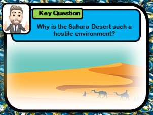
This 1 hour KS3 resource investigates the Sahara desert as a hostile environment. Pupils start by identifying patterns in the distribution of hot deserts, before considering their conditions. Students develop Geographical skills, using climate data to produce climate graphs. The atmospheric circulation model is used to help pupils understand why desert environments have such hot dry weather. A diamond 9 exercise is used to help pupils evaluate the challenges faced in desert environments.
**Bundle and save! This lesson is part of a larger bundle:- **
Development topic bundle
Check out some of my other products relating to weather and climate:-
What is development?
How can we measure development?
What are the causes of global inequality?
What are Africa’s climate zones?
How do squatter settlements affect peoples quality of life?
How does quality of life differ between HIC & LIC countries?
How can fair trade help to reduce the development gap?
This 1-2 hour KS3 lesson teaches pupils about the diverse landscapes that exist across China. Students learn to classify human and physical features and use satellite images to identify Geographical diversity. A mapping from memory exercise is used to familiarise pupils with China’s varying landscape. An source task is including, prompting pupils to consider how Geography influences population distribution.
Check out some of my other products relating to China:-
Where is China?
How is the population distributed across China?
What is rural to urban migration and why does it occur?
What are the problems of overpopulation?
How developed is China?
Was China’s one child policy an example of successful population control?
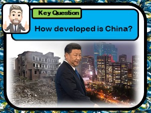
This 2 hour KS3 lesson teaches pupils how to assess development. Pupils are taught how countries are classified into LIC’s, NEE’s and HIC nations. Pupils make an initial judgement on China’s development, before delving deeper, using development indicators to reflect on China’s development. The lesson uses a fun kinaesthetic ‘Top Trumps’ style game to engage learners.
Check out some of my other products relating to China:-
Where is China?
What physical and human Geography exists across China?
How is the population distributed across China?
What is rural to urban migration and why does it occur?
What are the problems of overpopulation?
Was China’s one child policy an example of successful population control?