I am a Geography specialist who has also been teaching GCSE history for the past few years. I have uploaded some lessons for History and Geography. I hope people find them useful.
I am a Geography specialist who has also been teaching GCSE history for the past few years. I have uploaded some lessons for History and Geography. I hope people find them useful.
AQA GCSE Geography lesson for the new specification Unit 1A: In this fourth lesson in the section we look at the effects of climate change around the world.
We start with a quote from Great Thunberg and the pupils discuss whether they think she is right that we should be panicking about climate change and its impacts.
We then look briefly at climate change impacts in the UK where the pupils will annotate a map of the UK using information from a video clip. We then look at the impacts worldwide, the pupils will be given an A3 sheet with a map surrounded by the impacts, they first locate the region the where the impact will be felt, rate the seriousness of the impact and then categorise each one as either social, economic, environmental or political.
Using the information they have now gathered they write a response to Greta Thunberg’s quote using evidence from the lesson. We finish with a post-it plenary using a 2-mark question from the 2019 exam.
In a nutshell lesson includes:
Discussion starter over Greta Thunberg Quote
Annotated diagram of the impacts on the UK
A3 map task on the effects of climate change worldwide
Video clips where appropriate
GCSE-style question plenary
Hope this saves you some valuable planning time.
https://www.tes.com/teaching-resources/shop/markthegeographer
AQA GCSE Geography lesson for the new specification Unit 1C: In this lesson we look at how coastal management has been undertaken at Lyme Regis in Dorset.
The lesson has a retrieval practice starter based around a field sketch of a coastline. We firstly introduce Lyme Regis as an example of coastal management and consider which interest groups may have concerns about the construction of new sea defences. The pupils complete a worksheet where they read through the four phases of coastal management, highlight examples of hard and soft engineering and answer some questions. They then complete a map skills activity where they label on where the coastal defences have been built using 6-figure grid references. We then look at the positive and negatives of coastal management in Lyme Regis. We finish with a GCSE-style practice question with some guidance and structure provided for the students.
Hope this saves you some valuable planning time.
https://www.tes.com/teaching-resources/shop/markthegeographer
AQA GCSE Geography lesson for the new specification Unit 2B: In this lesson we look at the changing rural landscapes of the UK.
The lesson starts with a practice task. We then look at a cartoon which is showing rural-urban migration together with other geographical concepts. We then look at the reasons for people moving into rural areas. We then introduce two examples, one of rural population growth (South Cambridgeshire) and the other of rural population decline (Outer Hebrides). The pupils have a task worksheet to complete with various tasks for them to tackle. We finish with a 6-mark practice question with some guidance on how to respond.
Hope this saves you some valuable planning time.
https://www.tes.com/teaching-resources/shop/markthegeographer
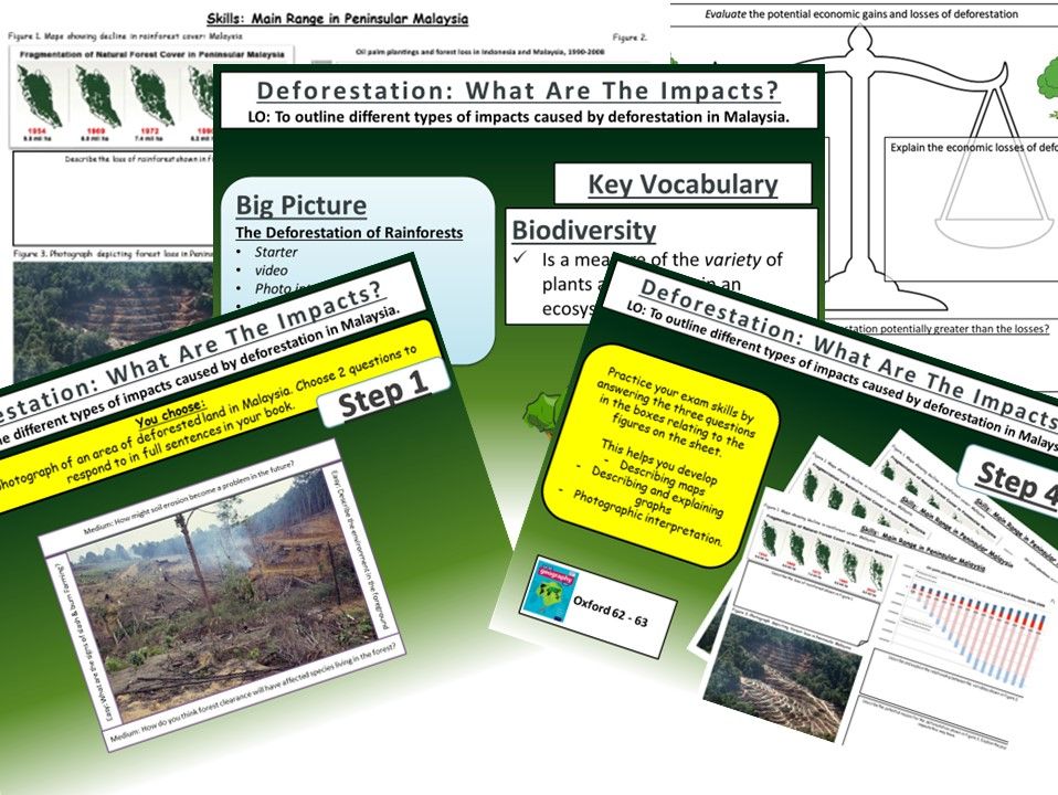
AQA GCSE Geography Lesson
This lesson requires the Oxford GCSE Geography for the AQA specification
This lesson includes a number of activities including photograph interpretation, a worksheet to help the students with an evaluation question and further skills such as map and graph interpretation. The actvities are based around the Oxford GCSE Geography for AQA.
Thanks, and hope it helps.
https://www.tes.com/teaching-resources/shop/markthegeographer
Some activities in this bundle require the blue Oxford AQA GCSE textbook for the new 2016 specification
This bundle has all the lessons required to teach the Tectonic Hazards section of unit 1A. The activities are varied and differentiated. Each lesson has a GCSE-style exam question with guidance for the students if needed. All worksheets in a format ready for printing. Some lessons do use the Oxford textbook as I have found this is the best way to teach it.
Hope this saves you some valuable planning time.
Order of the lessons is :-
The Distribution of Earthquakes and Volcanoes
Physical Processes at Plate Boundaries
The Effects of Earthquakes
Responses to Earthquakes
Living With The Risk From Tectonic Hazards
Reducing the Risk From Tectonic Hazards
https://www.tes.com/teaching-resources/shop/markthegeographer
AQA GCSE Geography lesson for the new specification Unit 2A: In this lesson we look at how London’s transport strategy and urban greening have improved the quality of life for people living in London.
We start with a retrieval practice grid based on previous learning from this section.
We then look at the green transport strategies London is adopting. Using an information sheet the pupils fill in sections on an A3 worksheet. We next look at Crossrail, the pupils consider the reasons why Crossrail was needed and the arguments for and against Crossrail before answering some questions on how it will improve quality of life in London. We move onto urban greening, using a video clip we consider the benefits of urban greening and then the pupils create a “London Eye” pie chart which they annotate to show how London is a green city and how it is continuing its urban greening.
Once we have completed the diagram we tackle a 6-mark question on how environmental change have led to an increase in the quality of life for people in a HIC city. The pupils do have some help with some points to get them going if they need it.
In a nutshell lesson includes:
Retrieval practice starter
A3 worksheet on transport in London and Crossrail
Two urban greening activities.
Video clips where appropriate
GCSE-style question with guidance
Hope this saves you some valuable planning time.
https://www.tes.com/teaching-resources/shop/markthegeographer
Complete bundle for the AQA GCSE Geography 2016 specification Unit 2a The Urban World using Lagos, Nigeria, as a case study.
All lessons have a variety of differentiated activities, skills tasks, video clips. exam-style questions with guidance and photocopying/printing ready worksheets and handouts.
The order of the lessons is
Urbanisation: An Increasingly Urban World
Megacities: The Emergence of Megacities
Introducing Lagos
Growing Lagos
Social Challenges in Lagos
Economic Challenges In Lagos
Improving Lagos’ Environment
Squatter Settlements in Lagos
Urban Planning in Lagos
I hope this saves you valuable planning time!
https://www.tes.com/teaching-resources/shop/markthegeographer
AQA GCSE Geography lesson for the new specification Unit 2A: In this lesson we look at economic opportunities in London, focusing on the regeneration of the London Docklands.
We start with a photo interpretation of the London Docklands in the late 1970s. The pupils start to think about why the area has declined and how it might affect the residents.
We then introduce the concept of urban regeneration and start by looking at the history of the Docklands and the pupils complete spray diagram of reasons why the area feel into disuse. We then look at the London Docklands Development Corporation (LDDC) and the pupils create an annotated diagram ‘the road to regeneration’ using information from the board.
Once we have completed the diagram we tackle a 6-mark question on economic improvements in a HIC city. The pupils do have some help with some points to get them going if they need it.
In a nutshell lesson includes:
Photo interpretation starter
Several tasks around the London Dockland’s and the LDDC
Video clips where appropriate
GCSE-style question with guidance
Hope this saves you some valuable planning time.
https://www.tes.com/teaching-resources/shop/markthegeographer
AQA GCSE Geography lesson for the new specification Unit 2A: In this lesson we look at the environmental challenges of urban sprawl and housing provision in London.
We start with a retrieval practice grid with questions based on the London unit so far (but you just amend to whatever you want).
We then look at what urban sprawl is, we then consider the advantages and disadvantages of urban sprawl in a spray diagram. The pupils are given some sentence starters to help them consider what they might be. We move on to consider if there is a housing shortage in London. We use house prices as a proxy for this and the pupils spend some time working with a graph of house prices and completing some questions related to the graph.
We then consider the options London has of developing on either brownfield or greenfield sites. The pupils complete a photo annotation task on the two types and what the advantages and disadvantages of building on both types are. We then move on to a mapping activity where the pupils map the available greenfield and brownfield sites for development. They answer some questions related to London’s options to solve its housing problems and what the impact on the environment might be.
Once we have completed the diagram we tackle a 6-mark question on the effects of urban sprawl on the environment and people. There is guidance should the pupils need it.
In a nutshell lesson includes:
Retrieval practice starter
Benefits and drawbacks of urban sprawl diagram task
Greenfield and brownfield photo annotation task
Video clips where appropriate
Mapping London’s greenfield and brownfield sites task.
GCSE-style question with guidance or live writing exercise.
Hope this saves you some valuable planning time.
https://www.tes.com/teaching-resources/shop/markthegeographer
AQA GCSE Geography lesson for the new specification Unit 2A: In this lesson we look at how urban change has led to social and economic inequalities in London.
The starter is called “perfect paragraph?” The pupils will see a response to a GCSE-style question and need to spot the errors in the paragraph, we then discuss if anything needs adding to the answer.
We then look at inequalities in London and we use an Iceberg Analysis to determine causes of social inequalities and short and long terms effects. The short term effects go in the iceberg above the water. The longer term effects go underneath the water. We then consider what indicators could we use to map social deprivation. We use percentage of people on benefits as an indicator and the pupils create a choropleth map of London. We consider the pattern and the pupils look at what the benefits and drawbacks of presenting the data this way is.
Once we have completed the diagram we tackle a 6-mark question on social inequalities in a HIC city. I usually do this as a live writing exercise, but there is guidance should the pupils need it.
In a nutshell lesson includes:
Perfect Paragraph Starter
Iceberg analysis of cause and effects of social inequalities
Choropleth map activity using percentage of people claiming benefits as an indicator.
GCSE-style question with guidance or live writing exercise.
Hope this saves you some valuable planning time.
https://www.tes.com/teaching-resources/shop/markthegeographer
AQA GCSE Geography lesson for the new specification Unit 1A: In this sixth lesson in the section we look at how we can adapt to climate change.
We start with a simple retrieval practice quiz on international agreements from last lesson,
We then look at 3 ways in which we may have to adapt in the future to cope with climate change, in agriculture, water supply and sea-level rise. We look at specific examples for water supply (the artificial glaciers in the Himalayas) and sea-level rise (the Maldives).
We finish the lesson with a GCSE-style question post-it plenary.
In a nutshell lesson includes:
Retrieval prctice starter
Photograph annotation task for agriculture
Video notes task for artificial glaciers in the Himalayas
Hexagon task for sea level rise in the Maldives
Video clips where appropriate
GCSE-style question post-it plenary.
Hope this saves you some valuable planning time.
https://www.tes.com/teaching-resources/shop/markthegeographer
included in the bundle are all the lessons for the AQA Water Management Section of Unit 2C. All the lessons are fully resourced and differentiated. Each is at least 1 hour long (some will be several lessons), include practice questions, video clips were appropriate, photocopying ready to print. key vocab and follow the Oxford textbook.
One lesson does use the AQA Oxford Textbook (The Lesotho highland Water Project), but can easily be taught without.
Lesson titles in order are:
Global Water Supplies
The Impact of Water Insecurity
How Can Water Supply Be Increased?
The Lesotho Highland Water Project
Sustainable Water Supplies
The Wakel River Basin Project
Hope this saves you valuable planning time.
https://www.tes.com/teaching-resources/shop/markthegeographer
AQA GCSE Geography lesson for the new specification Unit 2A: In this lesson we look at air quality and waste management issues in London.
There is a photo interpretation starter around landfill in London, e usually discuss how landfill and disposal is not a sustainable method of waste disposal.
We then look at air quality in London, we consider the causes of poor air quality in the city and the pupils explain the causes using the hexagons. We then consider which is the most likely cause of air pollution in London. We then use nitrogen dioxide as a proxy for air pollution and the pupils create a map to show where the concentrations are high. We discuss why this might be. We briefly look at London’s cycle super highways as a potential solution to air pollution.
Moving on to waste management the pupils create a pie chart to show how London disposes of its waste, we use the pie chart and look at the city of London’s hierarchy for dealing with waste and consider how successful they have been at meeting their targets.
Once we have completed the diagram we tackle a 6-mark question on waste disposal. There is guidance should the pupils need it.
In a nutshell lesson includes:
Photo Interpretation Starter
Causes of air pollution hexagon task.
Mapping activity using nitrogen dioxide as a proxy for air pollution
Video clips where appropriate
Pie chart activity
GCSE-style question with guidance or live writing exercise.
Hope this saves you some valuable planning time.
https://www.tes.com/teaching-resources/shop/markthegeographer
AQA GCSE Geography lesson for the new specification Unit 2B: In this lesson we look at the place of the UK in the wider world.
The lesson starts with a quick retrieval practice quiz true or false quiz. We then introduce some of the organisations that the UK is a member of and how this can give the UK global influence. The pupils then use a hexagon template to create an annotated diagram on our trade, transport, cultural and communication links. We then consider the UK’s relationship with the EU post-brexit and remind ourselves of how the UK left the EU. The pupils complete a cost/benefit analysis of this with explanation. We then look at the Commonwealth and the pupils complete an exercise that looks at the diversity of countries size and economies using indicators (Atlas or internet access needed). We then finish with a GCSE-style practice question with some guidance.
Hope this saves you some valuable planning time.
https://www.tes.com/teaching-resources/shop/markthegeographer
AQA GCSE Geography lesson for the new specification Unit 1C: In this lesson we look at types of hard engineering and where they are best applied.
The starter is a quiz where the pupils need to select the squares that have a depositional landform. There are sound effects too so it’s all very exciting.
We begin by looking at why certain areas of the coast need protecting and what factors go into consideration when planners are deciding whether or not to protect the coastline. The pupils are then given some information cards and a worksheet to fill in on the different types of hard engineering, they also have a visual scale to shade in for each one according to it’s effectiveness and durability, cost and sustainability. This can be done in a number of ways (group work, round the room, carousel etc). We then seek to apply this knowledge though the pupils completing a decision making exercise. This is based on a fictional town (Sandytown). The town has been divided into zones, the pupils read the information on each zone and decide what type fo hard engineering that zone needs and justify this.
We finish with a 6 mark question on hard engineering with some guidance on how they can answer this.
In a nutshell lesson includes:
Interactive starter quiz on depositional landforms.
Video clip.
Hard engineering worksheet with visual scale.
Decision making exercise activity.
6-mark GCSE-style question with guidance should the pupils need it.
Hope this saves you some valuable planning time.
https://www.tes.com/teaching-resources/shop/markthegeographer
AQA GCSE Geography lesson for the new specification Unit 1C: In this lesson we look at coastal landforms along the Swanage coastline.
The starter is called “perfect paragraph?” The pupils will see a response to a GCSE-style question and need to spot the errors in the paragraph, we then discuss if anything needs adding to the answer.
We introduce Swanage to the pupils and its location. The pupils will be working on an A3 sheet of paper that will become a revision resource for them in the future. We start by locating Swanage and the pupils describe its location using geographical language. We the look at the discordant and concordant sections of the coastline and the pupils create an annotated map showing the locations of the landforms we will study as well as an explanation of how the geology affects the coastline. We then look at Old Harry Rocks. The pupils will do a field sketch from photograph which they then label to show all the features on the landform. We then look at Lulworth Cove and how it has formed on a concordant coast. The pupils create a 3 stage diagram to show how this formed., they annotate this too/
We finish with a post-it plenary based on a short question regarding the content of the lesson.
In a nutshell lesson includes:
Perfect paragraph? Starter.
A3 poster worksheet with a variety of activities on the landforms around Swanage.
Video clip.
Post-it plenary.
Hope this saves you some valuable planning time.
https://www.tes.com/teaching-resources/shop/markthegeographer
AQA GCSE Geography lesson for the latest specification Unit 1B: In this lesson we look at the types of erosional landforms you find in glaciated landscapes.
The starter is just a quick coast-themed retrieval practice quiz which has been left blank so you can add your own questions.
We start by looking at the erosive power of glaciers and how corries form in highland areas. The pupils create a sequential diagram to show how a corrie forms from small nivation hollows. We then look at aretes and pyramidal peaks with examples of each and then look at how erosion has created a variety of further highland erosional features when the pupils annotate a diagram of a highland glaciated area. We finish with a 6 mark GCSE-style exam question with guidance on how to answer it. The lesson also uses some video clips to help the pupils visualise these features.
Hope this saves you some valuable planning time.
https://www.tes.com/teaching-resources/shop/markthegeographer
AQA GCSE Geography lesson for the latest specification Unit 1B: In this lesson we look at transportation and depositional landforms such as moraines, drumlins and erratics.
The starter is glaciation-themed retrieval quiz.
We then look at the idea of the glacial conveyor belt, what glacial till is and what the difference between sorted and unsorted material is and why they form in different environments. The pupils create diagrams of both. We then consider moraines and the different types of moraines. The pupils have a diagram to annotate and label. We then consider drumlins, the pupils again create diagrams and learn why they show direction of movement and collective called ‘basket of eggs’ topography. We then briefly look at erratics and how they can also show the history of glacier movement. We finish with a 4 mark GCSE-style exam question with guidance on how to answer it.
Hope this saves you some valuable planning time.
https://www.tes.com/teaching-resources/shop/markthegeographer
AQA GCSE Geography lesson for the latest specification Unit 1B: In this lesson we look at the processes of weathering, erosion, transportation and deposition in glacial environments.
The starter is just a quick photo mystery around glacial deposits.
We then look at the extent of the ice sheet during the Last Glacial Maximum (LGM). We introduce freeze-thaw weathering as the principle type of weathering in glacial environments as the pupils create a sequential diagram. The pupils are provided with a diagram to annotate for the processes of abrasion and plucking. We watch a video on the transportation of material by the glacier and the pupils create a diagram. They then construct a paragraph on transportation by guessing the missing words using the picture prompts. They also construct a paragraph on deposition based on sentence fragments. We finish with a 4 mark GCSE-style exam question with guidance on how to answer it.
Hope this saves you some valuable planning time.
https://www.tes.com/teaching-resources/shop/markthegeographer
This bundle includes all lessons on Lagos for the AQA specification Unit 2 section A.
Lessons include a variety of activities, video clips, exam-style questions and worksheets ready to print or copy.
the sequence of lessons is :
Introducing Lagos
Growing Lagos
Social challenges in Lagos
Economic challenges in Lagos
Improving Lagos’ environment
Managing Squatter Settlements in Lagos
Urban planning in Lagos
Hope this saves you some valuable planning time.
https://www.tes.com/teaching-resources/shop/markthegeographer