I've worked in primary teaching for over 10 years and specialise in creating fun and engaging educational resources, particularly for Geography and History.
I've worked in primary teaching for over 10 years and specialise in creating fun and engaging educational resources, particularly for Geography and History.
This lesson is part of Understanding Trade, a Geography unit designed for students in upper KS2 (Y5-6).
First the presentation helps students understand what trade is and introduces the concepts of imports and exports. It does this by linking these ideas to every day products we buy. It also looks at the different scales of trade – local, national and international.
The activity then challenges students to match up products with statements about the company which makes them and where they are produced/manufactured.
Easier – Match the products to the statements (on stickers)
Harder – Match the products to the statements (written)
Extension – Students complete a cloze procedure paragraph about trade.
If you like this resource, we would appreciate a review! We will happily send you a free resource in return for a review or useful suggestions/feedback. Contact us at ed@teachitforward.co.uk.
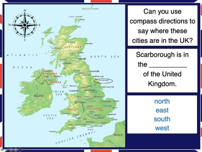
This lesson is part of Exploring the United Kingdom, a Geography unit designed for KS1 and lower KS2 (Y2-4).
N.B. If students are new to compass directions, use Introduction to compass directions to introduce the topic prior to this lesson.
First the presentation reminds students of the four cardinal compass directions. It then encourages them to use compass directions to describe the position of towns and cities around the UK.
In the activity, students have to find UK cities using compass clues. There are two differentiated activity worksheets:
Easier – Students locate cities using compass clues and starting letter clues.
Harder – Students locate cities using compass and harder starting letter clues.
Extension – Students complete cloze procedure sentence about the location of cities in the UK.
If you like this resource, we would appreciate a review! We will happily send you a free resource in return for a review or useful suggestions/feedback. Contact us at ed@teachitforward.co.uk.
This lesson is designed for KS2 students and is a great introduction to any volcanoes or earthquakes topic. It can be taught as a stand alone lesson but is also available as part of three wider units, all of which are available on TES:
-Volcanoes
-Earthquakes
-Volcanoes & Earthquakes
The presentation investigates the structure of the Earth and looks into the basic composition of the inner core, outer core, mantle and crust.
Students then complete an activity which is differentiated three ways:
Easier – Students label layers of the Earth and complete cloze procedure paragraph (6 gaps).
Medium – Students label layers of the Earth and complete cloze procedure paragraph (10 gaps).
Harder – Students label layers of the Earth – including drawing arrows – and complete cloze procedure paragraph (10 gaps).
Extension – Students think about what they would like to find out about volcanoes or earthquakes or both, depending on which topic you are doing.
If you like this resource, we would appreciate a review! We will happily send you a free resource in return for a review or useful suggestions/feedback. Contact us at ed@teachitforward.co.uk.
This lesson is designed for KS2 students. It can be taught as a stand alone lesson but is also available as part of two wider units, both of which are available on TES:
-Volcanoes
-Volcanoes & Earthquakes
The presentation investigates the five deadly features of a volcanic eruption including volcanic ash, lava flows, volcanic bombs, pyroclastic flows and mud flows (or ‘lahars’).
The activity challenges students to match pictures of each feature to a description. It is differentiated four ways:
Easier – Students match pictures of the five features of a volcanic eruption to the descriptions.
Medium – Students complete cloze procedure sentences. They then match pictures to each description.
Harder – Students complete cloze procedure sentences. They then match pictures to each description and add a title for each section.
Hardest – Children stick pictures of the five features of a volcanic eruption in their books and write their own description next to each one.
Extension – Which feature of a volcanic eruption do children think is the most deadly? Can they explain their answer?
If you like this resource, we would appreciate a review! We will happily send you a free resource in return for a review or useful suggestions/feedback. Contact us at ed@teachitforward.co.uk.
Exploring the UK is a Geography unit suitable for KS1 and lower KS2 (Y2-4).
The planning overview, topic title page and vocabulary page can be downloaded for free here. Lessons include:
L1 – Identifying the countries and capitals of the UK & Ireland (FREE)
L2 – Locating UK cities using compass directions
L3 – Identifying human & physical features of the UK
L4 – Investigating satellite photos of the UK
L5 – Comparing the city and the countryside
L6– Identifying famous features and characteristics of countries of the UK
L7 – Identifying flags of the United Kingdom
L8 – Identifying the four seasons of weather in the UK
Optional lesson – Identifying the countries and capital cities of Europe
Each lesson includes a presentation and differentiated activities/worksheets.
If you like this resource, we would appreciate a review! We will happily send you a free resource in return for a review or useful suggestions/feedback. Contact us at ed@teachitforward.co.uk.
This lesson is designed for KS2 children. It can be taught as a stand alone lesson but is also available as part of two wider units, both of which are available on TES:
-Earthquakes
-Volcanoes & Earthquakes
The presentation investigates the five deadly features of earthquakes including ground shaking, tsunamis, landslides, raising/lowering of land and liquefaction.
It is followed up by an activity which is differentiated four ways:
Easier – Students match pictures of the five features of an earthquake to descriptions.
Medium – Students complete cloze procedure sentences. They then match pictures to each description.
Harder – Students complete cloze procedure sentences. They then match pictures to each description and add a title for each section.
Hardest – Students stick pictures of the five features of an earthquake in their books and write their own description next to each one.
Extension – Can students unscramble the jumbled up earthquake facts?
If you like this resource, we would appreciate a review! We will happily send you a free resource in return for a review or useful suggestions/feedback. Contact us at ed@teachitforward.co.uk.
This lesson is part of Understanding Trade, a Geography unit designed for students in upper KS2 (Y5-6).
The presentation first asks students to think about how the products we buy arrive in the shops. It then introduces the concept of supply chains. To explain this concept, students look at the processes involved in the production of milk.
There are two activities:
Group Activity:
Students sort and sequence four mixed up supply chains including those of bananas, T-shirts, bookshelves and coffee.
Individual Activity:
Students sequence the supply chains of bananas, T-shirts, bookshelves and coffee.
Easier – Students sequence supply chains (first and last process given)
Harder – Students sequence supply chains (no clues)
If you like this resource, we would appreciate a review! We will happily send you a free resource in return for a review or useful suggestions/feedback. Contact us at ed@teachitforward.co.uk.
This lesson is part of Exploring Spain, a Geography unit designed for upper KS2 students (Y4-6), but can also be taught as a stand alone lesson.
Students first learn about the Iberian peninsula. They then explore some of the main geographical features of Spain itself and categorise these into human (e.g. cities) and physical (e.g. mountains).
The activity challenges students to identify these features on a map of Spain. It is differentiated two ways:
Easier – Students identify human & physical features of Spain using a colour-coded map and word bank
Harder – Students identify human & physical features of Spain using a map & word bank
Extension – Students complete a cloze procedure text about the human and physical geography of Spain.
If you like this resource, we would appreciate a review! We will happily send you a free resource in return for a review or useful suggestions/feedback. Contact us at ed@teachitforward.co.uk.
Earthquakes is an exciting Geography unit designed for students in KS2.
The planning overview, topic title page and vocabulary page can be downloaded for free here. Lessons include:
L1 – Understanding the structure of the Earth
L2 – Understanding tectonic plates
L3 – Understanding the causes of earthquakes
L4 – Investigating the five deadly features of an earthquake
L5 – Researching earthquakes using Wikipedia
L6 – Locating the world’s biggest earthquakes using latitude & longitude
L7 – Writing a fact file about a famous earthquake
Each lesson includes a presentation and differentiated activities/worksheets.
If you like this resource, we would appreciate a review! We will happily send you a free resource in return for a review or useful suggestions/feedback. Contact us at ed@teachitforward.co.uk.
This lesson is part of Mountain Environments, a Geography unit designed for students in upper KS2 (Y4-6).
First the presentation introduces some of the most famous mountain ranges from around the world.
The differentiated activity then challenges students to locate the world’s mountain ranges and encourages them to use and explore atlases. It is recommended that students do the activity in pairs.
Easier – Students identify the world’s famous mountain ranges (less writing).
Medium – Students identify the world’s famous mountain ranges (first letter clues)
Harder – Students identify the world’s famous mountain ranges (no clues)
If you like this resource, we would appreciate a review! We will happily send you a free resource in return for a review or useful suggestions/feedback. Contact us at ed@teachitforward.co.uk.
This lesson is part of The Seaside, a Geography unit designed for students in KS1 and lower KS2, but can also be taught as a stand alone lesson.
The presentation takes students on a tour of eight seaside towns and cities around the United Kingdom including: Ayr and St Andrews in Scotland; Aberystwyth in Wales; Blackpool and Newquay in England.
The activity then challenges students to use their map skills to locate these towns and cities on a map of the UK. This can be done using an atlas or the prompt maps included.
Easier - Students label 8 seaside towns and cities using a prompt map.
Medium - Students label 12 seaside towns and cities using a prompt map.
Harder - Students label 12 seaside towns and cities using an atlas.
Extension - Students locate and label 2 further seaside towns and cities from each country of the UK.
If you like this resource, we would appreciate a review! We will happily send you a free resource in return for a review or useful suggestions/feedback. Contact us at ed@teachitforward.co.uk.
This lesson is part of Exploring the United Kingdom, a Geography unit designed for KS1 and lower KS2 (Y2-4).
The presentation first explains how every country – just like people – has its own special features and characteristics. It then introduces a variety of famous UK landmarks, sports and foods and challenges students to work out whether each is from England, Scotland, Wales or Northern Ireland.
The activity can be done in two ways:
Partner activity:
In mixed ability partners, students match 20 features and characteristics to the four UK countries.
Individual activity:
Students match 20 features/characteristics to the four UK countries.
Easier – Students match features/characteristics to each country (using stickers with labels).
Harder – Students match features/characteristics to each country and label each one (using stickers without labels).
If you like this resource, we would appreciate a review! We will happily send you a free resource in return for a review or useful suggestions/feedback. Contact us at ed@teachitforward.co.uk.
Exploring Brazil is a Geography unit designed for students in KS2 (Y4-6).
The planning overview, topic title page and vocabulary page can be downloaded for free here. Lessons include:
L1 – Identifying the countries and capitals of South America
L2 – Writing a Brazil fact file
L3 – Using 4 and 6-figure grid references to locate Brazilian cities
L4 – Identifying the human and physical features of Brazil
L5 – Exploring Brazil’s ecosystems
L6 – Investigating Brazil’s weather and climate
Each lesson includes a presentation and differentiated activities/worksheets.
If you like this resource, we would appreciate a review! We will happily send you a free resource in return for a review or useful suggestions/feedback. Contact us at ed@teachitforward.co.uk.
This lesson is part of a wider unit called Exploring St Lucia and is designed to teach KS2 students about a contrasting non-European country.
This lesson looks at similarities and differences between St Lucia and the UK including:
– location in the world
– population
– languages
– currency
– heads of state
– physical geography
– types of employment
In the partner activity students sort statements about the countries into two groups – those describing St Lucia and those describing the UK. It is differentiated two ways:
Easier – Students sort statements about St Lucia and the UK (using stickers and a worksheet).
Harder – Students sort statements about St Lucia and the UK (completed in an exercise book).
Extension – Students think of similarities & differences between St Lucia and the UK.
If you like this resource, we would appreciate a review! We will happily send you a free resource in return for a review or useful suggestions/feedback. Contact us at ed@teachitforward.co.uk.
This resource is part of Exploring Australia, a Geography unit designed for students in upper KS1 and lower KS2 (Y2-Y4). All resources are compatible with both Microsoft Office and Google Workspace.
First the presentation compares and contrasts the UK and Australia, specifically focusing on:
-Location in the world
-Size/population
-Languages spoken
-Climate
-Native animals
-Famous landmarks
The activity then challenges students fill in a table comparing the UK and Australia.
Easier - Students fill in information for 7 categories (with vocab hints).
Harder - Students fill in information for 9 categories (no vocab hints).
Extension - Students identify whether animals are native to the UK or Australia.
If you like this resource, we would appreciate a review! We will happily send you a free resource in return for a review or useful suggestions/feedback. Contact us at ed@teachitforward.co.uk.
The Seaside is a Geography unit designed for students in upper KS1 and lower KS2 (Y2-Y3).
The planning overview, topic title page and vocabulary page can be downloaded for free here. Lessons include:
L1 – Identifying features of the seaside
L2 – Identifying human and physical features of the seaside
L3 – Locating seaside towns and cities of the UK
L4 – Investigating a seaside town - Lyme Regis
L5 – Identifying islands of the United Kingdom
L6 – Investigating what life is like on a small island
L7 - Packing for a seaside holiday
Each lesson includes a presentation and differentiated activities/worksheets.
If you like this resource, we would appreciate a review! We will happily send you a free resource in return for a review or useful suggestions/feedback. Contact us at ed@teachitforward.co.uk.
Exploring Spain is a Geography unit suitable for KS2 (Y4-6).
The planning overview, topic title page and vocabulary page can be downloaded for free here. Lessons include:
L1 – Writing a Spain fact file
L2 – Identifying human and physical features of Spain
L3 – Using 8 points of the compass to locate cities in Spain
L4 – Using 4-figure grid references in Spain
L5 – Investigating Spain’s weather and climate
L6 – Taking a tour of Madrid
Optional lesson – Identifying the countries and capital cities of Europe
Each lesson includes a presentation and differentiated activities/worksheets.
If you like this resource, we would appreciate a review! We will happily send you a free resource in return for a review or useful suggestions/feedback. Contact us at ed@teachitforward.co.uk.
This fun jigsaw activity is a great geography resource for reinforcing children’s knowledge of the world.
It is also available as part of the Our World topic, an introduction to the geography of Planet Earth for KS1 and lower KS2
The presentation introduces students to a map of the world and highlights physical features including the continents, oceans, rivers and mountain ranges.
The jigsaw puzzle activity is differentiated six ways. The age brackets below are a rough guide:
6 pieces – EYFS
12 pieces – EYFS/Y1
24 pieces – Y1/2/3
36 pieces – Y2/3/4
48 pieces – Y3/4/5
60 pieces – Y4/5/6
A guide map is included for students in Early Years and KS1. Challenge more able KS2 students to complete the puzzle without the guide map.
If you like this resource, we would appreciate a review! We will happily send you a free resource in return for a review or useful suggestions/feedback. Contact us at ed@teachitforward.co.uk.
This lesson is part of Understanding Trade, a Geography unit designed for students in upper KS2 (Y5-6).
First the presentation asks students to consider how everyday products arrive in our supermarkets. It then introduces and explains the concept of supply chains, looking specifically at the chocolate supply chain. There are two activities:
Group Activity:
The group activity challenges students to order the chocolate supply chain.
Writing Activity:
An accompanying writing activity is based on ‘The Story of Our Chocolate Journey’ (available on YouTube). It challenges students to sequence and explain the processes involved in the chocolate supply chain. It is differentiated three ways:
Easier – Students use a writing frame.
Harder – Students write in an exercise book using a vocabulary prompt.
If you like this resource, we would appreciate a review! We will happily send you a free resource in return for a review or useful suggestions/feedback. Contact us at ed@teachitforward.co.uk.
This lesson is part of Understanding Trade, a Geography unit designed for students in upper KS2 (Y5-6).
The presentation starts by recapping what imports and exports are. It goes on to look at the UK’s top ten exports – mainly manufactured products – and the human and physical factors which help UK exports in this area.
In the activity, students use Microsoft PowerPoint to create a table of the UK’s top ten exports. They then use an online chart maker to produce either a pie chart or bar graph to illustrate this data. It is differentiated three ways:
Easier – Students use step-by-step instructions with some data already filled in
Medium – Students use step-by-step instructions
Harder – Minimal instructions – IT experts only!
If you like this resource, we would appreciate a review! We will happily send you a free resource in return for a review or useful suggestions/feedback. Contact us at ed@teachitforward.co.uk.