NGfL Cymru was a website funded by the Welsh Government. The resources on TES are a legacy of this project. The content or format of these resources may be out of date. You can find free, bilingual teaching resources linked to the Curriculum for Wales on hwb.gov.wales.
NGfL Cymru was a website funded by the Welsh Government. The resources on TES are a legacy of this project. The content or format of these resources may be out of date. You can find free, bilingual teaching resources linked to the Curriculum for Wales on hwb.gov.wales.
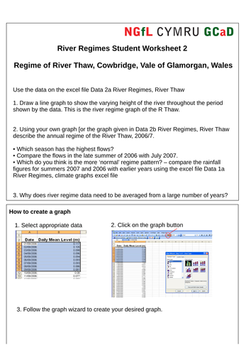
Excel data files of monthly rainfall and river height in S Wales are used to construct and analyse climate and river regime graphs as both whiteboard and independent student activities.
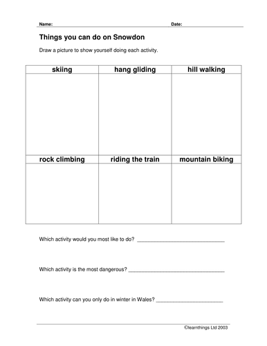
This resource is aimed at year 1 and 2 pupils. It takes them through the following steps:
* identifying geographical features such as a hill, mountain and river, and extending geographical vocabulary
* locating Snowdon on a map of Wales
* identifying activities that could be done on a mountain
* recognising features on a walk up a mountain
A series of whiteboard activities, investigations and up to date case studies that support the teaching of climate change. This resource adds to the understanding of the Key Questions in UNIT G1, Changing Physical Environments, Investigating Climate Change section of the WJEC AS GCE in Geography.
These activities do not attempt to cover the whole theme and can easily be incorporated into other resources and teaching and learning approaches.
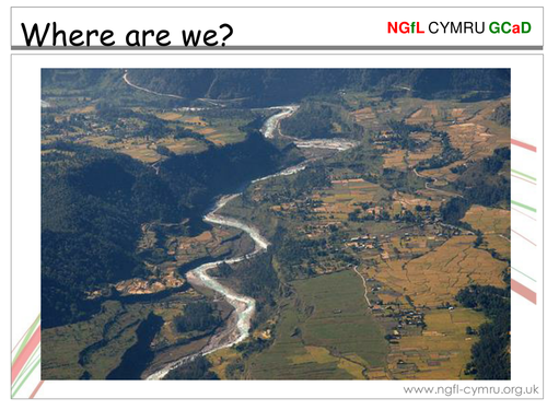
A thematic approach to delivering the skills of the new curriculum through the topic of Nepal.
The unit includes comprehensive teacher guidance with links to the skills framework, interactive and printable resources, videos and soundfiles.
A Decision-Making-Exercise, using virtual fieldwork, on the best option to reduce river flooding in Cowbridge area, contains data on the history of flooding in the area, outlines of the different options considered by Environmental Agency Wales, the different economic costs and the environmental impact once built. Whiteboard and independent student activities use OS maps, constructor’s diagrams, old newspapers, spider diagrams, calculations. Photographs with sound commentary allow students to visualise and assess the success of the chosen scheme
A unit of work to support understanding of the section on World Trade in the WJEC GCSE Geography (A) specification. The unit includes comprehensive notes with appropriate animations, a glossary of terms, activities to test understanding and model exam answers to questions. Pupils could use the units within their own study and parts could be used for whole class discussions. The materials are also suitable for other some exam board specifications.
The teacher delivering these activities must familiarise him/herself with the Outdoor Learning Cards prior to undertaking the lessons in this unit. The lessons here are pitched at an average ability level, but there may be requirements to adapt the lesson to different classes. The differentiation and progression sections on the O.L.C’s will aid in this process.
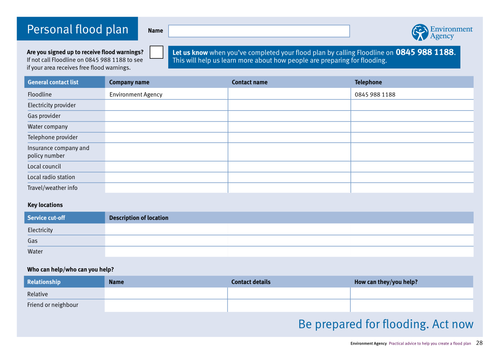
Links to interactive flood maps on the Environment Agency website. Floodplans may be developed for home and school. These activities make use of the flooding information and information on river and sea levels provided by the Environment Agency so that people living in flood risk areas are better informed and can decide what actions to take as the water levels change. For more materials relating to this resource, please visit the NGfl site, linked below.
A series of detailed resources with interactive elements and relevant tasks to support students studying in preparation for the U2 exam. The units contain materials that require the students to draw on relevant Knowledge, to make decisions, to solve problems and to evaluate issues. Much of the material can be printed out and there are numerous references to useful websites.
This unit uses animation to explain the formation of hanging valleys.
Processes such as plucking and abrasion are exemplified and images from Snowdonia and beyond are used to show how these processes have created the landscape.
A resource that helps students learn about urban land use patterns using the Burgees and Hoyt models.
By the end of this lesson students should:
* understand that urban areas consist of a number of land use zones or functions
* be able to define the term 'land use model'
* understand that models show simple patterns of land use, which can explain the complicated growth of a city
* know that there are two main land use models that apply to urban areas in MEDCs