I'm a Geography teacher with experience educating at various levels, ranging from mainstream schools, SEN and extra-curricular tuition. I also have experience in teaching humanities, English and PSHE topics. My resources are designed primarily as schemes of works for mainly Geographical topics with all levels considered
I'm a Geography teacher with experience educating at various levels, ranging from mainstream schools, SEN and extra-curricular tuition. I also have experience in teaching humanities, English and PSHE topics. My resources are designed primarily as schemes of works for mainly Geographical topics with all levels considered
This 31 page booklet gives students the opportunity to explore UEFA Euro, France and their connections to geography using different Geographical themes and skills. Chapters include:
Why Is Football So Popular?
How Is Football Linked To Geography?
Who Are UEFA?
Who’s Taking Part In 2016?
Friendly Rivals
We Are Number One!
Football As An Economic Activity
Flag Crossword
Getting The Vote
What Do You Know About France?
Where In France?
Population And Nationality
Country Climate
Seeing The Sites
What Have We Borrowed?
Build A Brand
Knowing The Neighbours
Football Acrostic
How Is This Omar Linked To Football?
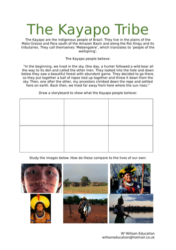
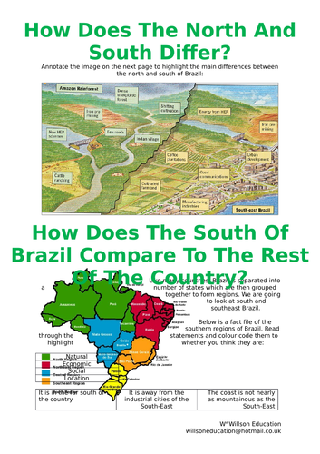
The Kayapo are the indigenous people of Brazil. They live in the plains of the Mato Grosso and Para south of the Amazon Basin and along the Rio Xingu and its tributaries. They call themselves ‘Mebengokre’, which translates to ‘people of the wellspring’.
These worksheets have the students explore the Kayapo’s beliefs, examine the differences and simalarities between us and them, as well as giving them an opportunity to research the tribe by answering their peers questions about them
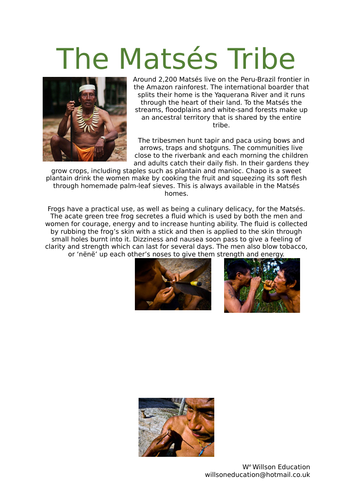
Around 2,200 Matsés live on the Peru-Brazil frontier in the Amazon rainforest. The international boarder that splits their home is the Yaquerana River and it runs through the heart of their land. To the Matsés the streams, floodplains and white-sand forests make up an ancestral territory that is shared by the entire tribe.
These worksheets have the students look closely at the acate green tree frog which, as well as being a culinary delicacy, are used to increase hunting ability. Additionally the students investigate an oil company who are exploring the Matses’s land to drill.
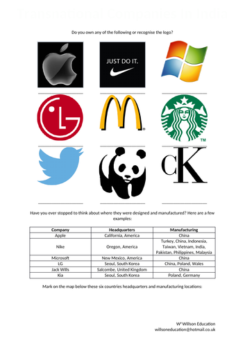
These worksheets look at the large companies and their locations around the work, then focus primarily on a Nike case study in India and the positives and negatives it brings to LEDCs
This lesson allows students to explain how and why people use the Alps, the physical and human attractions of the mountains and the environmental impacts these have
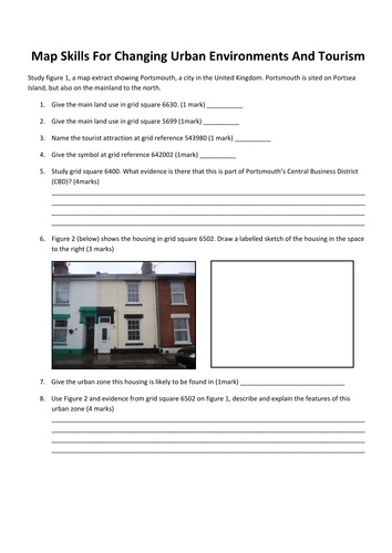
This worksheet uses Portsmouth as its bases for students to revise map skills such as grid references, sketching, housing zones and human and physical tourists attractions
Like many countries, Brazil is separated into a number of states which are then grouped together to form regions. These worksheets look primarily at south and southeast Brazil.
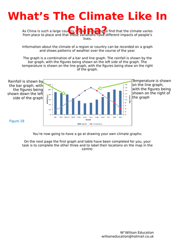
As China is such a large country it’s not surprising to find that the climate varies from place to place and that these variations have different impacts of people’s lives.
These worksheets help students to understand climate graphs, how to read ad draw them. They also give them a chance to develop their own graph and peer mark eachothers ideas with supporting comments.
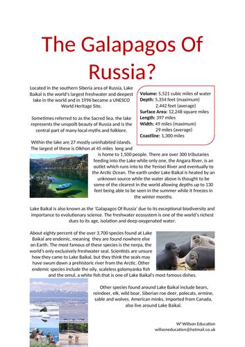
Located in the southern Siberia area of Russia, Lake Baikal is the world’s largest freshwater and deepest lake in the world and in 1996 became a UNESCO World Heritage Site.
Sometimes referred to as the Sacred Sea, the lake represents the unspoilt beauty of Russia and is the central part of many local myths and folklore. Lake Baikal is also known as the ‘Galapagos Of Russia’ due to its exceptional biodiversity and importance to evolutionary science. The freshwater ecosystem is one of the world’s richest dues to its age, isolation and deep oxygenated water.
These worksheets have the students research some of the unique flora and fauna which is found Lake Baikal and discusses the best stratagies to help protect these from the increasing number of visitors to the area.
Dark tourism has been around for many hundreds, if not thousands of years, but is only now coming to the fore. Dark tourism refers to the specific locations’ tourists visit due to their links to death or tragedy. There are many theories as to why people are attracted to these places.
This worksheet is a simple introduction to the topic looking at how similar destinations advertise themselves, whether it is thought right to advertise these places as ‘attractions’ and whether there is a location they would like to visit of the same genre.
These questions could be an interesting way to begin a unit on a tragic episode in our planets history and explain how we could learn from our past.
Please like and follow us on Facebook @WillsonEducation or Pinterest @willsoned for more exciting resources, activities, and upcoming events to incorporate into your lessons.
The Maasai Tribe live and farm in the savanna. Unfortunately, in the past fifty years the Maasai way of life has had to change due to pressures from commercial and government policies. As a result, the ecosystem has also started to suffer. The students’ task is to produce a project booklet about the Maasi Tribe including their location, statistics, gender roles, homes, dress, and culture. As well as the problems facing the tribes from tourism and desertification for example.
Please like and follow us on Facebook @WillsonEducation, Instagram @willsoneducation and Pinterest @willsoned for more exciting resources, activities, and upcoming events to incorporate into your lessons.
When looking at maps we can find it difficult to imagine what the landscape looks like if we were actually there. This worksheet explains how to draw a cross-section of Jeju Island, South Korea, by using the contours on a map and following a simple flow diagram.
Please like and follow us on Facebook @WillsonEducation or Pinterest @willsoned for more exciting resources, activities, and upcoming events to incorporate into your lessons.
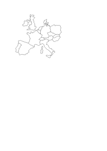
A four part quiz where students need to name the country by looking at its outline, name the landmark and where it is, general knowledge and name that song...Just a little fun for the end of term
This PowerPoint is divided into geographical topics and emphasizes several popular films which could be used within the classroom to demonstrate physical and human features. A number of children’s films include ‘extras’ which are educational as well as entertaining.
Here you will find a list of popular films which could be used within your lessons to help understand some of your students initial ideas of various geographictopics and the ‘extras’ you may not be aware of.
Please let me know of any others you may know of to add
Please like and follow us on Facebook @WillsonEducation or Pinterest @willsoned for more exciting resources, activities, and upcoming events to incorporate into your lessons.
This booklet encourages your students to explore what Christmas means to them and those around them. They examine the Nativity, alongside traditions and symbols of the festive season, learning their meanings and discussing whether they believe the original message of Christmas is still at the centre of the celebration today. How those less fortunate can be helped at this time of year is touched upon with the lesson concluding in a group project to re-write or script the Christmas story aimed to remind us of the true meaning of Christmas.
A range of activities are incorporated within this booklet, including a quiz, drawing a story board, gathering research from print and video, annotating their thoughts and ideas, and group work.
Please like and follow us on Facebook @WillsonEducation or Pinterest @willsoned for more exciting resources, activities, and upcoming events to incorporate into your lessons.
This booklet looks at how we categorize hazards, what they have in common and the different effects the have on MEDCs and LEDCs. It looks closely at hurricanes, tornadoes, earthquakes and volcanoes
This 50 page booklet allows students to explore China through a variety of activities both students and teacher lead. Chapters include, amongst others:
Where Are We Talking About?
What Do You Know About China?
Why Travel to China?
What Is The Climate Like in China?
What Is our Population Like?
What’s Happening To China’s Population?
What’s Happening To The Age Of China?
China’s Culture
A Taste Of China
Gung Hey Fat Choy!
Playing With Paper
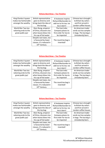
Britain’s Best Beverage
China’s Threatened Wildlife
The Great Wall
The Terracotta Army
The Forbidden City
Tiananmen Square
Three Gorge Dam
Transnational Companies In China
This five page activity allows students to explore where Las Vegas is, whether it is sustainable, why it is so dry and how they are trying to over come this by using Xeriscaping