I'm a teacher and the Author of the Amazon e-book;' Time Smart Teaching' and my mission is to create Geography resources to help teachers save time and reduce their workload. I am sharing additional time saving tips for teachers on my YOUTUBE channel ' Time Smart Teaching' if you fancy dropping by!
I'm a teacher and the Author of the Amazon e-book;' Time Smart Teaching' and my mission is to create Geography resources to help teachers save time and reduce their workload. I am sharing additional time saving tips for teachers on my YOUTUBE channel ' Time Smart Teaching' if you fancy dropping by!
This is a table designed to compare all major aspects of your chosen human/ physical fieldwork for GCSE Geography. Written specifically for AQA specification and filled in with examples from Urban regeneration and a coastal long-shore drift investigation, it can easily be adapted to suit your needs. Great revision tool for the paper 3 examination.
Absolutely, let’s optimize your resource description for better SEO and increased visibility. Here’s a revised version:
Title: Exploring Human Impacts on Cold Climates - Antarctica Lesson Plan
Description:
Discover the delicate balance between humanity and the pristine Antarctic environment with our engaging lesson, the fifth installment in our ‘Pol to Pole’ cold climate series. Building upon the thrilling insights gained from Lesson 4 on Antarctic Cruise and extreme tourism, students delve deeper into understanding human impacts on cold climates and specifically Antarctica.
Key Learning Objectives:
Evaluate and prioritize human threats to cold climates through a dynamic diamond 9 activity.
Develop critical thinking skills by identifying the most pressing and urgent challenges faced by Antarctica.
Encourage environmental stewardship by crafting an international code of conduct for Antarctic scientists and visitors.
Why Choose This Resource?
Rigorous analysis: Engage students in thoughtful discussions as they assess and rank human threats to Antarctica.
Practical application: Foster a sense of responsibility as students contribute to the creation of an international code of conduct for those interacting with this fragile ecosystem.
Ideal for:
Geography teachers seeking interactive and impactful lessons.
Educators looking to instill environmental awareness and responsibility in their students.
Boost your geography class with this immersive lesson on the human impact on Antarctica. Download now and empower your students to be environmental stewards!
As part of the AQA spec A GCSE Geography curriculum, ’ the challenge of resource management’, food is a major focus. All student must know the reasons for increased demand for food, as well as geographical areas of food surplus and food deficit. This lesson covers both. There are a full set of answers to the map/ graph starter question which asks students to analyse the bar chart on regional food production.
This lesson could be independantly self-taught, or done as remote learning via webinar as there are lots of video and signpost links to research areas on the internet, however the lower and Middle Abilities would need more structured classroom guidence.
This lesson focuses on skills such as graph analysis, independant study skills, and creating a mind map which gives an overview on the 4 main reasons for pushing up food demands globally. There is a 6 mark question to test students understanding.
This resource builds on students prior understanding of the biotic and abiotic parts of the pond ecosystem, to develop critical thinking skills or thunks. This resource present series of scenarios where man-made or natural actions cause an element of change in the pond ecosystem and food chain. Students must annotate their blank pond diagram, like the example shown, in order to likely or possible changes that happen as a direct or indirect result. This flexible activity could be done as a starter, in pairs or larger groups. Possibly as a carousel revision activity, or as a stimulus for an exam response. I would encourage students to share their annotations with the class and explain why they think these things will happen. Links with the ‘Living World’ aqa GCSE Geography specification.
This full lesson and associated worksheets examine the causes effects and responses to his UK based extreme weather flooding event. This lesson includes a fact file of key information like dates, times and damage impacts to help students complete a case study mind map or overview sheet. Could be used as a revision exercise or introducing this natural hazard event for the first time.
Graphs, maps and their analysis feature heavily in GCSE geography papers and examinations across all specifications. I put this handy wall display guide together to help my GCSE Geography students identify and describe the most common types of graphs and maps that they may see in the paper 3 examinations. It also gives a brief overview of the advantages and disadvantages of each type of display method- something students often struggle to articulate. It helped middle ability students picks up easy marks in their paper 3 fieldwork examinations and also made a great addition to classroom displays for open evenings and parent’s evenings. I hope you enjoy it!
As this is a FREE resource please consider buying a copy of my ebook ’ Time Smart Teaching; 8 Insider Tips that Schools Don’t tell you!
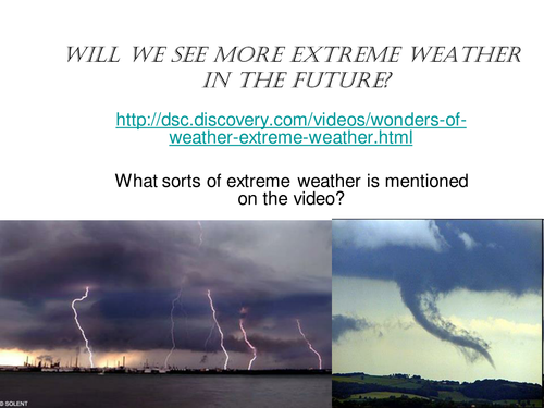
This is a lesson looking at trends in extreme tornadoes and where they occur. Activities include a mapping activity, analyzing data and a group facts race exercise, followed by a journalistic report.
Tropical storms form over warm seas close to the equator. Their large size brings many wide-ranging impacts to coastal areas. Students studying the AQA spec A course must have a detailed knowlege and understanding on the formation of tropical storms, and be able to recall key information from a real named storm example. This 4-in a row revision game lets students take charge of their learning. It can be played in pairs or teams of 4, and be done with or without book notes. Keep revision fun! This game could also be played over their phones/ laptops via facetime and live video calls if needed.
Manchester is a rapidly growing economic centre in the heart of Northern England. It is therefore an appropriate case study example to study for the GCSE Geography ‘Urban Issues & Challenges’ topic for the AQA spec. This internet research and study lesson focuses on 6 key characteristics of Manchester ( tourism, education, culture, Industry, Transport & religion), and how they come together to build the city as an important both nationally and globally. There are website links for each of these factors, so this lesson is suitable for home-study if needed. There is a grid for students to make notes on all 6 key areas. This lesson was originally designed so that small groups could each take a factor, and go away and build a presentation to bring back to the rest of the group. In that way, they become experts on one specific facet of the city. This framework could easily be adapted for a different HIC case study, if desired.
This test paper is made up of previous examination questions which involve the study and analysis of a range of maps. The ability to read, interpret and draw conclusions from maps is an important skill for success in any GCSE geography specification. There is a complete examiners mark scheme for the test paper, which pupils, parents or tutors can use to assess work ( AFL). The topics covered are linked to tourism, global distribution of biomes & migration. This worksheet is suitable for home study and remote learning.
Written for year 7, this lesson has a literacy focus and introduces students to some of the physical geography and landscape characteristics of the Tundra Biome and it’s cold environment. Students analyse the descriptive vocabulary and adjectives used to describe Svalbard, then build a bank of keywords as a class to use independently in their travel writing. The aim of the lesson is to complete an extended piece of writing to take the reader on an imaginary journey through the tundra around the archipelago of Svalbard ( travel journalism skills). There is a writing frame worksheet to support students write about the physical and human geography using the 5 senses. This differentiated lesson could easily be adapted for year 8 or 9 and gets student familiar with cold environments at GCSE geography.
Whilst students and parents are at home during the Spring and Easter time they can work through this bee project booklet offline, simply print it out and complete. It has been designed for distance/ remote learning.
Understanding the concept of an ecosystem being made up of both living and living things is important at Ks2 to prepare students for science and Geography at KS3 and high school. This geography based project is suitable for ages 7-10.
The global and national population of bees is falling, and this is unsustainable as they play an important part on pollination and growing crops that sustain humans. There is a movement now to protect and care for bees as an important part of nature and ecology.
By the end of the project , students will know;
the living and non-living parts in a garden ecosystem
The jobs that honey bees do
How to classify 3 types of bees based on their appearance
define some keywords linked to bees
The types of plants that attract bees
How to encourage bees into your garden
How to build a wild-bee house
Label the different parts/ anatomy of a bee
There is a printable completion certificate and bee-themes greeting card also.
This comprehensive lesson explores the concept of Urban farming, and how it improves food security in the developing city of Jakarta. Urban farming is the use of limited or marginalised city spaces ( for example roof tops) to grow a range of crops for sale in local markets or for self . This can be done by collective group efforts or individually.
Through a series of video tasks, photo analysis and problem solving, students will learn the needed facts and statistics needed for their GCSE Geography paper 2 ’ Human Exam’. This lesson fits in with the wider curriculum of the topic of the AQA spec ’ challenge of resource management '.
The main task involved writing a letter with stem prompts in the margin, to practice extended writing and literacy skills.
Food insecurity is where there is not enough physical, or financial access to a range of safe, nutritious food to keep a person healthy. The rise of global production chains and international food trading and export, has created food stress in various regions of the world, This has been made worse by climate change.
This GCSE lesson links to the topic ’ Challenge of Resource Management’ under the AQA spec A curriculum for GCSE Geography.
Each group will be given a different impact of food insecurity ( rising prices, social unrest, malnutrition, environmental degredation). They must explain the impact and come up with at least 3 ideas/ ways in which the problem can be alleviated. Think policy/ technology/ education. They are given 3 internet links to use may use in addition to textbooks to help.
When the group presents their ideas/ solutions back to the group, each student must chose and write the best one and write this on their worksheet grid. This lesson is about students leading learning and teaching each other.
Irrigation is the human process of artificially watering crops on a large scale using networks or canals ans sprinkler systems. Although irrigation can improve water availability and yield of crops in arid areas, it can also lead to contamination of local drinking water supplies which in turn creates substantial health problems.
This lesson is appropriate for self-study/ remote learning from home and is designed for the AQA GCSE Geography specification A curriculum. It has tasks with lots of prompts, a card sort with answers and a 9 mark exam practice question with a detailed PEEL structure to follow;
“(9marks) For a large scale agricultural scheme you have studied, explain how successful you think it has been in improving food supplies.”
The lesson looks at the positive and negative impact of the Rajasthan Canal in India on agriculture and the local population. Students have to evaluate whether overall they think that the canal is good or bad for the region.
An environmental quality survey ( or EQS) is a popular method of fieldwork. It involved measuring different aspects of the urban area by analysing a series of photographs from in and around Manchester ( although you could easily subsidize your own photo’s from your own local town or city). This GCSE focussed lesson takes students on a virtual journey from Manchester’s CBD to the urban rural fringe, showing them buildings and homes from along a transect. The students have to analyse the photographs carefully in order to make decisions on the appearence, safety and amount of green open space etc and fill in the pre-designed bi-polar grid accordingly. They can them choose to display their results on a radial graph ( template provided) or make a bar chart. The lesson ends with an exam questions, and gets them to evaluate the methods used to gather their primary data.
This lesson would be good at KS3 to prepare them for fieldwork requirements of GCSE, or as a preparation lesson prior to EQS fieldwork at GCSE.
The characteristics of sustainable cities must encompass social/ environmental / economic advantages to be holistic. This lesson introduces the concept of a sustainable city, by looking at the Bedzed zero carbon residential development in London. The lesson is aimed at the middle ability. mains tasks involve a gap fill to complete statements on what sustainable cities should look like, and be doing. Following this there is a video to make notes on Bedzed, which they then annotate around an image of the development. Finally there is a 9 mark GCSE past exam question with a mark scheme for peer assessment. This lesson fits in with the Urban Issues and Challenges topic, where students must know an example of a sustainable city.
This GCSE Geography lessons looks in-depth at the land use patterns around the edge of Manchester’s city, or the urban-rural fringe. This area is where the city meets the countryside and is desirable for a range of development opportunities including golf courses, airports and out of town shopping centres.
This lesson looks at an OS map of Manchester for the starter task, although using BING maps online will substitute if you do not have hard copies. The lesson develops map skills and annotation skills. There is a brownfield site card sort activity also to help students understand the advantages and disadvantages of building on brown field sites.
This lesson was written to compliment the AQA spec A GCSE curriculum, and briefly touches on the Burgess model, and how Manchester fits into this framework. It is part of other Manchester-based case study resources, also available from my shop. To go with the Urban Issues and Challenges topic SOW.
This worksheet allows students to test their knowlege and understanding on their chosen developing city case study and the causes, effects and responses to ward environmental pollution and over-crowing in slums. The sheet comprises of a range of short and longer GCSE exam type questions. The 6 and 8 mark questions have a hint-link underneath so that if the student struggles, they can click on it and be taken to the right part of the GCSE geography BBC bitesize revision page to answer it. Once complete there is an accompanying mark scheme at the back, so the student can self-assess their progress.