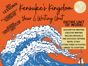
**20+ fully resourced lessons based on Kensuke’s Kingdom - perfect for any Year 6 class. **
Includes a range of extended writing opportunities, exemplar texts (WAGOLLs), reading comprehension questions, differentiated activities, success criteria checklists, collaborative learning tasks and more.
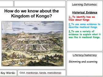
Lesson 4 of a unit enquiry on medieval African Kingdoms.
A full lesson on medieval Benin, centered around the question ‘How do we know about the Kingdom of Kongo. The lesson focuses on the disciplinary element of African history and includes a ‘Story, Source, Scholarship’ style sheet as inspired by Dan Warner-Meanwell.
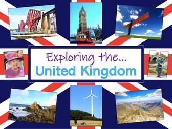
Exploring the UK is a Geography unit suitable for KS1 and lower KS2 (Y2-4).
The planning overview, topic title page and vocabulary page can be downloaded for free here. Lessons include:
L1 – Identifying the countries and capitals of the UK & Ireland (FREE)
L2 – Locating UK cities using compass directions
L3 – Identifying human & physical features of the UK
L4 – Investigating satellite photos of the UK
L5 – Comparing the city and the countryside
L6– Identifying famous features and characteristics of countries of the UK
L7 – Identifying flags of the United Kingdom
L8 – Identifying the four seasons of weather in the UK
Optional lesson – Identifying the countries and capital cities of Europe
Each lesson includes a presentation and differentiated activities/worksheets.
If you like this resource, we would appreciate a review! We will happily send you a free resource in return for a review or useful suggestions/feedback. Contact us at ed@teachitforward.co.uk.
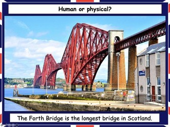
This lesson is part of Exploring the United Kingdom, a Geography unit designed for KS1 and lower KS2 (Y2-4).
The presentation helps students understand the difference between human and physical geographical features. It then challenges them to classify famous UK landmarks as either human or physical.
There are two engaging activities included:
Partner activity:
Students sort pictures/descriptions of UK landmarks into human and physical geographical features.
Individual activity:
Students match pictures of UK landmarks to their descriptions. This is differentiated three ways:
Easier – Students match 8 features to their descriptions.
Medium – Students match 12 features to their descriptions.
Harder – Students write a description of each UK landmark using a word bank.
Extension – Students sort the UK landmarks into human and physical geographical features.
If you like this resource, we would appreciate a review! We will happily send you a free resource in return for a review or useful suggestions/feedback. Contact us at ed@teachitforward.co.uk.
This lesson is part of Exploring the United Kingdom, a Geography unit designed for KS1 and lower KS2 (Y2-4).
The presentation first introduces students to satellite photos before going on to challenge them to match satellite photos to famous UK landmarks (e.g. Wembley Stadium, Edinburgh Castle).
In the activity, students use their geography detective skills to describe satellite photos and infer which famous UK landmark or feature each one is. It is differentiated two ways:
Easier – Students write description of each satellite photo on a writing template sheet.
Harder – Students stick satellite photos into their exercise book and write descriptions next to them.
If you like this resource, we would appreciate a review! We will happily send you a free resource in return for a review or useful suggestions/feedback. Contact us at ed@teachitforward.co.uk.
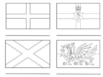
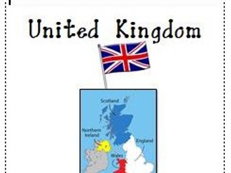
This resource provides an interactive exploration of the United Kingdom’s countries, featuring accurately colored flags for Northern Ireland, England, Scotland, and Wales. It includes a word bank for labeling each country and an extension activity for coloring the Union Jack, enhancing learners’ understanding of the UK’s national symbols and composition.
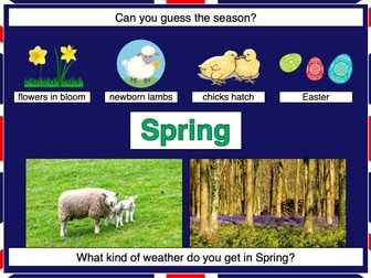
This lesson is part of Exploring the United Kingdom, a Geography unit designed for KS1 and lower KS2 (Y2-4).
In the lesson, students learn about the four seasons and characteristics associated with each. First they have to guess each season using different clues. They then find out about the different types of weather associated with each season.
The colourful activity is differentiated three ways:
Easier – Students match 16 pictures (with labels) to the seasons.
Medium – Students match 20 pictures (with labels) to the seasons.
Harder – Students match 20 pictures to the seasons and label them.
If you like this resource, we would appreciate a review! We will happily send you a free resource in return for a review or useful suggestions/feedback. Contact us at ed@teachitforward.co.uk.
This is a unit of work supporting the reading of Kensuke’s Kingdom and using the book-centred approach to write a range of text types, including diary writing, discussion and instructional texts.
The resource includes a PPT for each chapter with a focus on vocabulary, oracy and SATs style questioning. It is primariyl aimed at Year 5 or 6 pupils.
13 lessons on the Church and the Kingdom of God
(Catholic Christianity, Unit 5)
Lessons include a mix of PowerPoints and homework tasks. Revision lesson and assessment included for the end.
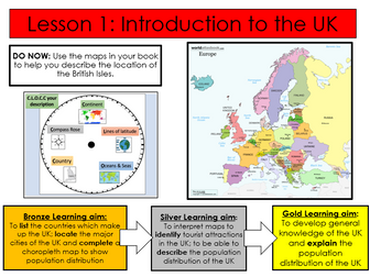
First lesson in a SOW on the geography of the UK.
Fully differentiated with extension activities.
Includes-
Workbook to complete tasks in
Activity identifying the differences between the UK, GB and British Isles
Activity locating major cities in the UK
Extension activities
Choropleth actvity mapping population density of different regions of the UK
Extension activities
Complete lesson
All resources required for lesson attached, including video links in PowerPoint notes section.
PowerPoint self explanatory.
LOs
Define key terminology.
Create a map of the UK.
Describe key facts of the UK.
This is actually intended as Lesson One of an Around the World unit for my year 1 Geography, but it would work well as a stand-alone introduction to the British Isles. It provides a simple introduction to the United Kingdom, with facts about England, Northern Ireland, Scotland and Wales, as well as a mini-assessment at the end with true/false statements the children can answer, based on the learning they have just done.
This booklet helps students to understand where we are located within the UK and what factors influence this. Locations with significant increasing and declining populations are explored with a look into immigration and the medias influence on our views of this
This is a Geography unit of work on the United Kingdom and is a series of 9 lessons focusing on topics of map work, landscape, cities, energy, carbon footprint, transport, tourism, urban v rural and climate change in the UK.
I made this after struggling to find a similar activity! Allows children to discover the names of the different countries and the capitals of the UK.
Give children an atlas and see if they can find them before revealing whether they are right or wrong.
Worked like a treat and built up some great atlas skills!!
This clear, detailed and visually-appealing resource offers a complete reference point for students revising knowledge relating to the United Kingdom, as a part of locational knowledge in geography. It contains comprehensive sections on:
Overview and map;
Counties and Cities of the UK;
Longest Rivers;
Highest Mountains;
Human Geography Features;
Physical Geography Features.
The resource is designed to be printed onto A3, and is provided as both a PDF and a Word version (so that you can edit if you want to). All images used are licensed for commercial use and are cited on a separate document (included). The resource is most suitable for students in KS2 or lower KS3.
This RE SMART and PowerPoint is a series of six lessons based on the Understanding Christianity unit “What kind of King is Jesus?” looking at the concept of the Kingdom of God in Christianity and how Jesus’ teachings are relevant to today’s world. All resources are included and lessons have a mixture of discussion and written activities. Resources include comprehensions and animations of bible passages, a charity pitch activity, a focus on how Jesus is represented in song, a comparison of heaven and Earth activity, a research activity into a Christian charity and a look at forgiveness in practice.
Lessons include videos, group/partner discussion, group tasks, individual tasks and making links to children’s own lives. All resources are included, and there is a printing requirement list for the whole unit. Please note - the SMART and PowerPoint contain the same content, but you need Notebook software to open SMART.
United Kingdom - A research project is a 18 pages study on United Kingdom. Use it as a class test or research project.
Download Preview File - Please view the preview file prior to purchasing as the preview is all the resources in this pack. Please ensure that the resource is appropriate for your grade level prior to purchasing
Answer is provided for the maps, flag and individual questions from 1 to 27 but not the short essays. The flag worksheets come with color/colour word.
Included are also 3 maps of United Kingdom posters ( regions in United Kingdom, capital cities, surrounding seas, main rivers of United Kingdom) and a flag of United Kingdom
 Quick View