I currently work at the top end of Primary school in Year 5/6. I create resources for a range of subjects and am always open to suggestions for resources people require.
I currently work at the top end of Primary school in Year 5/6. I create resources for a range of subjects and am always open to suggestions for resources people require.
A knowledge organiser about Texas that includes the following:
US state map with Texas highlighted
Close up map of Texas and surrounding areas
Information regarding where Texas is
10 varied facts about Texas
Key vocabulary, including words that come up in the knowledge organiser
The state bird, large animal and flower
There are two versions are included, one with UK spellings and one with US spellings.
A reading comprehension resource that focuses on the layers of the Earth, providing information about the different layers as well as activities linked to this to check understanding.
The resource includes:
A fact file about the layers of the Earth mentioned above (both in colour and black and white for ink saving purposes)
2 different comprehension activities - 1 with written responses required and one as a multiple choice activity with answers provided for both
A vocabulary activity that requires definitions to be found for each word provided.
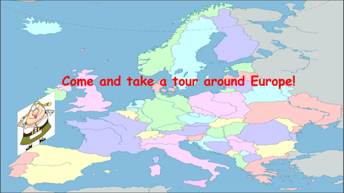
112 page Powerpoint that introduces the continent of Europe to children.
Within the powerpoint, Europe is split into six different zones, introducing every country in Europe. Included are the flags for every country, the capital city and currency for each country as well as two to three facts for every country in Europe.
Useful for introducing Europe or countries within Europe as well as being able to create a factfile using the slides.
A lesson that focuses on natural hazards, particularly in being able to identify the differences between climatic and tectonic hazards.
The lesson works well as an introductory lesson in teaching pupils about different natural hazards and understanding why these occur. There is everything needed to be able to deliver the lesson including the lesson PowerPoint, starter activity, three activities and support sheets.
The lesson starts with a starter focusing on the equator and tropics to prompt understanding of climate and weather conditions. This then moves on to identifying key vocabulary and introducing the idea of natural hazards.
Activity One then requires pupils to sort examples of natural hazards into climatic and tectonic. There is a cut and stick version of this with images or a separate version using written text for those looking to save on time and printing.
This then moves on to the second activity focusing on being able to identify similarities and differences between climatic and tectonic hazards. This is presented as a Venn diagram with a support sheet to help with ideas. However, there is also an alternative version of the activity should teachers wish to use it, with a reduced outcome through limited boxes available.
This is then followed up by more discussion and a review task to check understanding at the end of the lesson.
Additionally, a support sheet is provided with the key vocabulary, information and images from the PowerPoint all provided on one page for pupils to refer back to.
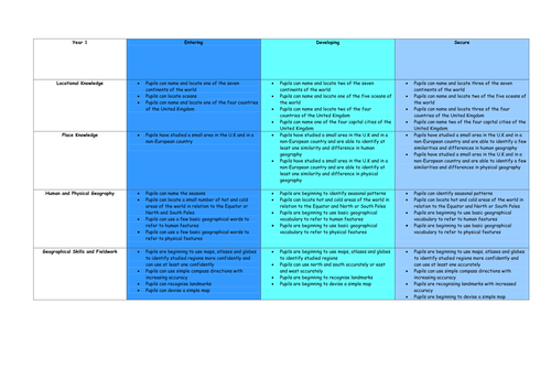
Geography assessment grids from Year 1 to 6 that can be used to check children's understanding and use as a progress measure if wished. These are to be used as best fit as there may be some areas they are weaker/ more confident in with the aim being a best fit judgement.
I created these as there appears to be a gap in geography assessment at the minute in primary schools since the move to assessment without levels. This enables schools to have something in place for a foundation subject that links well to other curricular areas, as well as showing an assessment system should visitors wish to know how you monitor progress.
A worksheet template that can be used when doing a case study where you want pupils to consider the primary and secondary effects of an event. This could be used in a number of ways and provides a one page, graphic way of organising the information.
There is also an example one included for the Christchurch earthquake in 2011 for how the sheet could be completed.
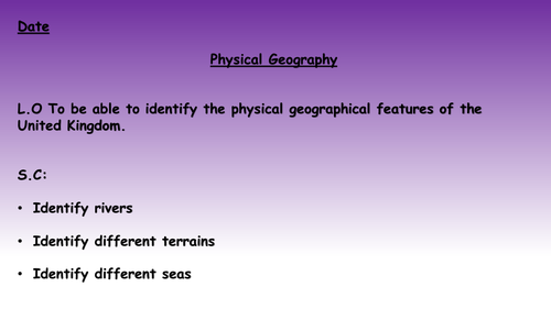
A lesson that focuses on the physical geography of Britain, including looking at the rivers, seas and terrain. All the resources that are needed to run the lesson are here including differentiated worksheets, the presentation and maps that can be used if you don't have access to atlases etc.
A lesson that acts as the final lesson in a nine lesson sequence, reviewing prior learning linked to the different continents and oceans of the world, including the Equator and tropics.
Included are a range of tasks that provide children the opportunity to highlight what they know about continents and countries. There is also a presentation included to discuss answers and an answer sheet for each section of the activities.
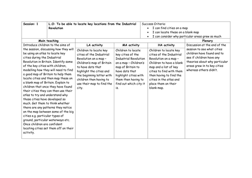
Attached are 5 lessons based on using map skills and linking them to the Industrial Revolution. These have been written with Year 5/6 in mind but are easily adaptable.
Included are the slides, resources and differentiated lesson plans.
Lesson 1 - Identifying UK cities on a map
Lesson 2 - Identifying rivers in the UK
Lesson 3 - Identifying how the UK changed during the Industrial Revolution
Lesson 4 - Identifying the Luddites area of operations
Lesson 5 - British Empire during the period and identifying countries around the world
N.B. You will need atlases for the general atlas activities.
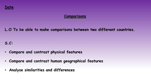
A lesson that focuses on comparing and contrasting physical and human geographical features between Canada and Spain. Each slide has a map of Spain and of Canada for a particular feature with the class then spending time noting down similarities and differences. These can then be discussed as a class before moving on to the next slide.
A lesson that focuses on comparing and contrasting physical and human geographical features between the United Kingdom and Spain. Each slide has a map of Spain and of the U.K for a particular feature with the class then spending time noting down similarities and differences. These can then be discussed as a class before moving on to the next slide.
Two lessons to focus on the physical and human geography of Canada.
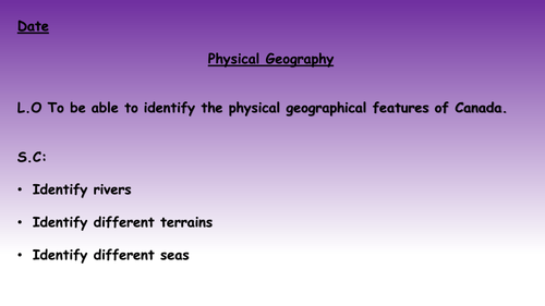
Lesson 1 (titled Lesson 7) - A lesson that focuses on the physical geography of Canada, including looking at the rivers, seas and terrain. All the resources that are needed to run the lesson are here including differentiated worksheets, the presentation and maps that can be used if you don't have access to atlases etc.
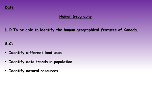
Lesson 2 (titled Lesson 8) - A lesson that focuses on the human geography of Canada, including looking at population trends, average life expectancy and land use. All the resources that are needed to run the lesson are here including differentiated worksheets, the presentation and maps that can be used if you don't have access to atlases etc.
N.B They are titled differently to their actual lesson numbers as they form part of a bigger unit of work.
A lesson that focuses on the human geography of Canada, including looking at population trends, average life expectancy and land use. All the resources that are needed to run the lesson are here including differentiated worksheets, the presentation and maps that can be used if you don't have access to atlases etc.
A lesson that focuses on comparing and contrasting physical and human geographical features between the United Kingdom, Canada and Spain. Each slide has a map of Spain, Canada and of the U.K for a particular feature with the class then spending time noting down similarities and differences. These can then be discussed as a class before moving on to the next slide.
A lesson that focuses on the physical geography of Canada, including looking at the rivers, seas and terrain. All the resources that are needed to run the lesson are here including differentiated worksheets, the presentation and maps that can be used if you don't have access to atlases etc.
A unit of work (11 lessons) that focuses on the Battle of Britain. It begins by building up to World War 2, looking at the advancement of technology and the build up to war. This is then followed up by some geography work on Europe, the Battle of Britain itself and why it was significant. It is all rounded up by a quiz at the end for a bit of fun and to see what children can remember.
Included is everything needed to run the lessons including the planning, slide show and differentiated resources.
It is written with 5/6 in mind but can easily be adapted.
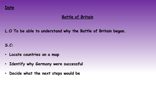
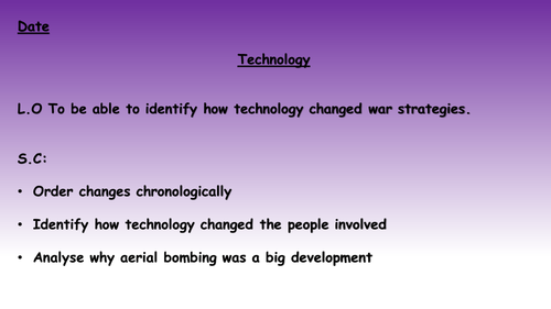
This lesson focuses on the beginning of the Second World War before identifying Germany's initial movements in 1940. This will then move on to thinking about what Germany's next logical step was to be able to reach Britain.
For the full unit visit:
https://www.tes.com/teaching-resource/battle-of-britain-unit-of-work-11659829
A unit of work (11 lessons) that focuses on the Battle of Britain. It begins by building up to World War 2, looking at the advancement of technology and the build up to war. This is then followed up by some geography work on Europe, the Battle of Britain itself and why it was significant. It is all rounded up by a quiz at the end for a bit of fun and to see what children can remember.
Included is everything needed to run the lessons including the planning, slide show and differentiated resources.
It is written with 5/6 in mind but can easily be adapted.
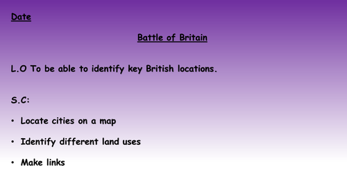
This lesson focuses on the key areas of Britain both in terms of industry and defence, getting children to consider where the most appropriate targets would be.
For the full unit visit:
https://www.tes.com/teaching-resource/battle-of-britain-unit-of-work-11659829
A unit of work (11 lessons) that focuses on the Battle of Britain. It begins by building up to World War 2, looking at the advancement of technology and the build up to war. This is then followed up by some geography work on Europe, the Battle of Britain itself and why it was significant. It is all rounded up by a quiz at the end for a bit of fun and to see what children can remember.
Included is everything needed to run the lessons including the planning, slide show and differentiated resources.
It is written with 5/6 in mind but can easily be adapted.
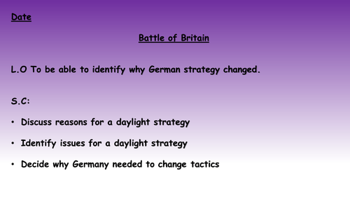
This lesson will focus on a change in strategy and how and why the bombing moved to night raids.
For the full unit visit:
https://www.tes.com/teaching-resource/battle-of-britain-unit-of-work-11659829