Hero image

GeographyFocus Shop

Average Rating4.55
(based on 40 reviews)

I am a geography teacher with 36 years experience in Years 7 to 12 in high schools in New South Wales and Western Australia. I am now retired but maintain a strong interest in producing resources for the subject for which I have a passion. This shop features a range of geography resources suitable for upper primary school and high school. Free resources are available for you to use within your school to trial the quality of my work.

124Uploads

94k+Views

9k+Downloads

I am a geography teacher with 36 years experience in Years 7 to 12 in high schools in New South Wales and Western Australia. I am now retired but maintain a strong interest in producing resources for the subject for which I have a passion. This shop features a range of geography resources suitable for upper primary school and high school. Free resources are available for you to use within your school to trial the quality of my work.
Crossword - Population Geography
swintrekswintrek

Crossword - Population Geography

(0)
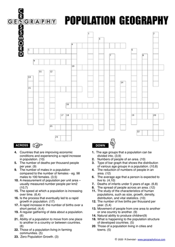
This is a crossword puzzle that focuses on the important terms used in population geography. There are three crossword puzzles to allow differentiation in your classes: one for the better ability students (no clues), one for moderate ability students (first letter clues) and one for weaker students (consonant clues). Crossword puzzles are a great way to reinforce basic concepts of a topic. The clues for this puzzle will help reinforce your students knowledge of the terms used in a study of population geography… A solution is provided with the puzzle.
Counties of England Bundle
swintrekswintrek

Counties of England Bundle

6 Resources
Set of Wordsearches with accompanying map exercises for the counties of England. Each of the six sets of counties has three differentiated word searches for the varying abilities of students in your class (a total of 18 wordsearches in the bundle). These wordsearches and map exercises are a fun way for your students to learn the names and locations of the counties of England.
Tracking Hurricane Florence - a latitude/longitude exercise
swintrekswintrek

Tracking Hurricane Florence - a latitude/longitude exercise

(0)
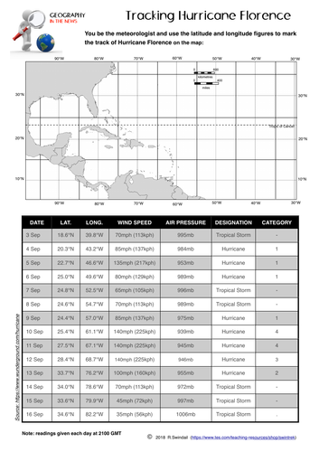
A simple worksheet that requires your students to plot the path using latitude and longitude of Hurricane Florence as it made its way from the mid-Atlantic to the US coast in the Carolinas. An answer key is provided. A good way to practice your students in plotting points using latitude and longitude, at the same time getting them to understand the relevance of this simple geographic skill to the real world.
Sulawesi Earthquake and Tsunami 2018 - worksheets
swintrekswintrek

Sulawesi Earthquake and Tsunami 2018 - worksheets

(0)
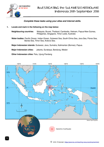
A four page worksheet focusing on the Sulawesi earthquake and tsunami on 28th September 2018 that helps develop student’s internet skills. Page 1 - simple mapping question to familiarise students with the geographic setting of Indonesia Page 2 - students to complete a fact file on Indonesia from internet research AND define basic terms associated with earthquakes as well as completing the labelling of an earthquake diagram Page 3 - a map of the earthquake area including tectonic plates - students to answer questions on the earthquake using the map and the other websites. Page 4 - students answer questions on the impact of the earthquake, the Indonesian government’s response and a question from the internet An answer key is provided for teachers.
Tracking Hurricane Dorian - a latitude/longitude exercise
swintrekswintrek

Tracking Hurricane Dorian - a latitude/longitude exercise

(0)
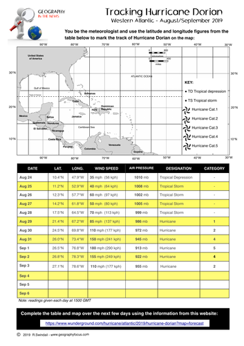
This is a mapping exercise that requires students to map the track of Hurricane Dorian from information given in a table. Students can follow the track of the hurricane over the next few days using the Weather Underground website (URL given on the worksheet). This exercise is also part of the Hurricane Dorian Enquiry, also available on my store.
Passage of a Cold Front - eastern Australia 2015
swintrekswintrek

Passage of a Cold Front - eastern Australia 2015

(0)
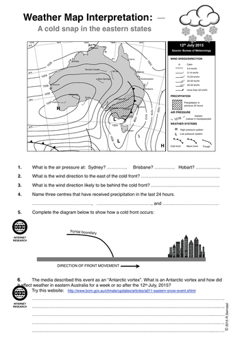
This is a one page worksheet that shows a cold front passing across Eastern Australia in July 2015. The questions ask students to interpret the weather map and to explain the cold front and associated polar vortex that brought snow as high as Queensland in Eastern Australia. Requires some internet research.
Maps of UK
swintrekswintrek

Maps of UK

(0)
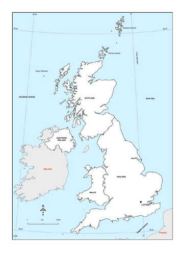
Two maps of the UK. One blank and one with countries and other features.
GEOGRAPHY IN THE NEWS weekly quiz - Climate Change special edition
swintrekswintrek

GEOGRAPHY IN THE NEWS weekly quiz - Climate Change special edition

(0)
Geography in the News is quiz based on current news from a geographic perspective. This quiz will suit students from upper primary school to upper high school. ​ A new quiz is published on Sunday each week based on news of the previous week. This quiz is a climate change special edition. ​ The quiz has two pages with five mapping questions and 15 multiple choice questions - answers are given in the second pdf download. ​ The quiz is a PDF that you can download and print for your classes. The quiz is coloured but will photocopy well as b/w. ​ How are schools using Geography in the News? As a quiz that can be completed in as little as 6 minutes. Group research. As homework exercises that students can research the answers from a range of news websites. Weekly group competitions within the class over a term or the year. Weekly school geography competitions to promote the subject. As a discussion starter. ​ In whatever way Geography in the News is being used it has been seen to engage students in Geography and improve their geographic knowledge by taking them beyond the classroom. ​ IF YOU AND YOUR STUDENTS ARE ENJOYING THIS QUIZ SPREAD THE WORD ABOUT IT BY TELLING COLLEAGUES AT OTHER SCHOOLS If you have any questions regarding the quiz contact Richard at swintrek@gmail.com. An Australian version of the quiz is available by yearly subscription - visit my GeographyFocus website
Water in the World: the Water Cycle text and worksheets
swintrekswintrek

Water in the World: the Water Cycle text and worksheets

(0)
This is a seven page package that include two pages of text that explain the basic operation of the water cycle and the processes within it. Five pages of activities are included that reinforce a basic understanding of the water cycle and its processes as well as extending your students’ thinking of the water cycle and how people have used and changed it. The package is designed for the Australian Curriculum (Geography Years 7/8) but could be used in other countries where the water cycle may be studied as part of a Geography or Science program in lower high school.
Eastern Australian Floods: February/March 2022
swintrekswintrek

Eastern Australian Floods: February/March 2022

(0)
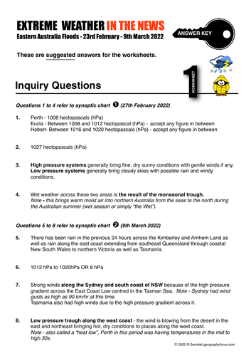
A series of two synoptic charts and four worksheets that introduce students to floods and investigate the floods in Eastern Australia during February/March 2022. Worksheets are: Worksheet 1 - skills questions based on one of the two provided synoptic charts Worksheet 2 - research questions based on a website linked video on floods in general across Australia. Worksheet 3 - research questions based on website link Worksheet 4 - students gather information on the floods from media in three areas (Southeast Queensland, New South Wales north coast rivers and the Sydney Basin/South Coast) Mainly suitable for junior high school but could also be used as a simple introduction to flood hazards in upper high school. An answer sheet is provided.
The Water Cycle Word Puzzles
swintrekswintrek

The Water Cycle Word Puzzles

4 Resources
A group of geography word puzzles that are a fun way to learn the terms associated with the water cycle. GeoBingo is a class activity whilst the crossword, word match and word search can be set as homework or class activities.
New Zealand Earthquake 13th November 2016
swintrekswintrek

New Zealand Earthquake 13th November 2016

(1)
This is a worksheet that asks students to investigate the 7.8 magnitude earthquake that struck New Zealand's South Island on 13th November 2016 (UTC). There are three pages to the worksheet: Page 1: Background of New Zealand - students will locate important features of NZ's physical landscape on a map and fill out a fact file. Page 2: Features a map of New Zealand (same as this worksheet's cover image) with a number of questions on the size of the earthquake, location of the epicentre and the major tectonic plates involved. Page 3: Mainly questions on the impact of the earthquakes and the NZ government response and that of the international community. This worksheet will help develop your students enquiry and internet skills.
Eastern Australia Floods March 2021
swintrekswintrek

Eastern Australia Floods March 2021

(0)
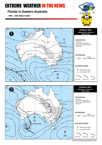
A series of two synoptic charts and three worksheets that introduce students to floods and investigate the floods in Eastern Australia during March 2021. Worksheets are: Worksheet 1 - skills questions based on one of the two provided synoptic charts Worksheet 2 - questions based on a linked video on floods in general across Australia. Worksheet 3 - students gather information on the floods from media in three areas (Gold Coat, New South Wales mid north coast and the Sydney Basin) Mainly suitable for junior high school but could also be used as a simple introduction to flood hazards in upper high school. An answer sheet is provided.
Weather Instruments Crossword
swintrekswintrek

Weather Instruments Crossword

(0)
A simple crossword puzzle that focuses on weather instruments and the units of measurement. Three levels of crosswords are included for varying levels of ability in your class: 1. No hints 2. First letter hints 3. Consonant hints Useful for revision, extension work or homework exercises.
Weather Instruments Word Puzzle Bundle
swintrekswintrek

Weather Instruments Word Puzzle Bundle

4 Resources
A collection of word puzzles including: 1. Crossword 2. GeoBingo 3. Matchwords 4. Wordsearch All useful for revision, homework, work for fill-in teacher etc.
Sharing Geographical Views
swintrekswintrek

Sharing Geographical Views

(0)
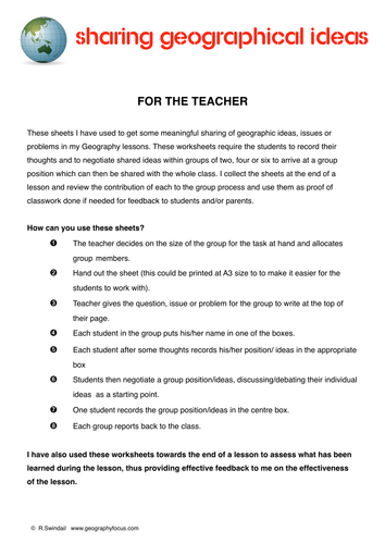
These worksheets I have used to get some meaningful sharing of geographic ideas, issues or problems in my Geography lessons. These worksheets require the students to record their thoughts and to negotiate shared ideas within groups of two, four or six to arrive at a group position which can then be shared with the whole class. I collect the sheets at the end of a lesson and review the contribution of each to the group process and use them as proof of classwork done if needed for feedback to students and/or parents. There are four sheets in the package - one explanation page for teachers and one each for groups of two, four or six students.
Investigating Italy and the earthquake of 24th August 2016
swintrekswintrek

Investigating Italy and the earthquake of 24th August 2016

(0)
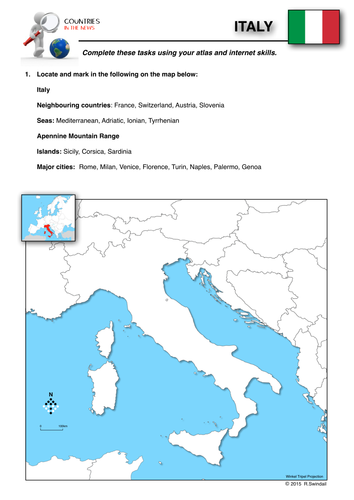
This is part of a series of worksheets that focuses on countries that make the news headlines and gets students to study them from a geographic perspective.. This three page worksheet on Italy asks students to use their atlas and internet skills to locate important natural and cultural features on a map, gather background information on Italy and then encourages them to investigate the earthquake that hit central Italy on the night of 24th August, 2016..
Countries in the News: Turkey
swintrekswintrek

Countries in the News: Turkey

(0)
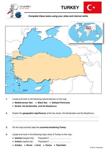
This is the first in a series of worksheets that focuses on countries that make the news headlines and gets students to study them from a geographic perspective.. This worksheet on Turkey asks students to use their atlas and internet skills to locate important natural and cultural features on a map, gather background information on Turkey, and to explain the reasons for the country featuring prominently in the media.