Hero image

NGfLCymru

Average Rating4.03
(based on 3892 reviews)

NGfL Cymru was a website funded by the Welsh Government. The resources on TES are a legacy of this project. The content or format of these resources may be out of date. You can find free, bilingual teaching resources linked to the Curriculum for Wales on hwb.gov.wales.

2k+Uploads

9590k+Views

11452k+Downloads

NGfL Cymru was a website funded by the Welsh Government. The resources on TES are a legacy of this project. The content or format of these resources may be out of date. You can find free, bilingual teaching resources linked to the Curriculum for Wales on hwb.gov.wales.
Sustainable Energy
NGfLCymruNGfLCymru

Sustainable Energy

(1)
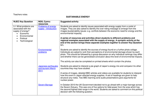
A series of detailed resources with interactive elements and relevant tasks to support students studying in preparation for the U2 exam. The units contain materials that require the students to draw on relevant Knowledge, to make decisions, to solve problems and to evaluate issues. Much of the material can be printed out and there are numerous references to useful websites. For more materials relating to this resource, please visit the NGfL site, linked below.
Gweta: Botwana
NGfLCymruNGfLCymru

Gweta: Botwana

(1)
Looking at a locality in a less economically developed country, including an interactive map of Gweta, slideshows and a Powerpoint file
Traffic Congestion
NGfLCymruNGfLCymru

Traffic Congestion

(1)
The thinking skills exercises in this activity are about traffic congestion, its causes, problems and solutions.
G1 – 1.4 Hurricanes
NGfLCymruNGfLCymru

G1 – 1.4 Hurricanes

(1)
The contrasting effects of hurricanes in the Caribbean are investigated using a variety of resources including numerical data, photos, aerial images, newspaper articles, interactive ICT, animations and posters. Activities include: describing impacts; evaluating strategies; contrasting effects on New Orleans, USA, MEDC and Guatemala, LEDC.
Transportation and deposition
NGfLCymruNGfLCymru

Transportation and deposition

(1)
These activities could be used to support the study of the development of coasts at key stage 3 and to develop enquiry skills and the skills required to analyse maps, photographs and diagrams. At key stage 4 the materials support ‘the Ice, rivers and sea’ element of the WJEC GCSE geography (A - mainstream) syllabus, in particular how beaches and spits are shaped and using OS maps and photographic evidence to interpret the processes involved.
Coastal features: erosion, deposition and defence
NGfLCymruNGfLCymru

Coastal features: erosion, deposition and defence

(1)
These lesson materials and resources are designed to support learners in their understanding of •the processes operating at the coast •how areas along the coast can be protected •the groups of people concerned about coastal protection •how to complete a fieldwork sketch Although these resources rely on images and materials based on Porthkerry and Penarth in the Vale of Glamorgan, the processes illustrated could be applied to any coastal area
Coastal erosion and management
NGfLCymruNGfLCymru

Coastal erosion and management

(1)
This resource provides a decision making exercise and case study of coastal erosion management at Penarth. For more materials relating to this resource, please visit the NGfl site, linked below.
Gelligaer Wind Farm
NGfLCymruNGfLCymru

Gelligaer Wind Farm

(1)
Thinking skills activities based on Gelligaer Wind farm also developing sketch map, memory map and classification skills.
River Flooding
NGfLCymruNGfLCymru

River Flooding

(1)
The thinking skills exercise in this file tests students understand of the key vocabulary associated with river flooding.
Brecon Beacons Mapping Exercise
NGfLCymruNGfLCymru

Brecon Beacons Mapping Exercise

(1)
The activities are based on the 1:25000 OS Explorer Map OL12 map of the Central Beacons but the exercise is adaptable to other OS maps. It aims to develop an enjoyment in map reading by making an area ‘come alive’. Students find map locations of different human activities from written descriptions. An aerial photograph helps in a decision-making activity based on the people ‘in the map’. The completion of the activities by small groups enables the development of discussion skills. There is opportunity for literacy skills if written work is completed
Brecon Beacons Mapping Exercise
NGfLCymruNGfLCymru

Brecon Beacons Mapping Exercise

(1)
The activities are based on the 1:25000 OS Explorer Map OL12 map of the Central Beacons but the exercise is adaptable to other OS maps. It aims to develop an enjoyment in map reading by making an area ‘come alive’. Students find map locations of different human activities from written descriptions. An aerial photograph helps in a decision-making activity based on the people ‘in the map’. The completion of the activities by small groups enables the development of discussion skills. There is opportunity for literacy skills if written work is completed.