

225Uploads
28k+Views
6k+Downloads
All resources

KS3 unit - DEVELOPMENT - L3 - development indicators
To develop a greater understanding of the factors that will affect development

KS3 unit - MAP SKILLS - L12 - the UK
To be able to say where England, Ireland, Scotland and Wales are on an outline of the UK.
To recognize the position of London and Newcastle on a map of the UK and know how far apart they are.
To recognize the flags of England, Ireland, Scotland and Wales.
fully resourced lesson
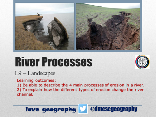
KS3 unit - LANDSCAPES - L7 - river processes
to be able to describe the 4 main processes of erosion in a river.
To explain how the different types of erosion change the river channel.
fully resourced lesson

KS3 unit - LANDSCAPES - L3 - rock types
To identify different types of rock and explain their formation
fully resourced lesson

KS3 unit - LANDSCAPES - L2 - erosion
To describe and explain the processes of erosion that shape our landscapes
To develop a sense of awe and wonder about our physical planet
fully resourced lesson

KS3 unit - LANDSCAPES - L4- the rock cycle
To describe and explain the processes of the rock cycle
fully resourced lesson

KS3 unit LANDSCAPES -L1 weathering lesson
To describe and explain the processes of weathering that shape our landscapes
To develop a sense of awe and wonder about our physical planet
fully resourced lesson

KS3 unit - MAP SKILLS - L2 - atlas skills
To understand that the ‘Index’ and ‘contents’ of an Atlas can help you to find places quickly and easily.
Identifying football stadiums/teams and locating them on maps of Britain
fully resourced unit

KS3 unit - MAP SKILLS - L1 intro to geography
To formulate a definition of Geography
To explain the difference between human and physical geography
fully resourced lesson

KS3 unit - MAP SKILLS L3 - intro to maps
What are maps?
What are map projections?
What do you know about Europe?
Do you know the UK?
fully resourced lesson

KS3 unit - MAP SKILLS - L6 scale
To identify what scale is and why it is used.
fully resourced lesson
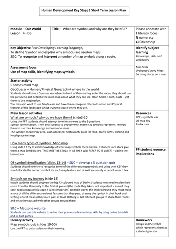
KS3 unit - MAP SKILLS - L4 map symbols
What are map symbols and why are they helpful
fully resourced lesson

KS3 unit - LANDSCAPES - L8 - waterfalls
To describe and explain how rivers shape our landscape and form waterfalls
fully resourced unit

KS3 unit - LANDSCAPES - L5 the water cycle
To describe the processes in the water cycle
fully resourced lesson

KS3 unit - LANDSCAPES - L9 - glaciation
To investigate the location of ice.
To examine the erosional processes associated with glaciation.
To explore the glacial system.
fully resourced lesson

KS3 unit - DEVELOPMENT - L12 assessment
an SDME style assessment focussing on solutions to conflict in Sudan
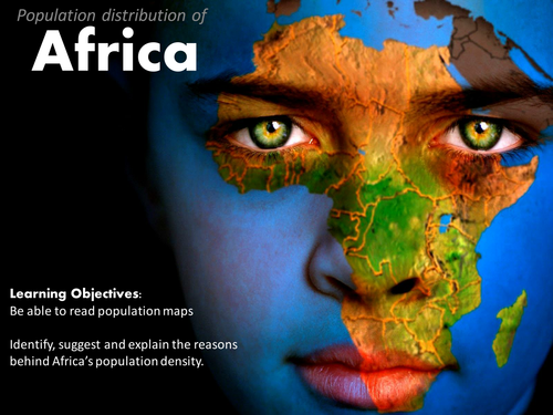
KS3 unit - DEVELOPMENT - L7 africa's population
Be able to read population maps
Identify, suggest and explain the reasons behind Africa’s population density.
fully resourced lesson

KS3 unit - DEVELOPMENT - L9 - Nigeria
to investigate the development of Nigeria
fully resourced lesson

KS3 unit - DEVELOPMENT - L11 - education in Ghana
To describe the impact of education on the life of a school student in Ghana and compare it with our own life.
To explain the challenges which make it difficult for all children to have a good education in Ghana
To explain how education connects with the other Millennium Development Goals

EDUQAS spec A - unit 2 - L9 - the DTM - fully resourced
To be able to identify the key features of a population pyramid.
To be able to create a population pyramid and analyse it.
To be able to explain how the population structure changes with the stages of DTM.